Category:June 2007 in Ireland
Jump to navigation
Jump to search
| ← | → | ||||||||||||
| ← | Jan | Feb | Mar | Apr | May | Jun | Jul | Aug | Sep | Oct | Nov | Dec | → |
|---|---|---|---|---|---|---|---|---|---|---|---|---|---|
| 24 | 43 | 3 | 68 | 10 | 95 | 65 | 50 | 4 | 83 | 56 | 23 | ||

Deutsch: Juni 2007 in Irland
English: June 2007 in Ireland
Subcategories
This category has the following 2 subcategories, out of 2 total.
D
Media in category "June 2007 in Ireland"
The following 93 files are in this category, out of 93 total.
-
 06 07 Ballincollig Castle W Monogram.JPG 2,592 × 1,944; 1.58 MB
-
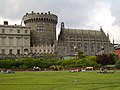
 E4391-Dublin-Castle.jpg 2,048 × 1,536; 1.15 MB
-
 E4392-Dublin-Castle.jpg 1,806 × 1,445; 912 KB
-
 E4393-Dublin-Castle.jpg 2,048 × 1,536; 1.12 MB
-
 E4394-Dublin-Castle.jpg 2,560 × 1,712; 1.46 MB
-
 E4395-Dublin-Castle.jpg 2,048 × 1,536; 1.12 MB
-
 E4397-Dublin-Castle.jpg 1,536 × 2,048; 1.12 MB
-
 Sideways Bike.JPG 1,008 × 670; 128 KB
-
 The Wonderful Barn Leixlip.jpg 3,296 × 2,480; 1.41 MB
-
 Flower stall in Grafton St - geograph.org.uk - 723922.jpg 640 × 426; 96 KB
-
 Upper Bohernabreena Reservoir - geograph.org.uk - 465461.jpg 640 × 480; 129 KB
-
 Lugworm casts on the sand - geograph.org.uk - 467671.jpg 640 × 480; 94 KB
-
 Space Cowboy Dublin1.jpg 2,240 × 3,360; 647 KB
-
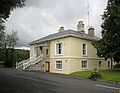 Crinken House Shankill.jpg 1,551 × 1,197; 911 KB
-
 Christ Church Dublin - geograph.org.uk - 1246545.jpg 640 × 480; 75 KB
-
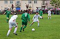 Amateur Football in Kilkenny-Ireland.jpg 460 × 298; 150 KB
-
 Ancient tree - geograph.org.uk - 486597.jpg 513 × 640; 98 KB
-
 AnnaghHill1632.jpg 3,888 × 1,628; 1.48 MB
-
 Askeaton Castle - geograph.org.uk - 485315.jpg 426 × 640; 110 KB
-
 Askeaton Castle - geograph.org.uk - 497981.jpg 1,024 × 774; 932 KB
-
 Askeaton Castle and the River Deel - geograph.org.uk - 497983.jpg 1,024 × 746; 865 KB
-
 Beltany Sunset.jpg 1,122 × 713; 799 KB
-
 Burtonport looking west - geograph.org.uk - 466201.jpg 640 × 480; 65 KB
-
 Bus Depot Stranorlar - geograph.org.uk - 483045.jpg 640 × 480; 133 KB
-
 Church in Listowel town square - geograph.org.uk - 506930.jpg 426 × 640; 125 KB
-
 Church in Rosemont.jpg 3,888 × 2,592; 2.29 MB
-
 Control room DublinPortTunnel.tif 2,832 × 2,128, 2 pages; 17.3 MB
-
 Crone Wood Car Park - geograph.org.uk - 466470.jpg 640 × 480; 146 KB
-
 Culdaff Beach, Co. Donegal - geograph.org.uk - 466172.jpg 640 × 480; 74 KB
-

-
 Dalkey island.jpg 3,882 × 1,302; 1.19 MB
-
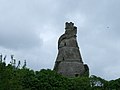
 Dawson Monument - geograph.org.uk - 487283.jpg 480 × 640; 86 KB
-
 Dublin Ulster Bank cajero.jpg 1,635 × 2,030; 1.4 MB
-
 Dunbrody ship NewRoss.jpg 1,200 × 1,600; 804 KB
-
 E4319-O-Connell-St.jpg 2,048 × 1,536; 1.08 MB
-
 E4320-Spire-of-Dublin.jpg 1,536 × 2,048; 1.14 MB
-
 E4322-Spire-of-Dublin.jpg 1,712 × 2,560; 1.45 MB
-
 E4323-People-at-Spire-of-Dublin.jpg 2,048 × 1,536; 1.13 MB
-
 E4324-Spire-of-Dublin.jpg 1,712 × 2,560; 1.44 MB
-
 E4398-Dublin-Castle.jpg 1,600 × 1,200; 621 KB
-
 Eyeries School - geograph.org.uk - 524464.jpg 640 × 480; 125 KB
-
 Fine Furniture Shop - geograph.org.uk - 471575.jpg 640 × 480; 140 KB
-
 Four Courts the River Liffey - geograph.org.uk - 887266.jpg 640 × 452; 302 KB
-
 Grace's Castle, Kilkenny - geograph.org.uk - 530716.jpg 640 × 426; 103 KB
-
 Head of Lough Talt from the Sligo Way - geograph.org.uk - 486944.jpg 640 × 480; 139 KB
-
 Holy Trinity Church, The Rock - geograph.org.uk - 454573.jpg 640 × 480; 46 KB
-
 IMG Arklow19Arches1551.jpg 3,888 × 2,592; 3.12 MB
-
 IMG BallybrophyHalt1347.jpg 3,888 × 2,592; 2.49 MB
-
 IMG Booterstown1483.jpg 3,888 × 2,592; 2.02 MB
-
 IMG DonaghmoreVillage1330b.jpg 3,888 × 2,592; 3.32 MB
-
 IMG HollyfortSchool1638.jpg 2,592 × 3,888; 4.13 MB
-
 IMG MonaseedSign1643.jpg 3,888 × 2,592; 3.16 MB
-
 IMG MountTemple1671.jpg 3,365 × 1,970; 1.26 MB
-
 IMG MountTemple1672.jpg 3,561 × 2,388; 2.71 MB
-
 IMG MoyvoughlySign1673.jpg 3,888 × 2,592; 4.37 MB
-
 IMG ProsperousPO1267w.jpg 3,888 × 2,592; 3.33 MB
-
 IMG R435atDonaghmore1325.jpg 3,888 × 1,911; 2.06 MB
-
 IMG RDerrySign1378.jpg 3,888 × 2,592; 3.57 MB
-
 IMG Rhode884c.jpg 3,888 × 2,066; 2.4 MB
-
 IMG Rosemount1677c.jpg 2,822 × 2,592; 1.27 MB
-
 Kilfenora Cathedral (1).JPG 1,728 × 2,304; 1.27 MB
-
 Kilfenora Cathedral (2).JPG 2,304 × 1,728; 1.3 MB
-
 Kilfenora Cathedral (3).JPG 1,728 × 2,304; 1.32 MB
-
 Kilfenora Ruine.JPG 1,728 × 2,304; 1.31 MB
-
 Killinierin, County Wexford, IE.jpg 3,727 × 1,995; 2.69 MB
-
 Knocktopher Church - geograph.org.uk - 476005.jpg 640 × 480; 84 KB
-
 Ladies View Killarney Lakes - geograph.org.uk - 498015.jpg 640 × 480; 152 KB
-
 Limerick castle.JPG 3,072 × 2,304; 1.35 MB
-
 Lough Eske, north of Donegal town. - geograph.org.uk - 466190.jpg 640 × 480; 87 KB
-
 Lugmore - geograph.org.uk - 471919.jpg 640 × 479; 67 KB
-
 Lugmore Townland - geograph.org.uk - 471921.jpg 640 × 479; 65 KB
-
 Main Street, Killarney - geograph.org.uk - 524512.jpg 640 × 480; 155 KB
-
 Mallowtown.jpg 1,536 × 2,048; 891 KB
-
 Onagh Bridge - geograph.org.uk - 467290.jpg 640 × 480; 113 KB
-
 R724 Kildavin 1385b.jpg 3,888 × 1,959; 2.46 MB
-
 Ringfort entrance way 2.JPG 2,048 × 1,536; 1,007 KB
-
 River Barrow - geograph.org.uk - 722250.jpg 640 × 411; 44 KB
-
 River Dargle - geograph.org.uk - 459593.jpg 640 × 480; 103 KB
-
 River Dargle Pipebridge - geograph.org.uk - 462971.jpg 480 × 640; 131 KB
-
 S-bend on the Healy Pass - geograph.org.uk - 486262.jpg 640 × 426; 108 KB
-
 Shannonbridge view from east bank.jpg 2,216 × 1,576; 944 KB
-
 ShootingInTheMidlands.jpg 1,200 × 798; 229 KB
-
 Shrine on the Healy Pass - geograph.org.uk - 486225.jpg 426 × 640; 94 KB
-
 Tara Protest Banner.jpg 1,280 × 960; 257 KB
-
 TaraHill1590c.jpg 3,888 × 1,411; 1.39 MB
-

-
 The River Deel at Askeaton - geograph.org.uk - 485321.jpg 640 × 426; 91 KB
-
 The River Nore at Brownsbarn Bridge - geograph.org.uk - 534000.jpg 640 × 426; 112 KB
-
 The road to Easky Lough - geograph.org.uk - 487285.jpg 640 × 480; 122 KB
-
 The Summerhouse, above the Dargle River - geograph.org.uk - 462966.jpg 480 × 640; 140 KB
-
 Timahoe Round tower and Monastery - geograph.org.uk - 463441.jpg 640 × 480; 59 KB
-

-
 Woodenbridge.jpg 3,888 × 2,592; 3.35 MB


.JPG)
.JPG)
.JPG)


