Category:July 2021 in the East Riding of Yorkshire
Jump to navigation
Jump to search
Ceremonial counties of England: Bedfordshire · Berkshire · Cambridgeshire · Cheshire · Cornwall · Cumbria · Derbyshire · Devon · Dorset · Durham · East Riding of Yorkshire · East Sussex · Essex · Gloucestershire · Greater London · Greater Manchester · Hampshire · Herefordshire · Hertfordshire · Kent · Lancashire · Leicestershire · Lincolnshire · Merseyside · Norfolk · North Yorkshire · Northamptonshire · Oxfordshire · Shropshire · Somerset · South Yorkshire · Staffordshire · Suffolk · Surrey · Warwickshire · West Midlands · West Sussex · West Yorkshire · Wiltshire ·
City-counties: Bristol ·
Former historic counties:
Other former counties:
City-counties: Bristol ·
Former historic counties:
Other former counties:
Deutsch: Bilder, die im Juli 2021 in the East Riding of Yorkshire aufgenommen worden sind. Bitte beachten Sie, dass dies weder das Datum des Uploads noch das Datum des Scannens eines Fotos ist.
English: Images/pictures taken in the East Riding of Yorkshire during July 2021. Note this is not the date of the upload, nor the date a photo was scanned.
Español: Fotografías o imágenes tomadas en the East Riding of Yorkshire durante julio 2021. No es la fecha de subida ni escaneo, sino la fecha en que las fotografías o imágenes se crearon.
Esperanto: Bildoj faritaj en the East Riding of Yorkshire en julio 2021. Tio ne estas la dato, kiam la bildoj estis alŝutitaj aŭ skanitaj.
Français : Photographies ou images prises en the East Riding of Yorkshire durant juillet 2021. Ce n'est pas la date du téléchargement ou du scan.
Galego: Fotografías ou imaxes tomadas en the East Riding of Yorkshire durante xullo 2021. Non é a data de subida nin escaneamento, senón a data na que se crearon as fotografías ou imaxes.
Italiano: Fotografie o immagini scattate a the East Riding of Yorkshire nel luglio 2021. Nota bene: la data non si riferisce né a quella di upload né a quella in cui la foto è stata digitalizzata.
Norsk bokmål: Bilder tatt i the East Riding of Yorkshire i løpet av juli 2021. Merk at dette ikke er datoen for opplasting, eller når et bilde har blitt skannet.
Norsk nynorsk: Bilete teke i the East Riding of Yorkshire i løpet av juli 2021. Merk at dette ikkje er datoen for opplasting, eller når eit bilete har vorte skanna.
Русский: Изображения, сделанные в the East Riding of Yorkshire в течение июль 2021 (не дата загрузки изображения).
Українська: Зображення, зроблені в the East Riding of Yorkshire протягом липень 2021. Зауважте, що це не дата завантаження чи дата сканування фотографії.
| July 2020 | ← | July 2021 | → | July 2022 | |||||||
| Jan | Feb | Mar | Apr | May | Jun | Jul | Aug | Sep | Oct | Nov | Dec |
| 6 | 11 | 12 | 108 | 49 | 29 | 81 | 5 | 4 | 4 | 7 | 41 |
|---|---|---|---|---|---|---|---|---|---|---|---|
Subcategories
This category has only the following subcategory.
Media in category "July 2021 in the East Riding of Yorkshire"
The following 80 files are in this category, out of 80 total.
-
 158 Squadron memorial (geograph 6907659).jpg 1,024 × 683; 543 KB
-
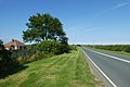 A1033 to Hollym (geograph 6909437).jpg 1,024 × 683; 511 KB
-
 Along Allison Lane (geograph 6907672).jpg 1,024 × 683; 484 KB
-
 Along Fisher Lane (geograph 6907667).jpg 1,024 × 683; 512 KB
-
 Along Skeffling Road (geograph 6909172).jpg 1,024 × 683; 584 KB
-
 Along Welwick Road (geograph 6909400).jpg 1,024 × 683; 502 KB
-
 Approaching Ulrome on Allison Lane (geograph 6907676).jpg 1,024 × 683; 526 KB
-
 B1242 Allison Lane (geograph 6907670).jpg 1,024 × 683; 536 KB
-
 B1242 Skipsea Lane (geograph 6908108).jpg 1,024 × 683; 453 KB
-
 B1445 Welwick Road (geograph 6909409).jpg 1,024 × 683; 471 KB
-
 Barley between Gransmoor and Lissett (geograph 6907653).jpg 1,024 × 683; 429 KB
-
 Barley near Hill Farm (geograph 6907647).jpg 1,024 × 683; 460 KB
-
 Barmston Main Drain (geograph 6907668).jpg 1,024 × 683; 407 KB
-
 Beeford Road (geograph 6907723).jpg 1,024 × 683; 405 KB
-
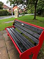 Bench and phone box, Kirk Ella (geograph 6889570).jpg 768 × 1,024; 1.37 MB
-
 Bend on Burnbutts Lane (geograph 6901903).jpg 1,024 × 683; 426 KB
-
 Bridlington Road in Skipsea (geograph 6907705).jpg 1,024 × 683; 397 KB
-
 Bridlington Road in Skipsea (geograph 6908085).jpg 1,024 × 683; 413 KB
-
 Burnbutt Lane (geograph 6901902).jpg 1,024 × 683; 418 KB
-
 Burnbutts Lane (geograph 6901882).jpg 1,024 × 683; 431 KB
-
 Crossways Fish and Chips (geograph 6908101).jpg 1,024 × 683; 376 KB
-
 Driveway to Ploughland (geograph 6909201).jpg 1,024 × 683; 468 KB
-
 End of Mill Lane (geograph 6908092).jpg 1,024 × 683; 331 KB
-
 Entrance to Cold Wold Farm (geograph 6911299).jpg 1,024 × 768; 164 KB
-
 Eroded road (geograph 6908095).jpg 1,024 × 683; 386 KB
-
 Farmhouse near Willerby (geograph 6894075).jpg 1,024 × 835; 1.1 MB
-
 Farmland beside Allison Lane (geograph 6908110).jpg 1,024 × 683; 501 KB
-
 Farmland beside Burnbutts Lane (geograph 6901885).jpg 1,024 × 683; 448 KB
-
 Farmland beside Gransmoor Road (geograph 6907664).jpg 1,024 × 683; 456 KB
-
 Farmland beside Skipsea Lane (geograph 6908106).jpg 1,024 × 683; 471 KB
-
 Farmland south of Welwick Road (geograph 6909202).jpg 1,024 × 683; 472 KB
-
 Field south east of Gransmoor (geograph 6907638).jpg 1,024 × 683; 362 KB
-
 Fields beside Welwick Road (geograph 6909404).jpg 1,024 × 683; 469 KB
-
 Fields near Hill Farm (geograph 6907635).jpg 1,024 × 683; 363 KB
-
 Fields west of Patrington (geograph 6909418).jpg 1,024 × 683; 419 KB
-
 Fisher Lane (geograph 6907665).jpg 1,024 × 683; 407 KB
-
 Greenwich Meridian marker (geograph 6909410).jpg 683 × 1,024; 615 KB
-
 Greenwich Meridian Marker near Black Mill Farm (geograph 6909416).jpg 1,024 × 683; 613 KB
-
 Hollym Road (geograph 6909436).jpg 1,024 × 683; 433 KB
-
 House building, Kirk Ella (geograph 6889879).jpg 1,024 × 705; 1.13 MB
-
 Houses on West Ella Way, Kirk Ella (geograph 6889530).jpg 1,024 × 768; 1.18 MB
-
 Junction in Skipsea (geograph 6908082).jpg 1,024 × 683; 391 KB
-
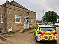 Kirk Ella police station (geograph 6889691).jpg 1,024 × 768; 1.21 MB
-
 Layby along the B1445 (geograph 6909185).jpg 1,024 × 683; 419 KB
-
 Layby on Allison Lane (geograph 6907671).jpg 1,024 × 683; 499 KB
-
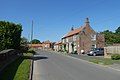 Main Street, Welwick (geograph 6909194).jpg 1,024 × 683; 462 KB
-
 Memorial for 158 Squadron (geograph 6907662).jpg 1,024 × 683; 431 KB
-
 Mill Farm (geograph 6908103).jpg 1,024 × 683; 405 KB
-
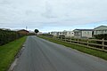 Mill Lane and caravan park (geograph 6908090).jpg 1,024 × 683; 382 KB
-
 Mill Lane at Skipsea Sands (geograph 6908094).jpg 1,024 × 683; 379 KB
-
 Minor road into Warter (geograph 6911309).jpg 1,024 × 706; 161 KB
-
 Minor road on Nunburnholme Wold (geograph 6911307).jpg 1,024 × 768; 192 KB
-
 Missing road (geograph 6908098).jpg 1,024 × 646; 398 KB
-
 Mown verge beside a field of barley (geograph 6907654).jpg 1,024 × 683; 400 KB
-
 Mown verge near Hill Farm (geograph 6907648).jpg 1,024 × 683; 405 KB
-
 New Haltemprice Farm? (geograph 6894083).jpg 1,024 × 786; 1.2 MB
-
 North of Skeffling Road (geograph 6909176).jpg 1,024 × 683; 481 KB
-
 Ponies near Cottingham (geograph 6892828).jpg 1,024 × 703; 1.34 MB
-
 Road at Burn Butts (geograph 6901884).jpg 1,024 × 683; 410 KB
-
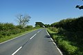 Road between Weeton and Skeffling (geograph 6909154).jpg 1,024 × 683; 484 KB
-
 Road between Weeton and Welwick (geograph 6909188).jpg 1,024 × 683; 500 KB
-
 Road near Hill Farm (geograph 6907646).jpg 1,024 × 683; 402 KB
-
 Road near Welwick Thorpe (geograph 6909406).jpg 1,024 × 683; 492 KB
-
 Road on Nunburnholme Wold (geograph 6911303).jpg 1,024 × 755; 150 KB
-
 Road to Skeffling (geograph 6909164).jpg 1,024 × 683; 413 KB
-
 Road to Ulrome (geograph 6907673).jpg 1,024 × 683; 446 KB
-
 Sign for double bend (geograph 6907656).jpg 1,024 × 683; 390 KB
-
 Signpost in Ulrome (geograph 6907677).jpg 1,024 × 683; 457 KB
-
 Skeffling Road (geograph 6909161).jpg 1,024 × 683; 523 KB
-
 St. Mary's Church (geograph 6909191).jpg 1,024 × 683; 477 KB
-
 St. Mary's Church (geograph 6909199).jpg 1,024 × 683; 519 KB
-
 The Green (geograph 6908104).jpg 1,024 × 683; 486 KB
-
 The Vicarage, Kirk Ella (geograph 6889678).jpg 1,024 × 923; 1.48 MB
-
 Track to Haverfield House (geograph 6909403).jpg 1,024 × 683; 399 KB
-
 Track to the reservoir (geograph 6911312).jpg 1,024 × 768; 296 KB
-
 Weeton Road near Scorborough House (geograph 6909152).jpg 1,024 × 683; 471 KB
-
 Welwick Road near Haverfield House (geograph 6909401).jpg 1,024 × 683; 434 KB
-
 Welwick Road near Westfield Farm (geograph 6909405).jpg 1,024 × 683; 435 KB
-
 Wheat beside Burnbutts Lane (geograph 6901881).jpg 1,024 × 683; 447 KB
-
 Wolfreton School, Willerby (geograph 6889831).jpg 1,024 × 768; 1.18 MB
.jpg)
.jpg)
.jpg)
.jpg)
.jpg)
.jpg)
.jpg)
.jpg)
.jpg)
.jpg)
.jpg)
.jpg)
.jpg)
.jpg)
.jpg)
.jpg)
.jpg)
.jpg)
.jpg)
.jpg)
.jpg)
.jpg)
.jpg)
.jpg)
.jpg)
.jpg)
.jpg)
.jpg)
.jpg)
.jpg)
.jpg)
.jpg)
.jpg)
.jpg)
.jpg)
.jpg)
.jpg)
.jpg)
.jpg)
.jpg)
.jpg)
.jpg)
.jpg)
.jpg)
.jpg)
.jpg)
.jpg)
.jpg)
.jpg)
.jpg)
.jpg)
.jpg)
.jpg)
.jpg)
.jpg)
.jpg)
.jpg)
.jpg)
.jpg)
.jpg)
.jpg)
.jpg)
.jpg)
.jpg)
.jpg)
.jpg)
.jpg)
.jpg)
.jpg)
.jpg)
.jpg)
.jpg)
.jpg)
.jpg)
.jpg)
.jpg)
.jpg)
.jpg)
.jpg)
.jpg)