Category:July 2018 in Leeds
Jump to navigation
Jump to search
Subcategories
This category has the following 14 subcategories, out of 14 total.
0
1
2
Media in category "July 2018 in Leeds"
The following 67 files are in this category, out of 67 total.
-
 91128 LNER Leeds.jpg 4,608 × 3,456; 3.83 MB
-
 Bike shed at the Temple Learning Academy (geograph 5834188).jpg 1,024 × 768; 266 KB
-
 Demolition of the former Yorkshire Tile Company building (geograph 5860427).jpg 1,024 × 768; 120 KB
-
 Ellers Road off Harehills Avenue, Leeds (geograph 5845008).jpg 1,600 × 1,065; 531 KB
-
 Ellers Road, Leeds (geograph 5845183).jpg 1,600 × 1,065; 590 KB
-
 Esso garage on Harrogate Road, Leeds (geograph 5844973).jpg 1,600 × 1,065; 644 KB
-
 Farm Hill Way, Leeds (geograph 5843076).jpg 1,600 × 1,065; 459 KB
-
 Footbridge over the Wyke Beck (geograph 5834167).jpg 1,024 × 768; 235 KB
-
 Former site of Whingate Primary School (geograph 5837521).jpg 1,024 × 683; 177 KB
-
 Harehills Lane at Cower Road, Leeds (geograph 5845457).jpg 1,600 × 1,065; 546 KB
-
 Harehills Lane at Strathmore Drive, Leeds (geograph 5845441).jpg 1,600 × 1,065; 529 KB
-
 Harehills Lane, Leeds (geograph 5845450).jpg 1,600 × 1,065; 533 KB
-
 Harehills Place off Harehills Road, Leeds (geograph 5845301).jpg 1,600 × 1,065; 571 KB
-
 Harrogate Road at Street Lane, Leeds (geograph 5844752).jpg 1,600 × 1,065; 503 KB
-
 Harrogate Road, Chapel Allerton, Leeds (geograph 5844930).jpg 1,600 × 1,065; 625 KB
-
 Harrogate Road, Chapel Allerton, Leeds (geograph 5844942).jpg 1,600 × 1,065; 433 KB
-
 Headingley Hall blue plaque 12 July 2018.jpg 1,552 × 1,541; 1.45 MB
-
 Holy Trinity Church, Meanwood, Leeds (geograph 5843312).jpg 1,600 × 1,065; 573 KB
-
 Holy Trinity Church, Meanwood, Leeds (geograph 5843314).jpg 617 × 1,600; 403 KB
-
 Holy Trinity Church, Meanwood, Leeds (geograph 5843318).jpg 622 × 1,600; 443 KB
-
 Holy Trinity Church, Meanwood, Leeds (geograph 5843324).jpg 1,123 × 1,600; 854 KB
-
 Holy Trinity Church, Meanwood, Leeds (geograph 5843326).jpg 1,600 × 1,065; 429 KB
-
 Holy Trinity Church, Meanwood, Leeds (geograph 5843526).jpg 1,065 × 1,600; 541 KB
-
 Houses on Allerton Hill, Chapel Allerton, Leeds (geograph 5844907).jpg 1,600 × 1,065; 564 KB
-
 Houses on Teale Court (geograph 5844979).jpg 1,600 × 1,065; 806 KB
-
 Ian Dewhurst 158860.jpg 4,608 × 3,456; 4.06 MB
-
 Jamia Masjid Bilal Mosque (geograph 5845306).jpg 1,600 × 1,065; 539 KB
-
 Lambton Grove joins Harehills Road, Leeds (geograph 5845196).jpg 1,600 × 1,065; 573 KB
-
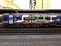
 Leeds station - Stopper to York - geograph.org.uk - 5852219.jpg 1,024 × 768; 185 KB
-
 Leeds Station Entrance 1 July 2018.jpg 2,304 × 3,072; 2.44 MB
-
 Leeds Student Medical Practice, Leeds (geograph 5842794).jpg 1,600 × 1,056; 525 KB
-
 LGI Entrance corridor 19 July 2018 2.jpg 2,116 × 3,066; 2.65 MB
-
 LGI Entrance corridor 19 July 2018 3.jpg 3,264 × 2,448; 2.45 MB
-
 LGI Entrance corridor detail 19 July 2018 1.jpg 2,448 × 3,264; 2.19 MB
-
 LGI Entrance corridor detail 19 July 2018 3.jpg 3,264 × 2,448; 1.95 MB
-
 LGI Entrance corridor floor 19 July 2018 1.jpg 3,264 × 2,448; 2.63 MB
-
 LGI Garden 19 July 2018 1.jpg 3,264 × 2,448; 3.41 MB
-
 LGI Garden 19 July 2018 2.jpg 3,264 × 2,448; 4.05 MB
-
 LGI Landing 19 July 2018 1.jpg 2,448 × 3,264; 2.24 MB
-
 LGI Staircase 19 July 2018.jpg 2,448 × 3,264; 2.51 MB
-
 LGI Walter Thompson memorial 19 July 2018.jpg 2,448 × 3,264; 2.13 MB
-
 Lower Street off Harehills Road, Leeds (geograph 5845250).jpg 1,600 × 1,065; 485 KB
-
 Mansion Gate off Harehills Lane, Leeds (geograph 5844976).jpg 1,600 × 1,065; 720 KB
-
 North Hill Court 18 July 2018 1.jpg 3,072 × 2,304; 2.06 MB
-
 Number 1 Aire Street 1 July 2018 02.jpg 2,304 × 3,072; 1.65 MB
-
 Number 1 Aire Street 1 July 2018.jpg 3,072 × 2,304; 1.6 MB
-
 Paperchase stationery shop.jpg 4,608 × 3,456; 4.03 MB
-
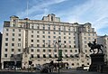 Queens Hotel 1 July 2018 01.jpg 3,054 × 2,088; 2.58 MB
-
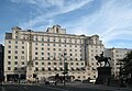 Queens Hotel 1 July 2018 02.jpg 2,880 × 2,001; 1.95 MB
-
 Queens Hotel 1 July 2018 03.jpg 2,829 × 2,139; 2.19 MB
-
 Queens Hotel LMSR 1 July 2018.jpg 1,504 × 1,150; 667 KB
-
 Queens Hotel station and offices 1 July 2018 02.jpg 2,235 × 1,791; 1.47 MB
-
 Scorched Earth at Park Square, Leeds (9th July 2018) 001.jpg 5,152 × 3,864; 6.71 MB
-
 Scorched Earth at Park Square, Leeds (9th July 2018) 002.jpg 5,152 × 3,864; 6.95 MB
-
 Shops on Lingfield Drive, Leeds (geograph 5844473).jpg 1,600 × 1,065; 390 KB
-
 St Pauls church, Ireland Wood (geograph 5834354).jpg 1,024 × 768; 341 KB
-
 Stainbeck Lane, Chapel Allerton, Leeds (geograph 5844935).jpg 1,600 × 1,065; 431 KB
-
 Stainbeck Road, Chapel Allerton, Leeds (geograph 5844897).jpg 1,600 × 1,065; 703 KB
-
 Stonegate Crescent, Leeds (geograph 5843103).jpg 1,600 × 1,065; 560 KB
-
 Stonegate Crescent, Leeds (geograph 5843104).jpg 1,600 × 1,065; 648 KB
-
 Stonegate Crescent, Leeds (geograph 5843105).jpg 1,600 × 1,065; 522 KB
-
 Stonelea Court from Stonegate Crescent, Leeds (geograph 5843101).jpg 1,600 × 1,065; 517 KB
-
 The Lingfield Centre at Lingfield Hill, Leeds (geograph 5844314).jpg 1,600 × 1,065; 662 KB
-
 The Nags Head, Chapel Allerton, Leeds (geograph 5844948).jpg 988 × 1,600; 393 KB
-
 The Shah Jalal Mosque, Ellers Road, Leeds (geograph 5845016).jpg 1,600 × 1,065; 521 KB
-
 Trinity United Reformed Church, Harehills Avenue, Leeds (geograph 5844992).jpg 1,600 × 1,065; 754 KB
-
 Victorian Postbox on Stainbeck Road, Chapel Allerton, Leeds (geograph 5844890).jpg 1,065 × 1,600; 781 KB

.jpg)
.jpg)
.jpg)
.jpg)
.jpg)
.jpg)
.jpg)
.jpg)
.jpg)
.jpg)
.jpg)
.jpg)
.jpg)
.jpg)
.jpg)

.jpg)
.jpg)
.jpg)
.jpg)
.jpg)
.jpg)

.jpg)
.jpg)


.jpg)


.jpg)
.jpg)


_001.jpg)
_002.jpg)
.jpg)
.jpg)
.jpg)
.jpg)
.jpg)
.jpg)
.jpg)
.jpg)
.jpg)
.jpg)
.jpg)
.jpg)
.jpg)
.jpg)
.jpg)