Category:July 2013 in York
Jump to navigation
Jump to search
Ok
Deutsch: Bilder, die im Juli 2013 in York aufgenommen worden sind. Bitte beachten Sie, dass dies weder das Datum des Uploads noch das Datum des Scannens eines Fotos ist.
English: Images/pictures taken in York during July 2013. Note this is not the date of the upload, nor the date a photo was scanned.
Español: Fotografías o imágenes tomadas en York durante julio 2013. No es la fecha de subida ni escaneo, sino la fecha en que las fotografías o imágenes se crearon.
Esperanto: Bildoj faritaj en York en julio 2013. Tio ne estas la dato, kiam la bildoj estis alŝutitaj aŭ skanitaj.
Français : Photographies ou images prises en York durant juillet 2013. Ce n'est pas la date du téléchargement ou du scan.
Galego: Fotografías ou imaxes tomadas en York durante xullo 2013. Non é a data de subida nin escaneamento, senón a data na que se crearon as fotografías ou imaxes.
Italiano: Fotografie o immagini scattate a York nel luglio 2013. Nota bene: la data non si riferisce né a quella di upload né a quella in cui la foto è stata digitalizzata.
Norsk bokmål: Bilder tatt i York i løpet av juli 2013. Merk at dette ikke er datoen for opplasting, eller når et bilde har blitt skannet.
Norsk nynorsk: Bilete teke i York i løpet av juli 2013. Merk at dette ikkje er datoen for opplasting, eller når eit bilete har vorte skanna.
Русский: Изображения, сделанные в York в течение июль 2013 (не дата загрузки изображения).
Українська: Зображення, зроблені в York протягом липень 2013. Зауважте, що це не дата завантаження чи дата сканування фотографії.
| July 2012 | ← | July 2013 | → | July 2014 | |||||||
| Jan | Feb | Mar | Apr | May | Jun | Jul | Aug | Sep | Oct | Nov | Dec |
| 31 | 88 | 97 | 43 | 370 | 202 | 370 | 41 | 63 | 113 | 234 | 82 |
|---|---|---|---|---|---|---|---|---|---|---|---|
Subcategories
This category has only the following subcategory.
Media in category "July 2013 in York"
The following 200 files are in this category, out of 369 total.
(previous page) (next page)-

-

-
 4 A4s - geograph.org.uk - 3544033.jpg 1,000 × 416; 182 KB
-

-

-

-
 60007 Sir Nigel Gresley at the NRM (name plate).JPG 4,608 × 3,440; 4.26 MB
-
 60007 Sir Nigel Gresley at the NRM.JPG 4,608 × 3,440; 4.1 MB
-
 A London King's Cross arrival at York terminus. - panoramio.jpg 3,888 × 2,592; 2.85 MB
-
 A4 Class locomotives, National Railway Museum - geograph.org.uk - 3566687.jpg 1,024 × 680; 212 KB
-
 A4 collection - geograph.org.uk - 3544021.jpg 640 × 427; 127 KB
-
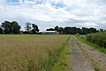
 Across Hob Moor - geograph.org.uk - 3544192.jpg 640 × 427; 86 KB
-
 Across the Tillmire - geograph.org.uk - 3554940.jpg 640 × 427; 93 KB
-
 After the concert - geograph.org.uk - 3573196.jpg 640 × 427; 93 KB
-
 After the finishing line - geograph.org.uk - 3554198.jpg 640 × 427; 130 KB
-
 Along Bad Bargain Lane - geograph.org.uk - 3573611.jpg 640 × 427; 86 KB
-
 Along Hagg Wood - geograph.org.uk - 3573665.jpg 640 × 427; 114 KB
-
 Along Kexby Stray - geograph.org.uk - 3573682.jpg 640 × 427; 121 KB
-
 Apple Tree Farm - geograph.org.uk - 3573599.jpg 640 × 427; 117 KB
-
 Approaching Londesborough Lodge - geograph.org.uk - 3573668.jpg 640 × 427; 109 KB
-
 Arch in Monk Bar.JPG 4,608 × 3,440; 3.93 MB
-
 Askham Bar park ^ ride terminus - geograph.org.uk - 3540507.jpg 800 × 533; 99 KB
-
 Aviva building, Rougier Street, York (15th July 2013).JPG 2,176 × 3,872; 1.76 MB
-
 Bad Bargain Lane - geograph.org.uk - 3573600.jpg 427 × 640; 125 KB
-
 Barley field - geograph.org.uk - 3554918.jpg 640 × 427; 105 KB
-
 Barley field - geograph.org.uk - 3554920.jpg 640 × 427; 96 KB
-
 Big screen and crowds - geograph.org.uk - 3554179.jpg 640 × 427; 144 KB
-
 Birth place of Guy Fawkes - geograph.org.uk - 3565605.jpg 680 × 1,024; 193 KB
-
 Bishopthorpe Bridge Stone - panoramio.jpg 2,560 × 1,920; 2.74 MB
-
 Bittern, National Railway Museum - geograph.org.uk - 3566679.jpg 680 × 1,024; 153 KB
-
 Blue footbridge over the River Foss (1).JPG 4,608 × 3,440; 4.46 MB
-
 Blue footbridge over the River Foss (2).JPG 4,608 × 3,440; 4.09 MB
-
 Bridge Street York - geograph.org.uk - 3784250.jpg 640 × 427; 147 KB
-
 Bridleway across Kexby Stray - geograph.org.uk - 3573716.jpg 640 × 427; 119 KB
-
 Bridleway along A64 - geograph.org.uk - 3554856.jpg 640 × 427; 94 KB
-
 Bridleway on Heslington Common - geograph.org.uk - 3554858.jpg 640 × 427; 95 KB
-
 Bridleway to Stockton Lane - geograph.org.uk - 3573626.jpg 640 × 427; 78 KB
-
 Bridleway towards Fulford Golf club - geograph.org.uk - 3554861.jpg 640 × 427; 106 KB
-

-
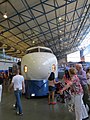 BulletTrain01LB.jpg 2,112 × 2,816; 1.46 MB
-
 Bustardthorpe and stage - geograph.org.uk - 3573181.jpg 640 × 427; 92 KB
-
 Bustardthorpe lawns - geograph.org.uk - 3554170.jpg 640 × 427; 105 KB
-
 Bustardthorpe stand - geograph.org.uk - 3554173.jpg 640 × 427; 100 KB
-
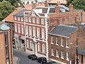
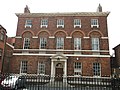 Castlegate House, York.JPG 4,608 × 3,440; 3.97 MB
-
 Central Hall and Vanbrugh - geograph.org.uk - 3554997.jpg 640 × 427; 68 KB
-
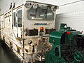 Channel Tunnel construction locomotive at NRM (1).JPG 4,608 × 3,440; 3.91 MB
-
 Channel Tunnel construction locomotive at NRM (2).JPG 4,608 × 3,440; 3.73 MB
-
 Channel Tunnel construction locomotive at NRM (3).JPG 4,608 × 3,440; 3.88 MB
-
 CLASS 31 DIESEL NATIONAL RAILWAY MUSEUM YORK JULY 2013 (9255992097).jpg 3,517 × 2,496; 5.63 MB
-
 Class 37 D6700 at the National Railway Museum, York. 10 July 2013.jpg 2,235 × 2,201; 2.83 MB
-
 Clifford Tower York - geograph.org.uk - 3609927.jpg 800 × 534; 235 KB
-
 Clifford Tower York - geograph.org.uk - 3609952.jpg 800 × 534; 263 KB
-
 Clifford Tower York - geograph.org.uk - 3609956.jpg 534 × 800; 288 KB
-
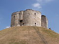 Clifford's Tower in July sun.JPG 4,608 × 3,440; 4.03 MB
-
 Concert stage - geograph.org.uk - 3573160.jpg 640 × 427; 104 KB
-
 Confluence of the River Ouse and River Foss, York - geograph.org.uk - 3647865.jpg 1,952 × 2,928; 2.25 MB
-
 Constantine the Great - geograph.org.uk - 3563513.jpg 680 × 1,024; 148 KB
-
 Constantine The Great York Minster - geograph.org.uk - 3613262.jpg 534 × 800; 277 KB
-
 Construction in progress - geograph.org.uk - 3563474.jpg 640 × 427; 99 KB
-
 Construction site fence - geograph.org.uk - 3563468.jpg 640 × 427; 95 KB
-
 Course enclosure - geograph.org.uk - 3573195.jpg 640 × 427; 115 KB
-
 Course of the old railway - geograph.org.uk - 3573703.jpg 640 × 427; 111 KB
-
 Creme Cone of Leeds - geograph.org.uk - 3609937.jpg 800 × 534; 282 KB
-
 Cross Keys Deangate York - geograph.org.uk - 3783540.jpg 640 × 427; 122 KB
-
 Cycle Response Unit York Minster - geograph.org.uk - 3613324.jpg 534 × 800; 259 KB
-
 Deangate - geograph.org.uk - 3542562.jpg 427 × 640; 93 KB
-
 Detail on the western face of York Minster (15th July 2013).JPG 2,176 × 3,872; 2.16 MB
-
 Detail, west front York Minster - geograph.org.uk - 3565615.jpg 1,024 × 680; 243 KB
-
 Dominion of Canada, National Railway Museum - geograph.org.uk - 3566658.jpg 1,024 × 680; 148 KB
-
 Dwight D Eisenhower, National Railway Museum - geograph.org.uk - 3566649.jpg 680 × 1,024; 174 KB
-
 Dwight D Eisenhower, National Railway Museum - geograph.org.uk - 3566677.jpg 1,024 × 680; 168 KB
-
 Early morning call on the 'Scarborough' side of York station. - panoramio.jpg 1,092 × 724; 1.19 MB
-
 East Bank of the River Ouse seen from Ousebridge, York (15th July 2013).JPG 3,872 × 2,176; 2.82 MB
-
 Eastfield Lane - geograph.org.uk - 3573649.jpg 427 × 640; 87 KB
-
 Edge of Heslington Tillmire - geograph.org.uk - 3554977.jpg 640 × 427; 89 KB
-
 Edinburgh arrival at York, July 15, 2013. - panoramio.jpg 1,166 × 776; 1.41 MB
-
 Entrance to the Tillmire - geograph.org.uk - 3554948.jpg 640 × 427; 121 KB
-
 Fairfax House from Cliford's Tower (1).JPG 4,608 × 3,440; 4.29 MB
-
 Fairfax House from Cliford's Tower (2).JPG 4,608 × 3,440; 4.09 MB
-
 Fairfax House, York (1).JPG 4,608 × 3,440; 4.56 MB
-
 Fairfax House, York (10).JPG 4,608 × 3,440; 2.15 MB
-
 Fairfax House, York (11).JPG 4,608 × 3,440; 4.3 MB
-
 Fairfax House, York (12).JPG 4,608 × 3,440; 4.02 MB
-
 Fairfax House, York (13).JPG 4,608 × 3,440; 3.96 MB
-
 Fairfax House, York (14).JPG 4,608 × 3,440; 4.24 MB
-
 Fairfax House, York (15).JPG 4,608 × 3,440; 3.98 MB
-
 Fairfax House, York (16).JPG 4,608 × 3,440; 4.12 MB
-
 Fairfax House, York (17).JPG 4,608 × 3,440; 3.79 MB
-
 Fairfax House, York (18).JPG 4,608 × 3,440; 4.15 MB
-
 Fairfax House, York (19).JPG 4,608 × 3,440; 3.95 MB
-
 Fairfax House, York (2).JPG 4,608 × 3,440; 4.35 MB
-
 Fairfax House, York (20).JPG 4,608 × 3,440; 4.2 MB
-
 Fairfax House, York (21).JPG 4,608 × 3,440; 4.06 MB
-
 Fairfax House, York (22).JPG 4,608 × 3,440; 3.94 MB
-
 Fairfax House, York (23).JPG 4,608 × 3,440; 3.8 MB
-
 Fairfax House, York (3).JPG 4,608 × 3,440; 3.8 MB
-
 Fairfax House, York (4).JPG 4,608 × 3,440; 3.82 MB
-
 Fairfax House, York (5).JPG 4,608 × 3,440; 3.84 MB
-
 Fairfax House, York (6).JPG 4,608 × 3,440; 4 MB
-
 Fairfax House, York (7).JPG 4,608 × 3,440; 3.5 MB
-
 Fairfax House, York (8).JPG 4,608 × 3,440; 3.88 MB
-
 Fairfax House, York (9).JPG 4,608 × 3,440; 3.88 MB
-
 Farmland along Bad Bargain Lane - geograph.org.uk - 3573618.jpg 640 × 427; 97 KB
-
 Farmland along The Outgang - geograph.org.uk - 3554823.jpg 640 × 427; 95 KB
-
 Farmland near Hagg Wood - geograph.org.uk - 3573664.jpg 640 × 427; 91 KB
-
 Farmland off Eastfield Lane - geograph.org.uk - 3573658.jpg 640 × 427; 99 KB
-
 Farmland off Holtby Lane - geograph.org.uk - 3573628.jpg 640 × 427; 99 KB
-
 Field of poppies - geograph.org.uk - 3554925.jpg 640 × 427; 116 KB
-
 Field of wheat - geograph.org.uk - 3554904.jpg 640 × 427; 117 KB
-
 Fingerposts at the end of Landing Lane, Fulford Ings - panoramio.jpg 1,920 × 2,560; 2.33 MB
-
 Fishergate Tower, York 14.JPG 4,608 × 3,440; 3.63 MB
-
 Footbridge - geograph.org.uk - 3554944.jpg 640 × 427; 78 KB
-
 Footpath along Fulford Ings, York.jpg 2,560 × 1,920; 1.04 MB
-
 From the footbridge - geograph.org.uk - 3544047.jpg 640 × 428; 128 KB
-
 Fulford Golf Club.jpg 4,000 × 3,000; 1.01 MB
-
 Fulford golf course - geograph.org.uk - 3554987.jpg 640 × 427; 102 KB
-
 Fulford, UK - panoramio.jpg 2,560 × 1,920; 1.53 MB
-
 Garter blue gathering at York, July 2013 - panoramio.jpg 1,167 × 780; 1.49 MB
-
 Gateway on Fulford Ings, York.jpg 2,560 × 1,920; 1.64 MB
-
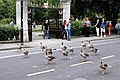 Geese on the road - geograph.org.uk - 3542879.jpg 800 × 533; 131 KB
-
 Ghost sign beside the River Foss - geograph.org.uk - 3542890.jpg 800 × 533; 173 KB
-
 Ghost sign on Lord Mayor's Walk - geograph.org.uk - 3542882.jpg 800 × 533; 111 KB
-
 Glass Caves York - geograph.org.uk - 3784276.jpg 640 × 427; 161 KB
-
 Gorse along the bridleway - geograph.org.uk - 3554954.jpg 427 × 640; 131 KB
-
 Grape Lane - geograph.org.uk - 3542886.jpg 533 × 800; 105 KB
-

-
 Hay drying - geograph.org.uk - 3544018.jpg 640 × 427; 115 KB
-
 Heslington Common - geograph.org.uk - 3554963.jpg 427 × 640; 123 KB
-

-
 Hob Moor ^ School - geograph.org.uk - 3544199.jpg 640 × 427; 88 KB
-
 Holgate Junction - geograph.org.uk - 3544185.jpg 640 × 427; 89 KB
-
 Holgate Windmill.jpg 1,000 × 1,333; 925 KB
-
 Horses passing helicopters - geograph.org.uk - 3554183.jpg 640 × 427; 125 KB
-
 Horses passing the helicopters - geograph.org.uk - 3554193.jpg 640 × 427; 127 KB
-
 Horses passing the horse ambulances - geograph.org.uk - 3554184.jpg 640 × 427; 132 KB
-
 Horses round the bend - geograph.org.uk - 3573190.jpg 640 × 305; 69 KB
-
 Horses warming up - geograph.org.uk - 3554189.jpg 640 × 427; 155 KB
-
 Human statue on Stonegate, York (15th July 2013).JPG 3,872 × 2,176; 2.78 MB
-
 Inside Clifford's Tower, York (1).JPG 4,608 × 3,440; 4.12 MB
-
 Inside Clifford's Tower, York (10).JPG 4,608 × 3,440; 3.75 MB
-
 Inside Clifford's Tower, York (11).JPG 4,608 × 3,440; 4.4 MB
-
 Inside Clifford's Tower, York (12).JPG 4,608 × 3,440; 4.43 MB
-
 Inside Clifford's Tower, York (13).JPG 4,608 × 3,440; 4.12 MB
-
 Inside Clifford's Tower, York (14).JPG 4,608 × 3,440; 4.01 MB
-
 Inside Clifford's Tower, York (15).JPG 4,608 × 3,440; 3.75 MB
-
 Inside Clifford's Tower, York (16).JPG 4,608 × 3,440; 4.05 MB
-
 Inside Clifford's Tower, York (2).JPG 4,608 × 3,440; 4.22 MB
-
 Inside Clifford's Tower, York (3).JPG 4,608 × 3,440; 4.16 MB
-
 Inside Clifford's Tower, York (4).JPG 4,608 × 3,440; 3.8 MB
-
 Inside Clifford's Tower, York (5).JPG 4,608 × 3,440; 2.52 MB
-
 Inside Clifford's Tower, York (6).JPG 4,608 × 3,440; 3.56 MB
-
 Inside Clifford's Tower, York (7).JPG 4,608 × 3,440; 4.28 MB
-
 Inside Clifford's Tower, York (8).JPG 4,608 × 3,440; 4 MB
-
 Inside Clifford's Tower, York (9).JPG 4,608 × 3,440; 3.85 MB
-
 John Smith's day - geograph.org.uk - 3554203.jpg 427 × 640; 109 KB
-
 Jubilee celebration stone at Fulford Ings - panoramio.jpg 1,920 × 2,560; 2.11 MB
-

-
 Kaiser Chiefs on stage - geograph.org.uk - 3573184.jpg 640 × 427; 109 KB
-
 Kexby Stray - geograph.org.uk - 3573676.jpg 640 × 427; 114 KB
-
 Kexby Stray track - geograph.org.uk - 3573718.jpg 640 × 427; 119 KB
-
 Leeman Road, York - geograph.org.uk - 3565628.jpg 1,024 × 680; 164 KB
-
 Lendal Bridge - geograph.org.uk - 3542568.jpg 640 × 480; 96 KB
-
 Lendal Bridge - geograph.org.uk - 3542569.jpg 480 × 640; 79 KB
-
 Lendal Bridge over the River Ouse, York (4).JPG 4,608 × 3,440; 4.03 MB
-
 LNER A4 Pacific 60007 "Sir Nigel Gresley" at York National Railway Museum.jpg 3,049 × 2,125; 935 KB
-
 LNER A4 Pacific 60009 "Union of South Africa" at York, NRM, North Yard.jpg 2,853 × 1,917; 642 KB
-
 Londesborough Lodge - geograph.org.uk - 3573672.jpg 640 × 427; 107 KB
-
 Looking onto the Tillmire - geograph.org.uk - 3554957.jpg 640 × 427; 84 KB
-
 Looking towards Fenwick's Lane, Fulford Ings - panoramio.jpg 2,560 × 1,920; 1.41 MB
-
 LSWR locomotive, Station Hall, National Railway Museum, York (15th July 2013).JPG 3,872 × 2,176; 2.27 MB
-

-
 Mallard 75 - geograph.org.uk - 3544042.jpg 1,000 × 376; 163 KB
-
 Mallard, National Railway Museum - geograph.org.uk - 3566639.jpg 680 × 1,024; 184 KB
-
 Mallard, National Railway Museum - geograph.org.uk - 3566645.jpg 680 × 1,024; 133 KB
-
 Mallard, National Railway Museum - geograph.org.uk - 3566662.jpg 1,024 × 680; 145 KB
-
 MALLARD, National Railway Museum - geograph.org.uk - 3566682.jpg 1,024 × 680; 89 KB
-
 Martello Way - geograph.org.uk - 3563466.jpg 640 × 427; 93 KB
-
 Milestone near Fulford Ings (Bishopthorpe Palace in the background) - panoramio.jpg 2,560 × 1,920; 1.8 MB
-
 Milestone near Fulford Ings - panoramio.jpg 1,920 × 2,560; 2.57 MB
-
 Minster Way - geograph.org.uk - 3554991.jpg 640 × 427; 98 KB
-
 Minster Way - geograph.org.uk - 3573721.jpg 640 × 427; 107 KB
-
 Model of York Minster - geograph.org.uk - 3565620.jpg 1,024 × 680; 234 KB
-
 Monk Bar on York city walls (1).JPG 4,608 × 3,440; 3.61 MB
-
 Monk Bar on York city walls (2).JPG 4,608 × 3,440; 2.8 MB
-
 Monk Bar on York city walls (3).JPG 4,608 × 3,440; 2.82 MB
-
 Monk Bar on York city walls (4).JPG 4,608 × 3,440; 4.23 MB
-
 Monk Bar on York city walls (5).JPG 4,608 × 3,440; 4.04 MB
-
 Monk Bar on York city walls (6).JPG 4,608 × 3,440; 4.34 MB
-
 Monk Bar on York city walls (7).JPG 4,608 × 3,440; 4.38 MB
-
 Murton Grange - geograph.org.uk - 3573621.jpg 640 × 427; 82 KB
-
 National Railway Museum - geograph.org.uk - 3565629.jpg 1,024 × 680; 171 KB
-
 National Railway Museum York - geograph.org.uk - 3776260.jpg 640 × 427; 121 KB
-
 National Railway Museum York - geograph.org.uk - 3776266.jpg 640 × 446; 165 KB
-
 National Railway Museum York - geograph.org.uk - 3776271.jpg 412 × 640; 101 KB
-
 National Railway Museum York - geograph.org.uk - 3776274.jpg 427 × 640; 127 KB
-
 National Railway Museum York - geograph.org.uk - 3776283.jpg 640 × 427; 154 KB
-
 NATIONAL RAILWAY MUSEUM YORK JULY 2013 (9303334454).jpg 4,381 × 2,691; 6.91 MB
-

-
 Nettle lined bridleway - geograph.org.uk - 3573706.jpg 427 × 640; 140 KB
-
 Nettle lined path - geograph.org.uk - 3573710.jpg 427 × 640; 137 KB
.jpg)
.jpg)

.jpg)
.jpg)
.jpg)
.JPG)


.JPG)


.JPG)
.JPG)


.JPG)


.JPG)
.JPG)
.JPG)
.jpg)


.JPG)


.JPG)


.JPG)
.JPG)
.JPG)
.JPG)
.JPG)
.JPG)
.JPG)
.JPG)
.JPG)
.JPG)
.JPG)
.JPG)
.JPG)
.JPG)
.JPG)
.JPG)
.JPG)
.JPG)
.JPG)
.JPG)
.JPG)
.JPG)
.JPG)
.JPG)
.JPG)


.JPG)
.JPG)
.JPG)
.JPG)
.JPG)
.JPG)
.JPG)
.JPG)
.JPG)
.JPG)
.JPG)
.JPG)
.JPG)
.JPG)
.JPG)
.JPG)
.JPG)


.JPG)


.JPG)
.jpg)


_-_panoramio.jpg)


.JPG)
.JPG)
.JPG)
.JPG)
.JPG)
.JPG)
.JPG)


.jpg)
.jpg)

