Category:July 2007 in County Down
Jump to navigation
Jump to search
English: Images taken in County Down, Northern Ireland in this month of 2007 (not the date of the upload).
| Jan | Feb | Mar | Apr | May | Jun | Jul | Aug | Sep | Oct | Nov | Dec | ||
| ← | 32 | 14 | 70 | 47 | 139 | 43 | 36 | 57 | 72 | 42 | 38 | 30 | → |
|---|
Subcategories
This category has only the following subcategory.
J
- July 2007 in Down (district) (1 F)
Media in category "July 2007 in County Down"
The following 35 files are in this category, out of 35 total.
-
 18th Fairway at Kilkeel Golf Course - geograph.org.uk - 528788.jpg 640 × 480; 115 KB
-
 Annalong Harbour1 - geograph.org.uk - 494451.jpg 640 × 480; 87 KB
-
 Arriving home to Annalong - geograph.org.uk - 494456.jpg 640 × 480; 130 KB
-
 Attical Village - geograph.org.uk - 500897.jpg 640 × 480; 112 KB
-
 Bambrick Terrace, Banbridge - geograph.org.uk - 482638.jpg 640 × 427; 94 KB
-
 Bangor marina (4) - geograph.org.uk - 493051.jpg 640 × 426; 80 KB
-
 Bollards, Groomsport harbour - geograph.org.uk - 505938.jpg 640 × 426; 79 KB
-
 Clock, Ardglass - geograph.org.uk - 502783.jpg 640 × 426; 55 KB
-
 Course of old railway near Ballyroney - geograph.org.uk - 487778.jpg 640 × 426; 109 KB
-
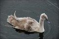 Cygnet, Kernan Lake near Gilford - geograph.org.uk - 500701.jpg 640 × 426; 47 KB
-
 Donegan's - geograph.org.uk - 494457.jpg 640 × 360; 59 KB
-
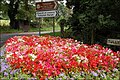
 Flower beds, Scarva (2) - geograph.org.uk - 482676.jpg 640 × 427; 122 KB
-
 Flowerbed, Tullylish near Banbridge - geograph.org.uk - 500800.jpg 640 × 426; 134 KB
-
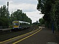
 Holywood Railway Station (2) - geograph.org.uk - 504033.jpg 640 × 360; 65 KB
-
 Holywood Railway Station - geograph.org.uk - 504029.jpg 640 × 480; 76 KB
-
 Killough Post Office - geograph.org.uk - 502831.jpg 640 × 426; 94 KB
-
 Men at Work - geograph.org.uk - 502406.jpg 640 × 426; 130 KB
-
 Millpark CC, Tullylish - geograph.org.uk - 500816.jpg 640 × 426; 81 KB
-
 Moira Railway Station - geograph.org.uk - 502401.jpg 640 × 420; 123 KB
-
 Moira Railway Station - geograph.org.uk - 502409.jpg 640 × 426; 137 KB
-
 Old millrace at Millmount, Banbridge (3) - geograph.org.uk - 500661.jpg 640 × 426; 126 KB
-
 Old railway station at Killough - geograph.org.uk - 502797.jpg 640 × 426; 109 KB
-
 Railway Bridge - geograph.org.uk - 501975.jpg 640 × 426; 141 KB
-

-
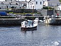
 The "Samuel J" at Donaghadee - geograph.org.uk - 491614.jpg 637 × 423; 94 KB
-
 The Ballynanny Road near Loughbrickland - geograph.org.uk - 505281.jpg 640 × 426; 167 KB
-
 The Bann Road near Poyntzpass - geograph.org.uk - 494351.jpg 640 × 426; 92 KB
-
 The Bannaghan Road, Raholp - geograph.org.uk - 502875.jpg 640 × 426; 123 KB
-
 The Corbet Road near Banbridge - geograph.org.uk - 494244.jpg 640 × 426; 88 KB
-

-
 The Terryhoogan Road, Scarva (2) - geograph.org.uk - 507872.jpg 640 × 426; 128 KB
-

-

-
 Warrenpoint Windmill.jpg 800 × 801; 171 KB
-
 Welcome to Scarva - geograph.org.uk - 482680.jpg 640 × 427; 77 KB


_-_geograph.org.uk_-_493051.jpg)


_-_geograph.org.uk_-_482676.jpg)

_-_geograph.org.uk_-_504033.jpg)


_-_geograph.org.uk_-_500661.jpg)


_-_geograph.org.uk_-_502905.jpg)
_-_geograph.org.uk_-_507872.jpg)


