Category:Johann Matthias Hase
Jump to navigation
Jump to search
Johann Matthias (Matyhias) Hase (Haas, Haase) (Latinized as Johannes Hasius) (1684–1742) was a German mathematician, astronomer, and cartographer.
German astronomer, mathematician and cartographer (1684-1742) | |||||
| Upload media | |||||
| Date of birth | 14 January 1684 Augsburg | ||||
|---|---|---|---|---|---|
| Date of death | 24 September 1742 Lutherstadt Wittenberg | ||||
| Country of citizenship | |||||
| Educated at | |||||
| Occupation | |||||
| Employer | |||||
| Work location | |||||
| |||||
Subcategories
This category has the following 4 subcategories, out of 4 total.
C
- Cartouches by Homann family (26 F)
H
- Hase (crater) (8 F)
Pages in category "Johann Matthias Hase"
This category contains only the following page.
Media in category "Johann Matthias Hase"
The following 98 files are in this category, out of 98 total.
-
1730 map of Russia and Tartary by Johann Matthias Hase.jpg 13,412 × 11,835; 29.39 MB
-
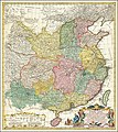
1735 Homann Heirs Map of China.jpg 800 × 895; 212 KB
-
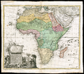
1737 map of Africa by Johann Matthias Hase.jpg 14,252 × 11,944; 36.44 MB
-
1739 map of Russia and Tartary by Johann Matthias Hase.jpg 13,912 × 12,251; 39.69 MB
-
1740 map detail showing Liaodong by Homann Heirs.jpg 2,810 × 2,529; 1.77 MB
-
1740 map of China, published by Homann Heirs.jpg 12,726 × 14,291; 45.99 MB
-
1740 map of China, published by Homannsche Erben.jpg 12,536 × 14,169; 45.43 MB
-
1743 Homann Heirs - Haas Map of Europe - Geographicus - Europa-hmhr-1743.jpg 5,000 × 4,327; 7.98 MB
-
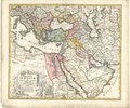
1743 map - Carte de l'Asie Mineure ou de la Natolie et du Pont Euxin.djvu 9,063 × 7,663; 3.88 MB
-
1743 map of West Africa by Johann Matthias Hase.jpg 14,435 × 12,468; 35.08 MB
-
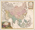
1744 Homann Heirs Map of Asia - Geographicus - Asia-homannheirs-1744.jpg 4,000 × 3,653; 3.97 MB
-
1744 map of Asia by Johann Matthias Hase.jpg 14,110 × 12,210; 36.59 MB
-
1744 map of the Balkan peninsula centered on the Kingdom of Hungary by Johann Matthias Hase.jpg 14,837 × 12,082; 42.54 MB
-
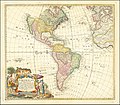
Americae Mappa generalis, Homann Heirs & Johann Matthaus Haas (1746).jpg 6,386 × 5,528; 18.83 MB
-
Americae Mappa generalis, Homann Heirs, Johann Matthaus Haas (1746).jpg 1,600 × 1,394; 2.65 MB
-
Ca. 1737 map of Africa, published by Homannsche Erben.jpg 14,526 × 11,679; 44.2 MB
-
Ca. 1740 map of China, published by Homann Heirs.jpg 12,577 × 14,235; 40.47 MB
-
Ca. 1740 map of China, published by Homannsche Erben.jpg 12,863 × 14,455; 32.53 MB
-
Carte de l'Asie Minevre ou de la Natolie et du Pont Euxin 01.jpg 7,523 × 6,521; 17.12 MB
-
Carte de l'Asie Minevre ou de la Natolie et du Pont Euxin 02.jpg 7,744 × 6,400; 16.96 MB
-
Cartouche on an Ottoman map by Homann.jpg 3,609 × 2,213; 2.74 MB
-
China1740.jpg 1,400 × 1,564; 3.29 MB
-
Circuli Sueviae mappa ex subsidijs Michalianis delineata - a I.M. Hasio - btv1b53040860z.jpg 8,048 × 6,850; 11.34 MB
-
Europa adhibitis quoque veterum monumentorum subsidiis descripta.jpg 7,610 × 6,349; 18.1 MB
-
Figurative cartouche on an Ottoman map by Hase and Homann.jpeg 2,548 × 1,677; 1.19 MB
-
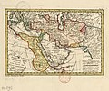
Imperium Partho-Persicum vel Persarum posteriorum - (tirée de hasius) - btv1b59636417.jpg 3,264 × 2,664; 1.34 MB
-
Johann Matthias Hase, Carte de l'Asie Mineure ou de la Natolie et du Pont Euxin (FL36010617 2716022).jpg 14,700 × 12,746; 271.19 MB
-
Johann Matthias Hase, Carte de l'Asie Mineure ou de la Natolie et du Pont Euxin (FL36011275 2875647).jpg 14,051 × 11,992; 246.96 MB
-
Johann Matthias Hase, Typus Aetiologicus I (FL200878570 2368585).jpg 6,167 × 4,720; 45.23 MB
-
Johann Matthias Hass - Map of Asia - 1744 (posthumous).jpg 3,060 × 2,830; 1.92 MB
-
Karte von Niederschlesien und angrenzenden Ländern - Hase 1745.png 19,363 × 9,488; 173.53 MB
-
Map - Special Collections University of Amsterdam - OTM- HB-KZL 31-05-50.tif 7,584 × 6,451; 139.97 MB
-
Map - Special Collections University of Amsterdam - OTM- HB-KZL 33.05.30.tif 7,936 × 6,612; 150.13 MB
-
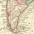
Patagonia in Americae Mappa generalis (1746).jpg 776 × 776; 277 KB
-
Persarmenia XVIII century.webp 547 × 403; 100 KB
-
Regni Sinae vel Sinae Propriae Mappa et Descriptio Geographica.jpg 6,416 × 7,071; 9.98 MB
-
Resized-inu-afrmap-3992815-recto-master.png 3,353 × 2,959; 20 MB
-
South America in Americae Mappa generalis (1746).jpg 742 × 1,002; 261 KB
-
Typus Aetiologicus II - (tirée de hasius) - btv1b5963638r.jpg 5,728 × 4,720; 3.84 MB
-
Typus Aetiologicus II - (tirée de hasius) - btv1b59636395.jpg 5,600 × 3,864; 3.1 MB
-
Нюрнбергте 1730 жылы жарық көрген картадағы буряттар (Bvratti).jpg 2,673 × 1,878; 1.44 MB
-
Нюрнбергте 1730 жылы жарық көрген картадағы торғауыттар (Kalmaki Torgavti).jpg 3,480 × 2,345; 2.4 MB
-
Нюрнбергте 1730 жылы жарық көрген картадағы хошоуыттар (Kalmaki Kokonor coshoti).jpg 4,031 × 2,829; 3.13 MB


