Category:Jarrah-Karri Forest and Shrublands Ecoregion
Jump to navigation
Jump to search
biogeographic region in southern Western Australia | |||||
| Upload media | |||||
| Instance of | |||||
|---|---|---|---|---|---|
| Location | Australasian realm, South Australia, AUS | ||||
 | |||||
The Jarrah-Karri Forest and Shrublands Ecoregion is a designated ecoregion by WWF and One Earth also known as Warren. It is classified as a Mediterranean Forests, Woodlands & Scrub Biome. It is one of eight ecoregions in the South Australian Mediterranean Forests, Woodlands & Scrub Bioregion.
Subcategories
This category has the following 18 subcategories, out of 18 total.
B
- Beedelup National Park (7 F)
- Brockman National Park (1 F)
D
G
K
L
M
P
- Pemberton Forest (10 F)
Q
- Quarram Nature Reserve (1 F)
S
- Shannon National Park (1 F)
T
W
- Warren National Park (15 F)
- William Bay National Park (23 F)
Y
- Yeagerup Dunes (4 F)
Media in category "Jarrah-Karri Forest and Shrublands Ecoregion"
The following 36 files are in this category, out of 36 total.
-
Australian Ringneck Parrot (26274990497).jpg 2,362 × 3,543; 4.39 MB
-
Baker's Landing, Molloy Island, 2015 (01).JPG 3,968 × 2,232; 4.01 MB
-
Baker's Landing, Molloy Island, 2015 (02).JPG 2,736 × 2,736; 3.96 MB
-
Baker's Landing, Molloy Island, 2015 (03).JPG 2,736 × 2,736; 4.87 MB
-
Bibbulmun Track Oct 08 109.JPG 2,572 × 1,928; 1.26 MB
-
Big tree country - panoramio.jpg 768 × 1,024; 618 KB
-
Boranup gnangarra 21.JPG 3,104 × 4,672; 8.25 MB
-
Boranup1.jpg 4,000 × 3,000; 7.3 MB
-
Brushtail Possum,North Donnelly State Forest, Western Australia.jpg 4,182 × 2,750; 1.55 MB
-
Caves Road at Mammoth Cave, Boranup, Western Australia, October 2023 01.jpg 4,608 × 3,456; 5.4 MB
-
Eucalyptus marginata 3.jpg 2,272 × 1,704; 852 KB
-
Flinders Bay turnoff.jpg 2,048 × 1,536; 912 KB
-
Former rail line formation near Flinders Bay 01.jpg 1,632 × 2,464; 1.04 MB
-
Former rail line formation near Flinders Bay 02.jpg 2,464 × 1,632; 1.06 MB
-
Former rail line formation near Flinders Bay 03.jpg 2,464 × 1,632; 1.08 MB
-
JF Jarrah-marri forest 10 Blackwood SF VII-2012.JPG 4,000 × 3,000; 2.89 MB
-
Karri forest 2 Gloucester NP VIII-2010.jpg 4,608 × 3,456; 5.56 MB
-
Karri forest 3 Warren NP XII-2015.jpeg 4,608 × 3,456; 7.67 MB
-
Kumbadjena extrema 107571406.jpg 2,048 × 1,365; 471 KB
-
Margaret River Western Australia SMC 2006.jpg 1,440 × 1,080; 523 KB
-
OIC Augusta bush 1.jpg 1,024 × 768; 441 KB
-
OIC Augusta bush 2.jpg 1,024 × 768; 395 KB
-
OIC Augusta bush west of town.jpg 1,024 × 768; 443 KB
-
OIC Margaret River bush 1.jpg 1,024 × 768; 441 KB
-
OIC pemberton bibbulmun track sign to cascades.jpg 1,024 × 768; 487 KB
-
P1030161Road leaving Denmark heading west, Western Australia.JPG 3,648 × 2,736; 6.2 MB
-
Rainbow and karri trees, Denmark WA.jpg 3,072 × 2,048; 1.69 MB
-
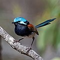
Red-winged Fairy-wren.jpg 2,501 × 2,501; 4.3 MB
-
Sandy Beach, Molloy Island, 2015 (02).JPG 3,968 × 2,232; 4.44 MB
-
Sandy Beach, Molloy Island, 2015 (03).JPG 3,776 × 2,520; 3.88 MB
-
Sandy Beach, Molloy Island, 2015 (04).JPG 3,968 × 2,232; 3.71 MB
-
ShelterislandWA.jpg 4,288 × 3,216; 3.12 MB
-
Sphaerolobium rostratum habit.jpg 4,608 × 3,456; 3.59 MB
-
The Marina, Molloy Island, 2015 (01).JPG 3,776 × 2,520; 5.97 MB
-
Western Rosella (27273315448).jpg 2,636 × 1,883; 3.58 MB
-
Yeagarup WA 6260, Australia - panoramio.jpg 680 × 1,024; 595 KB


