Category:January 2015 in the East Riding of Yorkshire
Jump to navigation
Jump to search
Ceremonial counties of England: Bedfordshire · Berkshire · Buckinghamshire · Cambridgeshire · Cheshire · Cornwall · Cumbria · Derbyshire · Devon · Dorset · Durham · East Riding of Yorkshire · East Sussex · Essex · Gloucestershire · Greater London · Greater Manchester · Hampshire · Herefordshire · Hertfordshire · Kent · Lancashire · Lincolnshire · Merseyside · Norfolk · North Yorkshire · Northamptonshire · Northumberland · Nottinghamshire · Oxfordshire · Shropshire · Somerset · Staffordshire · Suffolk · Surrey · Tyne and Wear · Warwickshire · West Midlands · West Sussex · West Yorkshire · Wiltshire · Worcestershire
City-counties: Bristol ·
Former historic counties:
Other former counties:
City-counties: Bristol ·
Former historic counties:
Other former counties:
Deutsch: Bilder, die im Januar 2015 in the East Riding of Yorkshire aufgenommen worden sind. Bitte beachten Sie, dass dies weder das Datum des Uploads noch das Datum des Scannens eines Fotos ist.
English: Images/pictures taken in the East Riding of Yorkshire during January 2015. Note this is not the date of the upload, nor the date a photo was scanned.
Español: Fotografías o imágenes tomadas en the East Riding of Yorkshire durante enero 2015. No es la fecha de subida ni escaneo, sino la fecha en que las fotografías o imágenes se crearon.
Esperanto: Bildoj faritaj en the East Riding of Yorkshire en januaro 2015. Tio ne estas la dato, kiam la bildoj estis alŝutitaj aŭ skanitaj.
Français : Photographies ou images prises en the East Riding of Yorkshire durant janvier 2015. Ce n'est pas la date du téléchargement ou du scan.
Galego: Fotografías ou imaxes tomadas en the East Riding of Yorkshire durante xaneiro 2015. Non é a data de subida nin escaneamento, senón a data na que se crearon as fotografías ou imaxes.
Italiano: Fotografie o immagini scattate a the East Riding of Yorkshire nel gennaio 2015. Nota bene: la data non si riferisce né a quella di upload né a quella in cui la foto è stata digitalizzata.
Norsk bokmål: Bilder tatt i the East Riding of Yorkshire i løpet av januar 2015. Merk at dette ikke er datoen for opplasting, eller når et bilde har blitt skannet.
Norsk nynorsk: Bilete teke i the East Riding of Yorkshire i løpet av januar 2015. Merk at dette ikkje er datoen for opplasting, eller når eit bilete har vorte skanna.
Русский: Изображения, сделанные в the East Riding of Yorkshire в течение январь 2015 (не дата загрузки изображения).
Українська: Зображення, зроблені в the East Riding of Yorkshire протягом січень 2015. Зауважте, що це не дата завантаження чи дата сканування фотографії.
| January 2014 | ← | January 2015 | → | January 2016 | |||||||
| Jan | Feb | Mar | Apr | May | Jun | Jul | Aug | Sep | Oct | Nov | Dec |
| 27 | 233 | 372 | 66 | 218 | 51 | 98 | 47 | 25 | 61 | 18 | 30 |
|---|---|---|---|---|---|---|---|---|---|---|---|
Subcategories
This category has only the following subcategory.
Media in category "January 2015 in the East Riding of Yorkshire"
The following 26 files are in this category, out of 26 total.
-
 Abandoned caravan site (geograph 4329949).jpg 1,024 × 768; 187 KB
-
 Approaching Beverley Pastures - The Westwood (geograph 4322285).jpg 5,121 × 3,596; 4.4 MB
-
 Approaching the cliff top (geograph 4329940).jpg 1,024 × 768; 279 KB
-
 Beverley Westwood (geograph 4299490).jpg 1,024 × 768; 130 KB
-
 Black Mill, Beverley Westwood (geograph 4299296).jpg 1,024 × 768; 124 KB
-
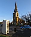 Church Road-New Walk, North Ferriby (geograph 4312210).jpg 543 × 640; 200 KB
-
 Cliff at Owthorne (geograph 4330390).jpg 1,024 × 768; 134 KB
-
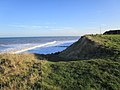
 Cliffs north of Withernsea (geograph 4329935).jpg 1,024 × 768; 181 KB
-
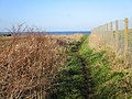
 End of the fence (geograph 4329951).jpg 1,024 × 768; 226 KB
-
 Flood gate in place (geograph 4330384).jpg 1,024 × 768; 134 KB
-
 Footpath to Waxholme Road (geograph 4329939).jpg 1,024 × 768; 220 KB
-
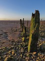
 Foreshore posts, North Ferriby (geograph 4312211).jpg 570 × 640; 192 KB
-
 Groyne and off-shore wind farm (geograph 4330379).jpg 1,024 × 768; 175 KB
-
 Groyne at Dusk (geograph 4321012).jpg 4,316 × 3,135; 1.37 MB
-
 Humber foreshore, North Ferriby (geograph 4312212).jpg 480 × 640; 186 KB
-
 Perimeter fence (geograph 4329953).jpg 1,024 × 768; 213 KB
-
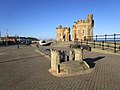
 Pier Towers (geograph 4330354).jpg 730 × 1,024; 123 KB
-
 Pier Towers x 2 (geograph 4330361).jpg 1,024 × 768; 182 KB
-
 Ploughed field and pylon (geograph 4299329).jpg 1,024 × 768; 107 KB
-
 The Black Mill, Beverley Westwood (geograph 4299497).jpg 1,024 × 768; 135 KB
-
 Trees by the Black Mill (geograph 4299501).jpg 1,024 × 768; 205 KB
-
 View towards the Grandstand (geograph 4299313).jpg 1,024 × 768; 158 KB
-
 Waves at Dusk (geograph 4321006).jpg 4,608 × 3,456; 2.44 MB
-
 Way down to the beach (geograph 4329987).jpg 1,024 × 768; 205 KB
-
 Where has the beach gone? (geograph 4330358).jpg 1,024 × 768; 152 KB
-
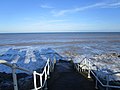 Where the pier was (geograph 4330367).jpg 1,024 × 768; 153 KB
.jpg)
.jpg)
.jpg)
.jpg)
.jpg)
.jpg)
.jpg)
.jpg)
.jpg)
.jpg)
.jpg)
.jpg)
.jpg)
.jpg)
.jpg)
.jpg)
.jpg)
.jpg)
.jpg)
.jpg)
.jpg)
.jpg)
.jpg)
.jpg)
.jpg)
.jpg)