Category:January 2010 in Newcastle upon Tyne
Jump to navigation
Jump to search
Deutsch: Bilder, die im Januar 2010 in Newcastle upon Tyne aufgenommen worden sind. Bitte beachten Sie, dass dies weder das Datum des Uploads noch das Datum des Scannens eines Fotos ist.
English: Images/pictures taken in Newcastle upon Tyne during January 2010. Note this is not the date of the upload, nor the date a photo was scanned.
Español: Fotografías o imágenes tomadas en Newcastle upon Tyne durante enero 2010. No es la fecha de subida ni escaneo, sino la fecha en que las fotografías o imágenes se crearon.
Esperanto: Bildoj faritaj en Newcastle upon Tyne en januaro 2010. Tio ne estas la dato, kiam la bildoj estis alŝutitaj aŭ skanitaj.
Français : Photographies ou images prises en Newcastle upon Tyne durant janvier 2010. Ce n'est pas la date du téléchargement ou du scan.
Galego: Fotografías ou imaxes tomadas en Newcastle upon Tyne durante xaneiro 2010. Non é a data de subida nin escaneamento, senón a data na que se crearon as fotografías ou imaxes.
Italiano: Fotografie o immagini scattate a Newcastle upon Tyne nel gennaio 2010. Nota bene: la data non si riferisce né a quella di upload né a quella in cui la foto è stata digitalizzata.
Norsk bokmål: Bilder tatt i Newcastle upon Tyne i løpet av januar 2010. Merk at dette ikke er datoen for opplasting, eller når et bilde har blitt skannet.
Norsk nynorsk: Bilete teke i Newcastle upon Tyne i løpet av januar 2010. Merk at dette ikkje er datoen for opplasting, eller når eit bilete har vorte skanna.
Русский: Изображения, сделанные в Newcastle upon Tyne в течение январь 2010 (не дата загрузки изображения).
Українська: Зображення, зроблені в Newcastle upon Tyne протягом січень 2010. Зауважте, що це не дата завантаження чи дата сканування фотографії.
| January 2009 | ← | January 2010 | → | January 2011 | |||||||
| Jan | Feb | Mar | Apr | May | Jun | Jul | Aug | Sep | Oct | Nov | Dec |
| 88 | 16 | 43 | 13 | 30 | 9 | 7 | 23 | 6 | 17 | 7 | 14 |
|---|---|---|---|---|---|---|---|---|---|---|---|
Media in category "January 2010 in Newcastle upon Tyne"
The following 88 files are in this category, out of 88 total.
-
Bank Foot Metro station, 2 January 2010.jpg 640 × 480; 67 KB
-
Fawdon Metro station, 2 January 2010.jpg 640 × 480; 65 KB
-
Kingston Park Metro station, 2 January 2010.jpg 640 × 480; 226 KB
-
Wansbeck Road Metro station (geograph 1644471).jpg 640 × 480; 65 KB
-
Kingston Park Metro station, Tyne & Wear (geograph 4254536).jpg 1,024 × 731; 205 KB
-
Regent Centre Metro station, Tyne & Wear (geograph 4254497).jpg 1,024 × 648; 153 KB
-
Regent Centre Metro station, Tyne & Wear (geograph 4259355).jpg 1,024 × 723; 118 KB
-
Wansbeck Road Metro station, Tyne & Wear (geograph 4254512).jpg 1,024 × 648; 186 KB
-
Akenside House, Akenside Hill (geograph 1683292).jpg 3,000 × 1,871; 1.01 MB
-
All Saints Church from Queen Street (geograph 1683271).jpg 769 × 1,024; 219 KB
-
Allied Irish Bank, Collingwood Street - geograph.org.uk - 1691900.jpg 1,023 × 1,024; 275 KB
-
Beehive Hotel, Cloth Market - geograph.org.uk - 1690436.jpg 769 × 1,024; 202 KB
-
Blacksmiths Needle, Quayside (geograph 1682397).jpg 1,024 × 768; 235 KB
-
Bolbec Hall and the Lit & Phil, Westgate Road (geograph 1693832).jpg 1,024 × 893; 256 KB
-
Burt Hall, Northumberland Road - geograph.org.uk - 1671309.jpg 1,024 × 768; 176 KB
-
Carliol Square car park (geograph 1680747).jpg 1,024 × 768; 214 KB
-
Carliol Square west side from car park (geograph 1673133).jpg 1,024 × 768; 215 KB
-
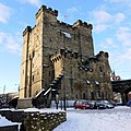
Castle Keep, Newcastle - geograph.org.uk - 1654844.jpg 640 × 640; 142 KB
-
Central Library, John Dobson Street - geograph.org.uk - 1672226.jpg 1,024 × 768; 196 KB
-
Circus Casino, Forth Street - geograph.org.uk - 1652430.jpg 640 × 480; 70 KB
-
Clayton Street (geograph 1694014).jpg 1,024 × 768; 213 KB
-
Cloth Market - geograph.org.uk - 1690384.jpg 3,000 × 1,764; 1.21 MB
-
Cloth Market - geograph.org.uk - 1690397.jpg 1,024 × 768; 257 KB
-
Cloth Market - geograph.org.uk - 1690485.jpg 1,024 × 768; 235 KB
-
Cloth Market Building, Cloth Market, Newcastle upon Tyne, 31 January 2010.jpg 985 × 1,024; 257 KB
-
Collingwood Buildings, Collingwood Street - geograph.org.uk - 1691813.jpg 1,024 × 768; 229 KB
-
Corner of Westgate Road and Collingwood Street - geograph.org.uk - 1690291.jpg 4,000 × 2,249; 1.65 MB
-
Cross House, Westgate Road (geograph 1694226).jpg 768 × 1,024; 171 KB
-
Downstream River Tyne - geograph.org.uk - 1672375.jpg 640 × 480; 54 KB
-
Durant Road and Ellison Place - geograph.org.uk - 1763798.jpg 3,000 × 1,479; 1.06 MB
-
Eldon Buildings, Blackett Street Grey Street (geograph 1695169).jpg 3,000 × 2,389; 1.22 MB
-
Ellison Place (geograph 1681916).jpg 1,024 × 769; 201 KB
-
Emerson Chambers Waterstones.jpg 769 × 1,024; 260 KB
-
Entrance to former Buz nightclub, John Dobson Street (geograph 1673066).jpg 1,024 × 768; 153 KB
-
Entrance to Monument Metro Station - geograph.org.uk - 1681072.jpg 1,024 × 675; 218 KB
-
Former Joint Stock Bank, Mosley Street (geograph 1692838).jpg 1,022 × 1,024; 299 KB
-
Grainger Street Market Street corner (geograph 1696662).jpg 1,024 × 768; 167 KB
-
Grey Street and Earl Grey Monument - geograph.org.uk - 1655022.jpg 640 × 480; 103 KB
-
Greys Monument from Grainger Street (geograph 2186005).jpg 739 × 1,024; 157 KB
-
High Bridge - geograph.org.uk - 1690452.jpg 1,024 × 666; 189 KB
-
High Bridge - geograph.org.uk - 1690473.jpg 768 × 1,024; 207 KB
-
High Bridge from Grey Street (geograph 2169420).jpg 768 × 1,024; 245 KB
-
High Bridge from Groat Market - geograph.org.uk - 1690412.jpg 3,000 × 1,860; 1.09 MB
-
High Bridge from Pilgrim Street (geograph 1682960).jpg 768 × 1,024; 262 KB
-
Junction of Westgate Road and Fenkle Street (geograph 1694184).jpg 4,000 × 1,795; 1.35 MB
-
Jurys Inn Hotel, St James Gate (geograph 1664961).jpg 480 × 640; 82 KB
-
Market Keeper's House, Newcastle upon Tyne, 31 January 2010.jpg 1,024 × 769; 193 KB
-
Nancys Bordello (geograph 1682227).jpg 1,024 × 769; 193 KB
-
Neptune Building, Close - geograph.org.uk - 1654476.jpg 4,289 × 5,600; 2.47 MB
-
Newcastle Law Courts, Quayside (geograph 1683576).jpg 1,024 × 769; 219 KB
-
Skis and homemade sledges - geograph.org.uk - 1657169.jpg 640 × 428; 81 KB
-
Church of the Divine Unity, Ellison Place (geograph 1681934).jpg 1,024 × 768; 181 KB
-
Newcastles Civic Centre (geograph 1669861).jpg 1,024 × 683; 128 KB
-
Panorama of roof tops around Greys Monument (geograph 1667133).jpg 5,000 × 1,904; 1.47 MB
-
Parsons Polygon, Blackett Street (geograph 1697679).jpg 768 × 1,024; 183 KB
-
Pudding Chare (geograph 1693214).jpg 768 × 1,024; 256 KB
-
Pudding Chare , Newcastle upon Tyne, 31 January 2010.jpg 768 × 1,024; 203 KB
-
Salvation Army Residential Centre, City Road - geograph.org.uk - 1756549.jpg 1,024 × 577; 166 KB
-
Sandgate - geograph.org.uk - 1756601.jpg 1,024 × 837; 258 KB
-
Sandhill (geograph 1641566).jpg 2,433 × 3,510; 1.22 MB
-
Side, Newcastle upon Tyne - geograph.org.uk - 1653625.jpg 640 × 481; 108 KB
-
South Gosforth Metro station, Tyne & Wear (geograph 4234327).jpg 1,024 × 731; 191 KB
-
St Nicholas Cathedral and the top of Side (geograph 1692675).jpg 4,000 × 2,039; 1.64 MB
-
Stephensons Works, No. 20 South Street (geograph 1693712).jpg 1,024 × 417; 135 KB
-
Sutherland Building, College Street - geograph.org.uk - 1671339.jpg 1,024 × 768; 200 KB
-
That's snow Angel of the North^ - geograph.org.uk - 1660493.jpg 428 × 640; 105 KB
-
The New Bridge (geograph 1682177).jpg 1,024 × 769; 246 KB
-
The Swirle Pavilion, Quayside (geograph 1683013).jpg 1,024 × 768; 214 KB
-
The Swirle Pavilion, Quayside (geograph 1683348).jpg 1,024 × 769; 223 KB
-
The Telegraph, Forth Street - geograph.org.uk - 1652424.jpg 640 × 480; 70 KB
-
Train at West Jesmond Metro Station - geograph.org.uk - 1643005.jpg 640 × 480; 56 KB
-
Union Rooms, Westgate Road - geograph.org.uk - 1652415.jpg 640 × 480; 74 KB
-
Upper level walkway above Higham Place - geograph.org.uk - 1672318.jpg 1,024 × 768; 184 KB
-
Vampire Rabbit, St Nicholas Church Yard (geograph 1682338).jpg 1,023 × 1,024; 273 KB
-
View from Grey's Monument, 24 January 2010 (3).jpg 4,000 × 1,638; 1.16 MB
-
View from High Level Bridge - geograph.org.uk - 1654427.jpg 8,192 × 3,885; 5.54 MB
-
West Jesmond Metro station, Tyne & Wear (geograph 4234311).jpg 1,024 × 731; 191 KB
-
Westgate Road - geograph.org.uk - 1694114.jpg 3,000 × 1,244; 871 KB
-
Wilders Public House, Carliol Square (geograph 1680729).jpg 1,024 × 769; 219 KB


