Category:Italian-language maps showing history
Jump to navigation
Jump to search
Subcategories
This category has the following 5 subcategories, out of 5 total.
D
- Dell'Arcano del Mare (28 F)
E
Media in category "Italian-language maps showing history"
The following 74 files are in this category, out of 74 total.
-
Assedio Nova Carthago 209 aC - prima fase.png 4,323 × 4,800; 866 KB
-
Assedio Nova Carthago 209 aC - seconda fase.png 4,323 × 4,800; 925 KB
-
Battaglia dei Campi Catalaunici.png 843 × 748; 178 KB
-
Battaglia Tunisi 310 a.C..png 800 × 500; 34 KB
-
Map of Bulgaria during WWII-IT.png 4,072 × 2,701; 1.21 MB
-
Cassino+Anzio1943JanFeb-it.jpg 1,265 × 966; 1.37 MB
-
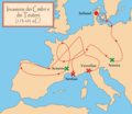
Cimbrians and Teutons - it.png 600 × 520; 80 KB
-
Dominios de Felipe II-it.png 800 × 494; 67 KB
-
Espansione del Sultanato di Rum (1100-1240).svg 1,578 × 721; 674 KB
-
Fertile Crescent map it.PNG 1,988 × 2,443; 729 KB
-
Finnish areas ceded in 1940-IT.png 619 × 800; 25 KB
-
Fronte Orientale 1941-06 al 1941-09.png 1,087 × 833; 364 KB
-
Giurisdizioni bresciane in epoca veneta (Luca Giarelli).png 1,367 × 2,000; 273 KB
-
League of Nations anachronous Map it.png 1,357 × 863; 86 KB
-
Map Ancient Egypt 1928-1940 - Touring Club Italiano CART-TRC-34.jpg 4,551 × 6,298; 2.78 MB
-
Map Ancient Palestine 1928-1940 - Touring Club Italiano CART-TRC-36.jpg 4,196 × 6,414; 2.61 MB
-
Map Crusader states 1135-it.png 978 × 1,330; 299 KB
-
Map Crusader states 1190-it.png 978 × 1,330; 298 KB
-
Map Early industrialization 1992 - Touring Club Italiano CART-TEM-073.jpg 5,000 × 3,467; 9.7 MB
-
Map Europe around 560 AD - Touring Club Italiano CART-TRC-50 01.jpg 3,873 × 3,205; 1.52 MB
-
Map Europe in 1660- Touring Club Italiano CART-TRC-51 01.jpg 3,853 × 3,195; 1.58 MB
-
Map Europe in 1789- Touring Club Italiano CART-TRC-51 02.jpg 3,836 × 3,065; 1.53 MB
-
Map Europe in 1810- Touring Club Italiano CART-TRC-52 01.jpg 3,787 × 3,209; 1.56 MB
-
Map Europe in 1815- Touring Club Italiano CART-TRC-52 02.jpg 3,871 × 3,094; 1.56 MB
-
Map Europe in 814- Touring Club Italiano CART-TRC-50 02.jpg 3,826 × 3,086; 1.51 MB
-
Map Historical demography 1992 - Touring Club Italiano CART-TEM-031.jpg 5,000 × 3,298; 9.01 MB
-
Map Historical evolution of settlements III 1992 - Touring Club Italiano CART-TEM-051.jpg 10,829 × 7,272; 47.44 MB
-
Map Italy around 1300- Touring Club Italiano CART-TRC-47.jpg 6,052 × 6,640; 4.72 MB
-
Map Italy around 500 b.C. - Touring Club Italiano CART-TRC-40.jpg 6,046 × 6,651; 4.22 MB
-
Map Italy at the time of Augustus- Touring Club Italiano CART-TRC-44.jpg 6,034 × 6,689; 4.97 MB
-
Map Italy in 1559 - Touring Club Italiano CART-TRC-48 01.jpg 3,189 × 4,222; 3 MB
-
Map Italy in 1748- Touring Club Italiano CART-TRC-48 02.jpg 3,010 × 4,139; 2.91 MB
-
Map Italy in 1815- Touring Club Italiano CART-TRC-49 01.jpg 3,230 × 4,205; 1.65 MB
-
Map Italy in the second half of 10th century- Touring Club Italiano CART-TRC-43 02.jpg 3,013 × 4,100; 1.46 MB
-
Map Map of the Persian Empire 1928-1940 - Touring Club Italiano CART-TRC-35.jpg 6,528 × 4,485; 3.45 MB
-
Map of Albania during WWII-IT.png 1,030 × 1,306; 292 KB
-
Map of Italy in 1861 - Touring Club Italiano CART-TRC-49 02.jpg 3,030 × 4,159; 1.53 MB
-
Map Rome in the Imperial Era- Touring Club Italiano CART-TRC-41.jpg 6,646 × 6,366; 3.82 MB
-
Map The decadence of the Ottoman Empire- Touring Club Italiano CART-TRC-45 02.jpg 4,874 × 3,102; 1.82 MB
-
Map The Ottoman Empire- Touring Club Italiano CART-TRC-45 01.jpg 4,877 × 3,317; 1.94 MB
-
Map The Roman Empire under Trajan and Adrian- Touring Club Italiano CART-TRC-42.jpg 6,816 × 5,069; 4.02 MB
-
Map Thirty Years War-it.png 462 × 599; 62 KB
-
Map Ubaid culture-it.png 2,000 × 1,750; 2.64 MB
-
Ordine Teutonico 1260.png 5,001 × 4,346; 1.73 MB
-
Paul the Apostle, fourth missionary journey (Rome).svg 998 × 524; 432 KB
-
Reame di Siagrio (486).png 1,440 × 1,344; 273 KB
-
Regni romano barbarici.png 746 × 512; 16 KB
-
Repubblica bresciana suddivisione cantoni.png 1,200 × 1,800; 76 KB
-
Roman empire 14 AD (provinces) it.png 2,000 × 1,183; 485 KB
-
Roman Soison Kingdom.png 500 × 337; 31 KB
-
Sardegna fenicia e punica.png 1,232 × 2,294; 403 KB
-
SuddivisioniIndocinafrancese.png 800 × 1,220; 171 KB
-
Tribu baltiche 1200.png 549 × 600; 92 KB


