
Category:Isle of Grain

peninsula  | |||||
| Upload media | |||||
| Instance of | |||||
|---|---|---|---|---|---|
| Location | Medway, Kent, South East England, England | ||||
| Located in or next to body of water | |||||
 | |||||
Subcategories
This category has the following 11 subcategories, out of 11 total.
B
G
- Grain Power Station (35 F)
- Grain railway station (3 F)
- Grain Tower (17 F)
L
- London Thamesport (8 F)
M
- Medway Power Station (4 F)
P
- Port Victoria, Kent (9 F)
Y
- Yantlet (5 F)
Media in category "Isle of Grain"
The following 200 files are in this category, out of 716 total.
(previous page) (next page)-

-
 'Yeoman Bontrup' on aggregate jetty, Grain - geograph.org.uk - 6860178.jpg 1,024 × 684; 217 KB
-
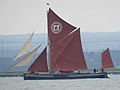
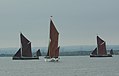
 110th Medway barge match 9056.jpg 4,604 × 2,310; 1.09 MB
-
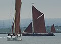
 110th Medway barge match 9064.jpg 3,226 × 2,418; 932 KB
-
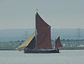
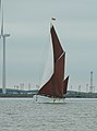
 110th Medway barge match 9065.jpg 3,918 × 1,675; 716 KB
-
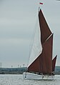
 110th Medway barge match 9066.jpg 3,585 × 1,936; 698 KB
-
 110th Medway barge match 9136.jpg 4,604 × 2,280; 1.09 MB
-
 110th Medway barge match 9139.jpg 4,562 × 2,094; 1 MB
-
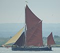
 110th Medway barge match Edith May 9073.jpg 3,227 × 2,423; 883 KB
-
 110th Medway barge match Edith May 9117.jpg 3,610 × 3,119; 1.25 MB
-
 110th Medway barge match Edith May 9118.jpg 3,636 × 2,587; 1.15 MB
-
 110th Medway barge match Edith May 9123.jpg 4,608 × 3,456; 3.32 MB
-
 110th Medway barge match Edith May Niagara Repertor 9075.jpg 4,389 × 2,423; 1.26 MB
-
 110th Medway barge match Edme 9085.jpg 3,227 × 2,423; 910 KB
-
 110th Medway barge match Edme 9086.jpg 2,054 × 2,464; 631 KB
-
 110th Medway barge match Edme 9100.jpg 4,608 × 3,456; 3.13 MB
-
 110th Medway barge match Edme 9103.jpg 3,769 × 2,755; 1.04 MB
-
 110th Medway barge match Edme 9110.jpg 2,372 × 2,909; 970 KB
-
 110th Medway barge match Edme 9114.jpg 4,338 × 3,134; 1.91 MB
-
 110th Medway barge match Edme Edith May 9070.jpg 3,707 × 2,745; 1.11 MB
-
 110th Medway barge match Edme Edith May Marjorie 9090.jpg 3,887 × 2,423; 1.19 MB
-
 110th Medway barge match Edme Niagara 9115.jpg 4,399 × 2,331; 1.12 MB
-
 110th Medway barge match Edme Niagara 9120.jpg 4,608 × 3,456; 2.99 MB
-
 110th Medway barge match Edme Niagara 9121.jpg 4,608 × 3,456; 3.32 MB
-
 110th Medway barge match Edme Niagara Edith-May 9062.jpg 3,227 × 2,423; 876 KB
-
 110th Medway barge match Lady of the Lea 9061.jpg 4,608 × 3,456; 3.53 MB
-
 110th Medway barge match Lady of the Lea 9063.jpg 2,417 × 3,226; 923 KB
-
 110th Medway barge match Lady of the Lea 9067.jpg 4,608 × 3,456; 3.46 MB
-
 110th Medway barge match Lady of the Lea 9067c.jpg 697 × 447; 79 KB
-
 110th Medway barge match Lady of the Lea 9125.jpg 4,608 × 3,456; 3.32 MB
-
 110th Medway barge match Lady of the Lea 9125c.jpg 3,227 × 2,423; 956 KB
-
 110th Medway barge match Lady of the Lea 9131.jpg 3,529 × 2,643; 1 MB
-
 110th Medway barge match Lady of the Lea 9137.jpg 4,608 × 3,456; 3.3 MB
-
 110th Medway barge match Lady of the Lea 9138.jpg 4,608 × 3,456; 3.21 MB
-
 110th Medway barge match Lady of the Lea 9140.jpg 4,199 × 3,126; 1.55 MB
-
 110th Medway barge match Lady of the Lea 9141.jpg 3,918 × 2,782; 1.41 MB
-
 110th Medway barge match Marjorie 9058.jpg 2,811 × 2,126; 708 KB
-
 110th Medway barge match Marjorie 9059.jpg 3,288 × 2,878; 1.24 MB
-
 110th Medway barge match Marjorie 9071.jpg 2,197 × 2,940; 741 KB
-
 110th Medway barge match Marjorie 9087.jpg 3,380 × 3,124; 1.28 MB
-
 110th Medway barge match Marjorie 9126.jpg 4,608 × 3,456; 3.18 MB
-
 110th Medway barge match Marjorie 9127.jpg 3,442 × 2,581; 968 KB
-
 110th Medway barge match Marjorie 9128.jpg 4,608 × 3,456; 3.47 MB
-
 110th Medway barge match Marjorie 9129.jpg 3,877 × 2,909; 1.17 MB
-
 110th Medway barge match Marjorie Edme 9092.jpg 4,507 × 2,422; 1.22 MB
-
 110th Medway barge match Marjorie Niagara 9084.jpg 3,227 × 2,422; 961 KB
-
 110th Medway barge match Marjorie Repertor 9083.jpg 3,498 × 2,423; 1,012 KB
-
 110th Medway barge match Marjorie Repertor 9130.jpg 3,462 × 2,597; 995 KB
-
 110th Medway barge match Niagara 9105c.jpg 4,124 × 3,126; 1.29 MB
-
 110th Medway barge match Niagara Repertor 9077.jpg 3,913 × 2,940; 1.18 MB
-
 110th Medway barge match Niagara Repertor 9078.jpg 4,608 × 3,456; 3.31 MB
-
 110th Medway barge match Pudge 9060.jpg 3,226 × 3,124; 1,019 KB
-
 110th Medway barge match Pudge 9068.jpg 3,227 × 2,423; 922 KB
-
 110th Medway barge match Pudge 9116.jpg 3,227 × 2,423; 982 KB
-
 110th Medway barge match Pudge Edith May 9124.jpg 4,608 × 3,456; 3.23 MB
-
 110th Medway barge match Pudge Repertor 9132.jpg 3,227 × 2,418; 931 KB
-
 110th Medway barge match Pudge Repertor 9134.jpg 4,477 × 3,357; 1.51 MB
-
 110th Medway barge match Repertor 9081.jpg 4,608 × 3,456; 3.11 MB
-
 110th Medway barge match Repertor 9081c.jpg 2,490 × 2,853; 801 KB
-
 110th Medway barge match Repertor 9119.jpg 4,608 × 3,456; 3.26 MB
-
 110th Medway barge match Repertor 9122.jpg 4,608 × 3,456; 3.48 MB
-
 110th Medway barge match Repertor Edith May 9088.jpg 3,227 × 2,423; 876 KB
-
 110th Medway barge match Repertor Marjorie 9142.jpg 4,372 × 2,981; 1.47 MB
-
 110th Medway barge match Repertor Marjorie 9143.jpg 3,781 × 2,109; 989 KB
-
 110th Medway barge match Repertor Niagara Lady of the Lea 9079.jpg 4,608 × 3,456; 3.44 MB
-
 110th Medway barge match SB Niagara 9057.jpg 3,226 × 3,452; 1.1 MB
-
 110th Medway barge match SB Niagara 9069.jpg 3,227 × 2,423; 848 KB
-
 110th Medway barge match SB Niagara 9072.jpg 3,319 × 2,648; 970 KB
-
 110th Medway barge match SB Niagara 9074.jpg 3,227 × 2,423; 892 KB
-
 110th Medway barge match SB Niagara 9076.jpg 3,801 × 2,422; 1 MB
-
 110th Medway barge match SB Niagara 9077a.jpg 2,361 × 3,098; 796 KB
-
 110th Medway barge match SB Niagara 9078c.jpg 2,623 × 1,885; 640 KB
-
 110th Medway barge match SB Niagara 9079c.jpg 4,046 × 2,397; 1.14 MB
-
 110th Medway barge match SB Niagara 9101.jpg 4,474 × 2,894; 1.24 MB
-
 110th Medway barge match SB Niagara 9102.jpg 2,484 × 3,360; 939 KB
-
 110th Medway barge match SB Niagara 9104.jpg 2,357 × 3,183; 901 KB
-
 110th Medway barge match SB Niagara 9105.jpg 2,263 × 3,209; 773 KB
-
 110th Medway barge match SB Niagara 9107c.jpg 3,455 × 3,307; 1.07 MB
-
 110th Medway barge match SB Niagara 9107cc.jpg 1,731 × 3,303; 583 KB
-
 110th Medway barge match SB Niagara 9108.jpg 2,708 × 3,373; 1.09 MB
-
 110th Medway barge match SB Niagara 9109.jpg 2,152 × 2,715; 566 KB
-
 110th Medway barge match SB Niagara 9111.jpg 4,608 × 3,456; 3.07 MB
-
 110th Medway barge match SB Niagara 9112.jpg 4,608 × 3,456; 3.25 MB
-
 110th Medway barge match SB Niagara 9113c.jpg 1,886 × 3,187; 730 KB
-
 40 MPH zone, B2001 - geograph.org.uk - 3013520.jpg 640 × 430; 56 KB
-
 40MPH zone, Grain Rd - geograph.org.uk - 3013527.jpg 640 × 430; 54 KB
-
 A derelict communications beacon - geograph.org.uk - 3000448.jpg 430 × 640; 62 KB
-
 A gap in the drainage channels - geograph.org.uk - 643554.jpg 640 × 480; 72 KB
-
 A salt marsh near Grain - geograph.org.uk - 5821928.jpg 4,000 × 3,000; 4.89 MB
-
 A submerged groyne - geograph.org.uk - 3002093.jpg 640 × 430; 60 KB
-
 A228 Grain Road - geograph.org.uk - 3738235.jpg 3,488 × 2,616; 2.16 MB
-
 A228 leaving Grain - geograph.org.uk - 3013536.jpg 640 × 430; 43 KB
-
 A228 leaving the Isle of Grain - geograph.org.uk - 3013541.jpg 640 × 430; 50 KB
-
 A228, Isle of Grain - geograph.org.uk - 2984631.jpg 640 × 386; 40 KB
-
 A228, Isle of Grain - geograph.org.uk - 2984633.jpg 640 × 407; 45 KB
-
 A228, Isle of Grain - geograph.org.uk - 2984635.jpg 640 × 430; 51 KB
-
 A228onGrain-by-Richard-Dorrell.jpg 640 × 480; 107 KB
-
 Abandoned boat on the River Medway, near Grain - geograph.org.uk - 4954718.jpg 3,264 × 2,448; 1.68 MB
-
 Abandoned car park - geograph.org.uk - 953010.jpg 640 × 480; 66 KB
-
 Abandoned Car Park, Port Victoria Road, Grain - geograph.org.uk - 4954774.jpg 3,264 × 2,448; 2.24 MB
-
 Abandoned fortifications at Grain - geograph.org.uk - 5819554.jpg 4,000 × 3,000; 4.72 MB
-
 Abandoned fortifications at Grain - geograph.org.uk - 5819565.jpg 4,000 × 3,000; 4.68 MB
-
 Abandoned fortifications at Grain - geograph.org.uk - 5822436.jpg 4,000 × 3,000; 4.99 MB
-
 Abandoned fortifications at Grain - geograph.org.uk - 5822438.jpg 4,000 × 2,248; 3.52 MB
-
 About as flat as it gets... - geograph.org.uk - 643721.jpg 640 × 480; 117 KB
-
 Access to Beach is Blocked - geograph.org.uk - 1107949.jpg 640 × 481; 89 KB
-

-
 Admiralty Chart No 3683 Sheerness and Approaches, Published 1930.jpg 18,777 × 11,312; 69.59 MB
-
 Ammunition hoist - geograph.org.uk - 3016996.jpg 4,272 × 2,848; 5.67 MB
-
 An entrance to Grain Coastal Park - geograph.org.uk - 3002078.jpg 640 × 430; 95 KB
-

-
 Anti invasion defences - geograph.org.uk - 3005011.jpg 640 × 430; 78 KB
-
 Anti invasion defences at Grain - geograph.org.uk - 3005015.jpg 640 × 430; 93 KB
-
 Anti-invasion defences at Grain - geograph.org.uk - 1884736.jpg 1,280 × 960; 598 KB
-
 Anti-Tank defences - geograph.org.uk - 5451644.jpg 4,500 × 3,000; 6.44 MB
-
 Approaching Grain Crossing - geograph.org.uk - 3013535.jpg 640 × 430; 62 KB
-
 B2001 - Grain crossing ahead - geograph.org.uk - 6046726.jpg 1,024 × 684; 225 KB
-
 B2001 entering Grain - geograph.org.uk - 2989456.jpg 640 × 430; 52 KB
-
 B2001 leaving Grain - geograph.org.uk - 3013506.jpg 640 × 399; 51 KB
-
 B2001 to Grain - geograph.org.uk - 2984642.jpg 640 × 430; 58 KB
-
 B2001, Grain Rd - geograph.org.uk - 2984653.jpg 640 × 430; 57 KB
-
 B2001, Grain Rd - geograph.org.uk - 2984658.jpg 640 × 376; 46 KB
-
 B2001, Grain Rd - geograph.org.uk - 2984671.jpg 640 × 430; 49 KB
-
 B2001, Grain Rd - geograph.org.uk - 3013514.jpg 640 × 367; 46 KB
-
 B2001, Grain Rd - geograph.org.uk - 3013531.jpg 640 × 430; 59 KB
-
 Barn on Grain Marsh - geograph.org.uk - 1026027.jpg 576 × 432; 93 KB
-
 Barrier - geograph.org.uk - 4663418.jpg 2,560 × 1,920; 1.53 MB
-
 Beach and esplanade at Grain - geograph.org.uk - 5451653.jpg 5,184 × 3,456; 7.5 MB
-
 Beach at Cockleshell Hard on the Medway Estuary - geograph.org.uk - 5822428.jpg 3,910 × 2,933; 1.59 MB
-
 Beach at Grain - geograph.org.uk - 5450223.jpg 800 × 148; 26 KB
-
 Beacon at Isle of Grain - geograph.org.uk - 637829.jpg 480 × 640; 62 KB
-
 Bend, B2001 - geograph.org.uk - 2984645.jpg 640 × 430; 59 KB
-
 Bend, Grain Rd - geograph.org.uk - 3013524.jpg 640 × 430; 50 KB
-
 Bend, Green Lane - geograph.org.uk - 3011381.jpg 640 × 388; 45 KB
-
 Black House - geograph.org.uk - 5451656.jpg 5,184 × 3,456; 7.2 MB
-
 Boat on the River Medway - geograph.org.uk - 2994150.jpg 640 × 430; 50 KB
-
 Branch line at Grain - geograph.org.uk - 5980706.jpg 5,202 × 3,465; 2.8 MB
-
 Brent Geese on Medway shore - geograph.org.uk - 639535.jpg 640 × 480; 131 KB
-
 Bridleway below the seawall - geograph.org.uk - 2996789.jpg 640 × 430; 74 KB
-
 Bridleway near Grain - geograph.org.uk - 2991621.jpg 640 × 430; 93 KB
-
 Bridleway near Grain Power Station - geograph.org.uk - 2989689.jpg 640 × 430; 108 KB
-
 Bridleway near the power station - geograph.org.uk - 2991622.jpg 640 × 430; 93 KB
-
 Bridleway off Port Victoria Rd - geograph.org.uk - 2991639.jpg 640 × 430; 84 KB
-
 Bridleway on Power Station Road - geograph.org.uk - 1107834.jpg 481 × 640; 87 KB
-
 Bridleway RS3 - geograph.org.uk - 2989559.jpg 640 × 430; 101 KB
-
 Bridleway signs, Port Victoria Rd - geograph.org.uk - 2991633.jpg 640 × 430; 72 KB
-
 Bridleway to the coast - geograph.org.uk - 2989473.jpg 640 × 430; 75 KB
-
 Bridleway to the power station - geograph.org.uk - 2989674.jpg 640 × 430; 125 KB
-
 Bridleway, Grain - geograph.org.uk - 2991631.jpg 640 × 430; 107 KB
-
 Broken Stile in Allhallows Marshes - geograph.org.uk - 1628437.jpg 640 × 479; 109 KB
-
 Buildings near Yantlet Creek Wharf - geograph.org.uk - 2999226.jpg 640 × 430; 46 KB
-
 Bulk carrier 'Vela' at Sheerness - geograph.org.uk - 6859352.jpg 1,024 × 684; 233 KB
-
 Car imports at Sheerness as seen from Grain - geograph.org.uk - 5821892.jpg 3,910 × 2,933; 1.46 MB
-
 Car park at the end of the High St - geograph.org.uk - 3005034.jpg 640 × 430; 71 KB
-
 Car park on the edge of Grain - geograph.org.uk - 2989475.jpg 640 × 430; 107 KB
-
 Chapel Rd - geograph.org.uk - 2989468.jpg 640 × 430; 51 KB
-
 Chapel Rd - geograph.org.uk - 3011394.jpg 640 × 430; 49 KB
-
 Chapel Rd and High St, Grain - geograph.org.uk - 2989464.jpg 640 × 399; 46 KB
-
 Chapel Road, Grain - geograph.org.uk - 3889420.jpg 3,488 × 2,616; 2.16 MB
-
 Chapel Road, Grain - geograph.org.uk - 4955123.jpg 3,264 × 2,448; 1.61 MB
-
 Chapel Road, Grain - geograph.org.uk - 5108205.jpg 3,264 × 2,448; 1.76 MB
-
 Chart No 1834 River Medway Stangate Creek to Rochester, Published 1941.jpg 20,443 × 11,286; 111.6 MB
-
 Chetney Marshes - geograph.org.uk - 255570.jpg 640 × 480; 91 KB
-
 Cliffe, Isle of Grain - geograph.org.uk - 1052729.jpg 640 × 480; 64 KB
-
 Closure of Footpath beside Cliff - geograph.org.uk - 1107963.jpg 481 × 640; 84 KB
-
 Clouds over Grain Power Station - geograph.org.uk - 2991624.jpg 640 × 430; 69 KB
-
 Coast at Grain - geograph.org.uk - 5451655.jpg 5,969 × 1,515; 3.39 MB
-
 Coastal path - geograph.org.uk - 3002004.jpg 640 × 430; 54 KB
-
 Coastguard Cottages - geograph.org.uk - 3011388.jpg 640 × 430; 64 KB
-
 Cockleshell Beach - geograph.org.uk - 1109423.jpg 640 × 481; 89 KB
-
 Cockleshell Hard - geograph.org.uk - 637867.jpg 640 × 480; 119 KB
-
 Cockleshell Hard, River Medway, near Grain - geograph.org.uk - 4954765.jpg 3,264 × 2,448; 1.68 MB
-
 Cockleshell Hard, River Medway, near Grain - geograph.org.uk - 4954768.jpg 3,264 × 2,448; 2.07 MB
-
 Concrete Shelter, Grain - geograph.org.uk - 1351921.jpg 640 × 480; 54 KB
-
 Concrete Shelter, Grain - geograph.org.uk - 1351923.jpg 640 × 480; 63 KB
-
 Container crane, Thamesport - geograph.org.uk - 4703646.jpg 480 × 640; 70 KB
-
 Container Terminal, Isle of Grain, Kent - geograph.org.uk - 4195140.jpg 1,238 × 929; 899 KB
-
 Container Terminal, Isle of Grain, Kent - geograph.org.uk - 4195142.jpg 1,238 × 929; 858 KB
-
 Coronation Rd, Chapel Rd junction - geograph.org.uk - 3011397.jpg 640 × 404; 46 KB
-
 Crane on jetty, Sheerness - geograph.org.uk - 4702864.jpg 640 × 480; 61 KB
-
 Cranes at Thamesport - geograph.org.uk - 4703667.jpg 640 × 640; 85 KB
-
 Cranes at Thamesport, Isle of Grain - geograph.org.uk - 4205893.jpg 772 × 1,024; 103 KB
-
 Cranes on Rushenden Pier - geograph.org.uk - 719661.jpg 470 × 640; 75 KB
-
 Cuckoo path, Grain Coastal Park - geograph.org.uk - 3002008.jpg 640 × 430; 53 KB
-
 Dam, head of Yantlet Creek - geograph.org.uk - 5157280.jpg 640 × 480; 181 KB
-
 Derelict building near Grain Power Station - geograph.org.uk - 3738375.jpg 3,488 × 2,616; 2.44 MB
-
 Derelict houses, Grain Road, Grain - geograph.org.uk - 1354923.jpg 640 × 480; 67 KB
-
 Derelict land near Grain - geograph.org.uk - 2991645.jpg 640 × 430; 58 KB
-

-

-
 Disused jetty, Thamesport - geograph.org.uk - 4703627.jpg 640 × 480; 72 KB
-
 Disused road, Grain power station - geograph.org.uk - 649480.jpg 640 × 480; 110 KB
-
 Disused Weighbridge, Grain - geograph.org.uk - 3738290.jpg 3,488 × 2,616; 1.96 MB
-
 Disused^ National Grid Jetty at Grain - geograph.org.uk - 4662176.jpg 2,560 × 1,920; 1.41 MB
-
 Doggetts Row, Grain - geograph.org.uk - 3738429.jpg 3,488 × 2,616; 1.85 MB
-
 Doggetts Row, Grain - geograph.org.uk - 4955124.jpg 3,264 × 2,448; 1.6 MB
-
 Dummy Battery - geograph.org.uk - 2991637.jpg 640 × 365; 39 KB
-
 Dummy Battery - geograph.org.uk - 5155482.jpg 640 × 480; 192 KB
-
 Dummy Battery, Grain - geograph.org.uk - 992933.jpg 640 × 480; 40 KB
-
 Dyke in Grain Marsh - geograph.org.uk - 1109545.jpg 640 × 481; 67 KB


