
Category:Islands of Massachusetts
States of the United States: Alabama · Alaska · Arizona · Arkansas · California · Colorado · Connecticut · Florida · Georgia · Hawaii · Idaho · Illinois · Indiana · Louisiana · Maine · Maryland · Massachusetts · Michigan · Minnesota · Mississippi · Missouri · Montana · Nebraska · Nevada · New Hampshire · New Jersey · New York · North Carolina · Ohio · Oregon · Pennsylvania · Rhode Island · South Carolina · South Dakota · Tennessee · Texas · Utah · Vermont · Virginia · Washington · West Virginia · Wisconsin · Wyoming – District of Columbia: Washington, D.C.
American Samoa · Northern Mariana Islands · Puerto Rico · United States Virgin Islands – United States Minor Outlying Islands
American Samoa · Northern Mariana Islands · Puerto Rico · United States Virgin Islands – United States Minor Outlying Islands
Wikimedia category | |||||
| Upload media | |||||
| Instance of | |||||
|---|---|---|---|---|---|
| Category combines topics | |||||
| Category contains | |||||
| Massachusetts | |||||
state of the United States of America  Playa de Race Point, en la península de Cape Cod    .svg) | |||||
| Pronunciation audio | |||||
| Instance of | |||||
| Part of | |||||
| Named after |
| ||||
| Location |
| ||||
| Located in or next to body of water | |||||
| Capital | |||||
| Legislative body | |||||
| Executive body | |||||
| Highest judicial authority | |||||
| Official language | |||||
| Anthem |
| ||||
| Head of government |
| ||||
| Headquarters location | |||||
| Inception |
| ||||
| Highest point |
| ||||
| Population |
| ||||
| Area |
| ||||
| Elevation above sea level |
| ||||
| Replaces | |||||
| Different from | |||||
| Maximum temperature record |
| ||||
| Minimum temperature record |
| ||||
| official website | |||||
 | |||||
Subcategories
This category has the following 23 subcategories, out of 23 total.
*
A
- Amrita Island (1 F)
B
C
- Clark's Island (6 F)
E
G
- Gooseberry Neck (11 F)
H
- Head Island (5 F)
M
- Muskeget Island (5 F)
N
- Nomans Land (Massachusetts) (44 F)
P
T
- Tuckernuck Island (1 F)
W
Media in category "Islands of Massachusetts"
The following 31 files are in this category, out of 31 total.
-
 Bartletts.jpg 3,072 × 2,048; 1.62 MB
-
 Bellatashmoo.jpg 1,500 × 859; 302 KB
-
 Billingsgate 1910.jpg 309 × 245; 49 KB
-
 Cedar Island, Marks Cove, Weweantic MA.jpg 3,264 × 2,448; 2.38 MB
-
 Chaypee map.JPG 639 × 680; 46 KB
-
 Crowninshield Island.jpg 1,500 × 1,000; 591 KB
-

-

-
-
 John Anderson 1812-1881 (cropped).tif 1,785 × 1,768; 1.54 MB
-
 LaNature1873-257-EcoleAnderson.png 779 × 422; 83 KB
-
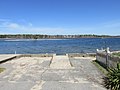
 MiseryIslandFromBeverlyFarms.jpg 1,024 × 680; 179 KB
-
 Monomoscoy Island, Mashpee MA.jpg 3,264 × 2,448; 1.74 MB
-
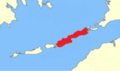 Naushon Island locator map.png 909 × 535; 83 KB
-
 NixesMate.JPG 2,592 × 1,944; 1.88 MB
-
 P1010021.jpg 320 × 240; 8 KB
-
 Pasque Island 2015.jpg 4,608 × 3,456; 3.37 MB
-
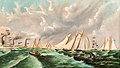
 Penikese Island - Harper's weekly v.17 1873.tif 4,165 × 6,178; 14.3 MB
-
 Penikese Island 2015.jpg 4,608 × 3,456; 3.48 MB
-
 PenikeseIsland (cropped).jpg 2,450 × 350; 594 KB
-
 PenikeseIsland.jpg 3,008 × 2,000; 3.41 MB
-
 Sampson's Island - panoramio.jpg 2,177 × 1,625; 1.55 MB
-
 Seals on South Monomoy Island (5527632439).jpg 2,816 × 2,112; 914 KB
-
 Seals on South Monomoy Island (5527633715).jpg 2,816 × 2,112; 780 KB
-
 Seals on South Monomoy Island (5527634079).jpg 2,816 × 2,112; 1.06 MB
-
 Seals on South Monomoy Island (5528221822).jpg 2,816 × 2,112; 908 KB
-
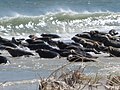 Seals on South Monomoy Island (5528223112).jpg 2,816 × 2,112; 1.04 MB
-
 Seconsett Island MA.jpg 3,264 × 2,448; 2.04 MB
-
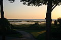
 View from Hog Island.jpg 3,072 × 2,048; 1.7 MB
-

-
 Wpdms na elizabeth islands.jpg 300 × 255; 34 KB


,_by_M._H._Howes_LHS_detail.jpg)
,_by_M._H._Howes_RHS_detail.jpg)
,_by_M._H._Howes.jpg)


.jpg)
.jpg)
.jpg)
.jpg)
.jpg)


_2014-06-18_13-53.jpg)

.jpg)