Category:Island of California
Jump to navigation
Jump to search
phantom island | |||||
| Upload media | |||||
| Instance of | |||||
|---|---|---|---|---|---|
| Facet of |
| ||||
| Location |
| ||||
| |||||
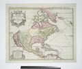
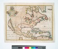
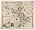
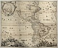
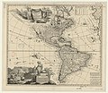
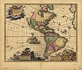
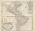
English: The Island of California refers to a long-held European misconception, dating from the 16th century, that the Baja California Peninsula was not part of mainland North America but rather a large island (spelled on early maps as Cali Fornia) separated from the continent by a strait now known as the Gulf of California.
Español: La isla de California hace referencia a un error cartográfico europeo del siglo XVI, en el cual, la península de Baja California aparece separada del resto de América por un supuesto estrecho, que en realidad es el golfo de California.
Subcategories
This category has the following 2 subcategories, out of 2 total.
B
- Burgerzaal map (24 F)
Media in category "Island of California"
The following 200 files are in this category, out of 267 total.
(previous page) (next page)-
Map of California Shown as an Island WDL2661.png 1,435 × 1,024; 3 MB
-
Map of California shown as an island. LOC 99443375.jpg 8,831 × 6,301; 9.82 MB
-
Map of California shown as an island. LOC 99443375.tif 8,831 × 6,301; 159.2 MB
-
California island Vinckeboons.jpg 8,831 × 6,301; 36.75 MB
-
California island Vinckeboons5 courtesy copy.jpg 8,359 × 5,800; 5.85 MB
-
California island Vinckeboons5.jpg 8,359 × 5,800; 39.02 MB
-
Island of California.jpg 8,831 × 6,301; 4.52 MB
-
Le Nouveau Mexique et la Floride (4072646568).jpg 2,000 × 1,294; 2.65 MB
-
Sedmera mest Cibole.jpg 800 × 518; 124 KB
-
Paskaerte van Nova Granada en t'Eylandt California (NYPL b13908778-1619058).jpg 5,448 × 4,644; 5.94 MB
-
Paskaerte van Nova Granada en t'Eylandt California (NYPL b13908778-1619058).tiff 7,230 × 5,428; 112.28 MB
-
Paskaerte van Nova Granada en tEylandt California (7537871982).jpg 2,000 × 1,732; 3.48 MB
-
Cartes generales de toutes les parties du monde 1681 (127473131).jpg 13,988 × 9,430; 15.93 MB
-
Map of California, 1684.jpg 467 × 710; 176 KB
-
Tillemon & Coronelli Nouveau Mexique 1687 UTA.jpg 2,908 × 2,244; 6.4 MB
-
De Fer Cette Carte de Californie et du Nouveau Mexique 1705 UTA.jpg 1,180 × 802; 271 KB
-
Fer - La Californie ou Nouvelle Caroline.png 1,024 × 712; 1.46 MB
-
Map of California as an island R.W. Seale 1745.jpg 450 × 794; 392 KB
-
(The North Part Of America by Henry Briggs 1625) (1906).jpg 4,128 × 3,384; 3.87 MB
-
Purchas his Pilgrimes by Samuel Purchas (2).jpg 1,664 × 1,469; 1.27 MB
-
America Septentrionalis (NYPL b15315142-434086).jpg 5,283 × 4,720; 5.32 MB
-
America Septentrionalis (8342418351).jpg 800 × 672; 137 KB
-
America Septentrionalis. NYPL434518.tiff 5,723 × 5,064; 82.92 MB
-
Amerique septentrionale (NYPL b15315129-434926).jpg 5,419 × 4,368; 4.41 MB
-
Insel Kalifornien 1650.jpg 1,813 × 1,300; 3.29 MB
-
Sanson Amerique Septentrionale 1650 UTA.jpg 3,836 × 2,688; 1.89 MB
-
A-3-37-24-Florida-Mexico-California.jpg 3,000 × 2,282; 684 KB
-
America Septentrionalis LOC 2006629174.jpg 5,628 × 4,785; 4.68 MB
-
America Septentrionalis LOC 2006629174.tif 5,628 × 4,785; 77.05 MB
-
Amerique Septentrionale (NYPL b15315113-434922).jpg 6,043 × 4,688; 5.53 MB
-
Amerique Septentrionale (NYPL b15315113-483734).jpg 5,483 × 4,416; 4.97 MB
-
A chart of the South Sea RMG F8084.tiff 4,667 × 3,798; 50.71 MB
-
L'America settentrionale nouvamente corretta... - da Guglielmo Sansone... - btv1b8468780n.jpg 9,816 × 7,704; 10.55 MB
-
America Settentrionale, 1677 - DPLA - 4d39b852ffa0e4d188a302665ffbdc00.jpg 3,098 × 2,478; 1.22 MB
-
America Septentrionalis (NYPL b15315162-434087).jpg 5,483 × 4,976; 5.41 MB
-
America Septentrionalis. NYPL434087.tiff 5,483 × 4,976; 78.07 MB
-
Sjökort-Karta över Stilla havet - Sjöhistoriska museet - 2007-006-44.tif 5,906 × 5,045, 2 pages; 48.95 MB
-
Strait of Anian from Novissima totius tarrarum orbis tabula by Hugo Allard.png 1,131 × 763; 670 KB
-
Cartes generales de toutes les parties du monde 1681 (127472904).jpg 13,958 × 9,436; 16.94 MB
-
New Mexico; Florida. NYPL1503453.tiff 5,248 × 6,299; 94.6 MB
-
Amérique septentrionale - par P. Du-Val... - btv1b84698238.jpg 9,372 × 6,874; 9.73 MB
-
Map of North and South America, 1685.jpg 636 × 900; 448 KB
-
Coronelli America Settentrionale Colle Nuove Scoperti fin all' Anno 1688 UTA.jpg 10,657 × 7,681; 20.96 MB
-
North America. NYPL465051.tiff 2,357 × 2,236; 15.09 MB
-
Vincenzo Coronelli00.jpg 902 × 678; 194 KB
-
Atlante Veneto Volume 1 077.jpg 6,632 × 9,856; 7.02 MB
-
Amerique septentrionale divisée en ses principale parties (NYPL b15315096-434921).jpg 5,603 × 4,768; 5.55 MB
-
Amerique septentrionale divisée en ses principale parties. NYPL434921.tiff 5,603 × 4,776; 49.4 MB
-
America Settentrionale (13605399323).jpg 2,500 × 1,827; 2.41 MB
-
North America (NYPL b15383509-433725).jpg 3,700 × 3,265; 2.18 MB
-
North America. NYPL433725.tiff 3,700 × 3,265; 34.57 MB
-
Americae Septentrionalis Tabula.jpg 2,614 × 1,634; 1.12 MB
-
Moll - John Lord Sommers This map of North America.png 2,911 × 1,767; 8.04 MB
-
Map of North and South America, 1719.jpg 850 × 1,021; 182 KB
-
Northam1721.jpg 800 × 600; 103 KB
-
Northam1721sw.jpg 800 × 600; 109 KB
-
North America - according to the latest observations. NYPL433753.tiff 4,185 × 3,201; 38.33 MB
-
Moll - A new map of the whole world (Detail).png 699 × 480; 643 KB
-
A new and correct map of the trading part of the West Indies.png 2,780 × 1,567; 7.34 MB
-
Hensel Polyglot, Maps of the Continents 1741 Cornell CUL PJM 1022 01.jpg 6,333 × 5,440; 4.29 MB
-
1741 maps of Europe, Asia, Africa and America showing the distribution of languages.jpg 3,910 × 3,507; 2.16 MB
-
Pacific Ocean showing part of North and South America.) NYPL478199.tiff 4,108 × 3,563; 41.88 MB
-
1668MapAmericasNHMDF.JPG 3,872 × 2,592; 2.94 MB
-
America (NYPL b15307865-434532).jpg 2,644 × 1,703; 1.13 MB
-
America - Petrus Kaerius caelav., anno Do 1646. NYPL434532.tiff 2,253 × 1,587; 13.65 MB
-
Novissima et accuratissima totius Americae descriptio - per N. Visscher. NYPL464998.tiff 5,547 × 4,856; 77.07 MB
-
1670 America Visscher mr.jpg 2,500 × 2,022; 4.72 MB
-
A chart of the South Sea (8429866651).jpg 800 × 692; 145 KB
-
A generall chart of the South Sea ... NYPL481132.tiff 7,230 × 5,428; 112.28 MB
-
A new map of America from the latest observations (4072635516).jpg 2,000 × 1,707; 3.76 MB
-
America (13605399223).jpg 1,845 × 2,000; 1.76 MB
-
America (13783143475).jpg 2,500 × 1,756; 1.89 MB
-
America (13783482204).jpg 1,526 × 2,000; 1.61 MB
-
America (4072637822).jpg 1,369 × 2,000; 2.77 MB
-
America - btv1b525051420.jpg 19,848 × 16,621; 47.7 MB
-
America - by H. Moll, geographer, 1726. NYPL433734.tiff 2,320 × 2,946; 19.56 MB
-
America - by H. Moll, geographer. NYPL464991.tiff 4,248 × 4,819; 58.57 MB
-
America 1646 Kaerius³.jpg 1,735 × 1,251; 2.01 MB
-
America by Nicolass Visscher.jpg 1,047 × 873; 303 KB
-
America cum Supplementis Poly-Glottis by Gottfried Hensel.jpg 5,078 × 4,061; 4.06 MB
-
America cum Supplementis Poly-Glottis.jpg 2,947 × 2,441; 1.92 MB
-
America LOC 87691568.jpg 11,661 × 7,476; 15.26 MB
-
America LOC 87691568.tif 11,661 × 7,476; 249.42 MB
-
America Septentrionalis novissima ; America Meridionalis accuratissima LOC 2003623106.jpg 7,272 × 6,213; 7.16 MB
-
America Septentrionalis novissima ; America Meridionalis accuratissima LOC 2003623106.tif 7,272 × 6,213; 129.26 MB
-
America. NYPL465060.tiff 4,592 × 4,185; 54.99 MB
-
Americae (4072630072).jpg 2,000 × 1,596; 3.24 MB
-
Americae (8430919308).jpg 800 × 689; 153 KB
-
Americae - Hugo Allardt, excudit - btv1b84687152.jpg 10,150 × 8,100; 12.17 MB
-
Americae nova descriptio - btv1b8468994c.jpg 9,370 × 7,692; 9.84 MB
-
Americae nova discriptio (5384787285).jpg 2,000 × 1,608; 2.93 MB
-
Americam utramque - aliis correctiorem LOC 96686639.jpg 7,196 × 6,182; 6.22 MB
-
Americam utramque - aliis correctiorem LOC 96686639.tif 7,196 × 6,182; 127.27 MB
-
Americqve septentrionale LOC 2017585902.jpg 3,318 × 2,431; 1.44 MB
-
Americqve septentrionale LOC 2017585902.tif 4,556 × 6,354; 82.82 MB
-
Americæ descriptio nova LOC 84695068.jpg 5,245 × 4,324; 3.81 MB
-
Americæ descriptio nova LOC 84695068.tif 5,245 × 4,324; 64.89 MB
-
Americæ nova descriptio LOC 96686646.jpg 5,297 × 4,427; 3.49 MB
-
Americæ nova descriptio LOC 96686646.tif 5,297 × 4,427; 67.09 MB
-
AMH-8631-NA Map of the Pacific Ocean.jpg 2,400 × 2,223; 551 KB
-
Amérique - btv1b84685584.jpg 8,410 × 6,660; 10.52 MB
-
Amérique septentrionale (2e édition) - par N. Sanson ; reveüe... par G. Sanson - btv1b8469996h.jpg 10,104 × 7,488; 11.06 MB
-
Amérique septentrionale - par N. Sanson ; reveüe... par G. Sanson... - btv1b8469001x.jpg 11,292 × 8,424; 12.88 MB
-
Amérique septentrionale - par N. Sanson ; reveüe... par G. Sanson... - btv1b84691834.jpg 10,068 × 7,632; 10.36 MB
-
Amérique septentrionale - par N. Sanson ; reveüe... par G. Sanson... - btv1b8469420n.jpg 9,900 × 7,404; 10.36 MB
-
Amérique septentrionale - par N. Sanson ; reveüe... par G. Sanson... - btv1b8469821f.jpg 9,888 × 7,740; 10.05 MB
-
Amérique septentrionale - par N. Sanson ; reveüe... par G. Sanson... - btv1b8469822v.jpg 9,924 × 7,561; 9.89 MB
-
Amérique septentrionale divisée en ses principaux Estats... - par le Sr Sanson... - btv1b53027505c.jpg 15,727 × 12,194; 24.23 MB
-
Amérique septentrionale LOC 2003623388.jpg 6,743 × 4,712; 5.66 MB
-
Amérique septentrionale LOC 2003623388.tif 6,743 × 4,712; 90.9 MB
-
Amérique septentrionale LOC 2003623390.jpg 6,793 × 4,972; 5.28 MB
-
Amérique septentrionale LOC 2003623390.tif 6,793 × 4,972; 96.63 MB
-
Amérique septentrionale old map.jpg 1,685 × 1,178; 601 KB
-
Atlante Veneto Volume 1 048.jpg 9,619 × 6,773; 8.36 MB
-
Atlas Van der Hagen-KW1049B13 072-Novissima et Accuratissima TOTIUS AMERICAE DESCRIPTIO.jpeg 5,500 × 4,497; 3.11 MB
-
Californie - Globe terrestre du Père Grégoire 2.jpg 4,000 × 3,000; 4.33 MB
-
Californie - Globe terrestre du Père Grégoire.jpg 4,000 × 3,000; 4.25 MB
-
Dutch map of the Americas, 1680.jpg 2,383 × 2,058; 4.17 MB
-
From Map of North America by Edward Wells, M.A. 1722 - NARA - 135841385.jpg 2,981 × 2,122; 548 KB
-
Itaú Cultural 2018 014.jpg 3,456 × 5,184; 22.13 MB
-
John Lord Sommers This map of North America Herman Moll Geogr. RMG F0005.tiff 7,278 × 4,418; 91.99 MB


