Category:Isla Lemuy, Chile
Jump to navigation
Jump to search
island in Chile | |||||
| Upload media | |||||
| Instance of | |||||
|---|---|---|---|---|---|
| Part of | |||||
| Location | Los Lagos Region, Chile | ||||
| Located in or next to body of water | |||||
| Capital | |||||
| Width |
| ||||
| Length |
| ||||
| Population |
| ||||
| Area |
| ||||
| Elevation above sea level |
| ||||
 | |||||
English: Lemuy Island is an island in Chiloé Archipelago, Chile, off the eastern coast of Chiloé Island. It has an area of 97 km2 and a population of 4,125 (2002). It is coterminous with the commune of Puqueldón.
Español: Lemuy (del mapudungun: lemuy, "es boscoso") es una isla del sur de Chile. Es la tercera isla más grande del archipiélago de Chiloé, después de la Isla Grande y de Quinchao. Tiene una superficie de unos 97 kmª y constituye la comuna de Puqueldón. Tal como la isla de Quinchao, está conectada a la red de luz regional por un gran cable que se extiende sobre el Canal Yal, que la separa de la comuna de Chonchi. Un transbordador lleva vehículos y peatones a la isla desde el sector de Puerto Huicha hasta Chulchuy.
Subcategories
This category has the following 3 subcategories, out of 3 total.
A
I
- Iglesia de Detif (7 F)
- Iglesia de Ichuac (24 F)
Pages in category "Isla Lemuy, Chile"
This category contains only the following page.
Media in category "Isla Lemuy, Chile"
The following 85 files are in this category, out of 85 total.
-
AldachildoEscuela.jpg 714 × 484; 65 KB
-
AldachildoVistaGeneral.jpg 2,864 × 1,375; 422 KB
-
Bahía en Detif.jpg 960 × 720; 69 KB
-
Camino Puqueldón - Detif.jpg 960 × 720; 60 KB
-
Campos en la punta Apahuén.JPG 3,264 × 2,448; 1.73 MB
-
Canal Lemuy entre Puqueldón y Quinched - panorámica.png 4,481 × 1,672; 10.49 MB
-
Canal Lemuy, Quinched y Chonchi - panorámic.png 19,424 × 1,806; 57.85 MB
-
Casa vacacional, isla Lemuy A74078820240106.jpg 6,964 × 3,708; 21.75 MB
-
Cascada Parque Yayanes, isla Lemuy A74084620240106.jpg 4,217 × 5,988; 26.42 MB
-
Chiloé Lemuy telaraña.jpg 720 × 960; 108 KB
-
Chiloé Lemuy Trauco.jpg 720 × 960; 145 KB
-
Chiloé Lemuy.jpg 720 × 960; 182 KB
-
Chiloé Lemuy2.jpg 720 × 960; 119 KB
-
Chulchuy.jpg 1,479 × 921; 683 KB
-
CL Isla Lemuy 1002 (1) (17228941525).jpg 800 × 535; 97 KB
-
CL Isla Lemuy 1002 (2) (17202995056).jpg 800 × 535; 82 KB
-
CL Isla Lemuy 1002 (3) (17202994856).jpg 800 × 535; 103 KB
-
CL Isla Lemuy 1002 (4) (17042758859).jpg 800 × 535; 95 KB
-
CL Isla Lemuy 1002 (5) (17021515627).jpg 800 × 535; 83 KB
-
CL Isla Lemuy 1002 (6) (17228940505).jpg 800 × 535; 89 KB
-
Columpio de Luzbel A74079820240106.jpg 5,958 × 3,451; 13.69 MB
-
Corazón de Fuego, cerro Yelqui A74081420240106.jpg 7,008 × 4,672; 16.5 MB
-
Costa de Lemuy 01.JPG 3,264 × 1,688; 2.05 MB
-
Costa de Lemuy 02.JPG 3,264 × 2,448; 2.14 MB
-
Costa de Lemuy 03.JPG 3,264 × 2,129; 3.15 MB
-
Costa de Lemuy 04.JPG 3,264 × 2,448; 1.55 MB
-
Costa de Lemuy 05.JPG 3,264 × 2,448; 2.04 MB
-
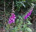
Digitalis purpurea A74084420240106.jpg 4,275 × 3,723; 5.01 MB
-
Entrada de Ichuac 01.JPG 3,264 × 2,448; 1.59 MB
-
Entrada de Ichuac 02.JPG 3,264 × 2,448; 1.64 MB
-
Entrada de Ichuac 03.JPG 3,264 × 2,448; 1.68 MB
-
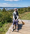
Figura de Bruja, Muelle de los Brujos A74081220240106.jpg 4,455 × 4,990; 10.87 MB
-
Fuchsia magellanica A74083620240106.jpg 5,142 × 2,965; 5.3 MB
-
Fuchsia magellanica A74084220240106.jpg 2,669 × 2,372; 2.53 MB
-
Hydrangea Macrophylla A74078720240106.jpg 6,343 × 4,397; 12 MB
-
Isla de Lemuy.JPG 1,280 × 960; 593 KB
-
Isla Lemuy.png 690 × 425; 88 KB
-
Lemuy Linlinao Quinched.jpg 2,048 × 1,536; 1.53 MB
-
Lilium bulbiferum A74079020240106.jpg 2,972 × 2,300; 4.45 MB
-
Lilium bulbiferum-2 A74079220240106.jpg 3,030 × 2,266; 4.06 MB
-
Linlinao y Lemuy.jpg 615 × 442; 66 KB
-
Linlinao y Puqueldón 2013-11.jpg 4,000 × 2,139; 3.52 MB
-
Michimáhuida desde Quinched 01.jpg 3,975 × 1,841; 5.16 MB
-
Michimáhuida desde Quinched 02.jpg 4,000 × 3,000; 4.99 MB
-
Mirador Muelle de los Brujos, cerro Yelqui, isla Lemuy A740799-Pano20240106.jpg 14,624 × 3,981; 37.21 MB
-
Paisaje, isla Lemuy A74077520240106.jpg 11,426 × 3,880; 31.55 MB
-
Planicie de Detif.JPG 3,264 × 2,448; 3.07 MB
-
Preparación del Curanto en hoyo A74090820240107.jpg 4,023 × 2,959; 6.7 MB
-
Preparación del Curanto en hoyo A74091020240107.jpg 5,265 × 3,259; 8.39 MB
-
Punta Apahuén 01.JPG 2,824 × 1,761; 2.54 MB
-
Punta Apahuén 03.JPG 1,976 × 1,380; 1.48 MB
-
Punta Apahuén 04.JPG 3,021 × 2,265; 759 KB
-
Punta Apahuén 05.JPG 3,264 × 2,448; 1.69 MB
-
Punta Detif 01.JPG 3,264 × 2,448; 4.24 MB
-
Punta Detif 02.JPG 3,264 × 2,448; 3.53 MB
-
Punta Detif 03.JPG 3,264 × 2,448; 3.71 MB
-
Punta Detif 04.JPG 2,448 × 3,264; 3.82 MB
-
Punta Detif 05.JPG 2,448 × 3,264; 3.23 MB
-
Punta Detif 06.JPG 3,264 × 2,448; 3.04 MB
-
Punta Detif 07.JPG 3,264 × 1,326; 2.49 MB
-
Puqueldón en Lemuy 01.JPG 4,000 × 2,142; 4.2 MB
-
Puqueldón1.jpg 2,367 × 1,459; 363 KB
-
Puqueldón2.jpg 2,517 × 1,539; 1.59 MB
-
Puqueldón3.jpg 2,964 × 1,648; 547 KB
-
Quinched-Isletilla-Pozuelo.JPG 640 × 374; 56 KB
-
Quinched-Linlinao-Isletilla-Lemuy.JPG 640 × 480; 68 KB
-
Salmonera en Ichuac 01.JPG 3,264 × 2,448; 1.23 MB
-
Salmonera en Ichuac 02.JPG 3,264 × 2,448; 1.18 MB
-
Salmonera en Ichuac 03.JPG 3,264 × 2,448; 1.44 MB
-
Salmonera en Ichuac 04.JPG 3,264 × 2,448; 1.72 MB
-
Salmonera en Ichuac 05.JPG 3,264 × 2,448; 1.29 MB
-
Salmonera en Ichuac 06.JPG 3,264 × 2,448; 1.73 MB
-
Salmonera en Ichuac 07.JPG 3,264 × 2,448; 1.35 MB
-
Salmonera en Ichuac 08.JPG 3,264 × 2,448; 2.07 MB
-
Salmonera en Ichuac 09.JPG 3,264 × 2,448; 2.07 MB
-
Salmonera en Ichuac 10.JPG 3,264 × 2,448; 1.62 MB
-
Salmonera en Ichuac 11.JPG 3,264 × 2,448; 5.54 MB
-
Salmonera en Ichuac 12.JPG 3,264 × 2,448; 4.91 MB
-
Salmonera en Ichuac 13.JPG 1,240 × 1,296; 1.22 MB
-
Salmonera en Ichuac 14.JPG 3,264 × 2,448; 1.71 MB
-
SanAgustín1.jpg 630 × 390; 33 KB
-
SanAgustín2.jpg 617 × 364; 26 KB
-
SanAgustín3.jpg 465 × 343; 22 KB
-
Sendero Parque Yayanes, isla Lemuy A74083820240106.jpg 3,892 × 6,249; 21.8 MB
-
Sur de Lemuy.JPG 2,657 × 1,265; 1.68 MB


