Category:Iroise sea maps
Jump to navigation
Jump to search
| NO WIKIDATA ID FOUND! Search for Iroise sea maps on Wikidata | |
| Upload media |
Media in category "Iroise sea maps"
The following 15 files are in this category, out of 15 total.
-
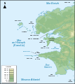
Carte mer d'Iroise localisation.png 1,894 × 1,260; 170 KB
-
Carte mer d'Iroise muette.png 1,500 × 1,181; 141 KB
-
Carte mer d'Iroise.png 1,500 × 1,181; 281 KB
-
Carte Parc naturel marin d'Iroise.png 1,894 × 1,260; 65 KB
-
Carte Réserve biosphère îles et mer Iroise.png 1,894 × 1,260; 81 KB
-
Carte zone Iroise de Météo France.png 1,894 × 1,260; 58 KB
-
Iroise sea map-br.svg 776 × 867; 339 KB
-
Iroise sea map-de.svg 776 × 867; 406 KB
-
Iroise sea map-en.svg 776 × 867; 406 KB
-
Iroise sea map-fr Camaret 1694.svg 776 × 867; 409 KB
-
Iroise sea map-fr.svg 776 × 867; 406 KB
-
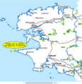
Lavieille.png 501 × 516; 264 KB
-
Mer d'Iroise.jpg 501 × 516; 80 KB
-
Périmètre PNM Iroise.png 1,091 × 872; 518 KB


