Category:Ireby and Uldale
Jump to navigation
Jump to search
civil parish in Allerdale, Cumbria, England  | |||||
| Upload media | |||||
| Instance of | |||||
|---|---|---|---|---|---|
| Named after | |||||
| Location | Allerdale, Cumbria, North West England, England | ||||
| Population |
| ||||
 | |||||
Subcategories
This category has the following 8 subcategories, out of 8 total.
A
- Aughertree (2 F)
H
- High Ireby (5 F)
I
L
- Longlands Fell (10 F)
- Lowthwaite Fell (7 F)
O
- Overwater Hall (3 F)
U
Media in category "Ireby and Uldale"
The following 200 files are in this category, out of 428 total.
(previous page) (next page)-
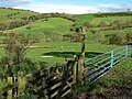
 A Bright Spring Day - geograph.org.uk - 6169145.jpg 4,000 × 3,000; 3.4 MB
-
 A minor road near Over Water - geograph.org.uk - 3382344.jpg 2,592 × 1,944; 2.59 MB
-
 A Slow Decline - geograph.org.uk - 2887818.jpg 2,560 × 1,920; 1.95 MB
-
 Above Charleton Gill - geograph.org.uk - 1952271.jpg 640 × 480; 66 KB
-
 Above Dash Beck - geograph.org.uk - 1332955.jpg 640 × 480; 70 KB
-
 Above Dash Farm - geograph.org.uk - 1329051.jpg 480 × 640; 73 KB
-
 Above Hause Gill - geograph.org.uk - 1329070.jpg 640 × 480; 55 KB
-
 Above Horsemoor Hills - geograph.org.uk - 1325527.jpg 640 × 480; 73 KB
-
 Above Meal Fel - geograph.org.uk - 2887801.jpg 2,560 × 1,920; 2.13 MB
-
 Above the Ellen - geograph.org.uk - 2276760.jpg 2,560 × 1,920; 1.58 MB
-
 Above Trusmadoor - geograph.org.uk - 2275653.jpg 2,560 × 1,920; 788 KB
-
 Above Trusmadoor - geograph.org.uk - 2887805.jpg 2,560 × 1,920; 1.27 MB
-
 Across the Dash valley - geograph.org.uk - 2327826.jpg 3,872 × 2,592; 4.69 MB
-
 Armathwaite Head - geograph.org.uk - 2220161.jpg 2,592 × 1,944; 1.15 MB
-
 Ascending Great Cock Up - geograph.org.uk - 3091772.jpg 3,264 × 2,448; 3.72 MB
-
 Ascending Great Cockup - geograph.org.uk - 1325528.jpg 640 × 480; 51 KB
-
 Ascending Great Cockup - geograph.org.uk - 1325530.jpg 640 × 480; 63 KB
-
 Ascending Great Cockup - geograph.org.uk - 2275659.jpg 2,560 × 1,920; 1.02 MB
-
 At the road junction by Whitefield Cottage - geograph.org.uk - 5803426.jpg 1,600 × 1,067; 357 KB
-
 Aughertree Fell - geograph.org.uk - 4082416.jpg 640 × 480; 62 KB
-
 Aughertree Fell - geograph.org.uk - 5585655.jpg 1,024 × 768; 206 KB
-
 Aughertree Fell - geograph.org.uk - 5585660.jpg 1,024 × 768; 260 KB
-
 Aughertree near Midtown Farm - geograph.org.uk - 5586549.jpg 1,024 × 767; 254 KB
-
 Baggra Yeat Farm - geograph.org.uk - 1023978.jpg 640 × 480; 110 KB
-
 Barn at Orthwaite - geograph.org.uk - 5806588.jpg 1,600 × 1,066; 263 KB
-
 Bield, Burntodd Gill - geograph.org.uk - 3549820.jpg 2,560 × 1,920; 2.01 MB
-
 Binsey Fell Cairn - geograph.org.uk - 3193120.jpg 4,752 × 3,168; 4.87 MB
-
 Binsey Fell Trig Point and Shelters - geograph.org.uk - 3193655.jpg 4,752 × 3,168; 4.65 MB
-
 Binsey summit - geograph.org.uk - 5932387.jpg 2,048 × 1,536; 759 KB
-
 Binsey summit, Trig Point and Tumulus - geograph.org.uk - 6192623.jpg 4,000 × 3,000; 4.56 MB
-
 Birch Cottage, Stanthwaite - geograph.org.uk - 5586728.jpg 1,024 × 768; 203 KB
-
 Black Lion, Ireby - geograph.org.uk - 5804840.jpg 1,600 × 1,067; 252 KB
-
 Black Nettle Hause - geograph.org.uk - 2327666.jpg 3,872 × 2,592; 4.37 MB
-
 Blossom on the road to Overwater Hall Hotel - geograph.org.uk - 3952639.jpg 1,024 × 768; 214 KB
-
 Bracken of eastern slope of Binsey - geograph.org.uk - 4613118.jpg 1,500 × 1,000; 1.16 MB
-
 Bracken on north side of Little Cockup - geograph.org.uk - 4616539.jpg 1,500 × 1,000; 1.44 MB
-
 Bracken on slope above Brockle Crag - geograph.org.uk - 4614174.jpg 1,500 × 1,000; 1.24 MB
-
 Bridleway alongside Charleton Gill - geograph.org.uk - 3338274.jpg 1,500 × 971; 1.18 MB
-
 Bridleway at Kitty Beck - geograph.org.uk - 5586545.jpg 1,024 × 768; 261 KB
-
 Bridleway leaving Uldale Mill Farm - geograph.org.uk - 5804858.jpg 1,600 × 1,067; 267 KB
-
 Bridleway near Johnny Beck - geograph.org.uk - 5586539.jpg 1,024 × 768; 290 KB
-
 Bridleway near Uldale Mill Farm and church - geograph.org.uk - 5804846.jpg 1,067 × 1,600; 344 KB
-
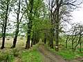
 Bridleway rising through avenue of trees - geograph.org.uk - 4612570.jpg 1,500 × 1,000; 2.34 MB
-
 Bridleway to Binsey Plantation - geograph.org.uk - 3952633.jpg 1,024 × 768; 256 KB
-
 Brockle Crag - geograph.org.uk - 1332943.jpg 640 × 480; 72 KB
-
 Broken lane leading to High Ireby - geograph.org.uk - 3339962.jpg 3,264 × 2,448; 3.98 MB
-
 Burn Tod Snow in November - geograph.org.uk - 3213357.jpg 3,264 × 2,448; 2.7 MB
-
 Butterbur beside minor road on north side of Overwater - geograph.org.uk - 4612567.jpg 1,500 × 1,000; 2.18 MB
-
 Cairn marking the pass in Trusmadoor - geograph.org.uk - 1753278.jpg 800 × 530; 210 KB
-
 Cairn on Binsey - geograph.org.uk - 5803403.jpg 1,600 × 1,067; 536 KB
-
 Cairn on Binsey summit - geograph.org.uk - 6192627.jpg 4,000 × 3,000; 4.62 MB
-
 Cairn on Great Cockup - geograph.org.uk - 1328983.jpg 640 × 480; 44 KB
-
 Cairn on Great Sca Fell - geograph.org.uk - 5807014.jpg 1,600 × 1,067; 240 KB
-
 Cairn, Great Calva - geograph.org.uk - 898716.jpg 640 × 480; 80 KB
-
 Caldbeck fells from High Ireby - geograph.org.uk - 3339946.jpg 1,600 × 1,200; 517 KB
-
 Caldbeck fells viewed from Binsey - geograph.org.uk - 3301156.jpg 3,872 × 2,592; 1.9 MB
-
 Castle How, Over Water ^ Latrigg - geograph.org.uk - 6170129.jpg 4,000 × 3,000; 3.07 MB
-
 Cattle with bull in field - geograph.org.uk - 4617028.jpg 1,500 × 1,000; 1.42 MB
-
 Chapel House Farm - geograph.org.uk - 5586766.jpg 1,024 × 768; 308 KB
-
 Chapelhouse Reservoir - geograph.org.uk - 5585145.jpg 1,024 × 768; 260 KB
-
 Chapelhouse Reservoir - geograph.org.uk - 5586778.jpg 1,024 × 768; 241 KB
-

-
 Charleton Gill - geograph.org.uk - 1952275.jpg 640 × 480; 76 KB
-
 Charleton Gill - geograph.org.uk - 1952281.jpg 640 × 480; 64 KB
-
 Charleton Gill - geograph.org.uk - 1952290.jpg 640 × 480; 74 KB
-
 Charleton Gill - geograph.org.uk - 1952292.jpg 640 × 480; 86 KB
-
 Charleton Wath - geograph.org.uk - 58637.jpg 480 × 360; 23 KB
-

-
 Cottage at Chapelhouse Reservoir - geograph.org.uk - 5586783.jpg 1,024 × 768; 310 KB
-
 Country west of Ireby - geograph.org.uk - 3592143.jpg 2,592 × 1,944; 1.64 MB
-
 Crossing Aughertree Fell - geograph.org.uk - 5910233.jpg 640 × 427; 214 KB
-
 Crossing Hause Gill - geograph.org.uk - 3642455.jpg 1,600 × 1,064; 504 KB
-
 Crossroads and houses in Ireby - geograph.org.uk - 4617005.jpg 1,500 × 907; 1.06 MB
-
 Crossroads, Uldale - geograph.org.uk - 5586581.jpg 1,024 × 768; 234 KB
-
 Dale Hows, Aughertree Fell - geograph.org.uk - 5585666.jpg 1,024 × 768; 268 KB
-
 Dale Hows, Aughertree Fell - geograph.org.uk - 5586502.jpg 1,024 × 768; 232 KB
-
 Dash Beck - geograph.org.uk - 4387512.jpg 640 × 480; 111 KB
-
 Dash Farm - geograph.org.uk - 1520694.jpg 427 × 640; 85 KB
-
 Dash Farm - geograph.org.uk - 1520701.jpg 640 × 381; 75 KB
-
 Dash Farm - geograph.org.uk - 3642310.jpg 1,600 × 1,064; 470 KB
-
 Dash Farm - geograph.org.uk - 944993.jpg 426 × 640; 67 KB
-
 Dash Farm viewed from Bakestall - geograph.org.uk - 945433.jpg 640 × 426; 67 KB
-
 Dash Valley - geograph.org.uk - 1024030.jpg 640 × 480; 94 KB
-
 Dash valley and Dash Farm - geograph.org.uk - 945445.jpg 640 × 426; 98 KB
-
 Derelict sheepfold near Burntod Gill - geograph.org.uk - 5806932.jpg 1,600 × 1,067; 485 KB
-
 Descending Great Calva - geograph.org.uk - 3245242.jpg 2,560 × 1,920; 2.06 MB
-
 Descending Great Calva - geograph.org.uk - 3273204.jpg 2,560 × 1,920; 2.06 MB
-
 Descending Great Calva - geograph.org.uk - 3285498.jpg 2,560 × 1,920; 2.12 MB
-
 Descending Great Cockup - geograph.org.uk - 818551.jpg 640 × 480; 73 KB
-
 Descending Great Sca Fell - geograph.org.uk - 2887799.jpg 2,560 × 1,920; 1,014 KB
-
 Descending Great Sca Fell - geograph.org.uk - 818513.jpg 640 × 480; 49 KB
-
 Descending Meal Fell - geograph.org.uk - 3292610.jpg 2,560 × 1,920; 2.19 MB
-
 Descending Meal Fell - geograph.org.uk - 818529.jpg 640 × 480; 65 KB
-
 Descending White Hause - geograph.org.uk - 1331175.jpg 640 × 480; 59 KB
-
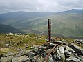
 Detail of Binsey trig point - geograph.org.uk - 2301851.jpg 1,936 × 2,592; 2.64 MB
-
 Direction Sign – Signpost - geograph.org.uk - 6507685.jpg 598 × 897; 262 KB
-
 Direction Sign – Signpost - geograph.org.uk - 6507751.jpg 559 × 839; 209 KB
-
 Direction Sign – Signpost - geograph.org.uk - 6507765.jpg 540 × 810; 177 KB
-
 Direction Sign – Signpost - geograph.org.uk - 6507769.jpg 486 × 728; 236 KB
-

-
 Disused quarry at the foot of Binsey - geograph.org.uk - 3952588.jpg 1,024 × 768; 124 KB
-
 Double Rainbow over Brockle Crag - geograph.org.uk - 2137161.jpg 2,560 × 1,920; 916 KB
-
 Drive to Baggra Yeat Farm - geograph.org.uk - 5585637.jpg 1,024 × 768; 312 KB
-
 Ducks on Overwater - geograph.org.uk - 5803453.jpg 1,600 × 1,067; 186 KB
-

-
 Farm buildings south of Overwater Hall Hotel - geograph.org.uk - 3952656.jpg 1,024 × 768; 152 KB
-
 Farm track heading west, above Uldale - geograph.org.uk - 4493226.jpg 905 × 678; 101 KB
-
 Farm ^ Rectory near Uldale - geograph.org.uk - 5586569.jpg 1,024 × 768; 242 KB
-
 Farmhouse, Chapel House Farm - geograph.org.uk - 5586768.jpg 1,024 × 768; 298 KB
-
 Farmland in the valley of the River Ellen - geograph.org.uk - 5016188.jpg 1,024 × 768; 144 KB
-
 Farmland near High Ireby - geograph.org.uk - 3339978.jpg 3,264 × 2,448; 3.87 MB
-
 Farmland near Lowthwaite - geograph.org.uk - 5585535.jpg 1,024 × 768; 193 KB
-
 Farmland near Over Water - geograph.org.uk - 950418.jpg 640 × 426; 70 KB
-
 Farmland north of Mirkholme - geograph.org.uk - 4614159.jpg 1,500 × 1,000; 1.8 MB
-
 Farmland north of Uldale - geograph.org.uk - 5016179.jpg 1,024 × 768; 173 KB
-
 Farmland outside the open access area - geograph.org.uk - 4493220.jpg 1,024 × 768; 108 KB
-
 Farmland west of Scawthwaite Mire - geograph.org.uk - 4493198.jpg 1,024 × 768; 136 KB
-
 Fence rising towards Great Calva - geograph.org.uk - 3342057.jpg 1,500 × 1,125; 1.21 MB
-
 Field gate, south-west of Uldale - geograph.org.uk - 4493187.jpg 1,024 × 768; 125 KB
-
 Field near Longlands - geograph.org.uk - 5585268.jpg 1,024 × 768; 242 KB
-
 Field near Lowthwaite - geograph.org.uk - 5585142.jpg 1,024 × 768; 249 KB
-
 Field with mown grass - geograph.org.uk - 4617018.jpg 1,500 × 1,000; 1.45 MB
-
 Field with sheep, Great Cockup beyond - geograph.org.uk - 4613941.jpg 1,500 × 1,000; 1.33 MB
-
 Fields above Orthwaite Farm - geograph.org.uk - 2220122.jpg 2,592 × 1,944; 1.44 MB
-
 Fields at Baggra Yeat Farm - geograph.org.uk - 3382173.jpg 2,592 × 1,944; 1.4 MB
-
 Fields between Binsey and Latrigg - geograph.org.uk - 3382309.jpg 2,592 × 1,944; 1.43 MB
-
 Fields near Dogkennel Wood - geograph.org.uk - 3382322.jpg 2,592 × 1,944; 1.07 MB
-
 Fields near Ireby - geograph.org.uk - 2932359.jpg 2,592 × 1,944; 1.28 MB
-
 Fields near Longlands - geograph.org.uk - 5585633.jpg 1,024 × 768; 266 KB
-
 Fields near Over Water - geograph.org.uk - 5585124.jpg 1,024 × 768; 248 KB
-
 Fields north of Uldale - geograph.org.uk - 3382290.jpg 2,592 × 1,944; 1.45 MB
-
 Fields with Skiddaw distant - geograph.org.uk - 4613919.jpg 1,500 × 1,000; 1.23 MB
-
 Flowers on Binsey - geograph.org.uk - 3154990.jpg 2,560 × 1,920; 2.12 MB
-
 Footpath High Ireby - geograph.org.uk - 3339948.jpg 1,200 × 1,600; 726 KB
-
 Footpath near Chapel House Farm - geograph.org.uk - 5586760.jpg 1,024 × 768; 287 KB
-
 Former field boundary, near Rosthwaite Beck - geograph.org.uk - 4493147.jpg 1,024 × 768; 138 KB
-
 Former quarry on Aughertree Fell - geograph.org.uk - 2493210.jpg 2,592 × 1,944; 1.59 MB
-
 Former trackway, Aughertree Fell - geograph.org.uk - 5586519.jpg 1,024 × 768; 275 KB
-

-
 From the summit of Green How - geograph.org.uk - 2493216.jpg 2,592 × 1,944; 1.41 MB
-
 From White Hause - geograph.org.uk - 1331178.jpg 640 × 480; 64 KB
-

-
 Frozen Fell - geograph.org.uk - 3549853.jpg 2,560 × 1,920; 679 KB
-
 Frozen Fell with ground rising eastwards to Knott - geograph.org.uk - 2628053.jpg 1,500 × 1,125; 1.57 MB
-
 Frozen Fell, Knott - geograph.org.uk - 1753346.jpg 800 × 530; 208 KB
-
 Frozenfell Gill - geograph.org.uk - 3292605.jpg 2,560 × 1,920; 836 KB
-
 Frozenfell Gill - geograph.org.uk - 3549854.jpg 2,560 × 1,920; 945 KB
-
 Frozenfell Gill - geograph.org.uk - 818521.jpg 640 × 480; 58 KB
-
 Frozenfell Gill Waterfall - geograph.org.uk - 3088627.jpg 640 × 420; 110 KB
-
 Gill Beck from Gill Bridge - geograph.org.uk - 2932368.jpg 1,944 × 2,592; 2.28 MB
-
 Gill, Burn Tod - geograph.org.uk - 1329017.jpg 480 × 640; 111 KB
-
 Grassland, Uldale - geograph.org.uk - 2744607.jpg 640 × 360; 183 KB
-
 Grassy slope south-west of summit of Knott - geograph.org.uk - 3342177.jpg 1,500 × 1,125; 1.23 MB
-
 Great Calva - geograph.org.uk - 1507668.jpg 640 × 480; 89 KB
-
 Great Calva from Blencathra - geograph.org.uk - 2838443.jpg 800 × 530; 132 KB
-
 Great Calva summit - geograph.org.uk - 4277593.jpg 640 × 480; 71 KB
-
 Great Calva summit from the south - geograph.org.uk - 2595590.jpg 2,592 × 1,944; 1.11 MB
-
 Great Cockup - geograph.org.uk - 5554728.jpg 480 × 640; 66 KB
-
 Great Sca Fell from the route to Knott - geograph.org.uk - 6666874.jpg 5,472 × 3,648; 7.54 MB
-
 Grouse Butt, Great Cockup - geograph.org.uk - 1325532.jpg 480 × 640; 82 KB
-
 Grouse Butt, Great Cockup - geograph.org.uk - 3727148.jpg 2,560 × 1,920; 2.05 MB
-
 Hause Gill - geograph.org.uk - 1329078.jpg 640 × 480; 93 KB
-
 Hause Gill - geograph.org.uk - 1331170.jpg 480 × 640; 93 KB
-
 Hawthorn - geograph.org.uk - 1332966.jpg 480 × 640; 132 KB
-
 Heading towards Knott - geograph.org.uk - 1623403.jpg 640 × 480; 78 KB
-
 Hillside above Uldale - geograph.org.uk - 4493230.jpg 1,024 × 768; 124 KB
-
 Hillside above Whitewater Dash - geograph.org.uk - 1712421.jpg 2,272 × 1,712; 809 KB
-
 House in Uldale - geograph.org.uk - 5586584.jpg 1,024 × 768; 226 KB
-
 Ireby Ford - geograph.org.uk - 4387486.jpg 3,872 × 2,592; 4.87 MB
-
 Ireby from the south-east - geograph.org.uk - 5586553.jpg 1,024 × 768; 218 KB
-
 Ireby Old Chancel from footpath - geograph.org.uk - 3045401.jpg 3,264 × 2,448; 2.95 MB
-
 Junction of footpath tracks and lane Ireby - geograph.org.uk - 3045407.jpg 3,264 × 2,448; 3.44 MB
-
 Junction of Lanes near Ireby - geograph.org.uk - 3046160.jpg 3,264 × 2,448; 4.09 MB
-

-
 Lane at Longlands - geograph.org.uk - 5584538.jpg 640 × 427; 147 KB
-
 Lane near High Ireby - geograph.org.uk - 1416314.jpg 640 × 481; 124 KB
-
 Lane near Overwater Hotel - geograph.org.uk - 5803434.jpg 1,600 × 1,067; 437 KB
-
 Latrigg - geograph.org.uk - 4612558.jpg 1,500 × 1,000; 1.67 MB
-
 Latrigg Fellside - geograph.org.uk - 1514349.jpg 640 × 480; 83 KB
-
 Left for Uldale and Caldbeck - geograph.org.uk - 3952608.jpg 1,024 × 768; 172 KB
-
 Lines of mown grass in field - geograph.org.uk - 4612378.jpg 1,500 × 1,000; 1.43 MB
-
 Little Cockup - geograph.org.uk - 1024014.jpg 640 × 480; 59 KB
-
 Little Cockup - geograph.org.uk - 1506808.jpg 640 × 480; 109 KB
-
 Little digger above an issue-fed beck - geograph.org.uk - 3953239.jpg 1,024 × 768; 138 KB
-

-
 Little Tarn - geograph.org.uk - 3565786.jpg 640 × 478; 72 KB
-
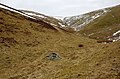
 Lone Walker above Broad Moss - geograph.org.uk - 2275643.jpg 2,560 × 1,920; 628 KB
-
 Longlands - geograph.org.uk - 1520709.jpg 640 × 365; 79 KB
-
 Longlands - geograph.org.uk - 1541546.jpg 640 × 405; 94 KB
-
 Longlands - geograph.org.uk - 5585266.jpg 1,024 × 768; 180 KB
-
 Longlands Beck - geograph.org.uk - 3382259.jpg 2,592 × 1,944; 2.24 MB
-
 Longlands Fell - geograph.org.uk - 2231549.jpg 640 × 480; 86 KB
-
 Longlands Fell - geograph.org.uk - 3727151.jpg 2,560 × 1,920; 1.95 MB
-
 Longlands Fell - geograph.org.uk - 5807103.jpg 1,600 × 1,067; 402 KB
-
 Looking down Burn Todd Gill - geograph.org.uk - 818526.jpg 640 × 480; 55 KB
-
 Looking east across Aughertree Fell - geograph.org.uk - 5910408.jpg 640 × 427; 240 KB
-
 Looking south-east from the summit of Binsey - geograph.org.uk - 3952540.jpg 1,024 × 768; 143 KB
-
 Looking towards Castle How - geograph.org.uk - 3727156.jpg 2,560 × 1,920; 1.96 MB
-
 Looking up at Binsey - geograph.org.uk - 5932810.jpg 2,048 × 1,536; 768 KB
-
 Looking up Lowthwaite Fell - geograph.org.uk - 5807094.jpg 1,600 × 1,067; 370 KB


