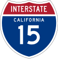
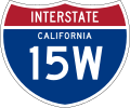
Category:Interstate 15 in California
Jump to navigation
Jump to search
section of Interstate Highway in California, United States | |||||
| Upload media | |||||
| Instance of | |||||
|---|---|---|---|---|---|
| Location |
| ||||
| Transport network | |||||
| Connects with | |||||
| Owned by | |||||
| Maintained by | |||||
| Inception |
| ||||
| Length |
| ||||
| Terminus | |||||
| official website | |||||
| |||||
English: Media related to Interstate 15 in California
- The westernmost portion — from San Diego (city) and San Diego County, through the Inland Empire and San Bernardino (city) and over Cajon Pass, and on through the Mojave Desert in San Bernardino County to the California /Nevada border.
- The primary Southern California highway to Las Vegas and points east.
Subcategories
This category has the following 6 subcategories, out of 6 total.
2
- Interstate 215 (California) (13 F)
C
- Clyde V. Kane Rest Area (5 F)
L
Z
- Zzyzx Road interchange (13 F)
Media in category "Interstate 15 in California"
The following 91 files are in this category, out of 91 total.
-
I-15 (CA).svg 600 × 600; 19 KB
-
Business Loop 15 (CA).svg 600 × 600; 21 KB
-
I-15E (CA).svg 480 × 401; 21 KB
-
I-15W (CA).svg 751 × 628; 19 KB
-
24-san-diego-805-15.jpg 3,729 × 2,838; 3.01 MB
-
60 EAST CLOSED AT JCT 15 WEEKENDS ONLY FROM PM TO AM.jpeg 3,024 × 4,032; 1.35 MB
-
Aerial Photograph of Victorville, California 2020-02-03 21 21 45 949000.jpeg 2,448 × 3,264; 2.25 MB
-
Aerial Photograph of Victorville, California 2020-02-03.jpeg 2,448 × 3,264; 1.99 MB
-
2010-0615-BakerCA.jpg 3,910 × 2,754; 8.65 MB
-
Baker aus östlicher Richtung von der Inerstate 15 aus gesehen..jpg 5,472 × 3,648; 8.71 MB
-
Baker California Aerial (50637877766).jpg 2,400 × 3,600; 3.09 MB
-
Baker California panorama.jpg 800 × 502; 73 KB
-
Barstow, California.jpg 640 × 480; 36 KB
-
CA 48 I15 FHWA 1980 761.jpg 2,976 × 2,392; 1.06 MB
-
Cajon Pass.JPG 640 × 480; 58 KB
-
California Inspection Station on I-15.jpg 2,442 × 1,560; 1.13 MB
-
California Interstate 15 and State Route 58.png 1,152 × 640; 212 KB
-
California Interstate 15.svg 1,152 × 640; 736 KB
-
California Interstate and State Route 15.svg 1,152 × 640; 736 KB
-
California Winter Scenery, I-15 Las Vegas to Los Angeles.jpg 6,000 × 3,156; 3.61 MB
-
Cave Mountain Interstate 15.jpg 800 × 436; 81 KB
-
Corona, California southeastern city limit sign.JPG 1,035 × 1,086; 371 KB
-
CoronaCA (cropped).jpg 800 × 411; 69 KB
-
CoronaCA.jpg 800 × 596; 84 KB
-
Desert 1 2013-06-21.jpg 3,264 × 2,448; 1.29 MB
-
Halloran Springs and Hollow Hills Wilderness Area (50637877581).jpg 3,600 × 2,400; 2.9 MB
-
Highway To Las Vegas (85210697).jpeg 2,048 × 1,366; 732 KB
-
I 15 - panoramio.jpg 3,800 × 1,700; 1.48 MB
-
I 15 Original File - panoramio.jpg 3,264 × 1,610; 297 KB
-
I-15 and Lake Hughes 6 shot pano.jpg 12,316 × 1,903; 7.13 MB
-
I-15 Express Lanes.jpg 2,551 × 1,295; 604 KB
-
I-15 from Grantville, San Diego 1.jpg 6,048 × 8,064; 34.88 MB
-
I-15 from Grantville, San Diego 2.jpg 8,064 × 6,048; 35.37 MB
-
I-15 northbound at Ontario Avenue, Corona, CA (2010).jpg 3,648 × 2,736; 1.96 MB
-
I10eastneari15interchange.jpg 400 × 242; 44 KB
-
I15Barastow2.JPG 1,408 × 1,060; 326 KB
-
I15Barstow1.JPG 1,408 × 1,060; 288 KB
-
I15Victor.JPG 1,408 × 1,060; 518 KB
-
Interstate 15 and 10 junction California.jpg 3,000 × 3,744; 2.02 MB
-
Interstate 15 at Temescal Valley, California northern town limit sign (2021-04-11).jpeg 3,264 × 2,448; 1.25 MB
-
Interstate 15 closure at SR 78 on 2010-12-09.jpg 4,248 × 2,388; 1.37 MB
-
Interstate 15 San Diego.jpg 4,032 × 3,024; 3.14 MB
-
Interstate 15 southbound entering Temecula Valley.jpg 2,532 × 1,960; 700 KB
-
Interstate 215 Interstate 15 Junction.jpg 4,272 × 2,848; 4.75 MB
-
Interstate15 between Barstow and Las Vegas.jpg 1,417 × 1,063; 900 KB
-
Interstate15 Ivanpah Valley.jpg 800 × 557; 88 KB
-
Interstate15 Shadow Valley.jpg 800 × 495; 86 KB
-
Lake Hodges Bridge.jpg 1,767 × 1,349; 642 KB
-
LakeHodgesI15ByPhilKonstantin.jpg 3,264 × 2,448; 1.06 MB
-
Lilac Road Bridge.JPG 3,148 × 1,238; 1.39 MB
-
LIMONITE AVE I-15 INTERCHANGE PROJECT SIGN.jpeg 3,024 × 4,032; 1.54 MB
-
Looking east across I-15 at Wildomar, California 1.jpg 8,064 × 6,048; 22.52 MB
-
Looking east across I-15 at Wildomar, California 2.jpg 8,064 × 6,048; 30.37 MB
-
Looking east across I-15 in Murrieta, California.jpg 8,064 × 6,048; 25.27 MB
-
Los Angeles (California) to Las Vegas (Nevada).webm 3 h 36 min 36 s, 1,280 × 720; 3.89 GB
-
Mark Skovorodko Photography - Escondido Highway 15 Aerial.jpg 3,600 × 2,398; 7.51 MB
-
Miramar pauses to acknowledge selfless service of Tuskegee Airmen 130222-M-RR352-007.jpg 2,500 × 1,667; 2.13 MB
-
Mojave Evoque.jpg 945 × 1,339; 360 KB
-
Mojave Freeway Swerving Between the Mountains.jpg 3,600 × 2,400; 3.16 MB
-
North From Rainbow Bridge (W. Lilac Rd.) - panoramio.jpg 1,024 × 768; 103 KB
-
Ontario California I-15 at CA60 Aerial.jpg 2,400 × 3,600; 5.48 MB
-
QNoQ.jpg 1,411 × 574; 159 KB
-
Road to Nowhere - panoramio (1).jpg 2,592 × 1,936; 2.29 MB
-
San Bernardino County, CA, USA - panoramio (45).jpg 2,048 × 1,370; 790 KB
-
San Bernardino County, CA, USA - panoramio (46).jpg 2,048 × 1,598; 847 KB
-
San Bernardino County, CA, USA - panoramio (47).jpg 2,048 × 1,153; 719 KB
-
Staring Down at the I15 - panoramio.jpg 2,592 × 1,936; 2.6 MB
-
Temescal Valley, California Neighborhood, Santa Ana Mountains in the Distance.jpg 7,691 × 5,768; 30.98 MB
-
Transverse Ranges 3D.png 7,680 × 4,320; 45.56 MB
-
U.S. Route 466.svg 1,028 × 609; 4.55 MB
-
Valley Wells Rest Area 8285664149 o.jpg 612 × 612; 117 KB
-
Walker Canyon (32678657014).jpg 1,440 × 1,080; 115 KB
-
Walker Canyon (32678666274).jpg 2,736 × 1,824; 3.72 MB
-
Walker Canyon (33365545842).jpg 1,440 × 1,080; 105 KB
-
Walker Canyon (33481574386).jpg 2,736 × 1,824; 2.46 MB
-
Walker Canyon (33481575246).jpg 1,824 × 2,736; 4.33 MB
-
කැලිෆෝනියා-නෙවාඩා දේශ සීමාව.JPG 2,081 × 1,366; 1,001 KB


