Category:Internet-related maps of the world
Jump to navigation
Jump to search
Subcategories
This category has the following 8 subcategories, out of 8 total.
A
B
D
R
S
T
W
Media in category "Internet-related maps of the world"
The following 63 files are in this category, out of 63 total.
-
 2012 size of the internet.png 1,599 × 900; 531 KB
-
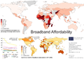 Broadband Affordability.png 3,508 × 2,480; 905 KB
-
 BrowserAddonHyperTranslateOfficialLanguagesWorldSupportMap.png 2,753 × 1,400; 116 KB
-
 Carna Botnet March-December 2012.png 3,197 × 1,800; 1.41 MB
-
 Carnabotnet geovideo lowres.gif 600 × 337; 2.33 MB
-
 Internet Censorship World Map suggested.svg 863 × 443; 1.54 MB
-
 Countries by most used web browser3.png 1,452 × 743; 63 KB
-
 Countries initially affected in WannaCry ransomware attack.png 1,425 × 625; 28 KB
-
 Countries that use .co.png 1,879 × 953; 196 KB
-
 CW BB ext world ccTLD.png 549 × 518; 140 KB
-
 Dragora contributors.svg 1,405 × 601; 305 KB
-
 EGDI-levels by country 2020.svg 2,560 × 1,314; 1.54 MB
-
 Geography of Twitter @replies (6238509140).jpg 5,100 × 4,878; 5.34 MB
-
 Google Maps zusammenhängende Regionen (2).png 1,425 × 625; 45 KB
-
 Internet Download Speed by Country acc ookla.svg 856 × 433; 1.19 MB
-
 Internet hosts.PNG 1,642 × 715; 45 KB
-
 Internet Hosts.svg 940 × 415; 1.56 MB
-
 Internet Penetration across the world - 2014.png 2,508 × 1,228; 300 KB
-
 Internet.svg 1,800 × 820; 436 KB
-
 ITunes-Store-map.svg 940 × 477; 2.5 MB
-
 League of Legends Top Level Professional Map Region.png 808 × 408; 85 KB
-
 Legal status of bitcoin.svg 2,754 × 1,398; 1.18 MB
-
 List of countries by IPv4 address allocation per 1000 population.jpg 1,644 × 975; 195 KB
-
 List of countries by IPv4 address allocation.jpg 1,644 × 975; 197 KB
-
 Map of Web archiving initiatives 58632FRT.jpg 1,159 × 675; 68 KB
-
 Map of Web archiving initiatives worldwide in June 2011.png 944 × 589; 136 KB
-
 Mapa mundial de los 10 paises que han realizado mas búsquedas sobre mapas en 2004-2009.jpg 6,600 × 5,100; 2.47 MB
-
 Mapa mundial de territorios más interesados en mapas.jpg 6,600 × 5,100; 2.03 MB
-
 Most popular social networking sites by country-sh.svg 2,752 × 1,396; 1.43 MB
-
 Most popular social networking sites by country.svg 2,752 × 1,396; 1.43 MB
-
 Online Trading Academy Campuses.png 1,425 × 625; 56 KB
-
 Outage 2junDown.png 715 × 486; 192 KB
-
 Paises vevo.png 2,000 × 981; 207 KB
-
 Pirate Bay Blocking as of 2017.png 1,427 × 628; 37 KB
-
 Play Books availability.png 4,170 × 2,326; 687 KB
-
 Pokémon Go Release Map.svg 2,560 × 1,314; 1.24 MB
-
 Popularity of Facebook August 2019.png 6,460 × 3,480; 1.29 MB
-
 Power users 2012 world BB CW.png 1,274 × 1,146; 641 KB
-
 Power users BB 2012 world.svg 1,035 × 463; 10.63 MB
-

-
 Regional Internet Registries world map.png 440 × 194; 43 KB
-
 Roblox restrictions by country.jpg 3,500 × 1,611; 1.04 MB
-
 RSF-internet-2008.png 1,385 × 631; 61 KB
-
 RSF-internet-2009-03-12.png 1,385 × 631; 61 KB
-
 RSF-internet-2011-03-12.png 1,385 × 631; 61 KB
-
 RSF-internet-2012-03-12.png 1,385 × 631; 61 KB
-
 Social networks.jpg 1,357 × 628; 147 KB
-
 Submarine cable map umap.png 1,040 × 541; 318 KB
-
 Sydney2000map.png 1,425 × 625; 56 KB
-
 Terra2.jpg 4,500 × 2,234; 1.15 MB
-
 Tor network map.png 1,443 × 1,026; 1.25 MB
-
 Tor-ийн catogram .png 1,280 × 819; 443 KB
-
 Twitter TT.PNG 2,644 × 1,196; 103 KB
-
 Webcams2.jpg 597 × 289; 148 KB
-
 Why is so ? - Google Search.png 6,460 × 6,560; 2.46 MB
-
 WiGLE map World.png 1,024 × 768; 105 KB
-
 World map of countries where Google Play Books are available.png 1,920 × 974; 411 KB
-
 WorldLow.png 790 × 506; 91 KB
-
 Yandex Street View by country.jpg 800 × 413; 54 KB
-
 YouTube Kids Geographic Availability.png 6,460 × 3,403; 2.11 MB
-
 YouTube Localisation-sh.svg 2,754 × 1,398; 1.06 MB
-
 YT Music availability.png 6,460 × 3,480; 1.36 MB
-
 世界の大陸間光海底ファイバケーブル.jpg 890 × 498; 61 KB


.jpg)
.png)


