Category:Inondation risk maps of Loire River
Jump to navigation
Jump to search
Subcategories
This category has the following 4 subcategories, out of 4 total.
Media in category "Inondation risk maps of Loire River"
The following 56 files are in this category, out of 56 total.
-
45-Crue-cevenole.svg 1,930 × 1,824; 2.67 MB
-
45-Crue-mixte.svg 1,930 × 1,824; 4.51 MB
-
45-Digues-Bou.png 5,457 × 3,543; 2.16 MB
-
45-ZI-Vals-Orléanais.png 5,457 × 3,559; 760 KB
-
45024-Baule-Zone inondable.jpg 3,507 × 2,480; 619 KB
-
45028-Beaugency-Zone inondable.jpg 3,507 × 2,480; 681 KB
-
45067-Chaingy-Zone inondable - Copie.jpg 3,507 × 2,480; 603 KB
-
45098-Cléry-Saint-André-Zone inondable.jpg 3,507 × 2,480; 652 KB
-
45130-Dry-Zone inondable.jpg 3,507 × 2,480; 616 KB
-
45156-Girolles-Zone inondable.jpg 3,507 × 2,480; 546 KB
-
45179-Lailly-en-Val-Zone inondable.jpg 3,507 × 2,480; 830 KB
-
45196-Mareau-aux-Prés-Zone inondable.jpg 3,507 × 2,480; 592 KB
-
45203-Meung-sur-Loire-Zone inondable.jpg 3,507 × 2,480; 752 KB
-
45269-Saint-Ay-Zone inondable.jpg 3,507 × 2,480; 547 KB
-
ZI-Bonnée.png 5,457 × 3,578; 3.8 MB
-
ZI-Les Bordes.png 5,457 × 3,578; 3.49 MB
-
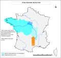
Crue-océanique.svg 1,930 × 1,824; 11.79 MB
-
ZI-Châteauneuf-sur-Loire.png 5,457 × 3,578; 5.21 MB
-
ZI-Chécy.png 5,457 × 3,578; 3.87 MB
-
ZI-Combleux.png 5,457 × 3,578; 2.63 MB
-
ZI-Dampierre-en-Burly.png 5,457 × 3,578; 3.5 MB
-
ZI-Darvoy.png 5,457 × 3,578; 6.41 MB
-
ZI-Férolles.png 5,457 × 3,578; 6.48 MB
-
ZI-Germigny-des-Prés.png 5,457 × 3,578; 6 MB
-
ZI-Giennois-Nevoy.png 5,457 × 3,543; 1.29 MB
-
ZI-Guilly.png 5,457 × 3,578; 5.73 MB
-
ZI-Hydro-Saint-Firmin-sur-Loire.png 5,457 × 3,578; 3.79 MB
-
ZI-Jargeau.png 5,457 × 3,578; 6.56 MB
-
ZI-Marcilly-en-Villette.png 5,457 × 3,578; 4.22 MB
-
ZI-Mardié.png 5,457 × 3,578; 3.94 MB
-
ZI-Neuvy-en-Sullias.png 5,457 × 3,578; 4.37 MB
-
ZI-Olivet.png 5,457 × 3,578; 4.32 MB
-
ZI-Orléans.png 5,457 × 3,578; 4.64 MB
-
ZI-Ouvrouer-les-Champs.png 5,457 × 3,578; 6.58 MB
-
ZI-Ouzouer-sur-Loire.png 5,457 × 3,578; 3.37 MB
-
ZI-RD-Gien.png 5,457 × 3,578; 4.22 MB
-
ZI-RD-Lion-en-Sullias.png 5,457 × 3,578; 3.52 MB
-
ZI-RD-Nevoy.png 5,457 × 3,578; 3.68 MB
-
ZI-RD-Saint-Brisson-sur-Loire.png 5,457 × 3,578; 3.4 MB
-
ZI-RD-Saint-Firmin-sur-Loire.png 5,457 × 3,578; 2.4 MB
-
ZI-Saint-Aignan-le-Jaillard.png 5,457 × 3,578; 3.93 MB
-
ZI-Saint-Cyr-en-Val.png 5,457 × 3,578; 5.51 MB
-
ZI-Saint-Denis-de-l'Hôtel.png 5,457 × 3,578; 6.31 MB
-
ZI-Saint-Denis-en-Val.png 5,457 × 3,578; 5 MB
-
ZI-Saint-Hilaire-Saint-Mesmin.png 5,457 × 3,578; 3.76 MB
-
ZI-Saint-Jean-de-Braye.png 5,457 × 3,578; 3.39 MB
-
ZI-Saint-Jean-de-la-Ruelle.png 5,457 × 3,578; 3.59 MB
-
ZI-Saint-Jean-le-Blanc.png 5,457 × 3,578; 5.01 MB
-
ZI-Saint-Martin-d'Abbat.png 5,457 × 3,578; 4.57 MB
-
ZI-Saint-Pryvé-Saint-Mesmin.png 5,457 × 3,578; 4.26 MB
-
ZI-Saint-Père-sur-Loire.png 5,457 × 3,578; 4.17 MB
-
ZI-Sandillon.png 5,457 × 3,578; 6.09 MB
-
ZI-Sigloy.png 5,457 × 3,578; 6.57 MB
-
ZI-Sully-sur-Loire.png 5,457 × 3,578; 3.87 MB
-
ZI-Tigy.png 5,457 × 3,578; 4.91 MB
-
ZI-Vienne-en-Val.png 5,457 × 3,578; 4.65 MB


