Category:Information boards in Ostalbkreis
Jump to navigation
Jump to search
Urban districts (cities): Baden-Baden · Freiburg · Heidelberg · Heilbronn · Karlsruhe · Mannheim · Pforzheim · Stuttgart ·
Deutsch: Informationstafeln im Ostalbkreis
Media in category "Information boards in Ostalbkreis"
The following 55 files are in this category, out of 55 total.
-
 Auerochsen am Hirschhof.jpg 6,000 × 4,000; 6.77 MB
-
 Aussichtsturm Himmelsstürmer-03-Tafel.jpg 3,240 × 4,320; 4.78 MB
-
 Aussichtsturm Himmelsstürmer-08-Aussicht.jpg 4,320 × 3,240; 5.43 MB
-
 Bildstöckle auf dem Braunenberg Tafel.JPG 4,608 × 3,456; 6.05 MB
-
 Die Kapelle Röthardt.JPG 4,608 × 3,456; 6.94 MB
-
 Felsen am Goldberg - panoramio.jpg 3,264 × 2,448; 4.07 MB
-
 Gebrauchsanleitung der Wassertret-Anlage.jpg 6,000 × 4,000; 10.95 MB
-
 Geschichte Ohmenheim.jpg 2,604 × 4,624; 4.51 MB
-
 Hagbergturm-05-Infotafel.jpg 4,320 × 3,240; 5.41 MB
-
 Infotafel Arbeiterweg Fachsenfeld (Heimatsmühle).jpg 4,000 × 6,000; 7.35 MB
-
 Infotafel Gemeindekreuz.jpg 6,000 × 4,000; 8.62 MB
-
 Infotafel Geologie am Goldberg - panoramio.jpg 2,448 × 3,264; 3.3 MB
-
 Infotafel Kocherburg Junker Hans.jpg 6,000 × 4,000; 8.45 MB
-
 Infotafel Kocherburg und ihre Wiederendecker.jpg 6,000 × 4,000; 6.19 MB
-
 Infotafel Renaturierung am Kocher.jpg 4,320 × 3,240; 4.96 MB
-
 Infotafel Siedlung Goldberg - panoramio.jpg 3,264 × 2,448; 2.88 MB
-
 Infotafel Woellwarthstein.JPG 4,608 × 3,456; 6.59 MB
-
 Infotagel am Goldberg - panoramio.jpg 3,264 × 2,448; 3.11 MB
-
 Johanneskirche (Aalen) Info.jpg 4,592 × 2,584; 6.41 MB
-

-

-

-

-
 Kastell Buch 2.jpg 640 × 480; 121 KB
-
 Kastell Buch 4.jpg 640 × 480; 120 KB
-
 Kastell Buch principia.jpg 3,888 × 2,592; 5.91 MB
-
 Kastell Buch Suedtor.jpg 3,888 × 2,592; 6.03 MB
-

-

-

-
 Kocherburg, Infotafel LDA.jpg 1,200 × 1,600; 395 KB
-
 Kurbelwellen-Brunnen Wasseralfingen Info.jpg 6,000 × 4,000; 9.77 MB
-

-
 Naturschutzgebiet Goldberg - panoramio (1).jpg 3,264 × 2,448; 3.18 MB
-
 Naturschutzgebiet Goldberg - panoramio.jpg 3,264 × 2,448; 2.52 MB
-
 Naturschutzgebiet Goldberg Esparsetten-Widdder - panoramio.jpg 2,448 × 3,264; 4.31 MB
-
 NordicAktiv bei Osterbuchhütte.jpg 6,000 × 4,000; 8.03 MB
-
 Palm und ein Fluss wird lebendig.jpg 6,000 × 4,000; 10.17 MB
-
 Reiterleskapelle 002.jpg 2,048 × 1,536; 1.35 MB
-
 Schwarze Mörtelbiene - panoramio.jpg 3,264 × 2,448; 3.79 MB
-
 Seiz-faberbrunnen.jpg 2,211 × 2,085; 1.47 MB
-
 St. Leonhard Hinweistafel.JPG 3,071 × 3,863; 2.1 MB
-
 Wasseralfinger Bergbaupfad Erste Zahnradbahn (Station 2).jpg 1,952 × 1,466; 1.08 MB
-
 Wasseralfinger Bergbaupfad Erzrutsche (Station 23) 2.jpg 4,032 × 3,024; 4.36 MB
-
 Wasseralfinger Bergbaupfad Erzrutsche (Station 23).jpg 2,016 × 1,669; 1.01 MB
-
 Wasseralfinger Bergbaupfad Erzweg (Station 3).jpg 2,016 × 1,512; 1.19 MB
-
 Wasseralfinger Bergbaupfad Fachsenfelder Arbeiterweg (Station 16).jpg 2,016 × 1,514; 1.01 MB
-
 Wasseralfinger Bergbaupfad Forst und Bergbau (Station 7).jpg 2,016 × 1,512; 1.3 MB
-
 Wasseralfinger Bergbaupfad Kalksteinbruch (Station 18).jpg 2,016 × 1,512; 1.32 MB
-
 Wasseralfinger Bergbaupfad Pulvermagazin (Station 21).jpg 2,016 × 1,512; 1.49 MB
-
 Wasseralfinger Bergbaupfad Seilbahn (Station 4).jpg 2,016 × 1,512; 1.02 MB
-
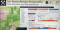 Wasseralfinger Bergbaupfad Streckenplan.png 1,598 × 798; 1.63 MB
-
 Wasseralfinger Bergbaupfad Stöcklesstollen (Station 6).jpg 2,016 × 1,512; 1.29 MB
-
 Wasseralfinger Bergbaupfad Woellwarth gegen Ellwangen (Station 17).jpg 2,016 × 1,512; 1.01 MB
-
 Wasseralfinger Bergbaupfad Woher kommt das Eisen (Station 8).jpg 2,016 × 1,512; 1.08 MB


.jpg)


_Info.jpg)
_along_the_limes_occupied_by_the_Ala_II_Flavia_Miliaria_Pia_Fidelis,_Raetian_Limes,_Germany_(17622064969).jpg)
_along_the_limes_occupied_by_the_Ala_II_Flavia_Miliaria_Pia_Fidelis,_Raetian_Limes,_Germany_(17782127326).jpg)
_along_the_limes_occupied_by_the_Ala_II_Flavia_Miliaria_Pia_Fidelis,_Raetian_Limes,_Germany_(17808248705).jpg)
_along_the_limes_occupied_by_the_Ala_II_Flavia_Miliaria_Pia_Fidelis,_Raetian_Limes,_Germany_(17808336795).jpg)


.jpg)
.jpg)


.jpg)


.jpg)
_2.jpg)
.jpg)
.jpg)
.jpg)
.jpg)
.jpg)
.jpg)
.jpg)

.jpg)
.jpg)
.jpg)