Category:Indian reservations in California
Jump to navigation
Jump to search
States of the United States: Alabama · Arizona · California · Colorado · Connecticut · Florida · Idaho · Illinois · Indiana · Kansas · Maine · Maryland · Massachusetts · Michigan · Minnesota · Montana · Nebraska · Nevada · New Mexico · New York · North Carolina · North Dakota · Oklahoma · Oregon · Rhode Island · South Dakota · Texas · Utah · Virginia · Washington · Wisconsin
Subcategories
This category has the following 10 subcategories, out of 10 total.
Media in category "Indian reservations in California"
The following 98 files are in this category, out of 98 total.
-
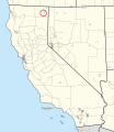
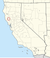
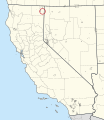
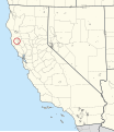
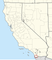
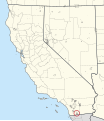
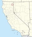
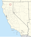
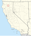
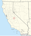
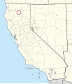
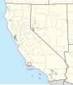
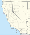
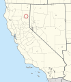
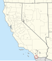
0095R Alturas Indian Rancheria Locator Map.svg 1,302 × 1,502; 4.23 MB
-
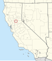
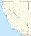
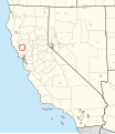
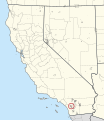
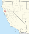
0120R Auburn Rancheria Locator Map.svg 1,302 × 1,502; 4.23 MB
-
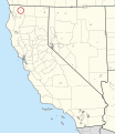
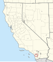
0125R Augustine Reservation Locator Map.svg 1,302 × 1,502; 4.23 MB
-
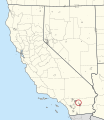
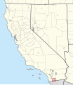
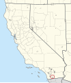
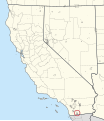
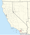
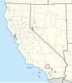
0155R Barona Reservation Locator Map.svg 1,302 × 1,502; 4.23 MB
-
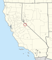
0185R Benton Paiute Reservation Locator Map.svg 1,302 × 1,502; 4.23 MB
-
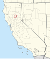
0200R Berry Creek Rancheria Locator Map.svg 1,302 × 1,502; 4.23 MB
-
0215R Big Bend Rancheria Locator Map.svg 1,302 × 1,502; 4.23 MB
-
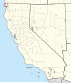
0240R Big Lagoon Rancheria Locator Map.svg 1,302 × 1,502; 4.23 MB
-
0250R Big Pine Reservation Locator Map.svg 1,302 × 1,502; 4.23 MB
-
0265R Big Sandy Rancheria Locator Map.svg 1,302 × 1,502; 4.23 MB
-
0275R Big Valley Rancheria Locator Map.svg 1,302 × 1,502; 4.23 MB
-
0290R Bishop Reservation Locator Map.svg 1,302 × 1,502; 4.23 MB
-
0325R Blue Lake Rancheria Locator Map.svg 1,302 × 1,502; 4.23 MB
-
0350R Bridgeport Reservation Locator Map.svg 1,302 × 1,502; 4.23 MB
-
0415R Cabazon Reservation Locator Map.svg 1,302 × 1,502; 4.24 MB
-
0435R Cahuilla Reservation Locator Map.svg 1,302 × 1,502; 4.23 MB
-
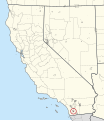
0450R Campo Indian Reservation Locator Map.svg 1,302 × 1,502; 4.24 MB
-
0495R Capitan Grande Reservation Locator Map.svg 1,302 × 1,502; 4.24 MB
-
0555R Cedarville Rancheria Locator Map.svg 1,302 × 1,502; 4.23 MB
-
0620R Chicken Ranch Rancheria Locator Map.svg 1,302 × 1,502; 4.23 MB
-
0720R Cold Springs Rancheria Locator Map.svg 1,302 × 1,502; 4.23 MB
-
0750R Colusa Rancheria Locator Map.svg 1,302 × 1,502; 4.23 MB
-
0780R Cortina Indian Rancheria Locator Map.svg 1,302 × 1,502; 4.23 MB
-
0825R Coyote Valley Reservation Locator Map.svg 1,302 × 1,502; 4.23 MB
-
0955R Dry Creek Rancheria Locator Map.svg 1,302 × 1,502; 4.23 MB
-
1010R Elk Valley Rancheria Locator Map.svg 1,302 × 1,502; 4.23 MB
-
1055R Enterprise Rancheria Locator Map.svg 1,302 × 1,502; 4.23 MB
-
1065R Ewiiaapaayp Reservation Locator Map.svg 1,302 × 1,502; 4.23 MB
-
1170R Fort Bidwell Reservation Locator Map.svg 1,302 × 1,502; 4.23 MB
-
1195R Fort Independence Reservation Locator Map.svg 1,302 × 1,502; 4.23 MB
-
1380R Greenville Rancheria Locator Map.svg 1,302 × 1,502; 4.23 MB
-
1395R Grindstone Indian Rancheria Locator Map.svg 1,302 × 1,502; 4.23 MB
-
1400R Guidiville Rancheria Locator Map.svg 1,302 × 1,502; 4.23 MB
-
1490R Hoopa Valley Reservation Locator Map.svg 1,302 × 1,502; 4.23 MB
-
1515R Hopland Rancheria Locator Map.svg 1,302 × 1,502; 4.23 MB
-
1560R Inaja and Cosmit Reservation Locator Map.svg 1,302 × 1,502; 4.23 MB
-
1670R Jamul Indian Village Locator Map.svg 1,302 × 1,502; 4.23 MB
-
1750R Karuk Reservation Locator Map.svg 1,302 × 1,502; 4.23 MB
-
1850R La Jolla Reservation Locator Map.svg 1,302 × 1,502; 4.23 MB
-
1895R La Posta Indian Reservation Locator Map.svg 1,302 × 1,502; 4.23 MB
-
1925R Laytonville Rancheria Locator Map.svg 1,302 × 1,502; 4.23 MB
-
1955R Likely Rancheria Locator Map.svg 1,302 × 1,502; 4.23 MB
-
1970R Lone Pine Reservation Locator Map.svg 1,302 × 1,502; 4.23 MB
-
1980R Lookout Rancheria Locator Map.svg 1,302 × 1,502; 4.23 MB
-
1995R Los Coyotes Reservation Locator Map.svg 1,302 × 1,502; 4.23 MB
-
2075R Lytton Rancheria Locator Map.svg 1,302 × 1,502; 4.23 MB
-
2115R Manzanita Reservation Locator Map.svg 1,302 × 1,502; 4.23 MB
-
2190R Mesa Grande Reservation Locator Map.svg 1,302 × 1,502; 4.23 MB
-
2255R Middletown Rancheria Locator Map.svg 1,302 × 1,502; 4.23 MB
-
2330R Montgomery Creek Rancheria Locator Map.svg 1,302 × 1,502; 4.23 MB
-
2340R Mooretown Rancheria Locator Map.svg 1,302 × 1,502; 4.23 MB
-
2495R North Fork Rancheria Locator Map.svg 1,302 × 1,502; 4.23 MB
-
2685R Paskenta Rancheria Locator Map.svg 1,302 × 1,502; 4.23 MB
-
2715R Pauma and Yuima Reservation Locator Map.svg 1,302 × 1,502; 4.23 MB
-
2745R Pechanga Reservation Locator Map.svg 1,302 × 1,502; 4.23 MB
-
2775R Picayune Rancheria Locator Map.svg 1,302 × 1,502; 4.23 MB
-
2820R Pinoleville Rancheria Locator Map.svg 1,302 × 1,502; 4.23 MB
-
2835T Pit River Trust Land Locator Map.svg 1,302 × 1,502; 4.23 MB
-
3020R Quartz Valley Reservation Locator Map.svg 1,302 × 1,502; 4.23 MB
-
3070R Ramona Village Locator Map.svg 1,302 × 1,502; 4.23 MB
-
3095R Redding Rancheria Locator Map.svg 1,302 × 1,502; 4.23 MB
-
3115R Redwood Valley Rancheria Locator Map.svg 1,302 × 1,502; 4.23 MB
-
3145R Resighini Rancheria Locator Map.svg 1,302 × 1,502; 4.23 MB
-
3165R Rincon Reservation Locator Map.svg 1,302 × 1,502; 4.23 MB
-
3185R Roaring Creek Rancheria Locator Map.svg 1,302 × 1,502; 4.23 MB
-
3195R Robinson Rancheria Locator Map.svg 1,302 × 1,502; 4.23 MB
-
3220R Rohnerville Rancheria Locator Map.svg 1,302 × 1,502; 4.23 MB
-
3250R Round Valley Reservation Locator Map.svg 1,302 × 1,502; 4.26 MB
-
3265R Rumsey Indian Rancheria Locator Map.svg 1,302 × 1,502; 4.23 MB
-
3445R San Manuel Reservation Locator Map.svg 1,302 × 1,502; 4.23 MB
-
3460R San Pasqual Reservation Locator Map.svg 1,302 × 1,502; 4.23 MB
-
3520R Santa Rosa Rancheria Locator Map.svg 1,302 × 1,502; 4.23 MB
-
3525R Santa Rosa Reservation Locator Map.svg 1,302 × 1,502; 4.23 MB
-
3540R Santa Ynez Reservation Locator Map.svg 1,302 × 1,502; 4.23 MB
-
3550R Santa Ysabel Reservation Locator Map.svg 1,302 × 1,502; 4.24 MB
-
3735R Sherwood Valley Rancheria Locator Map.svg 1,302 × 1,502; 4.23 MB
-
3750R Shingle Springs Rancheria Locator Map.svg 1,302 × 1,502; 4.23 MB
-
3855R Smith River Rancheria Locator Map.svg 1,302 × 1,502; 4.23 MB
-
3870R Soboba Reservation Locator Map.svg 1,302 × 1,502; 4.23 MB
-
3985R Stewarts Point Rancheria Locator Map.svg 1,302 × 1,502; 4.23 MB
-
4030R Sulphur Bank Rancheria Locator Map.svg 1,302 × 1,502; 4.23 MB
-
4060R Susanville Indian Rancheria Locator Map.svg 1,302 × 1,502; 4.23 MB
-
4090R Sycuan Reservation Locator Map.svg 1,302 × 1,502; 4.23 MB
-
4095R Table Bluff Reservation Locator Map.svg 1,302 × 1,502; 4.23 MB
-
4110R Table Mountain Rancheria Locator Map.svg 1,302 × 1,502; 4.23 MB
-
4255R Torres-Martinez Reservation Locator Map.svg 1,302 × 1,502; 4.26 MB
-
4275R Trinidad Rancheria Locator Map.svg 1,302 × 1,502; 4.23 MB
-
4330R Tuolumne Rancheria Locator Map.svg 1,302 × 1,502; 4.23 MB
-
4375R Twenty-Nine Palms Reservation Locator Map.svg 1,302 × 1,502; 4.23 MB
-
4430R Upper Lake Rancheria Locator Map.svg 1,302 × 1,502; 4.23 MB
-
4500R Viejas Reservation Locator Map.svg 1,302 × 1,502; 4.23 MB
-
4665R Woodfords Community Locator Map.svg 1,302 × 1,502; 4.23 MB
-
4680R XL Ranch Rancheria Locator Map.svg 1,302 × 1,502; 4.24 MB
-
4760R Yurok Reservation Locator Map.svg 1,302 × 1,502; 4.24 MB
-
Cupeño map labeled.svg 512 × 483; 56 KB
-
Red Hot Cinnamon Sauce.jpg 1,097 × 1,092; 698 KB
-
Yurok Indian Reservation.jpg 4,032 × 3,024; 4.16 MB
