Category:Index maps of Finland
Jump to navigation
Jump to search
Media in category "Index maps of Finland"
The following 16 files are in this category, out of 16 total.
-
24239854 Suomen yleiskartta, 1951, karttalehti F4.jpg 6,136 × 7,530; 9.38 MB
-
Digitaaliset Maastokartat 50 000 2018-2019.pdf 1,754 × 2,481; 7.54 MB
-
Digitaaliset Peruskartat 2018-2019.pdf 1,754 × 2,481; 7.55 MB
-
Kalmbergin kartasto ns. vihreä sarja indeksikartta.tif 6,315 × 5,372; 97.7 MB
-
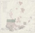
Kalmbergin kartaston lehtijako 1855.jpg 2,448 × 3,642; 1.34 MB
-
Maastokartta 50 000 1.1.2018.pdf 1,114 × 1,679; 4.31 MB
-
Peruskartta 25 000 kattavuus 1.1.2018.pdf 1,114 × 1,679; 6.19 MB
-
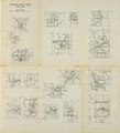
Pitajankartta 1930 1940 luku indeksikartta.pdf 2,081 × 1,712; 984 KB
-
Pitäjänkartta polyedriprojektio 1-20000 v1916-1926.pdf 1,837 × 1,750; 5.81 MB
-
Ruotsalainen Sverige-Finland topografinen kartta lehtijako 1944.tif 5,469 × 4,267; 67.4 MB
-
Suomen Yleislehtijakokartta 1975.pdf 4,406 × 7,075; 6.91 MB
-
Suomi 1 1 milj.pdf 877 × 1,422; 313 KB
-
Suomi taloudellisen kartan lehtijako.pdf 2,795 × 3,825; 23.44 MB
-
Suomi Yleislehtijakokartta 1969.pdf 4,406 × 7,050; 8 MB
-
Topografinen kartta 1 20 000 1918-1947 lehtijako erillislehdet.pdf 2,547 × 2,802; 1.45 MB
-
Yleiskartan III laitos lehtijako.png 361 × 685; 448 KB


