Category:Incident map images that should use vector graphics
Jump to navigation
Jump to search
Images composed of simple shapes, lines, and letters such as those below should be recreated using vector graphics as an SVG file. These have a number of advantages such as making it easier for subsequent editors to edit them, enabling arbitrary scaling at high quality, and sharp high-resolution renderings for print versions. See Commons:Images for cleanup for more information.
This is a subcategory of Category:Images that should use vector graphics. You can add images to this category using the template {{Convert to SVG|incident map}}.
Subcategories
This category has only the following subcategory.
Media in category "Incident map images that should use vector graphics"
The following 72 files are in this category, out of 72 total.
-
1497 voyage.png 2,857 × 1,724; 402 KB
-
1923 Kanto earthquake intensity-2.png 512 × 512; 49 KB
-
1941 atrocity in Jedwabne (map).jpg 522 × 547; 148 KB
-
1999SydHail Map Ctr.PNG 225 × 162; 5 KB
-
1999SydHail Map Nth.PNG 225 × 193; 5 KB
-
1999SydHail Map Sth.PNG 225 × 272; 6 KB
-
1999SydHail Map.PNG 517 × 507; 16 KB
-
2007 04L 5-day track.gif 895 × 716; 24 KB
-
2009 New York City bomb plot location.png 251 × 162; 57 KB
-
2015 Mass Shootings (cropped).jpg 777 × 382; 75 KB
-
2015 San Bernardino shooting map location of mass shooting.png 1,023 × 640; 318 KB
-
2017 Stockholm attack.png 584 × 584; 401 KB
-
365 Crete Earthquake, Apollonia, Map (Jona).png 801 × 522; 12 KB
-
Adam Air Flight 574.png 792 × 709; 183 KB
-
Air Canada Flight 624.png 640 × 386; 290 KB
-
Air Inter 148 crash site diagram.png 800 × 658; 65 KB
-
Al-Salam Boccaccio sinking in Red Sea.png 298 × 210; 184 KB
-
Armagh rail disaster map.gif 1,600 × 1,329; 37 KB
-
Aurora's drift.png 502 × 363; 13 KB
-
Bad Aibling rail accident-1945.jpg 574 × 772; 83 KB
-
Belgien1953.png 700 × 615; 187 KB
-
Bijlmerramproute.png 511 × 354; 66 KB
-
Breitscheidplatz-Karte.png 1,846 × 1,170; 307 KB
-
Colorado county map highlighting 14 counties affected by 2013 flooding.jpg 2,000 × 1,447; 536 KB
-
Columbus first voyage.jpg 1,001 × 597; 103 KB
-
Columbus fourth voyage.jpg 1,001 × 630; 112 KB
-
Columbus second voyage.jpg 1,001 × 563; 79 KB
-
Columbus third voyage.jpg 901 × 638; 93 KB
-
Costa-concordia-route2.png 885 × 636; 55 KB
-
Costa-concordia-routes.png 350 × 248; 21 KB
-
Costa-cordia-last-journey.png 1,454 × 804; 28 KB
-
Costa-cordia-route-map.png 850 × 625; 23 KB
-
ETH302 Accident Flight.gif 540 × 540; 11 KB
-
Fault model of 1923 Kanto earthquake.jpg 767 × 900; 163 KB
-
Flightroute epiclt ra2151g.gif 540 × 540; 13 KB
-
Fluchtroute Schiff.png 707 × 526; 37 KB
-
Franklin's lost expedition map.png 602 × 520; 121 KB
-
Gama armada in India, 1502.gif 349 × 428; 24 KB
-
Gaza Flotilla Route.jpg 454 × 482; 107 KB
-
Helios airways flight 522 en remi.png 1,440 × 900; 406 KB
-
Helios Airways Flight 522 remi.png 1,440 × 900; 407 KB
-
India subdivisions flood hit between July 3 and August 15 2007.png 1,024 × 1,195; 143 KB
-
Iran Air 655 Strait of hormuz 80.jpg 376 × 417; 59 KB
-
Iraq-gwi-map.jpg 242 × 229; 37 KB
-
Japan Airlines 123 - Estimated flight path en.png 854 × 486; 162 KB
-
Japan Airlines 123 - Estimated flight path pl.png 854 × 486; 160 KB
-
Karte der Terroranschläge vom 13. November 2015 in Paris - Copy.jpg 1,524 × 1,553; 1.14 MB
-
Location of Costa Concordia cruise-ship disaster (13-1-2012)-2.png 978 × 797; 285 KB
-
Location of Costa Concordia cruise-ship disaster (13-1-2012).png 1,082 × 800; 271 KB
-
Major Disasters in India.jpg 1,485 × 1,085; 192 KB
-
Malaysia Airlines Flight 17 crash site.png 451 × 456; 62 KB
-
Map, location of Tokaimura nuclear accident.tif 948 × 994; 167 KB
-
Minamata map illustrating Chisso factory effluent routes jp.png 670 × 580; 13 KB
-
Minamata map illustrating Chisso factory effluent routes2.png 670 × 580; 37 KB
-
Moors murders map.jpg 3,250 × 2,008; 354 KB
-
Nationalities of victims of 2015 Mina stampede.png 1,425 × 625; 72 KB
-
New-Orleans-deaths.jpg 387 × 354; 165 KB
-
Nhshootout.jpg 492 × 362; 138 KB
-
November-2015-Paris-Attacks-Divided-Map.png 1,946 × 1,924; 6.1 MB
-
Number of Terrorist Incidents.png 1,800 × 820; 130 KB
-
Oslo and Utøya v2.jpg 1,355 × 1,074; 437 KB
-
Oslo and Utøya.jpg 1,355 × 1,074; 393 KB
-
Queensland oil spill map small.PNG 239 × 293; 11 KB
-
Roswell Crash 1947.jpg 316 × 299; 27 KB
-
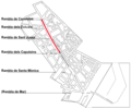
Spain.Barcelona.Les.Rambles.Terrorist.Attack.png 744 × 620; 122 KB
-
Titanicmap.png 431 × 179; 3 KB
-
Titanicmapclean.png 431 × 179; 3 KB
-
TitanicRoute.png 741 × 332; 89 KB
-
Towns evacuated around Fukushima on April 11th, 2011.png 502 × 570; 88 KB
-
U.S. mission and annex map for 2012 Benghazi attack.jpg 1,435 × 946; 335 KB


