Category:Images of a site of community importance in Catalonia from Wiki Loves Earth 2016 in Spain
Jump to navigation
Jump to search
Media in category "Images of a site of community importance in Catalonia from Wiki Loves Earth 2016 in Spain"
The following 200 files are in this category, out of 382 total.
(previous page) (next page)-
 004 Els Penjats (Sant Feliu de Guíxols).JPG 2,720 × 1,912; 2.99 MB
-
 008 Sant Elm i la punta de Garbí (Sant Feliu de Guíxols).JPG 2,816 × 1,632; 2.55 MB
-
 009 Navegant vora Sant Feliu de Guíxols, al fons el puig de les Forques.JPG 2,112 × 2,756; 2.92 MB
-
 012 Can Sopa, riera Coma Clara 5 (Alella).JPG 2,816 × 2,112; 3.14 MB
-
 013 Costa de Tossa de Mar, des del cap de Tossa fins a Salionç.JPG 2,704 × 1,928; 3.03 MB
-
 018 Casa Nova de l'Obac, parc de Sant Llorenç del Munt i l'Obac (Vacarisses).JPG 2,816 × 1,792; 1.48 MB
-
 019 Can Sopa, riera Coma Clara 5 (Alella).JPG 2,816 × 2,112; 3.84 MB
-
 019 Conglomerat al parc de Sant Llorenç del Munt i l'Obac.JPG 2,816 × 2,112; 4.72 MB
-
 019 Excursió als canyons del Maresme, al fons el cap de Tossa.JPG 2,816 × 2,112; 2.25 MB
-
 020 Costa de Tossa de Mar, des del cap de Tossa fins a Salionç.JPG 2,816 × 1,456; 2.75 MB
-
 023 Costa de Lloret i Canyelles.JPG 2,816 × 1,784; 2.22 MB
-
 024 Costa de Lloret, Canyelles i Llorell.JPG 2,816 × 1,320; 1.9 MB
-
 025 Platja de Tossa de Mar.JPG 2,752 × 1,712; 2.58 MB
-
 026 Costa de Tossa de Mar, puig d'en Pela, a la dreta Can Ferrer.JPG 2,816 × 1,840; 2.62 MB
-
 031 Cap de Tossa, far i torre de Joanàs.JPG 2,728 × 1,496; 2.34 MB
-
 032 Cap de Tossa, far i torre de Joanàs.JPG 2,752 × 1,896; 2.53 MB
-
 059 Can Jonc, riera Coma Clara 9 (Alella), angle sud-est.JPG 2,816 × 2,112; 2.85 MB
-
 060 Can Boquet, av. Sant Josep de Calassanç 8 (Alella).JPG 2,816 × 1,760; 2.31 MB
-
 071 Vil·la Möller (Can Jonc Events), des de Can Magarola (Alella).JPG 2,816 × 2,112; 2.72 MB
-
 087 Can Pau Arenes, riera Coma Clara 23 (Alella), entrada a la finca.JPG 2,816 × 2,112; 2.89 MB
-
 092 Can Colomer, riera Coma Clara 27 (Alella).JPG 2,816 × 2,112; 3.53 MB
-
 093 Riera de Coma Clara (Alella), tàpia de Can Pau Arenes.JPG 2,816 × 2,112; 4.71 MB
-
 100 Tossa de Mar, cala i torre des Codolar.JPG 2,816 × 2,112; 2.59 MB
-
 103 Tossa de Mar, cala i torre des Codolar.JPG 2,112 × 2,816; 2.42 MB
-
 104 La costa a ponent de Tossa de Mar, la Bola.JPG 2,816 × 1,848; 2.53 MB
-
 105 Tossa de Mar, torre des Codolar, cap de Tossa i far.JPG 2,816 × 1,896; 2.72 MB
-
 107 La costa a ponent de Tossa de Mar, la Bola i sa Pedra Tallada.JPG 2,728 × 2,032; 3.44 MB
-
 108 Tossa de Mar, torre des Codolar, cap de Tossa i far.JPG 2,744 × 2,016; 3.52 MB
-
 109 Tossa de Mar, cala i torre des Codolar.JPG 2,112 × 2,816; 2.58 MB
-
 113 Platja de Tossa de Mar.JPG 2,816 × 2,112; 2.96 MB
-
 118 Platja de Tossa de Mar.JPG 2,752 × 2,016; 3.36 MB
-
 119 Barques davant la platja de Tossa de Mar.JPG 2,816 × 2,112; 2.68 MB
-
 122 Can Magarola (Alella), des del camí del Greny.JPG 2,816 × 2,112; 3.21 MB
-
 122 La serra de la Pedrera des de la Mare de Déu de la Roca (Mont-roig del Camp).JPG 2,816 × 1,928; 2.66 MB
-
 123 La Muntanya Blanca des de la Mare de Déu de la Roca (Mont-roig del Camp).JPG 2,816 × 2,112; 2.19 MB
-
 124 Vinyes vora el camí del Greny (Alella).JPG 2,816 × 1,888; 3.81 MB
-
 125 Can Tito Serra Nou (Alella), des del camí del Greny.JPG 2,816 × 2,112; 2.89 MB
-
 126 L'illa de Tossa de Mar.JPG 2,816 × 1,912; 2.77 MB
-
 126 Vinyes vora el camí del Greny (Alella).JPG 2,816 × 2,112; 4.63 MB
-
 127 Can Ferrer (Tossa de Mar).JPG 2,736 × 1,816; 1.67 MB
-
 127 Turó dels Figuerals, des del camí del Greny (Alella).JPG 2,816 × 1,920; 2.69 MB
-
 128 Can Ferrer (Tossa de Mar), damunt la Cova Esclafada.JPG 2,112 × 2,816; 3 MB
-
 128 La vall de la riera de Coma Clara des del camí del Greny (Alella).JPG 2,816 × 1,936; 3.18 MB
-
 130 Can Ferrer (Tossa de Mar).JPG 1,980 × 2,696; 3.78 MB
-
 132 Illes des Palomar (Tossa de Mar).JPG 2,816 × 2,112; 3.15 MB
-
 133 Cova des Bergantí (Tossa de Mar).JPG 2,816 × 2,016; 3.3 MB
-
 134 Can Bruy (Alella), des del camí del Greny.JPG 2,816 × 2,112; 5.52 MB
-
 134 Coves de Cala Bona i sa Gatera, al fons les cases de la Pola (Tossa de Mar).JPG 2,704 × 1,960; 3.26 MB
-
 135 Vinyes al camí del Greny (Alella), al fons la vall de la riera de Coma Clara.JPG 2,816 × 2,112; 5.18 MB
-
 136 Cala Bona (Tossa de Mar).JPG 2,816 × 2,112; 3.26 MB
-
 136 Casa Arnús (el Pinar), c. Manuel Arnús 1-31 (Barcelona), porteria.JPG 2,816 × 2,112; 2.91 MB
-
 137 Cova de Cala Bona (Tossa de Mar).JPG 2,816 × 2,112; 3.37 MB
-
 138 Cova de sa Gatera (Tossa de Mar).JPG 2,112 × 2,816; 3.66 MB
-
 139 Cala Pola (Tossa de Mar).JPG 2,816 × 2,112; 3.53 MB
-
 139 La serra de la Pedrera des de l'ermita de Sant Ramon (Mont-roig del Camp).JPG 2,816 × 1,944; 2.22 MB
-
 140 Boscos del Baix Camp des de Sant Ramon, al fons los Dedalts de Vandellòs.JPG 2,816 × 2,112; 1.96 MB
-
 141 Cala Pola (Tossa de Mar).JPG 2,816 × 1,992; 2.43 MB
-
 142 Cala Pola (Tossa de Mar), vaixell.JPG 2,112 × 2,816; 3.2 MB
-
 143 Cap de Pola (Tossa de Mar).JPG 2,816 × 1,840; 2.32 MB
-
 144 Cap de Pola (Tossa de Mar).JPG 2,816 × 1,896; 2.57 MB
-
 145 Cap de Pola (Tossa de Mar), escales tallades a la roca.JPG 2,112 × 2,816; 3.2 MB
-
 146 Cap de Pola (Tossa de Mar).JPG 2,816 × 2,112; 2.97 MB
-

-
 149 Platja de Giverola (Tossa de Mar).JPG 2,816 × 1,960; 3.08 MB
-
 150 Punta de Giverola (Tossa de Mar).JPG 2,816 × 1,688; 2.14 MB
-
 151 Platja de Giverola (Tossa de Mar).JPG 2,816 × 2,112; 3.36 MB
-
 152 Punta de Giverola (Tossa de Mar).JPG 2,736 × 1,960; 3.68 MB
-
 153 Punta de Giverola (Tossa de Mar).JPG 2,112 × 2,816; 2.37 MB
-
 154 Punta de Giverola (Tossa de Mar).JPG 2,736 × 2,008; 3.65 MB
-
 155 Punta de Giverola, al fons el cap des Pentiner (Tossa de Mar).JPG 2,816 × 2,112; 3.2 MB
-
 156 Cala Fotedera (Tossa de Mar).JPG 2,816 × 2,112; 3.19 MB
-
 157 Cala Fotedera (Tossa de Mar), esculls.JPG 2,112 × 2,816; 2.92 MB
-
 158 Es Rossegall (Tossa de Mar).JPG 2,816 × 1,648; 2.32 MB
-
 159 Espadats i esculls vora la platja d'en Colomer (Tossa de Mar).JPG 2,816 × 2,112; 3.77 MB
-
 160 Punta de n'Aromir i sa Canal, al fons Salionç (Tossa de Mar).JPG 2,816 × 2,112; 3.33 MB
-
 161 Punta de n'Aromir i sa Canal, al fons Salionç (Tossa de Mar).JPG 2,736 × 2,048; 3.31 MB
-
 162 Punta de n'Aromir (Tossa de Mar).JPG 2,816 × 1,864; 2.91 MB
-
 163 Esculls dels Concagats (Santa Cristina d'Aro).JPG 2,816 × 2,112; 3.91 MB
-
 164 Punta de Canyet (Santa Cristina d'Aro), glorieta.JPG 2,816 × 2,032; 3.35 MB
-
 165 Punta de Canyet (Santa Cristina d'Aro), glorieta.JPG 2,720 × 2,032; 3.24 MB
-
 166 Cala Joana i Penya-seca (Sant Feliu de Guíxols).JPG 2,816 × 2,112; 2.58 MB
-
 167 Punta del Romaguer (Sant Feliu de Guíxols).JPG 2,816 × 1,984; 3.1 MB
-
 168 Punta d'en Bosc (Sant Feliu de Guíxols).JPG 2,720 × 1,976; 3.29 MB
-
 169 Cala del Vigatà i Sant Elm (Sant Feliu de Guíxols).JPG 2,712 × 1,816; 3.15 MB
-
 172 Cala de sota Sant Elm (Sant Feliu de Guíxols).JPG 1,968 × 2,696; 3.42 MB
-
 174 Port Salvi (Sant Feliu de Guíxols), amb l'ermita de Sant Elm al fons.JPG 2,816 × 2,112; 3.08 MB
-
 175 Barca davant l'illa del Freu (Sant Feliu de Guíxols).JPG 2,816 × 2,000; 2.6 MB
-
 176 Llosa des Freu, al fons la platja de Sant Feliu de Guíxols.JPG 2,816 × 1,872; 2.37 MB
-
 177 Punta de Garbí (Sant Feliu de Guíxols).JPG 1,980 × 2,612; 2.28 MB
-

-
 178 Punta de Garbí (Sant Feliu de Guíxols).JPG 2,816 × 2,112; 2.06 MB
-
 190 Platja de Sant Feliu de Guíxols, taules de surf i barques.JPG 2,816 × 2,112; 2.78 MB
-
 191 Platja de Sant Feliu de Guíxols, al fons la punta de Garbí.JPG 2,816 × 1,688; 2.21 MB
-
 193 Platja de Sant Feliu de Guíxols, al fons la punta de Garbí.JPG 2,816 × 1,872; 2.67 MB
-
 195 Estelada al passeig de Mar, al fons el puig de les Forques (Sant Feliu de Guíxols).JPG 2,816 × 2,112; 2.28 MB
-
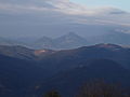
 197 Centelles, la pedrera del Fitó i el Montseny des del camí del Giol.JPG 2,768 × 1,800; 2.89 MB
-
 217 Riera de Coma Fosca (Alella), vora Can Cinto.JPG 2,816 × 2,112; 4.75 MB
-
 241 Can Pareras, riera Coma Fosca 33-37 (Alella), des de l'av. Jaume Rius i Fabra.JPG 2,816 × 2,112; 4.98 MB
-
 292 Can Bruy, camí de Martorelles 8 (Alella).JPG 2,816 × 2,112; 4.2 MB
-
 296 Jardí de Can Bruy, camí de Martorelles 8 (Alella).JPG 2,816 × 2,112; 4.34 MB
-
 Aiguestortes OlgaPibars.jpg 1,500 × 1,000; 137 KB
-
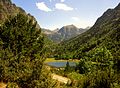 Aigüestortes, Estanc de la Llebreta.JPG 3,886 × 2,842; 5.8 MB
-
 Alta Garrotxa - Between Can Pentinet and La Quintana.JPG 4,000 × 3,000; 4.98 MB
-
 Alta Garrotxa - View to La Quintana.JPG 4,000 × 3,000; 4.84 MB
-
 Alta Garrotxa - Wall below Sant Grau D'Entreperes.JPG 4,000 × 3,000; 4.97 MB
-
 Alta Garrotxa 2006-09.JPG 1,840 × 1,232; 598 KB
-
 Alta Garrotxa 2006-10.jpg 2,048 × 1,536; 592 KB
-
 Alta Garrotxa 2007-01-30.jpg 3,072 × 2,304; 1.27 MB
-
 Alta Garrotxa 2007-01-31.jpg 3,072 × 2,304; 2.91 MB
-
 Alta Garrotxa 4.JPG 4,000 × 3,000; 4.82 MB
-
 Alta Garrotxa between Cingle des Bistoltes and Sant Grau.jpg 4,000 × 3,000; 4.93 MB
-
 Alta Garrotxa El Serradell from Cingle de Bistoltes.JPG 4,000 × 3,000; 3.72 MB
-
 Alta Garrotxa from Bac dEntreperes 1.JPG 4,000 × 3,000; 4 MB
-
 Alta Garrotxa from Bac dEntreperes 2.JPG 4,000 × 3,000; 3.85 MB
-
 Alta Garrotxa from La Quintana.JPG 4,000 × 3,000; 3.87 MB
-
 Alta Garrotxa from Rocabruna Castle 1.JPG 4,000 × 3,000; 3.99 MB
-
 Alta Garrotxa from Rocabruna Castle 2.JPG 4,000 × 3,000; 3.48 MB
-
 Alta Garrotxa from Rocabruna Castle 3.JPG 4,000 × 3,000; 5.06 MB
-
 Alta Garrotxa Juniperus.jpg 1,840 × 1,232; 955 KB
-
 Alta Garrotxa near Sant Grau.jpg 3,000 × 4,000; 5.02 MB
-
 Alta Garrotxa Sant Grau dEntreperes 2006-10.jpg 2,048 × 1,536; 671 KB
-
 Alta Garrotxa-a rock looking like a shark.JPG 4,000 × 3,000; 4.88 MB
-
 Alta Garrotxa-Can Diumenjo 2006 1.JPG 1,840 × 1,232; 801 KB
-
 Alta Garrotxa-Can Diumenjo 2006 2.JPG 1,840 × 1,232; 894 KB
-
 Alta Garrotxa-Can Diumenjo.JPG 4,000 × 3,000; 4.92 MB
-
 Alta Garrotxa-Can Pentinet La Quintana Sant Grau from Bac dEntreperes.JPG 4,000 × 3,000; 3.85 MB
-
 Alta Garrotxa-Can Pentinet.JPG 4,000 × 3,000; 4.98 MB
-
 Alta Garrotxa-Cingle de Bistoltes 2015-12-22.JPG 4,000 × 3,000; 4.91 MB
-
 Alta Garrotxa-Cingle de Bistoltes 2015-12-23.JPG 4,000 × 3,000; 4.62 MB
-
 Alta Garrotxa-Cupressus sempervirens.jpg 3,000 × 4,000; 4.92 MB
-
 Alta Garrotxa-Goats.JPG 4,000 × 3,000; 4.9 MB
-
 Alta Garrotxa-Impressions 2006 1.JPG 1,840 × 1,232; 626 KB
-
 Alta Garrotxa-Impressions 2006 2.JPG 1,840 × 1,232; 446 KB
-
 Alta Garrotxa-Morning Fog in Llierca Valley1.jpg 3,000 × 4,000; 4.93 MB
-
 Alta Garrotxa-Morning Fog in Llierca Valley2.jpg 4,000 × 3,000; 4.88 MB
-
 Alta Garrotxa-Morning Fog over Montagut.jpg 4,000 × 3,000; 3.98 MB
-
 Alta Garrotxa-Quercus ilex.JPG 4,000 × 3,000; 4.86 MB
-
 Alta Garrotxa-Rocabruna below Castle.JPG 4,000 × 3,000; 4.92 MB
-
 Alta Garrotxa-Rocabruna Castle 1.JPG 4,000 × 3,000; 4.94 MB
-
 Alta Garrotxa-Rocabruna Castle 2.JPG 4,000 × 3,000; 4.88 MB
-
 Alta Garrotxa-Rocabruna Castle Walls.JPG 4,000 × 3,000; 4.98 MB
-
 Alta Garrotxa-Rocabruna Castle1.JPG 4,000 × 3,000; 4.86 MB
-
 Alta Garrotxa-Rocabruna Castle2.JPG 4,000 × 3,000; 5 MB
-
 Alta Garrotxa-Rocabruna Castle3.JPG 4,000 × 3,000; 4.96 MB
-
 Alta Garrotxa-Rocabruna Castle4.JPG 4,000 × 3,000; 4.94 MB
-
 Alta Garrotxa-Rocabruna View to Beget.JPG 4,000 × 3,000; 4.86 MB
-
 Alta Garrotxa-Rocabruna.JPG 4,000 × 3,000; 5.11 MB
-
 Alta Garrotxa-Sant Grau dEntreperes-Baptistal Fond.jpg 2,048 × 1,536; 645 KB
-
 Alta Garrotxa-Sant Grau dEntreperes.jpg 2,048 × 1,536; 636 KB
-
 Alta Garrotxa-View from Can Pentinet to Montagut 2.JPG 4,000 × 3,000; 4.8 MB
-
 Alta Garrotxa-View from Can Pentinet to Montagut.JPG 4,000 × 3,000; 4.47 MB
-
 Alte Gaxxotxa One Big Tree.jpg 1,840 × 1,232; 1.18 MB
-
 Arc de pedra al pas de la foradada.JPG 3,648 × 2,736; 2.16 MB
-
 Arc de Sant Martí, Vinyes, Santa Maria de Miralles.jpg 6,000 × 4,000; 8.78 MB
-
 Arrossar segat i lliris al Delta de l'Ebre.jpg 4,912 × 3,264; 4.56 MB
-
 Atardecer en el Cap de Creus.JPG 2,560 × 1,652; 2.23 MB
-
 Au esperant a un mirador del Delta de l'Ebre.jpg 5,315 × 3,543; 1.44 MB
-
 Aus al Delta de l'Ebre.JPG 2,816 × 2,112; 827 KB
-
 Aus als Arrossars de Deltebre.jpg 3,568 × 2,368; 3.28 MB
-
 Baga de Queralt, capella de Sant Antoni.jpg 4,000 × 6,016; 10.85 MB
-
 BARRACA D´EN DALI.JPG 3,872 × 2,592; 2.43 MB
-
 Bonito paisaje.JPG 3,362 × 2,034; 1.25 MB
-
 Bosc de les Molleres de Gresolet.jpg 6,016 × 4,000; 9.48 MB
-
 CALA ESTRETA.JPG 3,872 × 2,592; 2.38 MB
-
 CALA S´ALGUER.JPG 3,872 × 2,592; 2.37 MB
-
 Camp de roselles a prop de Savallà del Comtat.jpg 4,000 × 2,329; 4.75 MB
-
 Camps de Segura al GR 171.jpg 2,592 × 1,711; 700 KB
-
 Camps del camí de Segura a Vallfogona de Riucorb.jpg 2,592 × 1,445; 1.74 MB
-
 Camí de Sant Miquel del Fai.jpg 3,648 × 2,736; 2.2 MB
-
 Cap al funicular de la santa cova.JPG 2,816 × 2,112; 1.18 MB
-
 Capvespre a Segura mirant cap a la vall del Seniol.jpg 3,264 × 2,176; 2.3 MB
-
 Cardo en Vallsanta, Vall del Corb.JPG 2,272 × 1,704; 861 KB
-
 Carena de l'Espluga.JPG 3,450 × 2,420; 3.36 MB
-
 Carpenter Bee in Collserola.jpg 4,000 × 3,000; 6.86 MB
-
 Casa dels Porxos i Serrats dels Lladres.jpg 6,016 × 4,000; 6.55 MB
-
 Casi imperceptible el monasterio de Montserrat.JPG 2,816 × 1,734; 1.13 MB
-
 Catched bird.jpg 1,804 × 2,539; 2.52 MB
-
 Cereals a la Baixa Segarra.jpg 2,496 × 1,359; 1.13 MB
-
 Cistus salviifolius with Apis Melifera.jpg 4,000 × 3,000; 4.35 MB
-
 Composició magmàtica.jpg 2,448 × 2,448; 2.06 MB
-
 Congost de Mont Rebei 2.jpg 1,000 × 1,500; 223 KB
-
 Congost de Mont Rebei 3.jpg 1,000 × 1,500; 276 KB
-
 Congost de Mont Rebei.jpg 1,000 × 1,500; 252 KB
-
 Congost de Mont-Rebei2.jpg 1,200 × 1,600; 914 KB
-
 Crepúsculo en la playa del Torn.JPG 4,000 × 3,000; 4.74 MB
-
 Crepúsculo en Playa de Torn.JPG 3,882 × 2,849; 1.29 MB
-
 CreusF.jpg 3,456 × 2,592; 3.25 MB
-
 Cràter del croscat des de dalt.jpg 2,448 × 2,448; 1.67 MB
-
 Curiosa representació del Naixement al Puig dels Llops.JPG 3,648 × 2,736; 4.03 MB
-
 Curioses roques.JPG 3,648 × 2,736; 2.83 MB
-
 Delta del Ebro desde Castellón.jpg 4,998 × 3,332; 7.87 MB
-
 Delta Ebre 2.jpg 5,379 × 3,264; 7.38 MB
-
 Depósito de agua - GR 171.JPG 3,888 × 2,592; 4.43 MB
-
 El camí G171 de Segura a Vallfogona.jpg 2,592 × 1,944; 1.89 MB
-
 El camí GR171.jpg 4,000 × 3,000; 5.27 MB
-
 El gornà.jpg 2,448 × 3,264; 2.72 MB
-
 El morral del drac.JPG 2,816 × 2,112; 1.57 MB
-
 El Pirineu vist des de les Obagues del Corb.jpg 7,680 × 1,440; 1.19 MB
-
 El riu Seniol amb gebra.jpg 2,697 × 1,678; 1.46 MB
-
 Els Encantats y su reflejo en el agua.JPG 1,920 × 2,560; 2.81 MB
.JPG)
.JPG)

.JPG)

.JPG)
.JPG)


,_angle_sud-est.JPG)
.JPG)
,_des_de_Can_Magarola_(Alella).JPG)
,_entrada_a_la_finca.JPG)
.JPG)
,_t%C3%A0pia_de_Can_Pau_Arenes.JPG)


,_des_del_cam%C3%AD_del_Greny.JPG)
.JPG)
.JPG)
.JPG)
,_des_del_cam%C3%AD_del_Greny.JPG)

.JPG)
.JPG)
.JPG)
,_damunt_la_Cova_Esclafada.JPG)
.JPG)
.JPG)
.JPG)
.JPG)
,_des_del_cam%C3%AD_del_Greny.JPG)
.JPG)
,_al_fons_la_vall_de_la_riera_de_Coma_Clara.JPG)
.JPG)
,_c._Manuel_Arn%C3%BAs_1-31_(Barcelona),_porteria.JPG)
.JPG)
.JPG)
.JPG)
.JPG)

.JPG)
,_vaixell.JPG)
.JPG)
.JPG)
,_escales_tallades_a_la_roca.JPG)
.JPG)
.JPG)
.JPG)
.JPG)
.JPG)
.JPG)
.JPG)
.JPG)
.JPG)
.JPG)
,_esculls.JPG)
.JPG)
.JPG)
.JPG)
.JPG)
.JPG)
.JPG)
,_glorieta.JPG)
,_glorieta.JPG)
.JPG)
.JPG)
.JPG)
.JPG)
.JPG)
,_amb_l%27ermita_de_Sant_Elm_al_fons.JPG)
.JPG)

.JPG)

.JPG)


.JPG)

,_vora_Can_Cinto.JPG)
,_des_de_l%27av._Jaume_Rius_i_Fabra.JPG)
.JPG)
.JPG)


