Category:Images from the Archive in Przemyśl
Jump to navigation
Jump to search
Media in category "Images from the Archive in Przemyśl"
The following 87 files are in this category, out of 87 total.
-
 01849 Markt Narol in Galizien.jpg 1,119 × 806; 245 KB
-
 01849 Markt Radymno in Galizien.jpg 1,294 × 1,109; 565 KB
-
 01849 Stadt Dembica in Galizien Tarnower Kreis cropped.jpg 1,159 × 833; 397 KB
-
 01849 Stadt Kanczuga in Galizien.jpg 1,648 × 1,190; 617 KB
-
 01850 Stadt Brzostek in Galizien.jpg 1,826 × 1,322; 767 KB
-

-
-

-
-

-

-

-
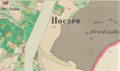 01852 2021-02-25 (20) Dorf Hoczew in Galizien Sanoker Kreis ( cropped ).png 949 × 564; 1.11 MB
-
 01852 2021-02-25 (21) Dorf Hoczew in Galizien Sanoker Kreis ( cropped ).png 880 × 567; 1.05 MB
-
-

-
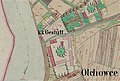
 01852 2021-02-26 (11) Stadt Dubiecko in Galizien Sanoker Kreis.png 1,003 × 617; 1.76 MB
-

-
-
 01852 2021-02-26 (16) Stadt Brzozów in Galizien Sanoker Kreis.png 505 × 625; 821 KB
-
 01852 2021-02-26 (18) Dorf Plonna in Galizien Sanoker Kreis.png 984 × 618; 1.22 MB
-
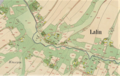 01852 2021-02-26 (19) Dorf Lalin in Galizien Sanoker Kreis (cropped).png 931 × 592; 1.18 MB
-
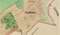 01852 Dorf Czerteż sammt Enclave Zabłotce in Galizien Sanoker Kreis, 1852.png 1,053 × 617; 1.49 MB
-
 01852 Dorf Nadolany in Galizien Sanoker Kreis.jpg 918 × 557; 263 KB
-
 01852 Dorf Olchowce in Galizien Sanoker Kreis (cropped).jpg 874 × 591; 264 KB
-
 01852 Dorf Zagórz in Galizien Sanoker Kreis (cropped).png 996 × 643; 1.34 MB
-
 01852 Markt Bukowsko in Galizien (cropped).jpg 864 × 602; 346 KB
-

-
 01852 Stadt Sanok in Galizien Sanoker Kreis (cropped).png 538 × 353; 418 KB
-
 01852 Stadt Sanok in Galizien Sanoker Kreis cropped.png 577 × 443; 653 KB
-
 01852 Stadt Sanok in Galizien Sanoker Kreis, Niwa ogrody (cropped).png 942 × 528; 1.12 MB
-

-
 01853 Katasterplan von Sanok, 1853, Galizien Cropped.jpg 558 × 385; 80 KB
-
 01853 Markt Lutowiska in Galizien Sanoker Kreis cropped.jpg 1,307 × 1,304; 488 KB
-
 01854 2021-02-27 (11) Dorf Prusiek in Galizien Sanoker Kreis ( cropped ).png 873 × 594; 1.13 MB
-

-

-

-
-
 01854 2021-02-27 (9) Markt Baligrod in Galizien Sanoker Kreis (cropped).png 900 × 604; 1.01 MB
-
 01854 2021-03-12 (2) Stadt Rymanow in Galizien Sanoker Kreis (cropped).png 1,103 × 619; 1.66 MB
-
 02021-02-24 (9) Stadt Jaśliska in Galizien Sanoker Kreis , 1853.png 1,064 × 576; 1.43 MB
-

-

-
 02021-03-21 (1853) Dorf Posada Olchowska in Galizien Sanoker Kreis.png 940 × 567; 1.37 MB
-
 02021-03-27 (12) Markt Kolbuszowa in Galizien Rzeszower Kreis cropped.png 950 × 618; 1.35 MB
-

-

-

-
 02021-03-27 (1854) Colonia Gillershof in Galizien Rzeszower Kreis.png 938 × 611; 1.27 MB
-

-

-
 02021-03-30 (3) Markt Rozwodow in Galizien, 1853.png 920 × 612; 1.43 MB
-

-

-
 02021-06-21 (5) Dorf Trepcza in Galizien Sanoker Kreis, 1852, cropped.png 930 × 572; 1.35 MB
-
 2021-02-27 (30) Markt Bircza in Galizien Sanoker Kreis (cropped).png 867 × 607; 1.23 MB
-
 2021-02-27 (54) Markt Bircza in Galizien Sanoker Kreis (cropped).png 451 × 323; 386 KB
-
 2021-02-27 (55) Market Square in Dukla.png 996 × 625; 1.53 MB
-
 2021-03-13 (14) Rymanów Castle.png 760 × 491; 748 KB
-
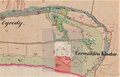
 2021-03-13 (15) Market Square in Łańcut, Galicia.png 776 × 567; 1.18 MB
-
 2021-03-14 (11) Stadt Przeworsk in Galizien , Kanczuger Vorstadt.png 990 × 618; 1.45 MB
-
 2021-03-14 (12) Stadt Przeworsk in Galizien, Lancuter Vorstadt.png 1,013 × 633; 1.6 MB
-
 2021-03-14 (17) Stad Jaroslau in Galizien Przemysler Kreis cropped.png 1,018 × 615; 1.42 MB
-
 2021-03-14 (18) Old cemetery in Jarosław.png 852 × 526; 1.05 MB
-
 2021-03-14 (7) Stadt Przeworsk in Galizien Rzeszower Kreis cropped.png 800 × 586; 1.14 MB
-
 2021-03-27 (1854) Colonia Gillershof in Galizien Rzeszower Kreis.png 818 × 570; 1.17 MB
-

-
 Borysławka na austriackiej mapie topograficznej, 1852 r.jpg 6,582 × 6,125; 7.47 MB
-
 Cemetery at Matejki Street in Sanok (1852).jpg 288 × 211; 18 KB
-
 Jan Lewicki sen. (1903) - Arch. Prz.jpg 895 × 1,063; 911 KB
-
 Map of Biała Góra at Sanok (-1914).jpg 1,189 × 1,374; 474 KB
-
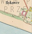 Map of Bykowce (-1914).jpg 536 × 570; 65 KB
-
 Map of Dąbrówka Polska at Sanok (-1914).jpg 651 × 498; 109 KB
-
 Map of Niżankowice (-1914).jpg 360 × 345; 88 KB
-
 Map of Zabłotce at Niżankowice (-1914).jpg 265 × 245; 41 KB
-
 PCK Sanok 1933.jpg 830 × 796; 100 KB
-
 Posada Rybotycka na austriackiej mapie topograficznej, 1852 r.jpg 6,012 × 7,309; 4.06 MB
-
 Signature of Antoni Dorosz (1933).jpg 1,147 × 350; 29 KB
-
 Signature of Antoni Dorosz (1934).jpg 917 × 234; 15 KB
-
 Signature of Antoni Szemelowski (1934).jpg 1,918 × 528; 488 KB
-
 Signature of Bronisław Pieracki (1932).jpg 1,675 × 612; 74 KB
-
 Signature of Franciszek Löwi (1927).jpg 1,541 × 315; 35 KB
-
 Signature of Marian Warmuzek (1933).jpg 1,499 × 439; 73 KB
-
 Signature of Michał Słuszkiewicz (1921).jpg 2,510 × 572; 72 KB
-
 Signature of Romuald Klimów (1930).jpg 912 × 746; 73 KB
-
 Signature of Romuald Klimów (1932).jpg 2,197 × 746; 168 KB


_Markt_Czudec_sammt_Ortschaft_Przedmie%C5%9Bcie_in_Galizien_(Jas%C5%82oer_Kreis)_,_cropped.png)
_Dorf_Besko_sammt_den_Ortschaften_Mymo%C5%84_und_Por%C4%99by_in_Galizien_Sanoker_Kreis_(cropped).png)
_Dorf_D%C4%85br%C3%B3wka_Polska_in_Galizien_Sanoker_Kreis_(cropped).png)
_Stadt_Sanok_in_Galizien_Sanoker_Kreis_(cropped).png)
_Stadt_Sanok_in_Galizien_Sanoker_Kreis_(cropped).png)
_Stadt_Sanok_in_Galizien_Sanoker_Kreis_(cropped).png)
_Dorf_Hoczew_in_Galizien_Sanoker_Kreis_(_cropped_).png)
_Dorf_Hoczew_in_Galizien_Sanoker_Kreis_(_cropped_).png)
_Dorf_Hoczew_in_Galizien_Sanoker_Kreis_(_cropped_).png)
_01852_Stadt_Sanok_in_Galizien_Sanoker_Kreis_(cropped).png)
_01852_Stadt_Sanok_in_Galizien_Sanoker_Kreis_(cropped).png)
_Stadt_Dubiecko_in_Galizien_Sanoker_Kreis.png)
_Dorf_Kamienne_in_Galizien_Sanoker_Kreis_(_cropped_).png)
_Dorf_Kamienne_in_Galizien_Sanoker_Kreis_(_cropped_).png)
_Stadt_Brzoz%C3%B3w_in_Galizien_Sanoker_Kreis.png)
_Dorf_Plonna_in_Galizien_Sanoker_Kreis.png)
_Dorf_Lalin_in_Galizien_Sanoker_Kreis_(cropped).png)


.jpg)
.png)
.jpg)
.png)
.png)

.png)
.png)


_Dorf_Prusiek_in_Galizien_Sanoker_Kreis_(_cropped_).png)
.png)
_Dorf_Prusiek_in_Galizien_Sanoker_Kreis_(_cropped_).png)
_Markt_Baligrod_in_Galizien_Sanoker_Kreis_(cropped).png)
_Markt_Baligrod_in_Galizien_Sanoker_Kreis_(cropped).png)
_Markt_Baligrod_in_Galizien_Sanoker_Kreis_(cropped).png)
_Stadt_Rymanow_in_Galizien_Sanoker_Kreis_(cropped).png)
_Stadt_Ja%C5%9Bliska_in_Galizien_Sanoker_Kreis_,_1853.png)
_Stadt_%C5%81a%C5%84cut_sammt_der_Ortschaft_K%C4%85ty_in_Galizien_Rzeszower_Kreis_cropped.png)
_Dorf_Posada_Sanocka_in_Galizien_Sanoker_Kreis_(cropped).png)
_Dorf_Posada_Olchowska_in_Galizien_Sanoker_Kreis.png)
_Markt_Kolbuszowa_in_Galizien_Rzeszower_Kreis_cropped.png)
_Der_%C3%A4lteste_Teil_des_Judenfriedhofs_zu_Rzesz%C3%B3w,_1849,_Altstadt_,_zwei_Synagogen,_Stadt_Rzesz%C3%B3w_sammt_Enclave_Ruska_Wie%C5%9B.png)
_Old_Jewish_Cemetery_of_Rzesz%C3%B3w,_Stadt_Rzesz%C3%B3w_sammt_Enclave_Ruska_Wie%C5%9B.png)
_Stadt_Rzesz%C3%B3w_sammt_Enclave_Ruska_Wie%C5%9B_in_Galizien_Rzeszower_Kreis.png)
_Colonia_Gillershof_in_Galizien_Rzeszower_Kreis.png)
_Stadt_Rzesz%C3%B3w_sammt_Enclave_Ruska_Wie%C5%9B_in_Galizien_Rzeszower_Kreis,_Neust%C3%A4dter_-_Rink.png)
_Stadt_Rzesz%C3%B3w_sammt_Enclave_Ruska_Wie%C5%9B_in_Galizien_Rzeszower_Kreis.png)
_Markt_Rozwodow_in_Galizien,_1853.png)
_Galicia_and_Bucovina_(1861%E2%80%931864)_-_Second_military_survey_of_the_Habsburg_Empire,_Lipsko.png)
_-_Second_military_survey_of_the_Habsburg_Empire,_Lipsko.png)
_Dorf_Trepcza_in_Galizien_Sanoker_Kreis,_1852,_cropped.png)
_Markt_Bircza_in_Galizien_Sanoker_Kreis_(cropped).png)
_Markt_Bircza_in_Galizien_Sanoker_Kreis_(cropped).png)
_Market_Square_in_Dukla.png)
_Ryman%C3%B3w_Castle.png)
_Market_Square_in_%C5%81a%C5%84cut,_Galicia.png)
_Stadt_Przeworsk_in_Galizien_,_Kanczuger_Vorstadt.png)
_Stadt_Przeworsk_in_Galizien,_Lancuter_Vorstadt.png)
_Stad_Jaroslau_in_Galizien_Przemysler_Kreis_cropped.png)
_Old_cemetery_in_Jaros%C5%82aw.png)
_Stadt_Przeworsk_in_Galizien_Rzeszower_Kreis_cropped.png)
_Colonia_Gillershof_in_Galizien_Rzeszower_Kreis.png)
_Galizien_und_Lodomerien_(1779%E2%80%931783)_-_First_Military_Survey,_Lypsk.png)

.jpg)
_-_Arch._Prz.jpg)
.jpg)
.jpg)
.jpg)
.jpg)
.jpg)


.jpg)
.jpg)
.jpg)
.jpg)
.jpg)
.jpg)
.jpg)
.jpg)
.jpg)