Category:Images from Wiki Loves Earth 2016, DE-TH
Jump to navigation
Jump to search

Deutsch: Wettbewerbsbeiträge für Wiki Loves Earth 2016 aus Thüringen. – Bitte die Bilder zusätzlich noch mit inhaltlichen/räumlichen Kategorien versehen, siehe v.a. Category:Protected areas of Thuringia.
Media in category "Images from Wiki Loves Earth 2016, DE-TH"
The following 200 files are in this category, out of 292 total.
(previous page) (next page)-
 10 Teiche im Vessertal.jpg 1,500 × 2,000; 3.07 MB
-
 2012-04-24 Mallinden Niederdorla-Thüringen.jpg 3,898 × 2,594; 13.87 MB
-
 2012-04-28 Mallinden Niederdorla-Thüringen.jpg 3,898 × 2,594; 14.95 MB
-
 2015 Hohenwarte 01.jpg 5,184 × 3,456; 5.21 MB
-
 2015 Hohenwarte 02.jpg 5,059 × 3,373; 4 MB
-
 2015 Hohenwarte 03.jpg 5,184 × 3,456; 6.12 MB
-
 2015 Hohenwarte 04.jpg 5,184 × 3,456; 5.59 MB
-
 2015 Hohenwarte 05.jpg 4,653 × 3,102; 3.47 MB
-
 2015 Hohenwarte 06.jpg 5,184 × 3,456; 5.61 MB
-
 2015 Hohenwarte 07.jpg 5,184 × 3,456; 3.48 MB
-
 2015 Hohenwarte 08.jpg 5,184 × 3,456; 5.52 MB
-
 2015 Hohenwarte 09.jpg 4,919 × 3,279; 3.88 MB
-
 2015 Hohenwarte 10.jpg 5,073 × 3,382; 3.45 MB
-
 2015-05-30 ND Strobe in Behringen Wartburgkreis.JPG 2,664 × 4,000; 4.25 MB
-
 Abschüssiger Forstpfad durch den Buchenwald, Kleiner Gleichberg, Thüringen.jpg 4,608 × 3,456; 6.07 MB
-

-
 Ausläufer des Fürstenbrunnens.jpg 4,730 × 2,280; 6.92 MB
-
 Bachlauf durch ein Bärlauchfeld unter den Buchen, Kleiner Gleichberg, Thüringen.jpg 3,456 × 4,608; 5.98 MB
-
 Barbarossahöhle- Thüringen...IMG 6710WI.JPG 5,184 × 3,456; 5.91 MB
-
 Barbarossahöhle- Thüringen...IMG 6720WI.JPG 5,184 × 3,456; 5.71 MB
-
 Barbarossahöhle- Thüringen...IMG 6763WI.JPG 5,184 × 3,456; 5.71 MB
-
 Barbarossahöhle- Thüringen...IMG 6771WI.JPG 5,184 × 3,456; 5.53 MB
-
 Barbarossahöhle- Thüringen...IMG 6811WI.JPG 5,184 × 3,456; 6.33 MB
-
 Barbarossahöhle- Thüringen...IMG 6956WI.JPG 5,184 × 3,456; 6.19 MB
-
 Barbarossahöhle- Thüringen...IMG 6966WI.JPG 5,184 × 3,456; 6.36 MB
-
 Barbarossahöhle- Thüringen...IMG 6971WI.JPG 5,184 × 3,456; 7.43 MB
-
 Bergwiese im Naturschutzgebiet 'Alter Gleisberg' bei Jena.jpg 5,163 × 3,442; 11.03 MB
-
 Biosphärenreservat Rhön nahe Frankenheim (22).jpg 3,888 × 2,592; 4.15 MB
-
 Biosphärenreservat Rhön nahe Frankenheim (23).jpg 3,888 × 2,592; 5.96 MB
-

-

-
 Blick ins schöne Vessertal.jpg 2,000 × 1,500; 2.35 MB
-
-
-
 BrembacherWeinberge.jpg 3,264 × 2,448; 2.55 MB
-
 Buchen mit Bärlauch-Teppich, Kleiner Gleichberg, Thüringen.jpg 4,608 × 3,456; 13.49 MB
-
 Buchenwald im Naturschutzgebiet 'Alter Gleisberg' bei Jena.jpg 5,184 × 3,456; 13.14 MB
-
 Buchenwald mit Totholz im Naturschutzgebiet 'Alter Gleisberg' bei Jena.jpg 5,184 × 3,456; 19.78 MB
-
 Der schmale Grat der Johannesberg-Horzontale (I).jpg 3,808 × 3,838; 6.62 MB
-
 Der schmale Grat der Johannesberg-Horzontale (II).jpg 3,554 × 4,621; 7.66 MB
-
 Drommberg10.jpg 2,448 × 3,264; 4.22 MB
-
 Drommberg11.jpg 2,448 × 3,264; 3.1 MB
-
 Drommberg12.jpg 3,264 × 2,448; 3.74 MB
-
 Drommberg13.jpg 3,264 × 2,448; 2.82 MB
-
 Drommberg14.jpg 3,264 × 2,448; 2.82 MB
-
 Drommberg15.jpg 3,264 × 2,448; 3.45 MB
-
 Drommberg16.jpg 2,448 × 3,264; 3.5 MB
-
 Drommberg17.jpg 2,848 × 4,288; 3.68 MB
-
 Drommberg18.jpg 2,448 × 3,264; 4.48 MB
-
 Drommberg19.jpg 2,448 × 2,448; 3.47 MB
-
 Drommberg20.jpg 4,288 × 2,848; 4.5 MB
-
 Drommberg21.jpg 4,288 × 2,848; 3.55 MB
-
 Drommberg7.jpg 3,264 × 2,448; 3.9 MB
-
 Drommberg8.jpg 7,947 × 1,771; 3.62 MB
-
 Drommberg9.jpg 3,264 × 2,448; 3.31 MB
-
 Dörringen-Teich im Plothener Teichgebiet.jpg 2,560 × 1,440; 941 KB
-
 Eingang zum Naturschutzgebiet im Pennickental.jpg 5,522 × 3,106; 7.82 MB
-
 Ellenbogen (Rhön).JPG 4,000 × 3,000; 3.24 MB
-
 Exmoor-Ponys Moorlandschaft Alperstedter Ried II.jpg 1,280 × 960; 1.66 MB
-
 Exmoor-Ponys Moorlandschaft Alperstedter Ried mit Nachwuchs.jpg 1,280 × 960; 1.36 MB
-
 Exmoor-Ponys Moorlandschaft Alperstedter Ried.jpg 1,280 × 960; 1.29 MB
-
 Feuchte Frühjahrswiese im Elstertal.jpg 219 × 156; 17 KB
-
 FFH Elstertal Berga 01.jpg 4,000 × 3,000; 3.72 MB
-
 FFH Elstertal Berga 02.jpg 3,172 × 2,362; 1.68 MB
-
 FFH Elstertal Berga 03.jpg 4,000 × 3,000; 5.04 MB
-
 FFH Elstertal Berga 04.jpg 4,000 × 3,000; 5.25 MB
-
 FFH Elstertal Berga 05.jpg 3,000 × 4,000; 4.38 MB
-
 FFH Elstertal Berga 06.jpg 4,000 × 3,000; 5.18 MB
-
 FFH Elstertal Berga 07.jpg 3,000 × 4,000; 4.06 MB
-
 FFH Elstertal Berga 08.jpg 3,000 × 4,000; 5.5 MB
-
 FFH Elstertal Berga 09.jpg 3,000 × 4,000; 3.99 MB
-
 FFH Elstertal Berga 10.jpg 4,000 × 3,000; 3.42 MB
-
 FFH Elstertal Berga 11.jpg 4,000 × 3,000; 4.25 MB
-
 FFH Elstertal Berga Clodramühle 01.jpg 3,000 × 4,000; 4.24 MB
-
 FFH Elstertal Berga Clodramühle 02.jpg 3,000 × 4,000; 3.96 MB
-
 FFH Elstertal Berga Clodramühle 03.jpg 4,000 × 3,000; 4.21 MB
-
 FFH Elstertal Berga Clodramühle 04.jpg 4,000 × 3,000; 4.07 MB
-
 FFH Elstertal Berga Clodramühle 05.jpg 4,000 × 3,000; 3.82 MB
-
 FFH Elstertal Berga Clodramühle 06.jpg 4,000 × 3,000; 3.85 MB
-
 FFH Elstertal Berga Clodramühle 07.jpg 4,000 × 3,000; 3.73 MB
-
 FFH Elstertal Berga Clodramühle 08.jpg 4,000 × 3,000; 3.81 MB
-
 FFH Elstertal Berga Clodramühle 09.jpg 3,000 × 4,000; 4.22 MB
-
 FFH Elstertal Berga Steinberg 1.jpg 3,000 × 4,000; 4.76 MB
-
 FFH Elstertal Berga Steinberg 2.jpg 4,000 × 3,000; 5.01 MB
-
 FFH Elstertal Berga Steinberg 3.jpg 4,000 × 3,000; 4.34 MB
-
 FFH Elstertal Berga Weg zum Unterhammer 01.jpg 4,000 × 3,000; 3.44 MB
-
 FFH Elstertal Berga Weg zum Unterhammer 02.jpg 4,000 × 3,000; 3.25 MB
-
 FFH Elstertal Berga Weg zum Unterhammer 03.jpg 3,000 × 4,000; 4.08 MB
-
 FFH Elstertal Berga Weg zum Unterhammer 04.jpg 3,000 × 4,000; 3.69 MB
-
 FFH Elstertal Berga Weg zum Unterhammer 05.jpg 3,000 × 4,000; 3.91 MB
-
 FFH Elstertal Berga Weg zum Unterhammer 06.jpg 4,000 × 3,000; 3.82 MB
-
 FFH Elstertal Berga Weg zum Unterhammer 07.jpg 3,000 × 4,000; 4.1 MB
-
 FFH Elstertal Berga Weg zum Unterhammer 08.jpg 4,000 × 3,000; 3.26 MB
-
 FFH Elstertal Berga Weg zum Unterhammer 09.jpg 4,000 × 3,000; 3.5 MB
-
 FFH Elstertal Berga Weg zum Unterhammer 10.jpg 3,000 × 4,000; 3.34 MB
-
 FFH Elstertal Berga Weg zum Unterhammer 11.jpg 3,000 × 4,000; 3.21 MB
-
 FFH Elstertal Berga Weg zum Unterhammer 12.jpg 4,000 × 3,000; 3.88 MB
-
 FFH Elstertal Berga Weg zum Unterhammer 13.jpg 4,000 × 3,000; 4.06 MB
-
 FFH Gebiet 5233-302 Fledermauswochenstuben Kleingölitz Kirche DE-TH 1.jpg 3,763 × 2,117; 3.82 MB
-
 FFH Gebiet 5233-302 Fledermauswochenstuben Kleingölitz Kirche DE-TH 2.jpg 4,604 × 2,588; 3.78 MB
-

-

-
 FFH Gebiet 5233-304 Muschelkalk-Landschaft westlich Rudolstadt Gölitzwände DE-TH 11.jpg 4,608 × 2,593; 4.25 MB
-
 FFH Gebiet 5233-304 Muschelkalk-Landschaft westlich Rudolstadt Gölitzwände DE-TH 15.jpg 3,456 × 4,319; 17.05 MB
-
 FFH Gebiet 5233-304 Muschelkalk-Landschaft westlich Rudolstadt Gölitzwände DE-TH 2.jpg 4,608 × 2,594; 4.38 MB
-
 FFH Gebiet 5233-304 Muschelkalk-Landschaft westlich Rudolstadt Gölitzwände DE-TH 3.jpg 4,608 × 2,593; 10.3 MB
-
 FFH Gebiet 5233-304 Muschelkalk-Landschaft westlich Rudolstadt Gölitzwände DE-TH 4.jpg 4,608 × 2,624; 3.77 MB
-
 FFH Gebiet 5233-304 Muschelkalk-Landschaft westlich Rudolstadt Gölitzwände DE-TH 6.jpg 4,599 × 2,589; 4.06 MB
-
 FFH Gebiet 5233-304 Muschelkalk-Landschaft westlich Rudolstadt Gölitzwände DE-TH 7.jpg 4,608 × 2,593; 4.02 MB
-
 FFH Gebiet 5233-304 Muschelkalk-Landschaft westlich Rudolstadt Gölitzwände DE-TH 8.jpg 4,608 × 2,593; 3.59 MB
-
 FFH Gebiet 5233-304 Muschelkalk-Landschaft westlich Rudolstadt Gölitzwände DE-TH 9.jpg 5,711 × 3,215; 3.76 MB
-
 FFH Gebiet 5233-304 Muschelkalk-Landschaft westlich Rudolstadt Gölitzwände DE-TH.jpg 3,660 × 2,057; 2.94 MB
-

-
-
 FFH Gebiet 5233-304 Muschelkalk-Landschaft westlich Rudolstadt Kesselwände DE-TH 2.jpg 4,232 × 2,381; 3.72 MB
-
 FFH-Gebiet 5233-303 Muschelkalkhänge um Teichel und Großkochberg DE-TH 1.jpg 3,102 × 4,295; 4.15 MB
-
 FFH-Gebiet 5233-303 Muschelkalkhänge um Teichel und Großkochberg DE-TH 2.jpg 2,571 × 3,566; 4.29 MB
-
 FFH-Gebiet 5233-303 Muschelkalkhänge um Teichel und Großkochberg DE-TH 3.jpg 3,366 × 2,527; 3.43 MB
-
 FFH-Gebiet 5233-303 Muschelkalkhänge um Teichel und Großkochberg DE-TH 4.jpg 3,613 × 2,712; 4.12 MB
-
 FFH-Gebiet 5233-303 Muschelkalkhänge um Teichel und Großkochberg DE-TH 5.jpg 2,069 × 1,553; 3.97 MB
-
 FFH-Gebiet 5233-303 Muschelkalkhänge um Teichel und Großkochberg DE-TH 6.jpg 3,525 × 2,643; 2.79 MB
-
 FFH-Gebiet 5434-302 Kirche Reichenbach DE-TH 1.jpg 4,066 × 2,286; 3.35 MB
-
 FFH-Gebiet 5434-302 Kirche Reichenbach DE-TH 2.jpg 3,751 × 2,112; 4.29 MB
-
 Fledermausquartier, ehemaliges Kasernengelände Jena-Lichtenhain.jpg 2,475 × 3,712; 4.6 MB
-
 Frühling im LSG Kyffhäuser in Sachsen-Anhalt...2H1A9527WI.jpg 5,472 × 3,648; 9.61 MB
-
 Frühling im Naturpark Kyffhäuser in Thüringen..2H1A0058ВЕ.jpg 3,995 × 2,663; 7.99 MB
-
 Frühling im Naturpark Kyffhäuser in Thüringen..2H1A9447WI.JPG 5,472 × 3,648; 7.14 MB
-
 Frühling im Naturpark Kyffhäuser in Thüringen..2H1A9543WI.JPG 5,472 × 3,648; 7.5 MB
-
 Frühling im Naturpark Kyffhäuser in Thüringen..2H1A9839WI.JPG 5,472 × 3,648; 7.11 MB
-
 Frühlingserwachen im Park.JPG 1,704 × 2,272; 909 KB
-
 Födischteich im Plothener Teichgebiet.jpg 2,560 × 1,440; 807 KB
-
 Geopfad Kyffhäuser-Denkmal in Thüringen..2H1A0001WI.JPG 5,472 × 3,648; 8.82 MB
-
 Geopfad Kyffhäuser-Denkmal in Thüringen..2H1A0003ВЕ.jpg 3,995 × 2,663; 12.12 MB
-
 Geopfad Kyffhäuser-Denkmal in Thüringen..2H1A0006WI.JPG 5,042 × 3,500; 6.06 MB
-
 Geopfad Kyffhäuser-Denkmal in Thüringen..2H1A0080ВЕ.jpg 3,995 × 2,663; 11.58 MB
-
 Geopfad Kyffhäuser-Denkmal in Thüringen..2H1A0083ВЕ.jpg 3,995 × 2,663; 10.5 MB
-
 Geopfad Kyffhäuser-Denkmal in Thüringen..2H1A0086ВЕ.jpg 3,995 × 2,663; 12.77 MB
-
 Geopfad Kyffhäuser-Denkmal in Thüringen..2H1A0088ВЕ.jpg 3,995 × 2,663; 13.04 MB
-
 Geopfad Kyffhäuser-Denkmal in Thüringen..2H1A0096ВЕ.jpg 3,995 × 2,663; 9.73 MB
-
 Geopfad Kyffhäuser-Denkmal in Thüringen..2H1A0105ВЕ.jpg 3,995 × 2,663; 10.53 MB
-
 Geopfad Kyffhäuser-Denkmal in Thüringen..2H1A0113ВЕ.jpg 3,995 × 2,663; 11.14 MB
-
 Geopfad Kyffhäuser-Denkmal in Thüringen..2H1A9693WI.JPG 5,472 × 3,648; 7.35 MB
-
 Geopfad Kyffhäuser-Denkmal in Thüringen..2H1A9986WI.jpg 4,104 × 2,736; 10.75 MB
-
 Geopfad Kyffhäuser-Denkmal in Thüringen..2H1A9990WI.JPG 5,472 × 3,648; 8.59 MB
-
 Geopfad Kyffhäuser-Denkmal in Thüringen..IMG 7502WI.jpg 4,251 × 2,834; 12.31 MB
-
 Gesteinsaufschluss an Mündung Hellerbach in Zimmerbach - NSG 328 Zimmerbachtal-Hellerbachtal.jpg 4,928 × 2,988; 16.26 MB
-
 Gipsplatten Barbarossahoehle.jpg 5,184 × 3,456; 6.08 MB
-
 GREIFENSTEIN.JPG 1,280 × 960; 933 KB
-
 Hangwald aus Buchen im Naturschutzgebiet 'Alter Gleisberg' bei Jena.jpg 3,339 × 5,008; 13.02 MB
-
 Hellerbach trocken - NSG 328 Zimmerbachtal-Hellerbachtal.jpg 4,818 × 2,988; 17.33 MB
-
 Hellerbach trockengefallen - NSG 328 Zimmerbachtal-Hellerbachtal.jpg 2,988 × 4,631; 16.51 MB
-
-
 Himmelteich, ehemaliges Kasernengelände Jena-Lichtenhain 01.jpg 4,884 × 3,256; 7.2 MB
-
 Himmelteich, ehemaliges Kasernengelände Jena-Lichtenhain 02.jpg 5,027 × 3,351; 8.27 MB
-
 Hirschkäfer1.JPG 5,184 × 3,456; 3.05 MB
-
 In Barbarossahöhle- Thüringen. IMG 6864WI.JPG 5,184 × 3,456; 6 MB
-
 In Barbarossahöhle- Thüringen...IMG 7040WI.JPG 5,184 × 3,456; 6 MB
-
 In Barbarossahöhle- Thüringen...IMG 7063WI.JPG 5,184 × 3,456; 6.84 MB
-
 Keulaer Wald im Herbst.jpg 4,000 × 3,000; 5.16 MB
-
 Keulaer Wald Weg zum Rondel.jpg 4,000 × 3,000; 5.17 MB
-
 Kleine bzw. obere Golke - NSG 328 Zimmerbachtal-Hellerbachtal.jpg 5,312 × 2,988; 17.8 MB
-
 Kleine-Hasenhöhe-Teich im Plothener Teichgebiet 1.jpg 2,560 × 1,440; 1,023 KB
-
 Kleine-Hasenhöhe-Teich im Plothener Teichgebiet 2.jpg 2,560 × 1,440; 1.11 MB
-
 Kleiner Himmelteich, ehemaliges Kasernengelände Jena-Lichtenhain.jpg 4,636 × 3,091; 6.72 MB
-
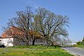
 Königseiche Volkenroda 1.jpg 3,000 × 4,000; 2.91 MB
-
 Künstlicher Wasserfall im Thüringer Wald.jpg 3,840 × 2,160; 3.09 MB
-
 Mallinden 1.jpg 5,184 × 3,456; 9.38 MB
-
 Mallinden 2.jpg 5,184 × 3,456; 5.74 MB
-
 Mallinden 3.jpg 5,184 × 3,456; 10.11 MB
-
 Mallinden 4.jpg 3,456 × 5,184; 8.88 MB
-

-
 Mühlengrund-Orla.jpg 2,848 × 4,288; 5.05 MB
-
 Mündung Hellerbach in Zimmerbach - NSG 328 Zimmerbachtal-Hellerbachtal.jpg 2,988 × 3,761; 12.86 MB
-
 Naturdenkmal im Naturschutzgebiet Alter Gleisberg bei Jena.jpg 3,173 × 4,759; 9.46 MB
-
 Naturdenkmal weimar puschkinstr.JPG 3,264 × 4,896; 5.58 MB
-
 Naturpark Kyffhäuser in Thüringen...2H1A9509WI.JPG 3,648 × 5,472; 5.97 MB
-
 Naturpark Kyffhäuser in Thüringen..2H1A9429WI.JPG 5,472 × 3,648; 6.57 MB
-
 Naturpark Kyffhäuser in Thüringen..2H1A9462WI.JPG 5,472 × 3,648; 8.58 MB
-
 Naturpark Kyffhäuser in Thüringen..2H1A9826WI.JPG 5,472 × 3,648; 6.73 MB
-
 Naturpark Kyffhäuser in Thüringen..2H1A9827WI.JPG 5,472 × 3,648; 6.47 MB
-
 Naturpark Kyffhäuser- Thüringen..IMG 7097WI.jpg 5,184 × 3,456; 10.13 MB
-
 Naturpark Kyffhäuser- Thüringen..IMG 7104WI.jpg 4,251 × 2,834; 12.66 MB
-
 Naturpark Thüringer Wald von Ines Griebel.jpg 1,836 × 3,264; 1.98 MB
-
 Naturpark thüringer wald.JPG 3,648 × 2,736; 6.27 MB
-
-
 Naturschutzgebiet Harthberg, WDPA ID 163534.jpg 3,664 × 2,748; 4.12 MB
-
 Naturschutzgebiet Werrabergland südwestlich Uder, WDPA ID 555537539.jpg 3,664 × 2,748; 2.95 MB
-
 Nebel vor dem Zug.JPG 2,272 × 1,704; 816 KB
-
 Neuer Teich im Plothener Teichgebiet.jpg 2,560 × 1,440; 1.07 MB
-

-
 NSG NR. 285 Staatsbruch Landkreis Saalfeld-Rudolstadt DE-TH 1.jpg 4,524 × 2,546; 3.5 MB
-
 NSG NR. 285 Staatsbruch Landkreis Saalfeld-Rudolstadt DE-TH 11.jpg 3,307 × 1,858; 3 MB
-
 NSG NR. 285 Staatsbruch Landkreis Saalfeld-Rudolstadt DE-TH 12.jpg 4,530 × 2,547; 4.26 MB
-
 NSG NR. 285 Staatsbruch Landkreis Saalfeld-Rudolstadt DE-TH 3.jpg 4,576 × 2,575; 4.27 MB
-
 NSG NR. 285 Staatsbruch Landkreis Saalfeld-Rudolstadt DE-TH 4.jpg 4,448 × 2,503; 3.65 MB
-
 NSG NR. 285 Staatsbruch Landkreis Saalfeld-Rudolstadt DE-TH 5.jpg 4,448 × 2,503; 3.19 MB
-
 NSG NR. 285 Staatsbruch Landkreis Saalfeld-Rudolstadt DE-TH 6.jpg 4,486 × 2,524; 3.2 MB
-
 NSG NR. 285 Staatsbruch Landkreis Saalfeld-Rudolstadt DE-TH 7.jpg 4,524 × 2,546; 3.47 MB
-
 NSG NR. 285 Staatsbruch Landkreis Saalfeld-Rudolstadt DE-TH 9.jpg 4,504 × 2,534; 3.99 MB
-
 Obstplantage im Naturpark Kyffhäuser..2H1A9504WI.JPG 5,472 × 3,648; 7.39 MB


_mit_bl%C3%BChenden_Winterlingen_im_Rautal_bei_Jena.jpg)


.jpg)
.jpg)


_und_NSG_Kelle-Teufelskanzel,_WDPA_ID_164048_(rechts).jpg)


.jpg)
.jpg)


.JPG)


_Landkreis_Saalfeld-Rudolstadt_DE_-TH_1.jpg)


