Category:Images from 3d.ruhr
Jump to navigation
Jump to search
Media in category "Images from 3d.ruhr"
The following 200 files are in this category, out of 229 total.
(previous page) (next page)-
2020 Bilstein Schrägluftbild.png 1,503 × 855; 2.58 MB
-
2020 Blick auf Schloss Hohenlimburg.png 1,314 × 856; 2.38 MB
-
2020 Luftbild AKH.png 1,541 × 856; 2.56 MB
-
2020 Luftbild Altenhagen.png 1,274 × 854; 2.45 MB
-
2020 Luftbild Ambrock.png 1,259 × 854; 2.2 MB
-
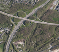
2020 Luftbild Autobahnkreuz Hagen.png 951 × 845; 1.66 MB
-
2020 Luftbild Bahnhofsplatz.png 1,643 × 857; 2.83 MB
-
2020 Luftbild Bahnhofsviertel.png 1,492 × 841; 2.69 MB
-
2020 Luftbild Bathey.png 945 × 854; 1.65 MB
-
2020 Luftbild Baukloh.png 1,275 × 853; 2.35 MB
-
2020 Luftbild Bechem.png 1,431 × 858; 2.2 MB
-
2020 Luftbild Berchum.png 1,273 × 847; 2.06 MB
-
2020 Luftbild Bilstein Werk Berchum.png 1,414 × 857; 2.15 MB
-
2020 Luftbild Bilstein Werk II.png 1,200 × 857; 1.91 MB
-
2020 Luftbild Boele.png 1,268 × 855; 2.44 MB
-
2020 Luftbild Boelerheide.png 1,276 × 857; 2.45 MB
-
2020 Luftbild Brechtefeld.png 1,335 × 858; 2.09 MB
-
2020 Luftbild Buschey-Friedhof.png 1,494 × 857; 2.52 MB
-
2020 Luftbild Buschmühle.png 1,546 × 858; 2.23 MB
-
2020 Luftbild Bölling.png 1,506 × 857; 2.47 MB
-
2020 Luftbild Dahl.png 1,276 × 854; 2.43 MB
-
2020 Luftbild Dahler Kirche.png 1,528 × 857; 2.4 MB
-
2020 Luftbild Deipenbrink.png 1,547 × 857; 2.51 MB
-
2020 Luftbild Delstern.png 1,272 × 842; 2.25 MB
-
2020 Luftbild Dörken.png 1,526 × 850; 2.64 MB
-
2020 Luftbild Eckesey.png 1,277 × 855; 2.35 MB
-
2020 Luftbild Ehemalige Hofstelle Rönsel.png 1,400 × 857; 2.3 MB
-
2020 Luftbild Eilpe.png 1,279 × 854; 2.42 MB
-
2020 Luftbild Eisenbahn-Ruhrbrücke.png 1,550 × 856; 2.32 MB
-
2020 Luftbild Elsey, Kirchenbergstadion.png 951 × 857; 1.77 MB
-
2020 Luftbild Elsey.png 1,641 × 857; 2.9 MB
-
2020 Luftbild Elseyer Kirche.png 1,234 × 754; 1.76 MB
-
2020 Luftbild Enervie-Verwaltung.png 1,518 × 858; 2.47 MB
-
2020 Luftbild Eugen-Richter-Turm.png 1,358 × 842; 2.01 MB
-
2020 Luftbild Fachhochschule Hagen.png 1,545 × 855; 2.59 MB
-
2020 Luftbild Fahrentrappe.png 1,356 × 855; 2 MB
-
2020 Luftbild FernUniversität.png 1,394 × 850; 2.37 MB
-
2020 Luftbild Flehinghaus.png 1,539 × 857; 2.52 MB
-
2020 Luftbild Fley.png 1,273 × 850; 2.26 MB
-
2020 Luftbild Freiherr-vom-Stein-Turm.png 1,327 × 853; 1.98 MB
-
2020 Luftbild Freilichtmuseum.png 1,476 × 856; 2.53 MB
-
2020 Luftbild Garenfeld Nord.png 1,275 × 858; 2.25 MB
-
2020 Luftbild Garenfeld.png 953 × 856; 1.54 MB
-
2020 Luftbild Gesamtschule Haspe.png 1,335 × 858; 2.21 MB
-
2020 Luftbild Griesenbecke.png 1,460 × 855; 2.17 MB
-
2020 Luftbild Gut Schede.png 1,506 × 856; 2.3 MB
-
2020 Luftbild Güterbahnhof Eckesey.png 1,266 × 819; 2.17 MB
-
2020 Luftbild Güterbahnhof Oege.png 1,565 × 856; 2.68 MB
-
2020 Luftbild Hagener Museumsquartier.png 1,250 × 788; 1.98 MB
-
2020 Luftbild Halden.png 1,267 × 858; 2.41 MB
-
2020 Luftbild Haspe Innenstadt.png 1,568 × 857; 2.83 MB
-
2020 Luftbild Haspe.png 1,258 × 819; 2.19 MB
-
2020 Luftbild Hasper Talsperre.png 955 × 782; 1.32 MB
-
2020 Luftbild Haßley.png 1,442 × 858; 2.39 MB
-
2020 Luftbild Haus Busch.png 1,441 × 858; 2.17 MB
-
2020 Luftbild Haus Ende.png 1,446 × 858; 2.29 MB
-
2020 Luftbild Haus Harkorten.png 1,629 × 852; 2.46 MB
-
2020 Luftbild Haus Mallinckrodt.png 1,467 × 857; 2.3 MB
-
2020 Luftbild Heizkraftwerk Kabel.png 1,409 × 855; 2.35 MB
-
2020 Luftbild Helfe.png 1,275 × 856; 2.46 MB
-
2020 Luftbild Hengstey.png 1,268 × 822; 1.79 MB
-
2020 Luftbild Hengsteysee 1.png 1,430 × 837; 2.02 MB
-
2020 Luftbild Hengsteysee 2.png 1,270 × 837; 2.08 MB
-
2020 Luftbild Hengsteysee, Bathey.png 1,271 × 835; 2.03 MB
-
2020 Luftbild Herbeck.png 1,271 × 857; 2.13 MB
-
2020 Luftbild Herdecke Bleichstein.png 1,517 × 855; 2.37 MB
-
2020 Luftbild Herdecke Innenstadt (2).png 1,559 × 856; 2.84 MB
-
2020 Luftbild Herdecke Innenstadt.png 1,581 × 857; 2.87 MB
-
2020 Luftbild Hildegardis-Schule.png 1,611 × 858; 2.41 MB
-
2020 Luftbild Hobräck.png 1,448 × 857; 2.05 MB
-
2020 Luftbild Hohenlimburg Innenstadt.png 1,271 × 849; 2.34 MB
-
2020 Luftbild Hohenlimburger Kalkwerke.png 1,519 × 858; 2.46 MB
-
2020 Luftbild Holthausen.png 1,276 × 851; 2.17 MB
-
2020 Luftbild Hugo Vogelsang - Bilstein Group.png 1,550 × 854; 2.34 MB
-
2020 Luftbild Hunsdiek.png 1,552 × 852; 2.42 MB
-
2020 Luftbild Hückinghausen.png 1,587 × 857; 2.5 MB
-
2020 Luftbild Hünenpforte.png 1,569 × 857; 2.64 MB
-
2020 Luftbild Ischeland.png 1,263 × 832; 2.31 MB
-
2020 Luftbild Ischelandstadion.png 1,533 × 858; 2.43 MB
-
2020 Luftbild Johanniskirche Hagen.png 1,588 × 858; 2.32 MB
-
2020 Luftbild Kabel.png 1,266 × 857; 2.37 MB
-
2020 Luftbild Kaiser-Friedrich-Turm.png 1,394 × 840; 2.15 MB
-
2020 Luftbild Kaiser-Wilhelm-Denkmal.png 1,469 × 854; 2.1 MB
-
2020 Luftbild Kirchenberg.png 1,413 × 855; 2.5 MB
-
2020 Luftbild Klinik Ambrock.png 1,573 × 854; 2.53 MB
-
2020 Luftbild Klärwerk Hagen.png 1,357 × 852; 2.02 MB
-
2020 Luftbild Kraftwerk Cuno.png 954 × 854; 1.4 MB
-
2020 Luftbild Krankenhaus Herdecke.png 1,310 × 858; 2.16 MB
-
2020 Luftbild Kuhlerkamp.png 1,264 × 851; 2.37 MB
-
2020 Luftbild Landgericht.png 1,414 × 853; 2.55 MB
-
2020 Luftbild Laufwasserkraftwerk Hengstey.png 1,434 × 855; 2.19 MB
-
2020 Luftbild Laufwasserkraftwerk Stiftsmühle.png 1,476 × 855; 2.25 MB
-
2020 Luftbild LB Eichen bei Haßley.png 1,353 × 856; 2.14 MB
-
2020 Luftbild LB Hangwiese und Gehölzstreifen Werninghausen.png 1,175 × 785; 1.81 MB
-
2020 Luftbild LB Helbecke.png 1,329 × 821; 1.89 MB
-
2020 Luftbild LB Kleingewässer Hückinghausen.png 1,494 × 857; 2.22 MB
-
2020 Luftbild LB Teichanlage Brechtefeld-Kalthausen.png 1,381 × 858; 2.11 MB
-
2020 Luftbild Lehrkind.png 1,504 × 857; 2.31 MB
-
2020 Luftbild Lindenhof.png 1,460 × 857; 2.33 MB
-
2020 Luftbild Linscheid.png 1,482 × 858; 2.36 MB
-
2020 Luftbild Marienhof.png 1,554 × 857; 2.32 MB
-
2020 Luftbild Nahmertal.png 1,255 × 852; 2.23 MB
-
2020 Luftbild Naturschutzgebiet Felderbachtal.png 1,506 × 857; 2.43 MB
-
2020 Luftbild Niggenbölling.png 1,511 × 858; 2.26 MB
-
2020 Luftbild NSG Ehemaliger Yachthafen Harkortsee.png 1,610 × 858; 2.1 MB
-
2020 Luftbild Obergraben-Ruhr-Brücken.png 1,451 × 843; 1.91 MB
-
2020 Luftbild Oege, Nahmer, Innenstadt.png 1,267 × 835; 2.24 MB
-
2020 Luftbild Priorei.png 1,268 × 852; 2.2 MB
-
2020 Luftbild Quambusch.png 1,278 × 857; 2.41 MB
-
2020 Luftbild Reformierte Kirche.png 1,444 × 855; 2.21 MB
-
2020 Luftbild Reh, Henkhausen.png 1,276 × 824; 2.24 MB
-
2020 Luftbild Remberg-Friedhof.png 1,374 × 858; 2.47 MB
-
2020 Luftbild Ruhr-Viadukt.png 947 × 719; 1.35 MB
-
2020 Luftbild Rummenohl.png 1,262 × 854; 2.18 MB
-
2020 Luftbild Rumscheid.png 1,454 × 855; 2.33 MB
-
2020 Luftbild Rüggebein.png 1,527 × 857; 2.32 MB
-
2020 Luftbild Selkinghausen.png 1,566 × 858; 2.46 MB
-
2020 Luftbild Sparkasse Hagen.png 1,323 × 858; 2.17 MB
-
2020 Luftbild Sportplatz Kirchende.png 1,470 × 851; 2.27 MB
-
2020 Luftbild Sportplatz Vorhalle.png 1,565 × 857; 2.64 MB
-
2020 Luftbild St. Bonifatius Kirche.png 1,542 × 855; 2.29 MB
-
2020 Luftbild St. Elisabeth Hagen.png 1,525 × 855; 2.35 MB
-
2020 Luftbild St. Marien Hagen.png 1,615 × 858; 2.49 MB
-
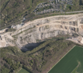
2020 Luftbild Steinbruch Donnerkuhle.png 954 × 846; 1.53 MB
-
2020 Luftbild Steinbruch Rolloch.png 950 × 851; 1.75 MB
-
2020 Luftbild Stiftsviertel Herdecke.png 1,436 × 855; 2.42 MB
-
2020 Luftbild Thyssenkrupp, Oege.png 1,262 × 834; 2.19 MB
-
2020 Luftbild Thyssenkrupp.png 1,483 × 857; 2.54 MB
-
2020 Luftbild Tiefendorf.png 943 × 849; 1.45 MB
-
2020 Luftbild Volmeabstieg.png 945 × 854; 1.72 MB
-
2020 Luftbild Vorhalle.png 1,264 × 858; 2.42 MB
-
2020 Luftbild Waelzholz (Theis).png 1,334 × 856; 2.22 MB
-
2020 Luftbild Wallburg Ambrock.png 1,570 × 858; 2.71 MB
-
2020 Luftbild Waterhövel.png 1,574 × 855; 2.6 MB
-
2020 Luftbild Weißenstein.png 1,199 × 752; 1.75 MB
-
2020 Luftbild Werninghausen.png 1,565 × 856; 2.5 MB
-
2020 Luftbild Wesselbachtal.png 949 × 770; 1.52 MB
-
2020 Luftbild Westerbauer.png 1,265 × 858; 2.33 MB
-
2020 Luftbild Westfalenbad.png 1,538 × 855; 2.56 MB
-
2020 Luftbild Wildwasserpark.png 1,463 × 858; 2.37 MB
-
2020 Luftbild Wippermann.png 1,237 × 858; 2.04 MB
-
2020 Luftbild Zur Höhe.png 1,533 × 856; 2.74 MB
-
2020 Luftblid Kalthausen.png 1,472 × 857; 2.32 MB
-
2020 Neubau Lennetalbrücke.png 1,775 × 855; 3.07 MB
-
2020 Papierfabrik Kabel.png 1,477 × 851; 2.4 MB
-
2020 Rangierbahnhof Vorhalle.png 953 × 750; 1.62 MB
-
2020 Rathaus Hohenlimburg.png 1,570 × 858; 2.31 MB
-
2020 Schloss Hohenlimburg.png 1,435 × 816; 2.05 MB
-
2020 Schrägluftbild DEW Hagen.png 1,532 × 855; 2.59 MB
-
2020 Schrägluftbild Hagen Hbf 1.png 1,599 × 855; 2.73 MB
-
2020 Schrägluftbild Hagen Hbf 2.png 945 × 702; 1.47 MB
-
2020 Schrägluftbild Hof Bärwinkel.png 1,409 × 852; 2.1 MB
-
2020 Schrägluftbild Rathaus Hagen.png 1,498 × 856; 2.41 MB
-
2020 Steinbruch Donnerkuhle.png 1,276 × 850; 2.01 MB
-
2020 Umspannwerk Garenfeld.png 951 × 700; 1.25 MB
-
2020 Wasserschloss Werdringen.png 1,217 × 783; 1.75 MB
-
2021 Haus Kemnade.png 1,267 × 765; 2.1 MB
-
2021 Henrichshütte Hattingen.png 1,355 × 765; 2.32 MB
-
2021 Kraftwerk Harkort.png 1,471 × 760; 2.27 MB
-
2021 Luftbild Altenbreckerfeld.png 1,262 × 761; 1.82 MB
-
2021 Luftbild Bismarckturm Hagen.png 1,367 × 759; 2.34 MB
-
2021 Luftbild Blankenstein, Welper.png 1,275 × 762; 2.87 MB
-
2021 Luftbild Breckerfeld-Mitte.png 1,328 × 760; 2.33 MB
-
2021 Luftbild Breckerfeld.png 1,273 × 763; 2.37 MB
-
2021 Luftbild Bredenscheid-Stüter.png 1,275 × 762; 2.15 MB
-
2021 Luftbild Brenscheid.png 1,275 × 757; 1.8 MB
-
2021 Luftbild Briefzentrum Hagen.png 1,386 × 766; 2.16 MB
-
2021 Luftbild Brockhausen.png 1,587 × 858; 3.03 MB
-
2021 Luftbild Burg Blankenstein.png 1,407 × 756; 2.46 MB
-
2021 Luftbild Burg Volmarstein.png 1,439 × 761; 2.47 MB
-
2021 Luftbild Dahler Kirche, Haus Dahl.png 1,222 × 761; 1.84 MB
-
2021 Luftbild Delstern-Süd.png 1,266 × 767; 2.23 MB
-
2021 Luftbild DHL Freight GmbH Hagen.png 1,458 × 761; 2.41 MB
-
2021 Luftbild Elbershallen.png 1,292 × 771; 2.21 MB
-
2021 Luftbild Erbbegräbnis Haus Busch.png 1,210 × 763; 1.82 MB
-
2021 Luftbild Forellenzucht Huxel.png 1,378 × 762; 2.12 MB
-
2021 Luftbild Freibad Hestert.png 1,598 × 857; 2.95 MB
-
2021 Luftbild Freiheit Wetter (1).png 1,398 × 754; 2.28 MB
-
2021 Luftbild Freiheit Wetter (2).png 1,335 × 764; 2.17 MB
-
2021 Luftbild Gewerbegebiet Reh.png 1,273 × 783; 2.31 MB
-
2021 Luftbild Glörtalsperre.png 1,261 × 753; 2.09 MB
-
2021 Luftbild Golfplatz Tiefendorf.png 1,562 × 856; 2.42 MB
-
2021 Luftbild Gut Herbeck.png 1,588 × 857; 2.97 MB
-
2021 Luftbild Harkortturm.png 1,372 × 766; 1.9 MB
-
2021 Luftbild Hattingen, Ruhr, Baak.png 1,273 × 765; 2.23 MB
-
2021 Luftbild Hattingen, St. Georg.png 1,406 × 761; 2.44 MB
-
2021 Luftbild Hattingen-Mitte.png 1,275 × 763; 2.43 MB
-
2021 Luftbild Hohenhof.png 1,211 × 760; 2.06 MB
-
2021 Luftbild Kläranlage Hagen-Fley.png 1,583 × 855; 2.35 MB
-
2021 Luftbild Motodrom Hagen.png 1,303 × 761; 2.28 MB
-
2021 Luftbild Niederelfringhausen.png 1,273 × 754; 2.05 MB
-
2021 Luftbild Niederschultenhof (Maihof).png 1,290 × 763; 2.07 MB
-
2021 Luftbild Oberelfringhausen.png 1,274 × 761; 1.99 MB
-
2021 Luftbild Oberhagen.png 1,550 × 857; 3.13 MB
-
2021 Luftbild Paketzentrum Hagen.png 1,374 × 760; 2.2 MB
-
2021 Luftbild Raffenberg.png 1,545 × 858; 3 MB
-
2021 Luftbild Ruhr-Viadukt.png 1,340 × 763; 2.09 MB
-
2021 Luftbild Ruine Haus Berchum.png 1,437 × 858; 2.53 MB
-
2021 Luftbild Schöpplenberg.png 1,315 × 760; 2.04 MB
-
2021 Luftbild Waldbauer-Zurstraße.png 1,267 × 763; 2.12 MB


