Category:Images by United States Geological Survey
Jump to navigation
Jump to search
Subcategories
This category has the following 10 subcategories, out of 10 total.
Media in category "Images by United States Geological Survey"
The following 37 files are in this category, out of 37 total.
-
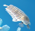
Aegirocassis.png 387 × 224; 160 KB
-
Black Warrior Basin.png 893 × 722; 336 KB
-
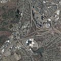
Braintree split 2019 MassGIS.jpg 20,000 × 20,000; 88.59 MB
-
Cambropachycope2.png 156 × 121; 29 KB
-
Dinomischus.png 119 × 156; 48 KB
-
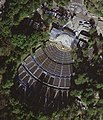
Hollywood Bowl USGS (cropped).jpg 288 × 384; 118 KB
-
Hollywood Bowl USGS 2010.jpg 480 × 640; 383 KB
-
Hollywood Bowl USGS.jpg 684 × 800; 461 KB
-
Map of ANSS free-field seismic stations across the U.S. in 2016.jpg 1,040 × 794; 85 KB
-
Metaspriggina2.png 281 × 179; 53 KB
-
Mount Cameroon and Bioko montane forests, satellite view.jpg 537 × 417; 86 KB
-
PAGER report example.jpg 630 × 809; 260 KB
-
Sanctacaris2.png 121 × 108; 21 KB
-
SLF in 1999.png 440 × 394; 323 KB
-
Spectacle Island USGS 2013-04-15.jpg 3,750 × 5,000; 31.49 MB
-
Tsunami run-up, height, and inundation.png 415 × 159; 65 KB
-
TTT Cambrian (2).png 1,458 × 1,024; 1.57 MB
-
TTT Carboniferous (3).png 1,571 × 1,020; 1.8 MB
-
TTT Cretaceous (2).png 1,444 × 1,017; 1.86 MB
-
TTT Devonian (2).png 1,389 × 1,008; 1.73 MB
-
TTT Eocene (2).png 1,345 × 1,026; 1.65 MB
-
TTT Jurassic (2).png 1,354 × 1,075; 2.2 MB
-
TTT Miocene (2).png 1,434 × 1,028; 2.25 MB
-
TTT Oligocene (2).png 1,397 × 1,016; 1.83 MB
-
TTT Ordovician (2).png 1,472 × 999; 1.44 MB
-
TTT Paleocene (2).png 1,552 × 938; 2.12 MB
-
TTT Permian (2).png 1,391 × 992; 2.08 MB
-
TTT Pleistocene (2).png 1,437 × 986; 1.84 MB
-
TTT Pliocene (2).png 1,350 × 995; 1.76 MB
-
TTT Silurian (2).png 1,330 × 1,045; 1.67 MB
-
TTT Triassic (2).png 1,374 × 1,023; 1.78 MB
-
USGS employee prepares unmanned aerial vehicle for takeoff.jpg 4,000 × 6,000; 4.63 MB
-
USGS HRO 08Jan2004 34d06m46.97sN 118d20m20.64sW.jpg 5,000 × 5,000; 20.64 MB
-
USGS HRO 16Dec2010 34d06m41.305sN 118d20m10.560sW.jpg 2,640 × 2,640; 7.32 MB
-
USGS scientists collect data from the surfaced Ecomapper AUV.jpg 1,100 × 733; 267 KB
-
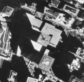
WTC in 1997.png 458 × 451; 401 KB


