Category:Images by Texas Radio and The Big Beat
Jump to navigation
Jump to search

Media in category "Images by Texas Radio and The Big Beat"
The following 200 files are in this category, out of 279 total.
(previous page) (next page)-
 "The Shopper" by Bill Scott - geograph.org.uk - 1602648.jpg 401 × 640; 73 KB
-
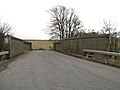
 18th Century Bridge at Castlecary - geograph.org.uk - 1617280.jpg 640 × 446; 105 KB
-
 A73 at Riggend - geograph.org.uk - 1625356.jpg 640 × 480; 86 KB
-
 A80 at Castlecary - geograph.org.uk - 1747802.jpg 968 × 648; 115 KB
-
 Abronhill Peat Bog - geograph.org.uk - 1625248.jpg 640 × 360; 69 KB
-
 Airdriehill Farm - geograph.org.uk - 1800895.jpg 1,159 × 775; 270 KB
-
 Allandale - geograph.org.uk - 1727689.jpg 1,024 × 685; 136 KB
-
 Almost There - geograph.org.uk - 1604568.jpg 640 × 480; 62 KB
-
 Annathill Village - geograph.org.uk - 1742763.jpg 968 × 648; 166 KB
-
 Approaching Easter Fannyside Farm - geograph.org.uk - 1750628.jpg 968 × 648; 219 KB
-
 Approaching Glenboig - geograph.org.uk - 1803112.jpg 1,239 × 824; 193 KB
-
 Approaching Meadowhead - geograph.org.uk - 1801028.jpg 952 × 737; 224 KB
-
 Arniebog Farmhouse (ruin) (geograph 2081939).jpg 1,448 × 968; 554 KB
-
 Auld Man's Rest - geograph.org.uk - 1717987.jpg 768 × 576; 212 KB
-
 Auldshields Bridge - geograph.org.uk - 1746146.jpg 845 × 634; 197 KB
-
 Balcastle Road - geograph.org.uk - 1627006.jpg 640 × 480; 102 KB
-
 Bedlay Colliery Landscape Restoration Project (geograph 1796565).jpg 1,159 × 775; 205 KB
-
 Bell Street - geograph.org.uk - 1611333.jpg 640 × 525; 97 KB
-

-
 Birkenshaw Road - geograph.org.uk - 1800931.jpg 968 × 966; 264 KB
-
 Bog Bridge and Toddle Knowe - geograph.org.uk - 1591213.jpg 640 × 360; 61 KB
-
 Bog Cottage (ruin) - geograph.org.uk - 1767162.jpg 778 × 584; 108 KB
-
 Bog Cottage (ruin) - geograph.org.uk - 1767168.jpg 778 × 584; 124 KB
-
 Bog Stank - geograph.org.uk - 1617326.jpg 640 × 480; 136 KB
-
 Branch of Palacerigg Railway - geograph.org.uk - 1571592.jpg 640 × 480; 127 KB
-
 Bridge at Cumbernauld Train Station - geograph.org.uk - 1600504.jpg 640 × 360; 69 KB
-
 Bridge in Vault Glen - geograph.org.uk - 1598083.jpg 640 × 480; 140 KB
-
 Bridge on B803 - geograph.org.uk - 1591269.jpg 640 × 360; 84 KB
-
 Bridge on Wyndford Road - geograph.org.uk - 1767193.jpg 778 × 584; 118 KB
-
 Bridge on Wyndford Road - geograph.org.uk - 1767208.jpg 778 × 584; 116 KB
-
 Bridge Over Bog Stank - geograph.org.uk - 1617335.jpg 640 × 480; 148 KB
-
 Bridge Over Bog Stank - geograph.org.uk - 1617351.jpg 640 × 417; 107 KB
-
 Bridge Over Cameron Burn at Glenhove - geograph.org.uk - 1598018.jpg 640 × 360; 73 KB
-
 Bridge Over The Garbethill Burn - geograph.org.uk - 1762419.jpg 968 × 648; 139 KB
-
 Broomhill Hospital (derelict) (geograph 1786456).jpg 851 × 578; 128 KB
-
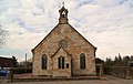
 Burns Church (derelict) - geograph.org.uk - 1706739.jpg 1,024 × 768; 167 KB
-
 Cameron Burn at Glenhove - geograph.org.uk - 1598009.jpg 640 × 360; 90 KB
-
 Castlecary Memorial Garden - geograph.org.uk - 1617300.jpg 640 × 332; 41 KB
-
 Castlecary Viaduct - geograph.org.uk - 1742750.jpg 1,044 × 629; 162 KB
-
 Central Station, Gordon Street - geograph.org.uk - 1611244.jpg 640 × 470; 82 KB
-
 Clarky Ballantyne's Garage - geograph.org.uk - 1600465.jpg 640 × 427; 53 KB
-
 Clayknowes Farm (ruin) (geograph 1883929).jpg 975 × 670; 195 KB
-

-

-

-

-
 Cochrane's Nursery - geograph.org.uk - 1600471.jpg 640 × 360; 70 KB
-
 Colzium House - geograph.org.uk - 1584187.jpg 640 × 480; 90 KB
-
 Concrete Sculpture - geograph.org.uk - 1602630.jpg 626 × 523; 116 KB
-
 Condorrat Arms and Main Road Shops - geograph.org.uk - 1742816.jpg 1,024 × 641; 113 KB
-
 Condorrat Library - geograph.org.uk - 1748270.jpg 968 × 648; 110 KB
-
 Condorrat Parish Church - geograph.org.uk - 1748134.jpg 1,076 × 685; 172 KB
-

-
 Craigmarloch Stables - geograph.org.uk - 1497319.jpg 640 × 399; 86 KB
-
 Crossrigg Wood - geograph.org.uk - 1806285.jpg 980 × 735; 213 KB
-
 Culloch Burn, Slamannan - geograph.org.uk - 1613474.jpg 640 × 480; 138 KB
-
 Culverted Burn at Hirst - geograph.org.uk - 1765934.jpg 778 × 584; 238 KB
-

-
 Cumbernauld House - Stables Area - geograph.org.uk - 1591539.jpg 640 × 427; 70 KB
-
 Cumbernauld House - West Pavilions - geograph.org.uk - 1591441.jpg 640 × 342; 50 KB
-
 Cumbernauld House and Grounds - geograph.org.uk - 1598172.jpg 640 × 360; 50 KB
-
 Dalmacoulter Reservoir - geograph.org.uk - 1802701.jpg 960 × 720; 195 KB
-
 Dalshannon Farm Restaurant (unoccupied) - geograph.org.uk - 1748110.jpg 968 × 648; 126 KB
-
 Darngavil Road - geograph.org.uk - 1804620.jpg 1,024 × 768; 100 KB
-
 Derelict Church, Longriggend - geograph.org.uk - 1611452.jpg 640 × 480; 70 KB
-

-
 Derelict House, Motherwell Street - geograph.org.uk - 1692402.jpg 768 × 576; 170 KB
-

-
 Dismantled Railway at Ryding - geograph.org.uk - 1625230.jpg 640 × 480; 126 KB
-
 Dismantled Railway by Rigghead - geograph.org.uk - 1613441.jpg 640 × 418; 62 KB
-
 Dismantled Railway near Langdales - geograph.org.uk - 1772935.jpg 768 × 576; 129 KB
-
 Dismantled Railway near Langdales - geograph.org.uk - 1772979.jpg 768 × 576; 99 KB
-
 Disused Entrance - geograph.org.uk - 1591574.jpg 640 × 427; 113 KB
-
 Disused Railway Platform at Ryding - geograph.org.uk - 1625342.jpg 640 × 480; 137 KB
-
 Dovecote - geograph.org.uk - 1604586.jpg 640 × 480; 100 KB
-
 Dovecote near Cumbernauld House - geograph.org.uk - 1597970.jpg 640 × 360; 86 KB
-
 Dullatur Colliery Building - geograph.org.uk - 1763448.jpg 1,046 × 700; 177 KB
-
 Dullatur Colliery Building - geograph.org.uk - 1763461.jpg 778 × 584; 80 KB
-
 Dullatur Marsh - geograph.org.uk - 1763514.jpg 908 × 681; 133 KB
-
 Dunmore Park House (geograph 4234099).jpg 1,600 × 1,200; 517 KB
-
 Dunmore Park House (geograph 4234103).jpg 1,600 × 1,270; 514 KB
-
 Dykehead Road - geograph.org.uk - 1750675.jpg 903 × 606; 150 KB
-
 Easter Fannyside Cottages (ruin) - geograph.org.uk - 1750650.jpg 865 × 579; 182 KB
-
 Elphistone Tower (geograph 4232300).jpg 1,600 × 1,185; 670 KB
-
 Entrance to Glenhove Plantation - geograph.org.uk - 1597979.jpg 640 × 360; 88 KB
-
 Entrance to Greengairs Landfill Site - geograph.org.uk - 1750658.jpg 778 × 584; 73 KB
-
 Falkirk Old Parish Church.jpg 986 × 740; 142 KB
-
 Fannyside Loch - geograph.org.uk - 1532017.jpg 640 × 333; 49 KB
-
 Fannyside Mill - geograph.org.uk - 1553242.jpg 640 × 462; 62 KB
-
 Fannyside Muir - geograph.org.uk - 1544672.jpg 640 × 453; 49 KB
-
 Fannyside Road (looking northwest) - geograph.org.uk - 1598157.jpg 640 × 360; 37 KB
-
 Fannyside Toll House - geograph.org.uk - 1597997.jpg 640 × 360; 39 KB
-
 Farm Track by Netherwood - geograph.org.uk - 1763545.jpg 1,037 × 778; 163 KB
-
 Farm Track Near Ryding - geograph.org.uk - 1625240.jpg 640 × 480; 95 KB
-
 Flowerhill Parish Church - geograph.org.uk - 1722656.jpg 908 × 681; 134 KB
-
 Footbridge to Greenfaulds - geograph.org.uk - 1773373.jpg 768 × 576; 111 KB
-
 Forbes Mausoleum (inscription above doorway) (geograph 2765360).jpg 800 × 325; 72 KB
-
 Forbes Mausoleum by Callendar House (geograph 2765355).jpg 600 × 800; 202 KB
-
 Forrestfield Road - geograph.org.uk - 1806557.jpg 1,139 × 832; 175 KB
-

-
 From Bog Bridge Looking East - geograph.org.uk - 1591226.jpg 640 × 360; 46 KB
-
 From Bog Bridge Looking West - geograph.org.uk - 1591218.jpg 640 × 360; 60 KB
-
 Garbet Farm (ruin) - geograph.org.uk - 1613763.jpg 640 × 480; 79 KB
-
 Glenboig Village Park (geograph 1822152).jpg 1,162 × 778; 263 KB
-
 Glencryan Burn in Vault Glen - geograph.org.uk - 1598089.jpg 640 × 480; 135 KB
-
 Glenhead Farm - geograph.org.uk - 1754558.jpg 778 × 584; 78 KB
-
 Glenhead Woodland Walk - geograph.org.uk - 1754569.jpg 778 × 584; 84 KB
-
 Glenmavis (shops) - geograph.org.uk - 1729070.jpg 887 × 534; 147 KB
-
 Glenvale Cottage (ruin) near Fannyside - geograph.org.uk - 1530135.jpg 640 × 480; 112 KB
-
-
 Greenfaulds Railway Station (geograph 2497341).jpg 1,600 × 1,096; 534 KB
-
 Greenhill Junction Box (geograph 1884890).jpg 966 × 717; 136 KB
-
 Haddington Sheriff Court (geograph 3774105).jpg 1,024 × 677; 177 KB
-
 High Bonnybridge Baptist Church (unoccupied) (geograph 1930908).jpg 1,024 × 768; 182 KB
-
 High Parish Church - geograph.org.uk - 1729053.jpg 813 × 532; 89 KB
-
 High Street - geograph.org.uk - 1746402.jpg 968 × 648; 126 KB
-
 Hirst (ruin) - geograph.org.uk - 1765900.jpg 778 × 584; 162 KB
-
 Hirst (ruin) - geograph.org.uk - 1765914.jpg 778 × 584; 150 KB
-
 Hirst House (ruin) - geograph.org.uk - 1767103.jpg 778 × 584; 170 KB
-
 Hirst House (ruin) - geograph.org.uk - 1767108.jpg 845 × 645; 168 KB
-
 Hirst House (ruin) - geograph.org.uk - 1767117.jpg 778 × 584; 225 KB
-
 Holehills and Beyond - geograph.org.uk - 1602569.jpg 640 × 480; 58 KB
-
 Holehills and Beyond - geograph.org.uk - 1602584.jpg 640 × 480; 60 KB
-
 Holehills and Beyond - geograph.org.uk - 1602605.jpg 640 × 480; 56 KB
-
 Holytown - geograph.org.uk - 1745138.jpg 845 × 634; 128 KB
-
 Hulks Road - geograph.org.uk - 1804676.jpg 1,024 × 768; 163 KB
-
 Ice House - geograph.org.uk - 1613576.jpg 640 × 480; 166 KB
-
 Ice House Stairway - geograph.org.uk - 1613590.jpg 640 × 480; 154 KB
-
 Jawcraig Brickworks - geograph.org.uk - 1746360.jpg 968 × 648; 129 KB
-
 Jawhills Farm (ruin) - geograph.org.uk - 1762045.jpg 931 × 613; 255 KB
-
 Jawhills Farm (ruin) - geograph.org.uk - 1762059.jpg 992 × 630; 182 KB
-
 Jawhills Farm (ruin) - geograph.org.uk - 1762070.jpg 918 × 600; 202 KB
-
 Jawhills Farm (ruin) - geograph.org.uk - 1762350.jpg 860 × 576; 223 KB
-
 John Baird's House - geograph.org.uk - 1748148.jpg 847 × 592; 123 KB
-
 Kelvinhead Jetty (ruin) - geograph.org.uk - 1764053.jpg 876 × 697; 213 KB
-
 Kilsyth Burns and Old Parish Church - geograph.org.uk - 1718181.jpg 768 × 576; 151 KB
-
 Kilsyth Burns and Old Parish Church - geograph.org.uk - 1718187.jpg 576 × 768; 106 KB
-
 Kilsyth Castle (ruin) - geograph.org.uk - 1613621.jpg 640 × 360; 109 KB
-
 Kilsyth Methodist Church - geograph.org.uk - 1718202.jpg 768 × 576; 100 KB
-
 Kilt Hire Shop, Holytown - geograph.org.uk - 1744831.jpg 845 × 634; 91 KB
-
 Lennox Castle Hospital (ruin) (geograph 2509703).jpg 1,024 × 768; 219 KB
-
 Lenziemill Farm (remains) - geograph.org.uk - 1656678.jpg 640 × 480; 84 KB
-
 Limekilns Farm (ruin) - geograph.org.uk - 1743088.jpg 816 × 612; 196 KB
-
 Limekilns Pond near Palacerigg - geograph.org.uk - 1571539.jpg 640 × 480; 131 KB
-
 Longrigg Woodland - geograph.org.uk - 1746352.jpg 968 × 648; 109 KB
-
 Longriggend Road - geograph.org.uk - 1746347.jpg 968 × 648; 117 KB
-
 Looking East from Bridge 14 - geograph.org.uk - 1740547.jpg 968 × 648; 129 KB
-
 Looking East from Forrestfield Road - geograph.org.uk - 1806358.jpg 1,024 × 768; 132 KB
-
 Looking North from Allandale - geograph.org.uk - 1747789.jpg 960 × 640; 143 KB
-
 Looking North from Bridge 14 - geograph.org.uk - 1740538.jpg 968 × 648; 133 KB
-
 Looking North From Bridge on B803 - geograph.org.uk - 1591312.jpg 640 × 360; 52 KB
-
 Looking North from Wilderness Brae - geograph.org.uk - 1762453.jpg 968 × 648; 121 KB
-
 Looking northeast from Drumriggend Road - geograph.org.uk - 1746338.jpg 968 × 648; 126 KB
-
 Looking northeast from track to Lennox Castle (geograph 2509663).jpg 1,024 × 768; 149 KB
-
 Low Cruix School - geograph.org.uk - 1600491.jpg 640 × 360; 48 KB
-

-

-
 Main Road, Condorrat - geograph.org.uk - 1748096.jpg 968 × 648; 119 KB
-
 Market Street - geograph.org.uk - 1718019.jpg 768 × 576; 92 KB
-
 Masonfield Farm (ruin) - geograph.org.uk - 1746372.jpg 968 × 648; 142 KB
-
 Masonfield Farm (ruin) - geograph.org.uk - 1746382.jpg 968 × 648; 214 KB
-
 Meikle Drumgray Road - geograph.org.uk - 1772987.jpg 768 × 576; 97 KB
-
 Milepost, Kilsyth - geograph.org.uk - 1493050.jpg 640 × 480; 93 KB
-
 Moss Road, Abronhill - geograph.org.uk - 1657022.jpg 640 × 480; 53 KB
-
 Moss Road, Abronhill - geograph.org.uk - 1657033.jpg 640 × 480; 59 KB
-
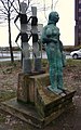
 Mother and Child Statue - geograph.org.uk - 1602661.jpg 528 × 519; 90 KB
-
 Motte (Balcastle) - geograph.org.uk - 1626912.jpg 640 × 384; 54 KB
-
 Neglected Mosaic - geograph.org.uk - 1612306.jpg 640 × 389; 70 KB
-
 Netherwood Basin - geograph.org.uk - 1763535.jpg 1,021 × 754; 162 KB
-
 Netherwood Basin - geograph.org.uk - 1763818.jpg 887 × 674; 142 KB
-
 Netherwood Cottage (ruin) - geograph.org.uk - 1767143.jpg 778 × 584; 99 KB
-
 Netherwood Cottage (ruin) - geograph.org.uk - 1767147.jpg 828 × 565; 136 KB
-
 Netherwood Farm - geograph.org.uk - 1742695.jpg 1,014 × 504; 105 KB
-
 New Footbridge - geograph.org.uk - 1806385.jpg 881 × 630; 138 KB
-
 New Housing Development, Greengairs - geograph.org.uk - 1803887.jpg 1,337 × 773; 292 KB
-
 Newhouse Station - geograph.org.uk - 1744813.jpg 845 × 634; 135 KB
-
 Newhouse Station Bridge - geograph.org.uk - 1744771.jpg 845 × 634; 162 KB
-
 Newhouse Station Bridge - geograph.org.uk - 1744802.jpg 845 × 634; 111 KB
-
 Newhouse Station Platform - geograph.org.uk - 1744824.jpg 845 × 634; 157 KB
-
 Old Coal Pit near Fannyside - geograph.org.uk - 1530150.jpg 640 × 303; 54 KB
-
 Old Entrance - geograph.org.uk - 1742789.jpg 1,600 × 1,071; 523 KB
-
 Old Entrance on the B803 - geograph.org.uk - 1746450.jpg 968 × 648; 319 KB
-
 Old Entrance to Vault Glen - geograph.org.uk - 1598038.jpg 640 × 360; 105 KB
-
 Old Farm Building at Glenhove - geograph.org.uk - 1598027.jpg 640 × 360; 86 KB
-
 Old Flax Kiln - geograph.org.uk - 1746316.jpg 968 × 648; 254 KB
-
 Old Industrial Units, Lenziemill - geograph.org.uk - 1656751.jpg 640 × 480; 83 KB
-
 Old Limekiln (near Arns Farm) - geograph.org.uk - 1538977.jpg 640 × 480; 87 KB
-
 Old Nunnery, Low Craigends - geograph.org.uk - 1719554.jpg 845 × 634; 88 KB
-
 Old Parish Road - geograph.org.uk - 1763481.jpg 778 × 584; 136 KB
-
 Old Post Office - geograph.org.uk - 1729087.jpg 773 × 520; 97 KB
-
 Old Shields Farmhouse - geograph.org.uk - 1754555.jpg 778 × 584; 85 KB
-
 Old Smiddy, Fannyside Road - geograph.org.uk - 1804725.jpg 966 × 661; 150 KB
-
 Opencast Mine - geograph.org.uk - 1804643.jpg 1,024 × 768; 190 KB
-
 Palacerigg Railway - geograph.org.uk - 1492301.jpg 640 × 480; 93 KB
-
 Path Through Vault Glen - geograph.org.uk - 1600579.jpg 640 × 480; 138 KB
-
 Path Through West End Park - geograph.org.uk - 1600603.jpg 640 × 480; 130 KB
-
 Queen Street Station - geograph.org.uk - 1611299.jpg 640 × 510; 74 KB
-
 Railway Bridge at Garngibboch - geograph.org.uk - 1656983.jpg 640 × 480; 107 KB
-
 Railway Bridge at Ryding - geograph.org.uk - 1625227.jpg 640 × 480; 110 KB
-
 Railway Bridge on Old Parish Road - geograph.org.uk - 1763581.jpg 968 × 648; 232 KB


_(geograph_2081939).jpg)


.jpg)


_-_geograph.org.uk_-_1767162.jpg)
_-_geograph.org.uk_-_1767168.jpg)


_(geograph_1786456).jpg)
_-_geograph.org.uk_-_1706739.jpg)


_(geograph_1883929).jpg)
_-_geograph.org.uk_-_1719529.jpg)
_-_geograph.org.uk_-_1719594.jpg)


_-_geograph.org.uk_-_1748110.jpg)


.jpg)
.jpg)

_-_geograph.org.uk_-_1750650.jpg)
.jpg)


_-_geograph.org.uk_-_1598157.jpg)


.jpg)

_-_geograph.org.uk_-_1553459.jpg)


_-_geograph.org.uk_-_1613763.jpg)
.jpg)


_-_geograph.org.uk_-_1729070.jpg)
_near_Fannyside_-_geograph.org.uk_-_1530135.jpg)

.jpg)
.jpg)
.jpg)
_(geograph_1930908).jpg)


_-_geograph.org.uk_-_1765900.jpg)
_-_geograph.org.uk_-_1765914.jpg)
_-_geograph.org.uk_-_1767103.jpg)
_-_geograph.org.uk_-_1767108.jpg)
_-_geograph.org.uk_-_1767117.jpg)


_-_geograph.org.uk_-_1762045.jpg)
_-_geograph.org.uk_-_1762059.jpg)
_-_geograph.org.uk_-_1762070.jpg)
_-_geograph.org.uk_-_1762350.jpg)

_-_geograph.org.uk_-_1764053.jpg)


_-_geograph.org.uk_-_1613621.jpg)


_(geograph_2509703).jpg)
_-_geograph.org.uk_-_1656678.jpg)
_-_geograph.org.uk_-_1743088.jpg)


.jpg)


_-_geograph.org.uk_-_1746372.jpg)
_-_geograph.org.uk_-_1746382.jpg)


_-_geograph.org.uk_-_1626912.jpg)


_-_geograph.org.uk_-_1767143.jpg)
_-_geograph.org.uk_-_1767147.jpg)


_-_geograph.org.uk_-_1538977.jpg)


_(geograph_2765360).jpg)