Category:Images by Malcolm Street
Jump to navigation
Jump to search

Media in category "Images by Malcolm Street"
The following 200 files are in this category, out of 407 total.
(previous page) (next page)-

-
 A quiet road to Kettlesing - geograph.org.uk - 68154.jpg 640 × 480; 99 KB
-

-
 A winter's day walk in the forest - geograph.org.uk - 72998.jpg 625 × 640; 171 KB
-
 A59 on Kexgill Moor - geograph.org.uk - 91792.jpg 640 × 480; 93 KB
-
 A65 just north of Addingham - geograph.org.uk - 71315.jpg 640 × 480; 110 KB
-
 Addingham Methodist Church - geograph.org.uk - 71320.jpg 640 × 480; 88 KB
-
 All Saints Parish Church of Roberttown - geograph.org.uk - 54946.jpg 640 × 480; 118 KB
-
 Allenheads Mine (disused) - geograph.org.uk - 71431.jpg 640 × 457; 71 KB
-
 Amberton Road - more semi-detached houses - geograph.org.uk - 77550.jpg 640 × 480; 105 KB
-
 An Old Overgrown Lane - geograph.org.uk - 81192.jpg 480 × 640; 134 KB
-
 Appletreewick - geograph.org.uk - 81119.jpg 640 × 480; 149 KB
-
 Approaching Addingham - geograph.org.uk - 71311.jpg 640 × 480; 123 KB
-
 Area of old coal workings - geograph.org.uk - 54292.jpg 640 × 480; 63 KB
-
 Ashfoldside - geograph.org.uk - 51415.jpg 640 × 480; 92 KB
-
 Ashfoldside Beck - geograph.org.uk - 51441.jpg 640 × 480; 84 KB
-
 Backbarrow Ironworks - geograph.org.uk - 74891.jpg 640 × 433; 75 KB
-
 Bacup Town Centre - geograph.org.uk - 81838.jpg 640 × 480; 107 KB
-
 Baitings and Baitings Pasture - geograph.org.uk - 52840.jpg 640 × 480; 94 KB
-
 Bellerby Moor - geograph.org.uk - 70403.jpg 640 × 480; 119 KB
-
 Ben Royd Terrace, Jagger Green - geograph.org.uk - 52837.jpg 640 × 480; 134 KB
-
 Beware^ Lots of obstacles - geograph.org.uk - 71330.jpg 640 × 480; 162 KB
-
 Birkenshaw Roundabout - geograph.org.uk - 54666.jpg 640 × 480; 88 KB
-
 Birstwith Post Office and General Store - geograph.org.uk - 68165.jpg 640 × 480; 116 KB
-
 Black Burn - geograph.org.uk - 73011.jpg 640 × 432; 131 KB
-
 Blackwood Common, Rishworth - geograph.org.uk - 52843.jpg 640 × 480; 87 KB
-
 Booth Wood Reservoir - geograph.org.uk - 52157.jpg 640 × 480; 99 KB
-
 Bridge - geograph.org.uk - 63090.jpg 640 × 480; 103 KB
-
 Brimham Rocks, Nidderdale - geograph.org.uk - 51391.jpg 640 × 480; 119 KB
-
 Britannia Mills - geograph.org.uk - 81857.jpg 640 × 480; 86 KB
-
 Brooks Hill, Silsden - geograph.org.uk - 81088.jpg 640 × 480; 80 KB
-
 Brow Chapel, Thornthwaite - geograph.org.uk - 56611.jpg 640 × 480; 100 KB
-
 Buckstones Edge - geograph.org.uk - 52554.jpg 640 × 480; 111 KB
-
 Bus Shelter in Hampsthwaite - geograph.org.uk - 68168.jpg 640 × 480; 111 KB
-
 Cantilever Footpath - geograph.org.uk - 52185.jpg 480 × 640; 120 KB
-
 Cash Burn, Rotherhope Fell - geograph.org.uk - 73040.jpg 640 × 386; 84 KB
-
 Cefncoch Gold Mine - geograph.org.uk - 74911.jpg 432 × 640; 108 KB
-
 Chatterley Whitfield Colliery - geograph.org.uk - 53144.jpg 480 × 640; 91 KB
-
 Chimney - geograph.org.uk - 81864.jpg 480 × 640; 71 KB
-
 Clarion House - geograph.org.uk - 54003.jpg 640 × 480; 73 KB
-
 Old Church, Clifton, Penrith - geograph.org.uk - 81249.jpg 640 × 480; 100 KB
-
 Clifton Methodist Church - geograph.org.uk - 54919.jpg 480 × 640; 94 KB
-
 Close up of the statue - geograph.org.uk - 77530.jpg 561 × 640; 65 KB
-
 Clough Foot - geograph.org.uk - 53976.jpg 640 × 480; 123 KB
-
 Coastal Defence Bunker - geograph.org.uk - 53868.jpg 640 × 480; 114 KB
-
 Coldstones Quarry, Greenhow Hill - geograph.org.uk - 51402.jpg 640 × 480; 84 KB
-

-
 Craven Cross Mine, Greenhow - geograph.org.uk - 91829.jpg 640 × 480; 70 KB
-
 Craven Cross, Greenhow - geograph.org.uk - 73407.jpg 640 × 437; 77 KB
-
 Craven Moor, Greenhow - geograph.org.uk - 91831.jpg 640 × 480; 130 KB
-
 Cyffty Lead Mine, Main Shaft - geograph.org.uk - 74879.jpg 440 × 640; 126 KB
-
 Spire House, near Greystoke - geograph.org.uk - 81224.jpg 640 × 480; 65 KB
-
 Dacre Banks - geograph.org.uk - 64962.jpg 640 × 480; 112 KB
-
 Dacre Banks Sports Club - geograph.org.uk - 64963.jpg 640 × 480; 94 KB
-
 Dales Farm - geograph.org.uk - 81767.jpg 640 × 480; 92 KB
-
 Darley Mill Centre - geograph.org.uk - 53859.jpg 640 × 480; 89 KB
-
 Daw Mill Colliery Shafts - geograph.org.uk - 53139.jpg 640 × 480; 78 KB
-
 Diglake Street, Audley - geograph.org.uk - 65270.jpg 640 × 506; 94 KB
-
 Draycot Hall, Low Fremington - geograph.org.uk - 70382.jpg 640 × 480; 149 KB
-
 Dusty Miller Restaurant, Low Laithe - geograph.org.uk - 64966.jpg 640 × 480; 128 KB
-
 Ease Gill - geograph.org.uk - 73697.jpg 640 × 440; 104 KB
-
 Easterly Road, Oakwood, Leeds - geograph.org.uk - 77544.jpg 640 × 480; 128 KB
-
 Ellerton Moor - geograph.org.uk - 70400.jpg 480 × 640; 72 KB
-
 Farmland - geograph.org.uk - 71343.jpg 640 × 480; 93 KB
-
 Felliscliffe Chapel of Ease - geograph.org.uk - 68156.jpg 640 × 480; 94 KB
-
 Fewston Church - geograph.org.uk - 53857.jpg 640 × 480; 108 KB
-
 Fields and Field Barns - geograph.org.uk - 73053.jpg 640 × 425; 79 KB
-
 Fire Brigade Monument - geograph.org.uk - 54665.jpg 480 × 640; 159 KB
-
 Firth House Mills - geograph.org.uk - 52501.jpg 480 × 640; 113 KB
-
 Firth House Mills - geograph.org.uk - 52504.jpg 640 × 480; 102 KB
-
 Flamborough Head - geograph.org.uk - 53865.jpg 640 × 480; 101 KB
-
 Fleensop - geograph.org.uk - 713007.jpg 640 × 480; 101 KB
-
 Fleensop Colliery - geograph.org.uk - 713014.jpg 640 × 480; 89 KB
-
 Float Bridge Farm - geograph.org.uk - 54001.jpg 640 × 480; 76 KB
-
 Flying Dutchman, Summerbridge - geograph.org.uk - 64965.jpg 640 × 480; 121 KB
-
 Forest Road - geograph.org.uk - 91845.jpg 640 × 480; 106 KB
-
 Fort Putnam, Greystoke - geograph.org.uk - 81221.jpg 640 × 480; 89 KB
-
 Fremington Sunday School - geograph.org.uk - 70379.jpg 640 × 480; 78 KB
-
 Gascoigne Wood Mine - geograph.org.uk - 71386.jpg 640 × 427; 65 KB
-
 Gledhow Valley Lake - geograph.org.uk - 73472.jpg 640 × 437; 97 KB
-
 Gledhow Valley Road, near Chapel Allerton - geograph.org.uk - 77555.jpg 640 × 480; 176 KB
-
 Gorple Gate Track, Widdop - geograph.org.uk - 53982.jpg 640 × 480; 95 KB
-
 Gouthwaite Reservoir - geograph.org.uk - 76678.jpg 640 × 480; 92 KB
-
 Greenhow Hill at Toft Gate - geograph.org.uk - 51396.jpg 640 × 480; 73 KB
-
 Greenhow Hill Top - geograph.org.uk - 50244.jpg 640 × 480; 58 KB
-
 Greenhow Village - geograph.org.uk - 50251.jpg 640 × 480; 79 KB
-
 Greystoke Church - geograph.org.uk - 81205.jpg 640 × 480; 81 KB
-
 Grove Rake Mine, Rookhope - geograph.org.uk - 53122.jpg 640 × 480; 96 KB
-
 Gwynfynydd Gold Mine - geograph.org.uk - 74826.jpg 434 × 640; 112 KB
-
 Hampsthwaite Bridge - geograph.org.uk - 68167.jpg 640 × 480; 91 KB
-
 Hampsthwaite Church - geograph.org.uk - 68166.jpg 640 × 480; 104 KB
-
 Hartshead - geograph.org.uk - 54941.jpg 640 × 480; 72 KB
-
 Hartshead Parish Church - geograph.org.uk - 54923.jpg 640 × 480; 91 KB
-
 Heathfield - geograph.org.uk - 76666.jpg 640 × 480; 86 KB
-
 Herding cows near Thoralby - geograph.org.uk - 65328.jpg 640 × 480; 137 KB
-
 Heyshaw - geograph.org.uk - 56630.jpg 640 × 480; 127 KB
-
 High Bishopside Moor - geograph.org.uk - 76724.jpg 640 × 480; 99 KB
-
 High House Farm, Colsterdale - geograph.org.uk - 73452.jpg 640 × 430; 136 KB
-
 High Mill, Addingham - geograph.org.uk - 91815.jpg 640 × 480; 116 KB
-
 Parish Church of Hightown - geograph.org.uk - 54929.jpg 640 × 480; 101 KB
-
 Hopewell Level (Lead) - geograph.org.uk - 74923.jpg 640 × 420; 115 KB
-
 House on Ladies Riggs Road - geograph.org.uk - 51419.jpg 640 × 480; 116 KB
-
 Interesting Gravestone - geograph.org.uk - 53183.jpg 480 × 640; 83 KB
-
 Jewish Cemetery, near Gildersome - geograph.org.uk - 77528.jpg 640 × 480; 105 KB
-
 Kentmere mine.jpg 640 × 434; 126 KB
-
 Killhope Lead Mining Museum - geograph.org.uk - 71427.jpg 640 × 399; 86 KB
-
 Klondyke Lead Mine - geograph.org.uk - 74887.jpg 437 × 640; 125 KB
-
 Krumlin Village - geograph.org.uk - 52168.jpg 640 × 480; 135 KB
-
 Lancashire Defence^ - geograph.org.uk - 53994.jpg 640 × 480; 73 KB
-
 Lane and woods - geograph.org.uk - 81061.jpg 640 × 480; 129 KB
-
 Parish Church of St Aiden - geograph.org.uk - 77541.jpg 480 × 640; 76 KB
-
 Leeming - Old Graveyard - geograph.org.uk - 59437.jpg 640 × 480; 111 KB
-
 Lily Green, Greenhow - geograph.org.uk - 91825.jpg 640 × 480; 127 KB
-
 Line of Semis on Street Lane, Gildersome - geograph.org.uk - 77525.jpg 640 × 480; 126 KB
-
 Liversedge Cemetery - geograph.org.uk - 54932.jpg 640 × 480; 125 KB
-
 Llanrwst Lead Mine Chimney - geograph.org.uk - 74883.jpg 428 × 637; 41 KB
-
-
 Llyn Y Parc - geograph.org.uk - 74854.jpg 640 × 438; 116 KB
-
 Loch Achray - geograph.org.uk - 54293.jpg 640 × 480; 60 KB
-
 Lochranza - geograph.org.uk - 74849.jpg 640 × 412; 71 KB
-
 Lovely Countryside - geograph.org.uk - 56578.jpg 640 × 480; 146 KB
-
 Low Stoney Grooves Engine House - geograph.org.uk - 73431.jpg 640 × 434; 69 KB
-
 Lower Fold and Slack Farm - geograph.org.uk - 59430.jpg 640 × 480; 120 KB
-
 Lower Laithe Reservoir - geograph.org.uk - 64968.jpg 640 × 480; 79 KB
-
 M62 Motorway - geograph.org.uk - 52159.jpg 480 × 640; 97 KB
-
 M621 Motorway - geograph.org.uk - 77527.jpg 640 × 480; 89 KB
-
 Marchup Heights - geograph.org.uk - 81093.jpg 640 × 480; 94 KB
-
 Milestone at the side of the A59 - geograph.org.uk - 71352.jpg 640 × 480; 138 KB
-
 Mills and Railway, Cornholme - geograph.org.uk - 81752.jpg 480 × 640; 77 KB
-
 Mills on the A644 - geograph.org.uk - 54953.jpg 640 × 480; 113 KB
-
 Modern Factory, Penrith - geograph.org.uk - 81236.jpg 640 × 480; 81 KB
-
 Monument to the Low Moor Steel Works - geograph.org.uk - 54664.jpg 640 × 480; 101 KB
-
 Moor Top Junction and Cattle Grid - geograph.org.uk - 68178.jpg 640 × 480; 95 KB
-
 Motherby - geograph.org.uk - 81200.jpg 640 × 480; 137 KB
-
 Myers Garage - geograph.org.uk - 56608.jpg 640 × 480; 124 KB
-
 Near Laudale House - geograph.org.uk - 74867.jpg 640 × 438; 80 KB
-
 New Houses, Old Mill - geograph.org.uk - 81760.jpg 640 × 480; 114 KB
-
 Nont Sarah's - geograph.org.uk - 52546.jpg 640 × 480; 80 KB
-
 Old and Tatty - geograph.org.uk - 56581.jpg 480 × 640; 156 KB
-
 Old Army Tank - geograph.org.uk - 53195.jpg 640 × 480; 130 KB
-
 Old Chapel at Howgill - geograph.org.uk - 91807.jpg 480 × 640; 121 KB
-
 Old House - geograph.org.uk - 81048.jpg 640 × 480; 139 KB
-
 Old Industrial Buildings - geograph.org.uk - 77529.jpg 640 × 480; 97 KB
-
 Old Packhorse Bridge - geograph.org.uk - 56620.jpg 640 × 480; 163 KB
-
 Old Railway Bridge - geograph.org.uk - 77537.jpg 640 × 480; 109 KB
-
 Old Railway Tunnel - geograph.org.uk - 54659.jpg 640 × 480; 142 KB
-
 Old Waterwheel at Marske - geograph.org.uk - 71424.jpg 640 × 430; 125 KB
-
 Old Winding House - geograph.org.uk - 65357.jpg 640 × 454; 94 KB
-
 Oxenhope Cemetery - geograph.org.uk - 59433.jpg 640 × 480; 114 KB
-
 Padside Crossroads - geograph.org.uk - 56624.jpg 640 × 480; 130 KB
-
 Padside Green - geograph.org.uk - 56626.jpg 640 × 480; 85 KB
-
 Palleys Crags - geograph.org.uk - 51438.jpg 640 × 480; 89 KB
-

-
 Parrock Nook, Rishworth - geograph.org.uk - 52841.jpg 640 × 480; 104 KB
-
 Part of Moss Moor - geograph.org.uk - 63075.jpg 640 × 480; 66 KB
-
 Path leading to the Aberllyn Lead Mine - geograph.org.uk - 74857.jpg 640 × 435; 114 KB
-
 Peat Store - geograph.org.uk - 51857.jpg 640 × 480; 119 KB
-
 Pennine Bridleway, Deerplay Moor - geograph.org.uk - 81814.jpg 640 × 480; 97 KB
-
 Plane Trees Farm - geograph.org.uk - 56597.jpg 640 × 480; 62 KB
-
 Ponies in field behind Bullace Trees Farm - geograph.org.uk - 54938.jpg 640 × 480; 121 KB
-
 Pool in the River Dee - geograph.org.uk - 53192.jpg 640 × 480; 130 KB
-
 Prosperous Smelt Mill, Merryfield - geograph.org.uk - 51408.jpg 640 × 480; 128 KB
-
 Queens gardens newcastle under lyme.jpg 640 × 480; 168 KB
-
 RAF Menwith Hill - geograph.org.uk - 56587.jpg 640 × 480; 76 KB
-
 RAF Menwith Hill - geograph.org.uk - 64954.jpg 640 × 480; 93 KB
-
 Rapes Clough - geograph.org.uk - 53987.jpg 640 × 480; 123 KB
-
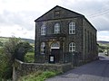
 Rehoboth Chapel (disused) - geograph.org.uk - 68162.jpg 640 × 480; 106 KB
-
 Ripponden - geograph.org.uk - 52148.jpg 640 × 480; 93 KB
-
 Rishworth Mill - geograph.org.uk - 52153.jpg 640 × 480; 94 KB
-
 Rishworth Mill - geograph.org.uk - 52155.jpg 480 × 640; 106 KB
-
 Rishworth School - geograph.org.uk - 52150.jpg 640 × 480; 140 KB
-
 Road over Pike Law - geograph.org.uk - 52163.jpg 640 × 480; 107 KB
-
 Road to Todmorden in Bacup - geograph.org.uk - 81849.jpg 640 × 480; 124 KB
-
 Rob Roy's Cave - geograph.org.uk - 73057.jpg 446 × 640; 137 KB
-
 Rookhope Church - geograph.org.uk - 65320.jpg 640 × 480; 102 KB
-
 Row of Semi's on Arlington Road - geograph.org.uk - 77548.jpg 640 × 480; 116 KB
-
 Scar Top Sunday School - geograph.org.uk - 54029.jpg 640 × 480; 92 KB
-
 Scot Gate Ash Quarries - geograph.org.uk - 76726.jpg 640 × 480; 95 KB
-
 Scot Hay Methodist Chapel - geograph.org.uk - 71384.jpg 424 × 640; 103 KB
-
 Shenton Hall - geograph.org.uk - 53175.jpg 640 × 480; 89 KB
-
 Shenton Village - geograph.org.uk - 53166.jpg 640 × 480; 125 KB
-
 Shield Water, Rotherhope Fell - geograph.org.uk - 73019.jpg 640 × 334; 134 KB
-
 Shopping Parade - geograph.org.uk - 77551.jpg 640 × 480; 97 KB
-
 Chapel, Silverdale Cemetery - geograph.org.uk - 65256.jpg 640 × 480; 119 KB
-
 Skell Gill Bridge - geograph.org.uk - 76733.jpg 640 × 480; 117 KB
-
 Skelwith Bridge Slate Works - geograph.org.uk - 65250.jpg 640 × 480; 132 KB
-
 Skipton Cemetery - geograph.org.uk - 76646.jpg 640 × 480; 139 KB
-
 Slitt Mine - geograph.org.uk - 73388.jpg 640 × 438; 118 KB
-

-
 Smelt Mill Flue Arch - geograph.org.uk - 71440.jpg 640 × 501; 81 KB
-
 Smelthouses - geograph.org.uk - 68173.jpg 640 × 480; 106 KB
-
 Sowerby Bridge in 2005.jpg 640 × 480; 124 KB
-
 Sowood.jpg 640 × 480; 130 KB
-
 Sportsmans Inn - geograph.org.uk - 81176.jpg 640 × 480; 101 KB
-
 St Anne's Church, Woodplumpton.jpg 640 × 407; 77 KB
-
 St James's Church, Birstwith - geograph.org.uk - 68163.jpg 640 × 480; 100 KB
-
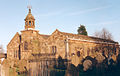
 St Mary's Church (ruins) - geograph.org.uk - 76716.jpg 640 × 480; 144 KB
-
 St Mary's Church, Goosnargh - geograph.org.uk - 71390.jpg 640 × 385; 81 KB
-
 St Peter's Church, Addingham - geograph.org.uk - 71334.jpg 480 × 640; 168 KB
-
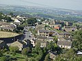
 Stainland - geograph.org.uk - 52828.jpg 640 × 480; 100 KB


_-_geograph.org.uk_-_71431.jpg)


_-_geograph.org.uk_-_74923.jpg)


_-_geograph.org.uk_-_68162.jpg)


_-_geograph.org.uk_-_76716.jpg)


