Category:Images by Liz Dawson
Jump to navigation
Jump to search

Media in category "Images by Liz Dawson"
The following 200 files are in this category, out of 1,241 total.
(previous page) (next page)-
 "Don't Forget the Cake" Holcombe Brook - geograph.org.uk - 367577.jpg 640 × 480; 142 KB
-
 "Frame" sculpture near Strongstry - geograph.org.uk - 348454.jpg 640 × 480; 136 KB
-
 "Waterfall" in Redisher Woods - geograph.org.uk - 373004.jpg 480 × 640; 161 KB
-
 20" gate valve - Calf Hey dam 1856 - geograph.org.uk - 363562.jpg 640 × 480; 171 KB
-
 A 458(T) - geograph.org.uk - 601150.jpg 640 × 480; 118 KB
-
 A 487 towards Minffordd - geograph.org.uk - 506458.jpg 480 × 640; 74 KB
-
 A458 (T) - geograph.org.uk - 601024.jpg 640 × 480; 84 KB
-
 A458 (T) on a rainy Bank Holiday - geograph.org.uk - 449347.jpg 640 × 480; 150 KB
-
 A470 - geograph.org.uk - 601199.jpg 480 × 640; 127 KB
-
 A494 near Dolserau - geograph.org.uk - 450008.jpg 640 × 480; 146 KB
-
 A56 Ramsbottom - geograph.org.uk - 381218.jpg 480 × 640; 57 KB
-
 A59 and valley near Blubberhouses - geograph.org.uk - 401330.jpg 640 × 480; 94 KB
-
 Abandoned football pitch - geograph.org.uk - 464863.jpg 640 × 480; 144 KB
-
 Abercwmeiddaw Quarry (disused) - geograph.org.uk - 1166941.jpg 640 × 480; 110 KB
-
 Abergynolwyn School - geograph.org.uk - 392941.jpg 640 × 480; 158 KB
-
 Aberllefenni Slate quarry - geograph.org.uk - 750870.jpg 640 × 480; 92 KB
-
 Abseiling down Peel Tower - geograph.org.uk - 497210.jpg 480 × 640; 44 KB
-
 Affetside Cross - geograph.org.uk - 470162.jpg 640 × 480; 114 KB
-

-
 Afon Cadair - geograph.org.uk - 601256.jpg 640 × 480; 99 KB
-
 Afon Caws - geograph.org.uk - 750794.jpg 640 × 480; 132 KB
-
 Afon Caws - geograph.org.uk - 750800.jpg 640 × 480; 128 KB
-
 Afon Dulas - geograph.org.uk - 1161832.jpg 640 × 480; 148 KB
-
 Afon Dulas from footbridge - geograph.org.uk - 1161826.jpg 640 × 480; 98 KB
-
 Afon Dulas, Aberllefenni - geograph.org.uk - 750846.jpg 640 × 480; 153 KB
-
 Afon Gwynant above Kings Youth Hostel - geograph.org.uk - 394100.jpg 640 × 480; 185 KB
-
 Alden Brook - geograph.org.uk - 417160.jpg 640 × 480; 181 KB
-

-
 Alden Farm, Alden Valley - geograph.org.uk - 417228.jpg 640 × 480; 120 KB
-
 Alden Valley - geograph.org.uk - 417116.jpg 640 × 480; 118 KB
-
 Alden Valley - geograph.org.uk - 417197.jpg 640 × 480; 144 KB
-
 Alpine Horn Players - geograph.org.uk - 497216.jpg 640 × 480; 176 KB
-
 Antony Gormley, Another Place - geograph.org.uk - 641376.jpg 480 × 640; 87 KB
-
 Apartments, Greenmount - geograph.org.uk - 469959.jpg 640 × 480; 108 KB
-
 Aqueduct beside River Irwell - geograph.org.uk - 464800.jpg 640 × 480; 154 KB
-
 Area behind sea wall in Waterloo - geograph.org.uk - 418186.jpg 640 × 480; 86 KB
-
 Arthog Field - geograph.org.uk - 392644.jpg 640 × 480; 84 KB
-
 Assault Course - Holcombe - geograph.org.uk - 391620.jpg 640 × 480; 118 KB
-
 Autumn leaves along Simon's Lodge - geograph.org.uk - 588759.jpg 640 × 480; 130 KB
-
 B6215, Greenmount - geograph.org.uk - 470388.jpg 480 × 640; 72 KB
-
 Back of Cheesden Lumb Mill 2007 - geograph.org.uk - 425026.jpg 640 × 480; 160 KB
-
 Bad Hair Day^ - geograph.org.uk - 495844.jpg 640 × 480; 148 KB
-
 Bandstand base Nuttall park - geograph.org.uk - 378291.jpg 640 × 480; 162 KB
-
 Bank Top Farm, Holcombe Hill - geograph.org.uk - 344062.jpg 640 × 480; 133 KB
-
 Barmouth Bay - geograph.org.uk - 1413182.jpg 640 × 480; 26 KB
-
 Barmouth Bridge - geograph.org.uk - 381492.jpg 640 × 480; 108 KB
-
 Barmouth Bridge at low tide - geograph.org.uk - 392667.jpg 640 × 480; 89 KB
-
 Barmouth from Cyfannedd-fawr - geograph.org.uk - 1413200.jpg 640 × 480; 75 KB
-
 Base for wind turbine - geograph.org.uk - 647923.jpg 640 × 480; 58 KB
-
 Bath Anyone^ - geograph.org.uk - 380329.jpg 640 × 480; 181 KB
-

-
 Beach Lawn, Waterloo - geograph.org.uk - 418173.jpg 640 × 480; 106 KB
-
 Bench in Aberangell - geograph.org.uk - 750786.jpg 480 × 640; 98 KB
-
 Bend on Rossendale Way - geograph.org.uk - 646388.jpg 640 × 480; 71 KB
-
 Bentley Hall Road - geograph.org.uk - 463781.jpg 640 × 480; 154 KB
-
 Bentley Hall Road, Walshaw - geograph.org.uk - 462900.jpg 640 × 480; 132 KB
-
 Bethesda Chapel, Llanymawddwy - geograph.org.uk - 506673.jpg 480 × 640; 120 KB
-
 Black Moss from Bull Hill - geograph.org.uk - 343995.jpg 640 × 480; 93 KB
-
 Black Moss from Holcombe Hill - geograph.org.uk - 371123.jpg 640 × 480; 118 KB
-
 Blocked footpath! - geograph.org.uk - 470100.jpg 480 × 640; 116 KB
-
 Blue Lake above Friog - geograph.org.uk - 392897.jpg 640 × 480; 130 KB
-
 Bolholt Reservoir - geograph.org.uk - 470480.jpg 640 × 480; 127 KB
-
 Boundary of "Danger Area" Holcombe - geograph.org.uk - 367554.jpg 480 × 640; 72 KB
-
 Brand new information boards - geograph.org.uk - 585234.jpg 640 × 480; 151 KB
-
 Bridge leading from lodge at Deeply Vale - geograph.org.uk - 380457.jpg 640 × 480; 195 KB
-
 Bridge near Redisher farm, Redisher Wood - geograph.org.uk - 344052.jpg 640 × 480; 130 KB
-
 Bridge over Afon Gwynant - geograph.org.uk - 394091.jpg 640 × 480; 201 KB
-
 Bridge over Afon Gwynant - geograph.org.uk - 394106.jpg 640 × 480; 196 KB
-
 Bridge over Afon Mawddach - geograph.org.uk - 1029379.jpg 640 × 480; 115 KB
-
 Bridge over Broadhead Brook - geograph.org.uk - 399171.jpg 640 × 480; 180 KB
-

-
 Bridge over River Irwell at Lumb - geograph.org.uk - 349429.jpg 640 × 480; 152 KB
-
 Bridge over River Irwell-Strongstry - geograph.org.uk - 348374.jpg 640 × 480; 159 KB
-
 Bridge, Witton Weavers way - geograph.org.uk - 483227.jpg 640 × 480; 179 KB
-
 Bridleway, Owlerbarrow - geograph.org.uk - 462886.jpg 480 × 640; 137 KB
-
 Broadhead Road - geograph.org.uk - 558249.jpg 640 × 480; 119 KB
-
 Brook running under Lumb Carr Road - geograph.org.uk - 418044.jpg 640 × 480; 196 KB
-
 Buchanan Sports and Social Club - geograph.org.uk - 378235.jpg 640 × 480; 155 KB
-
 Buchanan Street Ramsbottom - geograph.org.uk - 381232.jpg 640 × 480; 123 KB
-
 Buckden Wood - geograph.org.uk - 416134.jpg 480 × 640; 148 KB
-
 Buckden Woods (west) - geograph.org.uk - 418040.jpg 640 × 480; 202 KB
-
 Buckhurst Farm - geograph.org.uk - 380361.jpg 640 × 480; 155 KB
-
 Buckhurst Valley - geograph.org.uk - 380523.jpg 640 × 480; 79 KB
-
 Burnt out van top of Holcombe Valley - geograph.org.uk - 394155.jpg 480 × 640; 127 KB
-
 Bury Old Road - geograph.org.uk - 379149.jpg 480 × 640; 112 KB
-
 Bus Stop A494 - geograph.org.uk - 449638.jpg 640 × 480; 106 KB
-
-
 Buttercups - geograph.org.uk - 464858.jpg 640 × 480; 192 KB
-
 Bwlch Cwmmaria from Fairbourne - geograph.org.uk - 393340.jpg 640 × 480; 87 KB
-
 Calf Hey reservoir - geograph.org.uk - 363604.jpg 640 × 480; 107 KB
-
 Calf Hey Reservoir from Musbury Heights - geograph.org.uk - 558406.jpg 640 × 480; 122 KB
-
 Calf in field near Cockey Moor lodge - geograph.org.uk - 462935.jpg 640 × 480; 171 KB
-
 Calves in a meadow - geograph.org.uk - 462902.jpg 640 × 480; 153 KB
-

-
 Canada Geese, Whitehead's Middle lodge - geograph.org.uk - 463735.jpg 640 × 480; 116 KB
-
 Car Park Holden Wood - geograph.org.uk - 361168.jpg 640 × 480; 154 KB
-
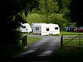
 Caravan in field near Cote Farm - geograph.org.uk - 475726.jpg 640 × 480; 141 KB
-
 Carr Bank Ramsbottom - geograph.org.uk - 347778.jpg 640 × 480; 135 KB
-
 Cattle Grid at entrance to Aberllefenni - geograph.org.uk - 750847.jpg 640 × 480; 131 KB
-
 Cemetery - geograph.org.uk - 449219.jpg 640 × 480; 150 KB
-
 Cemetery above Abercorris - geograph.org.uk - 1167079.jpg 640 × 480; 104 KB
-

-
 Ceunant Cerddin - geograph.org.uk - 506187.jpg 640 × 480; 97 KB
-
 Chapel, Pont Rhyd-Sarn - geograph.org.uk - 449291.jpg 640 × 480; 121 KB
-
 Chatterton Close from Buckden Woods - geograph.org.uk - 418057.jpg 640 × 480; 123 KB
-
 Chatterton Mill - geograph.org.uk - 489256.jpg 640 × 480; 170 KB
-
 Cheesden Lumb Mill 2007 - geograph.org.uk - 425015.jpg 640 × 480; 147 KB
-

-
 Chimney Musbury Heights - geograph.org.uk - 363346.jpg 640 × 480; 111 KB
-
 Cliffe Lodge - Stubbins - geograph.org.uk - 347815.jpg 640 × 480; 124 KB
-
 Cliffe Woods - geograph.org.uk - 348353.jpg 480 × 640; 164 KB
-
 Cloud over Mynydd Cedris - geograph.org.uk - 1167015.jpg 640 × 480; 26 KB
-
 Clough Head cafe and Information Centre - geograph.org.uk - 372231.jpg 640 × 480; 146 KB
-
 Cobbled footpath - geograph.org.uk - 464875.jpg 480 × 640; 136 KB
-
 Cobbled road leading from A56 - geograph.org.uk - 425399.jpg 480 × 640; 160 KB
-
 Cockerel Croston Close - geograph.org.uk - 380342.jpg 640 × 480; 170 KB
-
 Conduit from reservoir Deeply Vale - geograph.org.uk - 380479.jpg 640 × 480; 196 KB
-
 Converted farm and buildings - geograph.org.uk - 374946.jpg 640 × 480; 96 KB
-
 Converted farm Lumb Carr road - geograph.org.uk - 372259.jpg 640 × 480; 192 KB
-
 Cormar Carpets Greenmount - geograph.org.uk - 470056.jpg 640 × 480; 103 KB
-
 Corris Craft Centre - geograph.org.uk - 750955.jpg 640 × 480; 113 KB
-
 Corris Uchaf Quarry - geograph.org.uk - 1167043.jpg 640 × 480; 70 KB
-
 Cottage at the top of Holcombe Hill - geograph.org.uk - 371079.jpg 640 × 480; 133 KB
-
 Cottage next to stream - geograph.org.uk - 470360.jpg 640 × 480; 156 KB
-
 Cottages at Garneddwen - geograph.org.uk - 750937.jpg 640 × 480; 83 KB
-
 Cottages Mount Pleasant, Nangreaves - geograph.org.uk - 381142.jpg 640 × 480; 119 KB
-
 Cottages, Nangreaves - geograph.org.uk - 381133.jpg 640 × 480; 124 KB
-
 Cottages, Stormer Hill - geograph.org.uk - 470067.jpg 640 × 480; 162 KB
-
 Cow above Fairbourne and Friog - geograph.org.uk - 1413219.jpg 640 × 480; 83 KB
-
 Cow Parsley or Queen Annes Lace - geograph.org.uk - 495857.jpg 640 × 480; 131 KB
-
 Cow under Toll Bridge. Penmaenpool - geograph.org.uk - 512773.jpg 640 × 480; 123 KB
-
 Cows next to Witton Weaver's Way - geograph.org.uk - 847043.jpg 640 × 480; 69 KB
-
 Craig Cwm-Llwyd - geograph.org.uk - 392800.jpg 640 × 480; 119 KB
-
 Cranes at Seaforth Dock - geograph.org.uk - 641373.jpg 640 × 480; 61 KB
-
 Crooked roof - geograph.org.uk - 1161783.jpg 640 × 480; 67 KB
-
 Crossover of phone wires - geograph.org.uk - 449914.jpg 480 × 640; 75 KB
-
 Crowthorn school - geograph.org.uk - 366941.jpg 640 × 480; 99 KB
-
 Crowthorn school - geograph.org.uk - 366971.jpg 640 × 480; 118 KB
-
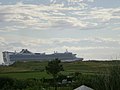 Cruise Ship leaving Liverpool - geograph.org.uk - 911756.jpg 640 × 480; 47 KB
-
 Curlew above Cranberry Moss - geograph.org.uk - 483265.jpg 640 × 480; 81 KB
-
 Dam end of Calf Hey Reservoir - geograph.org.uk - 435254.jpg 480 × 640; 108 KB
-
 Darul Loom Muslim College - Holcombe - geograph.org.uk - 372247.jpg 640 × 480; 159 KB
-
 Darwen Tower from Edgerton Moss - geograph.org.uk - 562405.jpg 640 × 480; 74 KB
-
 Darwen Tower from Holcombe Hill - geograph.org.uk - 752238.jpg 640 × 480; 86 KB
-
 Deeply Hill - geograph.org.uk - 380510.jpg 640 × 480; 96 KB
-
 Delph Reservoir from Cheetham Close - geograph.org.uk - 847020.jpg 640 × 480; 67 KB
-

-
 Delph, Dingle and Springs Reservoirs - geograph.org.uk - 847278.jpg 640 × 480; 52 KB
-
 Diggers on the bridge - geograph.org.uk - 601349.jpg 640 × 480; 44 KB
-

-
 Dipping Pond Redisher Woods - geograph.org.uk - 588768.jpg 640 × 480; 198 KB
-
 Dismantled railway - viaduct at Lumb - geograph.org.uk - 349433.jpg 640 × 480; 148 KB
-
 Disused quarry near Wickenlow farm - geograph.org.uk - 367121.jpg 640 × 480; 104 KB
-
 Disused Quarry, Pinfold - geograph.org.uk - 425398.jpg 640 × 480; 159 KB
-
 Disused Slate Quarry above Friog - geograph.org.uk - 393319.jpg 640 × 480; 145 KB
-
 Division of paths beside ruined farm - geograph.org.uk - 601277.jpg 640 × 480; 113 KB
-
 Dolserau Uchaf campsite - geograph.org.uk - 450015.jpg 640 × 480; 114 KB
-
 Dolserau Uchaf campsite off A494 - geograph.org.uk - 450012.jpg 640 × 480; 139 KB
-
 Dry lodge near Paradise - geograph.org.uk - 647912.jpg 640 × 480; 76 KB
-
 Ducks at Springwood - Ramsbottom - geograph.org.uk - 347776.jpg 640 × 480; 128 KB
-
 Edgerton Moss from Grane Road - geograph.org.uk - 372224.jpg 640 × 480; 90 KB
-
 ELR bridge over River Irwell - geograph.org.uk - 378248.jpg 640 × 480; 149 KB
-
 Elton Community centre - geograph.org.uk - 470497.jpg 640 × 480; 113 KB
-
 Elton Cricket Pitch - geograph.org.uk - 470766.jpg 640 × 480; 96 KB
-
 Elton Fold Working Men's Club - geograph.org.uk - 470519.jpg 640 × 480; 125 KB
-
 Elton High School - geograph.org.uk - 470478.jpg 640 × 480; 92 KB
-
 End of the line - geograph.org.uk - 489201.jpg 640 × 480; 211 KB
-
 End of the Track - geograph.org.uk - 1166996.jpg 640 × 480; 105 KB
-
 Entrance to Lumb Village - geograph.org.uk - 418226.jpg 640 × 480; 145 KB
-
 Entrance to Nuttall Park - geograph.org.uk - 378734.jpg 640 × 480; 156 KB
-
 Esgair-neiriau - geograph.org.uk - 1161779.jpg 640 × 480; 44 KB
-
 Fairbourne Beach at low tide - geograph.org.uk - 392676.jpg 640 × 480; 66 KB
-
 Fairbourne from Golwen Quarry - geograph.org.uk - 392904.jpg 640 × 480; 125 KB
-
 Fallen tree blocking Nant Gwernol - geograph.org.uk - 392963.jpg 640 × 480; 198 KB
-
 Farm at Sylfaen - geograph.org.uk - 392882.jpg 640 × 480; 94 KB
-
 Farm near Tyddyn-Evan-fychan - geograph.org.uk - 394088.jpg 640 × 480; 146 KB
-
 Farm, Affetside - geograph.org.uk - 470105.jpg 640 × 480; 46 KB
-
 Farmhouse above Corris Uchaf - geograph.org.uk - 1167048.jpg 640 × 480; 86 KB
-
 Fegla fawr from Daran - geograph.org.uk - 391817.jpg 640 × 480; 76 KB
-
 Firing Range Holcombe - geograph.org.uk - 495526.jpg 640 × 480; 126 KB
-
 Firing range, Holcombe - geograph.org.uk - 344725.jpg 640 × 480; 109 KB
-

-
 Flooded footpath, Irwell Sculpture Trail - geograph.org.uk - 489181.jpg 480 × 640; 157 KB
-
 Flower growing in between rock - geograph.org.uk - 512174.jpg 640 × 480; 206 KB
-
 Flowers beside footpath - geograph.org.uk - 464893.jpg 640 × 480; 143 KB
-
 Foel Dugeod - geograph.org.uk - 601169.jpg 640 × 480; 92 KB
-

-
 Footbridge at end of Two Brooks Valley - geograph.org.uk - 470370.jpg 480 × 640; 155 KB
-
 Footbridge over brook - geograph.org.uk - 380549.jpg 640 × 480; 207 KB
-
 Footbridge over M66 Ramsbottom - geograph.org.uk - 378325.jpg 640 × 480; 104 KB
-
 Footbridge over Nant Gwernol - geograph.org.uk - 392962.jpg 480 × 640; 139 KB
-
 Footbridge over reservoir - geograph.org.uk - 462931.jpg 640 × 480; 111 KB
-
 Footbridge, Elton - geograph.org.uk - 470778.jpg 480 × 640; 166 KB
-
 Footpath adjacent to brook in Woodhey - geograph.org.uk - 374959.jpg 480 × 640; 146 KB
-
 Footpath along forest edge - geograph.org.uk - 750343.jpg 480 × 640; 139 KB
-
 Footpath alongside Elton Cricket Club - geograph.org.uk - 470776.jpg 480 × 640; 144 KB
-
 Footpath and stile near firing range - geograph.org.uk - 364753.jpg 640 × 480; 158 KB
-
 Footpath behind Cormar Carpets - geograph.org.uk - 470050.jpg 480 × 640; 85 KB
-

-
 Footpath behind Nuttall housing - geograph.org.uk - 464896.jpg 480 × 640; 167 KB


_-_geograph.org.uk_-_601150.jpg)

_-_geograph.org.uk_-_601024.jpg)
_on_a_rainy_Bank_Holiday_-_geograph.org.uk_-_449347.jpg)


_-_geograph.org.uk_-_1166941.jpg)


_-_geograph.org.uk_-_418040.jpg)


