Category:Images by John Salter
Jump to navigation
Jump to search

Media in category "Images by John Salter"
The following 105 files are in this category, out of 105 total.
-

-
 Ardpatrick community centre - geograph.org.uk - 1539209.jpg 640 × 425; 69 KB
-
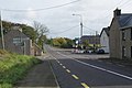
 Ardpatrick road works - geograph.org.uk - 1572644.jpg 640 × 425; 61 KB
-
 Ardpatrick, community centre - geograph.org.uk - 1572659.jpg 450 × 640; 65 KB
-
 Ardpatrick, Greenwood Inn - geograph.org.uk - 1572653.jpg 640 × 479; 94 KB
-
 Ardpatrick, Sunvale Inn - geograph.org.uk - 1572626.jpg 640 × 425; 76 KB
-
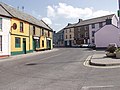
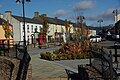
 Ardpatrick, village centre - geograph.org.uk - 1572636.jpg 640 × 425; 81 KB
-
 Askeaton sign - geograph.org.uk - 1577391.jpg 640 × 480; 132 KB
-
 Askeaton signpost - geograph.org.uk - 1577380.jpg 480 × 640; 44 KB
-
 Askeaton, River Deel - geograph.org.uk - 1577397.jpg 640 × 480; 77 KB
-
 Askeaton, River Deel - geograph.org.uk - 1577411.jpg 640 × 480; 100 KB
-
 Askeaton, The River Deel - geograph.org.uk - 1577370.jpg 480 × 640; 99 KB
-
 Askeaton, The Square - geograph.org.uk - 1577358.jpg 640 × 480; 80 KB
-
 Ballynacourty, Darragh Bridge. - geograph.org.uk - 1562420.jpg 640 × 425; 108 KB
-
 Barrabunocka Bridge, Keale Mountain. - geograph.org.uk - 1562437.jpg 640 × 425; 78 KB
-
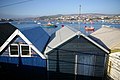 Beach Huts Teignmouth. - geograph.org.uk - 662818.jpg 640 × 425; 65 KB
-
 Boatyard Teignmouth. - geograph.org.uk - 662830.jpg 640 × 425; 95 KB
-
 Carran Hill - geograph.org.uk - 1625179.jpg 640 × 425; 77 KB
-
 Carrog railway station in 2007.jpg 640 × 428; 87 KB
-
 Charleville church - geograph.org.uk - 1552477.jpg 640 × 425; 50 KB
-
 Charleville Park Hotel, Charleville - geograph.org.uk - 1552012.jpg 640 × 425; 51 KB
-
 Charleville Railway Station - geograph.org.uk - 1570360.jpg 640 × 425; 56 KB
-
 Charleville Railway Station - geograph.org.uk - 1570367.jpg 640 × 425; 54 KB
-
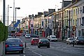 Charleville town centre.jpg 640 × 425; 75 KB
-
 Church at Billeragh East - geograph.org.uk - 1625155.jpg 640 × 425; 68 KB
-
 Church at Billeragh East - geograph.org.uk - 1625157.jpg 640 × 425; 57 KB
-
 Churchtown Village. - geograph.org.uk - 1552191.jpg 640 × 425; 56 KB
-
 Clogheen, "The Vee" - geograph.org.uk - 1555395.jpg 640 × 428; 66 KB
-
 Clogheen, Barrack Hill - geograph.org.uk - 1555534.jpg 640 × 428; 72 KB
-
 Clogheen, Fire Depot - geograph.org.uk - 1555525.jpg 640 × 428; 71 KB
-
 Cockwood Harbour - geograph.org.uk - 665457.jpg 640 × 425; 102 KB
-
 Cockwood harbour and railway. - geograph.org.uk - 665458.jpg 640 × 425; 78 KB
-
 Dawlish Railway Station - geograph.org.uk - 667226.jpg 640 × 480; 85 KB
-
 Dawlish, access bridge to beach - geograph.org.uk - 667227.jpg 640 × 480; 69 KB
-
 Derelict house in old quarry - geograph.org.uk - 1625161.jpg 640 × 425; 96 KB
-
 Dromina, garage. - geograph.org.uk - 1552173.jpg 640 × 425; 58 KB
-
 End of the line, Carrog. - geograph.org.uk - 663291.jpg 401 × 600; 311 KB
-
 Garriencoona, Railway Building - geograph.org.uk - 1570576.jpg 640 × 425; 104 KB
-
 Glanworth friary. - geograph.org.uk - 1577604.jpg 640 × 425; 62 KB
-
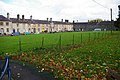
 Glanworth new houses - geograph.org.uk - 1577586.jpg 640 × 425; 78 KB
-
 Glanworth, Arbour Mews - geograph.org.uk - 1577679.jpg 640 × 425; 74 KB
-
 Glennahulla village. - geograph.org.uk - 1562358.jpg 640 × 425; 58 KB
-
 Glenosheen Village - geograph.org.uk - 1571355.jpg 640 × 396; 72 KB
-
 Great Western Hospital, Swindon - geograph.org.uk - 658127.jpg 640 × 428; 41 KB
-
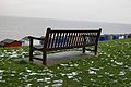 Herne Bay, the sea front. - geograph.org.uk - 665473.jpg 640 × 425; 70 KB
-
 Huts, Herne Bay. - geograph.org.uk - 665475.jpg 640 × 425; 63 KB
-
 Ilsington Lenda Lane - geograph.org.uk - 665461.jpg 398 × 600; 242 KB
-
 Inter City Express - geograph.org.uk - 1537921.jpg 640 × 425; 78 KB
-
 Kanturk, Egmont Place.jpg 640 × 425; 63 KB
-
 Kemble station, Tornado - geograph.org.uk - 1571620.jpg 640 × 425; 90 KB
-
 Kildorrery N73 road. - geograph.org.uk - 1562384.jpg 640 × 425; 72 KB
-
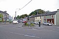
 Kildorrery Village - geograph.org.uk - 1552039.jpg 640 × 425; 62 KB
-
 Kildorrery, cottage - geograph.org.uk - 1553137.jpg 640 × 425; 71 KB
-
 Kildorrery, flooded fields - geograph.org.uk - 1571586.jpg 640 × 425; 56 KB
-
 Kildorrery, microwave tower - geograph.org.uk - 1552167.jpg 640 × 425; 47 KB
-
 Kildorrery, N73 road junction. - geograph.org.uk - 1553141.jpg 640 × 425; 74 KB
-
 Kildorrery, tourist information. - geograph.org.uk - 1553134.jpg 640 × 415; 50 KB
-
 Kildorrery,Tree Nursery - geograph.org.uk - 1571571.jpg 640 × 425; 104 KB
-
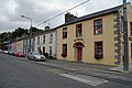
 Kilfinane village centre. - geograph.org.uk - 1534880.jpg 640 × 428; 85 KB
-
 Kilmallock Farmhouse - geograph.org.uk - 1571169.jpg 640 × 373; 64 KB
-
 Kilmallock Library - geograph.org.uk - 1534898.jpg 640 × 428; 49 KB
-
 Kilmallock R515 Road Junction - geograph.org.uk - 1571168.jpg 640 × 425; 69 KB
-
 Kilmallock Railway Station - geograph.org.uk - 1571171.jpg 640 × 425; 86 KB
-
 Knockanevin church. - geograph.org.uk - 1562394.jpg 640 × 425; 54 KB
-
 Lamp Post Teignmouth - geograph.org.uk - 662824.jpg 398 × 600; 188 KB
-
 Lansdowne Monument, Cherhill - geograph.org.uk - 662896.jpg 640 × 425; 40 KB
-
 Marshalstown, cemetery. - geograph.org.uk - 1562348.jpg 640 × 425; 110 KB
-
 Merthyr Vale, near Merthyr Tydfil. - geograph.org.uk - 667395.jpg 640 × 425; 84 KB
-
 Mitchelstown, Alms houses - geograph.org.uk - 1552511.jpg 640 × 426; 83 KB
-
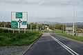 Mitchelstown, N8 ring road. - geograph.org.uk - 1552160.jpg 640 × 425; 55 KB
-
 Mitchelstown, New Square.jpg 640 × 425; 80 KB
-
 Moorcroft Pottery. Burslem. - geograph.org.uk - 663045.jpg 640 × 428; 45 KB
-
 Newton Abbot War Memorial - geograph.org.uk - 662802.jpg 425 × 640; 23 KB
-
 Orchard, Chartham Hatch. - geograph.org.uk - 719732.jpg 640 × 428; 81 KB
-
 Pembroke Dock. - geograph.org.uk - 665476.jpg 640 × 425; 74 KB
-
 Premier Travel Inn, Silverstone. - geograph.org.uk - 719675.jpg 640 × 428; 64 KB
-
 Queen Elizabeth Hospital - geograph.org.uk - 718918.jpg 640 × 428; 65 KB
-
 Road junction near Glenacunna Bridge - geograph.org.uk - 1625169.jpg 640 × 425; 87 KB
-
 Rockmills R512 road - geograph.org.uk - 1577561.jpg 640 × 425; 95 KB
-
 Rockmills, derelict cottage - geograph.org.uk - 1577570.jpg 640 × 425; 107 KB
-
 Rosslare Harbour - geograph.org.uk - 665480.jpg 640 × 425; 66 KB
-
 Rosslare Harbour - geograph.org.uk - 665483.jpg 640 × 425; 77 KB
-
 Sledmere village. - geograph.org.uk - 719699.jpg 640 × 428; 66 KB
-
 Sledmere, direction post. - geograph.org.uk - 719714.jpg 428 × 640; 48 KB
-
 South Devon seawall at Teignmouth - geograph.org.uk - 657897.jpg 398 × 600; 258 KB
-
 The River Maigue at Bruree - geograph.org.uk - 1537888.jpg 640 × 428; 75 KB
-
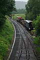
 Train approaching Staverton. - geograph.org.uk - 662900.jpg 640 × 425; 73 KB
-
 View from Carran Hill - geograph.org.uk - 1625165.jpg 640 × 425; 68 KB
-
 Village Church, Chartham - geograph.org.uk - 663007.jpg 640 × 428; 94 KB
-
 Village Green, Chartham. - geograph.org.uk - 663011.jpg 640 × 428; 85 KB
-
 Wandel Cottage - geograph.org.uk - 718942.jpg 640 × 428; 61 KB
-
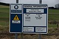 Wandel, railway information sign. - geograph.org.uk - 718938.jpg 640 × 428; 59 KB
-
 Wandel, road and rail. - geograph.org.uk - 718936.jpg 640 × 428; 72 KB
-
 Wareham Heath - geograph.org.uk - 719723.jpg 640 × 428; 84 KB
-
 West coast main line. - geograph.org.uk - 718926.jpg 640 × 428; 53 KB
-
 Westonzoyland memorial. - geograph.org.uk - 768165.jpg 401 × 600; 158 KB
-
 Westonzoyland village. - geograph.org.uk - 768144.jpg 640 × 428; 69 KB
-
 Westonzoyland War Memorial.jpg 401 × 600; 287 KB
-
 Bridge at Carrog. - geograph.org.uk - 663304.jpg 640 × 428; 91 KB
-
 Lamington church. - geograph.org.uk - 719686.jpg 640 × 428; 69 KB
-
 Lamington village. - geograph.org.uk - 719680.jpg 640 × 428; 66 KB
-
 Longbridge, Thelbridge Road. - geograph.org.uk - 665471.jpg 640 × 425; 94 KB
-
 Old Bwlch hill - geograph.org.uk - 657860.jpg 640 × 428; 89 KB
-
 Old Bwlch Hill - geograph.org.uk - 657861.jpg 640 × 428; 76 KB
-
 Old Bwlch Hill - geograph.org.uk - 657902.jpg 640 × 428; 57 KB


