Category:Images by Haeferl/Fotoausflug Matrei in Osttirol
Jump to navigation
Jump to search

Fotoausflug Matrei vom 22. - 25. Juni 2020
Media in category "Images by Haeferl/Fotoausflug Matrei in Osttirol"
The following 175 files are in this category, out of 175 total.
-
 Granatspitzgruppe - Bretterwandspitze und Kendlspitze.jpg 4,867 × 3,042; 11.63 MB
-
 Innergschlöss - Blick aus Innergschlöss zum Vorderen Kesselkopf 2718 m.jpg 5,239 × 3,492; 14.12 MB
-
 Innergschlöss - Brücke vor dem Venedigerhaus.jpg 6,000 × 4,000; 17.5 MB
-
 Innergschlöss - Gschlössbach und Vorderer Kesselkopf.jpg 3,959 × 5,279; 14.28 MB
-
 Innergschlöss - in den Berg gebaute Almhütte.jpg 5,413 × 3,609; 16.72 MB
-
 Innergschlöss - Pegelhaus am Gschlössbach - Tafel Das Schlatenkees.jpg 3,102 × 5,515; 11.78 MB
-
 Innergschlöss - Pegelhaus am Gschlössbach - Tafel Der Gschlößbach.jpg 3,572 × 5,359; 11 MB
-
 Innergschlöss - Pegelhaus am Gschlössbach - Tafel Die Pegelgeschichte.jpg 3,337 × 5,339; 10.21 MB
-
 Innergschlöss - Pegelhaus am Gschlössbach.jpg 3,640 × 4,853; 12.33 MB
-
 Innergschlöss - Spielplatz beim Venedigerhaus.jpg 5,081 × 3,387; 15.94 MB
-
 Innergschlöss - Venedigerhaus - TKK 53965.jpg 5,725 × 3,817; 14.64 MB
-
 Innergschlöss - Vorderer Kesselkopf aus dem Gschlösstal.jpg 4,588 × 3,441; 11.26 MB
-
 Innergschlöss - Wegkreuz Innergschlöss - TKK 17038.jpg 3,350 × 5,025; 15.46 MB
-
 Innergschlöss - Wegkreuz Innergschlöss - TKK 17039.jpg 3,821 × 5,732; 18.59 MB
-
 Matrei - abgestellter VW-Käfer - 1.jpg 5,056 × 3,371; 11.82 MB
-
 Matrei - abgestellter VW-Käfer - 2.jpg 5,059 × 3,794; 11.84 MB
-
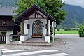
 Matrei - Albanusbrunnen - Fritz Tiefenthaler 1998 - TKK 104168.jpg 3,271 × 4,906; 10.64 MB
-
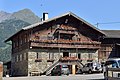
 Matrei - Bauernhaus Maurer - TKK 17048.jpg 5,124 × 3,415; 12.04 MB
-
 Matrei - Bauernhaus Metzger - TKK 17049.jpg 4,954 × 3,302; 9.89 MB
-
 Matrei - Bauernhof Messner - Gedenktafel für Virgil Rainer.jpg 3,683 × 5,525; 13.4 MB
-
 Matrei - bemalte Steine in Pflanzstein.jpg 5,495 × 3,664; 13.04 MB
-
 Matrei - bemalter Stein in Pflanzstein.jpg 4,612 × 3,076; 9.32 MB
-
 Matrei - Bichl 1 - Bauernhaus Grofn - 1 - TKK 17086.jpg 5,093 × 3,396; 12.79 MB
-
 Matrei - Bichl 1 - Bauernhaus Grofn - 2 - TKK 17086.jpg 5,423 × 3,615; 12.89 MB
-
 Matrei - Bichl 3 - Bauernhaus Jakober.jpg 4,879 × 3,252; 10.94 MB
-
 Matrei - Brunnen mit Skulptur Der Goashandel - 1.jpg 5,512 × 3,674; 13.04 MB
-
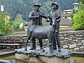 Matrei - Brunnen mit Skulptur Der Goashandel - 2.jpg 3,745 × 2,808; 6.78 MB
-
 Matrei - Brunnen mit Skulptur Der Goashandel - 3.jpg 4,000 × 6,000; 13.75 MB
-
 Matrei - Brunnen mit Skulptur Der Goashandel - 4.jpg 3,592 × 4,790; 11.14 MB
-
 Matrei - Eduard-Wallnöfer-Denkmal und -straße.jpg 3,655 × 4,873; 16.01 MB
-
 Matrei - ehem Gerichtsgebäude - 1.jpg 5,081 × 3,388; 10.64 MB
-
 Matrei - ehem Gerichtsgebäude - 2.jpg 3,375 × 5,061; 12.59 MB
-
 Matrei - ehem Gerichtsgebäude - 3.jpg 3,510 × 4,680; 8.69 MB
-
 Matrei - ehem Spitalskapelle Josefskapelle.jpg 4,913 × 3,685; 11.84 MB
-
 Matrei - Friedhof - Denkmal für die Namenlosen.jpg 3,315 × 4,973; 10.39 MB
-
 Matrei - Friedhofskreuz.jpg 3,575 × 5,363; 10.78 MB
-
 Matrei - Gasthof Bräuwirt - TKK 17046.jpg 5,399 × 3,599; 12.17 MB
-
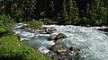
 Matrei - Hintereggkogel - Mündung des Tauernbachs in die Isel.jpg 5,006 × 3,337; 13.07 MB
-
 Matrei - Hintermarkt 12 (ehem Aichbergerwirtshaus) und 10 (Gasthof Bräuwirt - TKK 17046).jpg 4,331 × 3,248; 7.45 MB
-
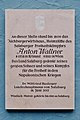 Matrei - Hintermarkt 12 - Gedenktafel für Anton Wallner.jpg 3,081 × 4,625; 8.46 MB
-
 Matrei - Hintermarkt 12 mit Gedenktafel für Anton Wallner.jpg 4,574 × 3,430; 8.44 MB
-
 Matrei - Kreuzbichler-Kapelle - 1.jpg 4,964 × 3,724; 9.38 MB
-
 Matrei - Kreuzbichler-Kapelle - 2.jpg 3,570 × 5,354; 14.34 MB
-
 Matrei - Kreuzbichler-Kapelle - 3.jpg 3,335 × 5,002; 9.08 MB
-
 Matrei - Lage der Wandbilder Familie und Arbeitsleben von Franz Walchegger - TKK 135029.jpg 5,071 × 3,382; 10.26 MB
-
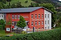
 Matrei - Landesmusikschule Matrei-Iseltal.jpg 5,569 × 3,712; 10.77 MB
-
 Matrei - Lourdeskapelle - 1.jpg 3,444 × 4,592; 10.1 MB
-
 Matrei - Lourdeskapelle - 2 - Fenster.jpg 3,850 × 2,888; 7.2 MB
-
 Matrei - Lourdeskapelle - 3.jpg 3,411 × 5,117; 13.18 MB
-
 Matrei - Lourdeskapelle - 4 - Lourdesgrotte.jpg 3,381 × 5,411; 12.8 MB
-
 Matrei - Musikschule - Relief vier Musikanten von Erich Trost - TKK 17133.jpg 4,492 × 2,995; 8.16 MB
-
 Matrei - Mündung des Tauernbachs in die Isel.jpg 4,335 × 2,890; 9.95 MB
-
 Matrei - Ortsansicht.jpg 5,962 × 3,726; 19.49 MB
-
 Matrei - Ortsteil Auerfeld.jpg 4,058 × 2,705; 8.69 MB
-
 Matrei - Ortsteile Auerfeld und Bruggen.jpg 4,774 × 3,182; 12.99 MB
-
 Matrei - Pfarrhaus - Tafel Haager Konvention 1954.jpg 4,000 × 6,000; 18.11 MB
-
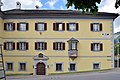
 Matrei - Pfarrhaus - TKK 17044.jpg 4,984 × 3,322; 9.67 MB
-
 Matrei - Pflanzsteine.jpg 5,116 × 3,410; 14.64 MB
-
 Matrei - Rauterstöckl - TKK 16983.jpg 3,730 × 2,487; 5.51 MB
-
 Matrei - Schloss Weißenstein - 1 - von der Lourdeskapelle aufgenommen.jpg 4,986 × 3,324; 11.38 MB
-
 Matrei - Schloss Weißenstein - 2 - aus der Rosa-Ghedina-Straße.jpg 5,594 × 3,729; 13.91 MB
-
 Matrei - Schloss Weißenstein - 3a - von der Kreuzbichler-Kapelle aus.jpg 5,187 × 3,458; 11.22 MB
-
 Matrei - Schloss Weißenstein - 3b - von der Kreuzbichler-Kapelle aus.jpg 5,187 × 3,242; 11.23 MB
-
 Matrei - Schulzentrum - Neue Mittelschule.jpg 5,872 × 3,915; 15.87 MB
-
 Matrei - Teil der Fraktion Waier - im Hintergrund St Nikolaus in der Ortschaft Ganz.jpg 5,287 × 3,525; 14.17 MB
-
 Matrei - Wandbild Arbeitsleben von Franz Walchegger.jpg 2,459 × 3,690; 6.91 MB
-
 Matrei - Wandbild Familie von Franz Walchegger - Signatur.jpg 1,292 × 861; 1.07 MB
-
 Matrei - Wandbild Familie von Franz Walchegger.jpg 3,042 × 4,056; 8.53 MB
-
 Matrei - Wegkreuz mit Assistenzfiguren - TKK 17005.jpg 3,651 × 5,477; 7.84 MB
-
 Matrei-Ganz - Bankerl am Weg zur Nikolauskirche.jpg 5,378 × 3,586; 19.24 MB
-
 Matrei-Ganz - Bauernhöfe Klabiner und Messner.jpg 5,567 × 3,479; 17.45 MB
-
 Matrei-Ganz - Brunnenhaus des Bauernhofs Klabiner.jpg 5,178 × 3,452; 13.8 MB
-
 Matrei-Ganz - Nikolauskirche - 01.jpg 5,322 × 3,547; 12.8 MB
-
 Matrei-Ganz - Nikolauskirche - 02.jpg 5,738 × 3,825; 17.34 MB
-
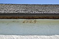 Matrei-Ganz - Nikolauskirche - 03 - Bezeichnung 1729.jpg 5,465 × 3,643; 12.05 MB
-
 Matrei-Ganz - Nikolauskirche - 04 - Innenansicht.jpg 3,790 × 5,684; 11.67 MB
-
 Matrei-Ganz - Nikolauskirche - 05 - Fresko.jpg 4,000 × 6,000; 14.56 MB
-
 Matrei-Ganz - Nikolauskirche - 06 - Statue hl Nikolaus von Myra.jpg 3,551 × 5,326; 10.92 MB
-
 Matrei-Ganz - Nikolauskirche - 07 - Fresken.jpg 6,000 × 4,000; 14.65 MB
-
 Matrei-Ganz - Nikolauskirche - 08 - Fresken.jpg 6,000 × 4,000; 17.36 MB
-
 Matrei-Ganz - Nikolauskirche - 09 - Fresken.jpg 6,000 × 4,000; 18.83 MB
-
 Matrei-Ganz - Nikolauskirche - 10 - Empore.jpg 5,269 × 3,951; 10.13 MB
-
 Matrei-Ganz - Nikolauskirche - 11 - Marienstatue.jpg 4,000 × 6,000; 15.4 MB
-
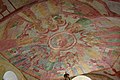 Matrei-Ganz - Nikolauskirche - 12 - Deckenfresko.jpg 6,000 × 4,000; 19.72 MB
-
 Matrei-Ganz - Nikolauskirche - 13 - geschützt durch die Haager Konvention von 1954.jpg 2,962 × 4,443; 10.26 MB
-
 Matrei-Ganz - Nikolauskirche - 14 - Fresko über dem Eingang.jpg 3,876 × 2,907; 9.52 MB
-
 Matrei-Ganz - Nikolauskirche - 15 - aufgenommen von der Lourdeskapelle aus.jpg 5,440 × 3,060; 14.28 MB
-
 Matrei-Ganz - Wegweiser.jpg 3,150 × 4,725; 9.17 MB
-
 Nationalpark Hohe Tauern - Gletscherweg Innergschlöß - 01 - Anfang.jpg 5,564 × 3,709; 20.58 MB
-
 Nationalpark Hohe Tauern - Gletscherweg Innergschlöß - 02 - Anfang.jpg 6,000 × 4,000; 19.87 MB
-
 Nationalpark Hohe Tauern - Gletscherweg Innergschlöß - 03 - Infotafel.jpg 5,601 × 3,733; 16.76 MB
-
 Nationalpark Hohe Tauern - Gletscherweg Innergschlöß - 04 - Bankerl am Beginn des Weges.jpg 5,710 × 3,806; 21.5 MB
-
 Nationalpark Hohe Tauern - Gletscherweg Innergschlöß - 05 - Aufstieg.jpg 3,518 × 5,278; 18.04 MB
-
 Nationalpark Hohe Tauern - Gletscherweg Innergschlöß - 06 - rot-weiß-rote Markierung.jpg 6,000 × 4,000; 18.94 MB
-
 Nationalpark Hohe Tauern - Gletscherweg Innergschlöß - 07 - Beginn der Kernzone.jpg 3,000 × 2,000; 5.85 MB
-

-
 Nationalpark Hohe Tauern - Gletscherweg Innergschlöß - 09 - Viltragenbach.jpg 4,000 × 6,000; 18.04 MB
-
 Nationalpark Hohe Tauern - Gletscherweg Innergschlöß - 10 - Viltragental.jpg 4,000 × 6,000; 18.9 MB
-
 Nationalpark Hohe Tauern - Gletscherweg Innergschlöß - 11 - Wasserfall des Schlatenbachs.jpg 3,724 × 5,587; 18.56 MB
-
-

-
 Nationalpark Hohe Tauern - Gletscherweg Innergschlöß - 14 - Schlatenbach.jpg 3,468 × 5,203; 15.46 MB
-

-
 Nationalpark Hohe Tauern - Gletscherweg Innergschlöß - 16 - Pflanzen in Felsritzen.jpg 5,945 × 3,963; 18.2 MB
-
 Nationalpark Hohe Tauern - Gletscherweg Innergschlöß - 17 - Schlatenbach.jpg 4,000 × 6,000; 18.55 MB
-
 Nationalpark Hohe Tauern - Gletscherweg Innergschlöß - 18 - Schlatenbach.jpg 5,599 × 3,733; 17.76 MB
-
 Nationalpark Hohe Tauern - Gletscherweg Innergschlöß - 19 - Viltragental.jpg 6,000 × 4,000; 16.52 MB
-
 Nationalpark Hohe Tauern - Gletscherweg Innergschlöß - 20 - Schlatenbach.jpg 3,555 × 5,333; 15.05 MB
-

-

-
 Nationalpark Hohe Tauern - Gletscherweg Innergschlöß - 23 - Wegweiser beim Salzbodensee.jpg 4,000 × 6,000; 18.46 MB
-
 Nationalpark Hohe Tauern - Gletscherweg Innergschlöß - 24 - Salzbodensee.jpg 5,676 × 3,784; 16.58 MB
-
 Nationalpark Hohe Tauern - Gletscherweg Innergschlöß - 25 - Salzbodensee.jpg 5,595 × 3,730; 15.23 MB
-
 Nationalpark Hohe Tauern - Gletscherweg Innergschlöß - 26 - Salzbodensee und Salzboden.jpg 5,854 × 3,902; 17.67 MB
-
 Nationalpark Hohe Tauern - Gletscherweg Innergschlöß - 27 - Salzboden.jpg 5,298 × 3,312; 12.14 MB
-
 Nationalpark Hohe Tauern - Gletscherweg Innergschlöß - 28 - Auge Gottes - Moränen.jpg 6,000 × 4,000; 17.18 MB
-
 Nationalpark Hohe Tauern - Gletscherweg Innergschlöß - 29 - Auge Gottes.jpg 5,218 × 3,261; 16.21 MB
-
 Nationalpark Hohe Tauern - Gletscherweg Innergschlöß - 30 - Auge Gottes.jpg 5,434 × 3,396; 13.87 MB
-
 Nationalpark Hohe Tauern - Gletscherweg Innergschlöß - 31 - Wegweiser beim Auge Gottes.jpg 3,732 × 5,598; 15.41 MB
-
 Nationalpark Hohe Tauern - Gletscherweg Innergschlöß - 32 - Blickpunkt 11 auf der Moräne.jpg 5,387 × 3,592; 13.72 MB
-

-

-
 Nationalpark Hohe Tauern - Gletscherweg Innergschlöß - 35 - Schlatenkees und Schlatenbach.jpg 3,773 × 5,660; 13.58 MB
-

-
 Nationalpark Hohe Tauern - Gletscherweg Innergschlöß - 37 - Gletscherschliff.jpg 6,000 × 4,000; 17.31 MB
-

-
 Nationalpark Hohe Tauern - Gletscherweg Innergschlöß - 39 - Huflattich (Tussilago farfara).jpg 4,295 × 2,863; 12.01 MB
-
 Nationalpark Hohe Tauern - Gletscherweg Innergschlöß - 40 - Huflattich (Tussilago farfara).jpg 5,104 × 3,403; 12.17 MB
-
 Nationalpark Hohe Tauern - Gletscherweg Innergschlöß - 41 - Schlatenbach.jpg 4,998 × 3,332; 15.86 MB
-
 Nationalpark Hohe Tauern - Gletscherweg Innergschlöß - 42 - Brücke über den Schlatenbach.jpg 5,723 × 3,815; 15.85 MB
-
 Nationalpark Hohe Tauern - Gletscherweg Innergschlöß - 43 - Schlatenbach.jpg 5,596 × 3,148; 13.98 MB
-
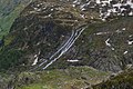
 Nationalpark Hohe Tauern - Gletscherweg Innergschlöß - 44 - Weg über den Gletscherschliff.jpg 5,663 × 3,775; 15.52 MB
-

-

-

-

-

-
-
 Nationalpark Hohe Tauern - Gletscherweg Innergschlöß - 51 - Gschlösstal.jpg 4,000 × 5,333; 16.1 MB
-
 Nationalpark Hohe Tauern - Gletscherweg Innergschlöß - 52 - Kristallwand aus NNO.jpg 6,000 × 4,000; 13.85 MB
-
 Nationalpark Hohe Tauern - Gletscherweg Innergschlöß - 53 - Keesbach.jpg 4,000 × 6,000; 18.26 MB
-

-
 Nationalpark Hohe Tauern - Gletscherweg Innergschlöß - 55 - Viltragenbach.jpg 5,170 × 2,908; 12.74 MB
-

-

-
-
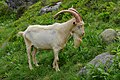
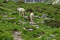
 Nationalpark Hohe Tauern - Gletscherweg Innergschlöß - 59 - Saanen-Ziegenbock.jpg 4,768 × 3,178; 12.64 MB
-
-
 Nationalpark Hohe Tauern - Gletscherweg Innergschlöß - 61 - Saanen-Ziegenböcke.jpg 5,030 × 3,353; 14.26 MB
-
-

-
 Nationalpark Hohe Tauern - Gletscherweg Innergschlöß - 65 - Rossebenbach.jpg 3,016 × 2,011; 4.44 MB
-

-
 Nationalpark Hohe Tauern - Granatspitzgruppe von Nussingkogel bis Kalser Höhe.jpg 12,134 × 3,408; 30.84 MB
-
 Venedigergruppe - Ochsenbug und Bretterwand.jpg 5,369 × 3,579; 12.76 MB
-
 Venedigergruppe - Pegömlspitze bis Bretterwand.jpg 9,070 × 3,579; 21.04 MB
-

-
 Venedigergruppe - Waldköpfl - Pegömlspitze - Bretterspitze - Ochsenbug.jpg 5,369 × 3,579; 12.4 MB
-
 Virgen - Bankerl am Weg der Sinne.jpg 6,000 × 4,000; 19.55 MB
-
 Virgen - Isel - im Hintergrund der Klaunzer Berg in Matrei.jpg 3,731 × 5,596; 15.66 MB
-
 Virgen - Isel.jpg 6,000 × 3,375; 16.82 MB
-
 Virgen - Mellitzbach - 1.jpg 3,949 × 5,264; 18.81 MB
-
 Virgen - Mellitzbach - 2.jpg 4,000 × 6,000; 19.61 MB
-
 Virgen - Mitteldorf.jpg 5,445 × 3,403; 15.56 MB
-
 Virgen - Weg der Sinne - Station Ohren auf.jpg 4,593 × 3,062; 12.35 MB
-
 Virgen - Weg der Sinne - Station Wasser.jpg 5,307 × 3,538; 14.52 MB
-
 Virgen - Weg der Sinne.jpg 5,252 × 3,501; 14.36 MB
-
 Virgen - Zwillingslärche in Mitteldorf - 1.jpg 2,000 × 3,000; 5.19 MB
-
 Virgen - Zwillingslärche in Mitteldorf - 2.jpg 4,000 × 6,000; 20.52 MB
-
 Virgen-Mitteldorf - Auenweg.jpg 4,000 × 6,000; 21.06 MB
-
 Virgen-Mitteldorf - Fratnikbach.jpg 5,611 × 3,741; 18.49 MB
-
 Virgen-Mitteldorf - Isel.jpg 4,000 × 6,000; 21.16 MB
-
 Virgen-Mitteldorf - Mündung des Fratnikbachs in die Isel.jpg 5,344 × 3,563; 13.96 MB
-
 Virgen-Mitteldorf - Mündung des Muritzbaches in die Isel.jpg 6,000 × 4,000; 19.67 MB
-
 Virgen-Mitteldorf - Samermühle - TKK 16241.jpg 2,407 × 3,210; 6.35 MB


_und_10_(Gasthof_Br%C3%A4uwirt_-_TKK_17046).jpg)


.jpg)
.jpg)


.jpg)
.jpg)


.jpg)
.jpg)


.jpg)
.jpg)


.jpg)


