Category:Images by Des Blenkinsopp
Jump to navigation
Jump to search

Subcategories
This category has only the following subcategory.
Media in category "Images by Des Blenkinsopp"
The following 200 files are in this category, out of 642 total.
(previous page) (next page)-
 "The Railway" at Curdridge (geograph 6980303).jpg 4,686 × 3,141; 2.06 MB
-
 120 Fleet Street and Bus - geograph.org.uk - 2852929.jpg 600 × 800; 136 KB
-
 14 The Avenue, Hampton-geograph-2270677-by-Des-Blenkinsopp.jpg 3,532 × 2,368; 1.17 MB
-
 A 34 at Chilton - geograph.org.uk - 1720385.jpg 1,600 × 1,200; 371 KB
-
 A Grand View Indeed (geograph 3807254).jpg 1,600 × 1,116; 480 KB
-
 A lull in the traffic at Dawlish Warren (geograph 5098238).jpg 4,000 × 3,000; 2.05 MB
-
 A Much Better Mill (geograph 4238552).jpg 1,600 × 1,200; 326 KB
-
 A Spinney - geograph.org.uk - 1743283.jpg 1,600 × 1,104; 416 KB
-
 A Tram at Tramms (geograph 4327683).jpg 1,600 × 1,172; 467 KB
-
 A Weird Sort of Gate (geograph 3938554).jpg 535 × 640; 133 KB
-
 Abbey Baptist Church - geograph.org.uk - 1741995.jpg 1,024 × 787; 176 KB
-
 Abbey Street - geograph.org.uk - 1742003.jpg 1,024 × 768; 167 KB
-
 Abbots Tower from the Abbey (geograph 5416726).jpg 1,600 × 1,028; 712 KB
-
 Abbots Tower, Buckland Abbey (geograph 5416718).jpg 3,888 × 2,592; 2.89 MB
-
 Airbus A300 of DHL Aviation 57986.jpg 640 × 446; 58 KB
-
 Aircraft Crossing (geograph 3250118).jpg 3,484 × 2,296; 1.35 MB
-
 Al-Qasimi Building.jpg 640 × 349; 82 KB
-
 Allnatt Avenue, Wallingford - geograph.org.uk - 3824294.jpg 1,024 × 604; 166 KB
-
 Allum Manor Community Centre.jpg 2,177 × 1,554; 909 KB
-
 Another Hide View (geograph 4202052).jpg 1,600 × 1,247; 475 KB
-
 Apex Plaza - geograph.org.uk - 1742053.jpg 1,600 × 1,269; 424 KB
-
 Appleton Manor Geograph-3058101-by-Des-Blenkinsopp.jpg 1,600 × 874; 543 KB
-
 Approaching Chiselhampton - geograph.org.uk - 1734270.jpg 1,600 × 1,200; 374 KB
-
 Arkells Brewery - geograph.org.uk - 1651382.jpg 640 × 480; 101 KB
-
 Art Deco House, Ailsa Road, Twickenham geograph-6030041-by-Des-Blenkinsopp.jpg 4,596 × 3,309; 1.77 MB
-
 Ascott Park - geograph.org.uk - 1733341.jpg 1,024 × 756; 226 KB
-
 Ashdown House - geograph.org.uk - 1651350.jpg 640 × 480; 87 KB
-
 Ashdown House - geograph.org.uk - 1658848.jpg 640 × 471; 110 KB
-
 At the Bus Stop, Arborfield Garrison (geograph 5420764).jpg 3,888 × 2,592; 2.3 MB
-
 Autumn Colours, Pinner Memorial Park geograph-5978897-by-Des-Blenkinsopp.jpg 4,500 × 3,000; 3.15 MB
-
 Axford Pumping Station - geograph.org.uk - 1804086.jpg 1,896 × 1,316; 691 KB
-
 Back Street In Front (geograph 6424952).jpg 4,774 × 2,599; 1.22 MB
-
 Bakers Lane - geograph.org.uk - 1691894.jpg 1,024 × 683; 265 KB
-
 Bampton Flood Warning Station - geograph.org.uk - 1702641.jpg 1,024 × 768; 336 KB
-
 Bannister Street, Withernsea (geograph 6421656).jpg 5,472 × 2,928; 1.54 MB
-
 Banterwick Barn Pumping Station - geograph.org.uk - 1715942.jpg 1,024 × 768; 386 KB
-
 Bar Mango - geograph.org.uk - 1742028.jpg 1,600 × 1,170; 405 KB
-
 Barford & Perkins Water Ballast Roller (geograph 3853474).jpg 1,600 × 1,200; 915 KB
-
 Barn along Cowden Lane (geograph 6440650).jpg 5,472 × 3,648; 2.78 MB
-
 Barn conversion at Upton, Bucknghamshire - geograph-6062306.jpg 4,918 × 3,112; 1.72 MB
-
 Beeching Way - geograph.org.uk - 1690553.jpg 1,024 × 734; 197 KB
-
 Benham Valence (geograph 5694759).jpg 3,888 × 2,592; 2.74 MB
-
 Benie Hoose - geograph-5453337.jpg 3,727 × 2,414; 2.69 MB
-
 Bernard Close, Cuddington (geograph 6062183).jpg 1,600 × 983; 349 KB
-
 Beware of Trains (geograph 3674047).jpg 1,600 × 1,242; 613 KB
-
 Big Cedar, Brightwell Park (geograph 2026574).jpg 2,651 × 3,208; 2.94 MB
-
 Big Pit - geograph-3838616-by-Des-Blenkinsopp.jpg 800 × 577; 143 KB
-
 Birds on a Branch (geograph 4202064).jpg 3,888 × 2,592; 3.55 MB
-
 Black Stuff - geograph.org.uk - 1706639.jpg 1,024 × 797; 142 KB
-
 Blacknest Gate and Lodge (geograph 6385571).jpg 5,016 × 3,273; 2.72 MB
-
 Blackthorn by the roadside (geograph 6111242).jpg 1,600 × 1,067; 541 KB
-
 Blackthorn Hedge on Cony Hill (geograph 6109625).jpg 1,600 × 1,102; 667 KB
-
 Bledlow School Board 1874 (geograph 4479523).jpg 2,552 × 2,600; 1.29 MB
-
 Blenheim Road, Shirburn (geograph 4200653).jpg 4,000 × 3,000; 2.34 MB
-
 Boat Store at Molesey Rowing Club (geograph 5035789).jpg 4,000 × 2,850; 2.76 MB
-
 Borth Station (geograph 6349510).jpg 5,472 × 3,648; 2.05 MB
-
 Bower Farm Cottage (geograph 4170001).jpg 4,000 × 3,000; 2.43 MB
-
 Bradfield War Memorial (geograph 5239694).jpg 3,651 × 2,694; 2.05 MB
-
 Bradleywood Farm - geograph.org.uk - 1734363.jpg 1,600 × 1,180; 439 KB
-
 Branches beside the Winterbourne - geograph.org.uk - 1804727.jpg 2,048 × 1,536; 1.42 MB
-
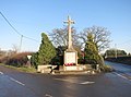
 Brandon House, and Cross (geograph 7594451).jpg 4,641 × 3,349; 3.42 MB
-
 Brethren's Meeting Room - geograph.org.uk - 1734885.jpg 1,600 × 1,200; 504 KB
-
 Brethren's Meeting Room. Way In - geograph.org.uk - 1734926.jpg 1,600 × 1,200; 597 KB
-
 Brick Barn at Little Baldon Farm (geograph 2997010).jpg 1,024 × 768; 219 KB
-
 Bridge over The Bourne (geograph 5378423).jpg 3,888 × 2,592; 3.48 MB
-
 Bridleway near Herdswick Farm - geograph.org.uk - 1910837.jpg 2,048 × 1,536; 511 KB
-
 Bridge in Brightwell Park (geograph 2253436).jpg 3,648 × 2,736; 1.32 MB
-
 Old Stone Shed, Brightwell Park (geograph 3452048).jpg 3,888 × 2,592; 3.59 MB
-
 The Lord Nelson (geograph 2028485).jpg 2,980 × 2,404; 2.56 MB
-
 Brightwell Baldwin Phone Box (geograph 2026561).jpg 3,648 × 2,736; 3.19 MB
-
 Bromley College-geograph-5227008.jpg 1,600 × 1,200; 435 KB
-
 Bromley War Memorial (geograph 5226971).jpg 2,853 × 3,071; 1.91 MB
-
 Brook at Callins Bridge (geograph 5374840).jpg 1,600 × 1,200; 1,008 KB
-
 Buckland Abbey (geograph 5419631).jpg 3,335 × 2,587; 2.39 MB
-
 Bucklebury Ford (geograph 3366013).jpg 2,560 × 1,920; 1.09 MB
-
 Buddleia in Burts Lane (geograph 4208408).jpg 1,600 × 1,178; 576 KB
-
 Building Site, Woodstock Road - geograph.org.uk - 5487374.jpg 1,600 × 1,067; 548 KB
-
 Buildings Round a Yard, Shirburn-geograph-3434817-by-Des-Blenkinsopp.jpg 2,560 × 1,491; 1.33 MB
-
 Bullrush Artwork - geograph.org.uk - 1655306.jpg 472 × 640; 77 KB
-
 Burford Priory (geograph 4017764).jpg 1,600 × 1,110; 379 KB
-
 Burghfield Brook in the Building Site (geograph 5263619).jpg 1,600 × 1,200; 805 KB
-
 Bus and Bungalow - geograph.org.uk - 2286777.jpg 1,936 × 1,352; 404 KB
-
 Bus at Arborfield Garrison (geograph 5420769).jpg 3,678 × 2,224; 2.44 MB
-
 Bus on the Corner - geograph.org.uk - 3025898.jpg 3,572 × 2,232; 1.19 MB
-
 Bus Stop by the Curry House (geograph 3396754).jpg 1,995 × 1,467; 395 KB
-
 Business Park Sculpture (geograph 3880110).jpg 1,600 × 1,042; 552 KB
-
 By The Bridge, Ogbourne St. George - geograph.org.uk - 1867450.jpg 1,868 × 1,408; 1 MB
-
 Byfield Manor (geograph 1830532).jpg 3,572 × 2,592; 2.49 MB
-
 Cafe at Broadcasting House (geograph 4399308).jpg 3,888 × 2,592; 1.05 MB
-
 Camoys Court (geograph 2325606).jpg 3,024 × 2,320; 1.29 MB
-
 Canoe on the Wye by Lower Bullingham - geograph-3624233.jpg 1,024 × 755; 275 KB
-
 Carbery Avenue, Acton (geograph 5122594).jpg 4,000 × 3,000; 2.82 MB
-
 Carmel College Amphitheatre - geograph.org.uk - 1659882.jpg 640 × 492; 112 KB
-
 Carmel College Playing Field - geograph.org.uk - 1691936.jpg 1,024 × 755; 151 KB
-
 Carswell Manor - geograph.org.uk - 2399288.jpg 3,584 × 2,232; 2.18 MB
-
 Castle Eden war memorial geograph-7274161-by-Des-Blenkinsopp.jpg 5,472 × 3,648; 3.52 MB
-
 Daffs and a Pink Bus in Rotherfield Way - geograph.org.uk - 2896912.jpg 1,600 × 1,161; 504 KB
-
 West side of Charlbury - geograph.org.uk - 1706587.jpg 1,024 × 797; 194 KB
-
 Cheapside, Bampton - geograph.org.uk - 1720549.jpg 1,024 × 776; 241 KB
-
 Cheddar, Market Cross (geograph 4151014).jpg 1,600 × 1,200; 549 KB
-
 Chilswell House Priory by Des Blenkinsopp Geograph 3430482.jpg 2,465 × 1,617; 1.78 MB
-
 Chilswell House Priory by Des Blenkinsopp Geograph 3430486.jpg 1,600 × 1,121; 692 KB
-
 Chiltern Park Airfield (geograph 2316561).jpg 2,721 × 2,041; 431 KB
-
 Chiltern Park Airfield 2 (geograph 2316580).jpg 2,721 × 2,041; 504 KB
-
 Chipping Norton Sewage Works - geograph.org.uk - 1702539.jpg 1,024 × 768; 352 KB
-
 Chipping Norton Sewage Works - geograph.org.uk - 1705250.jpg 1,024 × 751; 161 KB
-
 Chiswick Mall, Hounslow-geograph-4596896-by-Des-Blenkinsopp.jpg 3,956 × 2,312; 2.21 MB
-
 Church and Charity (geograph 3093799).jpg 3,648 × 2,736; 2.4 MB
-
 Church Street, Caversham - geograph.org.uk - 2022401.jpg 1,885 × 1,458; 639 KB
-
 Church Tower, Queen Victoria Street (geograph 5165383).jpg 3,000 × 3,866; 2.1 MB
-
 Churchyard and Pub (geograph 3891714).jpg 2,420 × 1,920; 1.14 MB
-
 Churn Estate - geograph.org.uk - 1734335.jpg 1,600 × 1,194; 613 KB
-
 City Of London Information - geograph.org.uk - 3395070.jpg 1,600 × 1,306; 650 KB
-

-
 Clapcot Way - geograph.org.uk - 1706710.jpg 1,024 × 768; 197 KB
-
 Clearwater Court - geograph.org.uk - 1743461.jpg 1,600 × 1,183; 301 KB
-
 Climbing Stones in the Park (geograph 3980227).jpg 1,600 × 1,200; 610 KB
-
 Clock by J. Smith & Sons (geograph 5164043).jpg 3,307 × 2,936; 2.03 MB
-
 Clock on the Wall, St Johns Lane (geograph 5960030).jpg 3,456 × 5,184; 3.15 MB
-

-
 Coach & Horses at The George (geograph 2664608).jpg 2,983 × 2,156; 1.03 MB
-
 Cold Duck - geograph.org.uk - 1658725.jpg 459 × 640; 75 KB
-
 Coloured Jumps - geograph.org.uk - 1702507.jpg 1,024 × 768; 295 KB
-
 Colourful Memorial, Washington (geograph 7319984).jpg 3,888 × 2,592; 3.05 MB
-
 Compton Pumping Station - geograph.org.uk - 1717027.jpg 1,024 × 768; 291 KB
-
 Conduit House Harcourt Hill Geograph-2162812-by-Des-Blenkinsopp.jpg 3,648 × 2,736; 2.87 MB
-
 Copson Lane Corner - geograph.org.uk - 1734231.jpg 1,600 × 1,200; 370 KB
-
 Corner of Holly Tree Lane (geograph 6601711).jpg 4,903 × 3,470; 2.46 MB
-
 Corner of West and Broad - geograph.org.uk - 1740926.jpg 640 × 480; 96 KB
-
 Corner of York Road and Sidwell Street - geograph.org.uk - 5151673.jpg 3,503 × 2,401; 1.67 MB
-
 Coronation Gates, Bledlow, 1902 geograph-4366419-by-Des-Blenkinsopp.jpg 3,196 × 4,500; 3.55 MB
-
 Cottage at Whittonditch - geograph.org.uk - 1804100.jpg 2,425 × 3,697; 2.62 MB
-
 County Hall Abingdon Geograph-3071725-by-Des-Blenkinsopp.jpg 2,048 × 1,536; 1.16 MB
-
 County Offices (geograph 3448394).jpg 3,888 × 2,592; 1.87 MB
-
 Courage Park (geograph 3979275).jpg 1,600 × 1,200; 921 KB
-
 Cowden Lane by the Wind Farm (geograph 6440623).jpg 4,851 × 2,865; 1.82 MB
-
 Crab on the Corner (geograph 6423390).jpg 2,928 × 3,034; 1.53 MB
-
 Cricket Ground between the Parks (geograph 5587729).jpg 3,439 × 2,254; 1.98 MB
-
 A Pond near Crowmarsh - geograph.org.uk - 1743315.jpg 1,600 × 1,107; 439 KB
-
 Crowsley Park House - geograph.org.uk - 1636400.jpg 640 × 459; 110 KB
-
 Curbridge Village Hall - geograph.org.uk - 3077834.jpg 3,680 × 2,200; 1.22 MB
-
 Curry House, Coffee Shop and Cottage (geograph 4099533).jpg 4,000 × 3,000; 2.08 MB
-
 Cycleway in Nonsuch Park (geograph 2871364).jpg 1,944 × 1,358; 1.12 MB
-
 Daggs Lane Drove (geograph 4202045).jpg 1,736 × 1,328; 876 KB
-
 Dale Walk Ducklington - geograph.org.uk - 1706447.jpg 1,024 × 761; 195 KB
-
 Dark Lane Quarry (geograph 3671234).jpg 1,600 × 1,097; 817 KB
-
 Decorative Brickwork, Elmhurst Road (geograph 7687606).jpg 4,916 × 3,499; 2.67 MB
-
 Deptford Creek Lift Bridge (geograph 4251998).jpg 1,600 × 1,094; 443 KB
-
 Derby Winner's Seat - geograph.org.uk - 1718911.jpg 1,600 × 1,200; 534 KB
-
 Derelict farm building in Checkendon, Oxfordshire.jpg 1,600 × 1,203; 694 KB
-
 Derelict Houses at Cavalry Barracks (geograph 6041327).jpg 1,600 × 1,167; 511 KB
-
 GWP. Bus and Visitor Centre - geograph.org.uk - 2802501.jpg 3,524 × 2,384; 1.82 MB
-
 Disused Station at Arncott (geograph 6272139).jpg 4,810 × 2,998; 2.47 MB
-
 Door Up The Wall - geograph.org.uk - 3523979.jpg 2,560 × 1,920; 1.17 MB
-
 Down the Drive - geograph.org.uk - 1659590.jpg 640 × 480; 124 KB
-
 Downstream from the Gauging Station - geograph.org.uk - 1639237.jpg 640 × 480; 75 KB
-
 Dr. Milleys Hospital (geograph 2172195).jpg 3,648 × 2,736; 2.56 MB
-
 Droop Street, W10 (geograph 3925432).jpg 2,048 × 1,535; 732 KB
-
 Duchess of Somersets Hospital (geograph 3776175).jpg 1,600 × 1,084; 347 KB
-
 Dutch Glass in the Church (geograph 3310764).jpg 1,436 × 1,324; 393 KB
-
 East Ewell Bramley Road bus stop in March 2012.jpg 3,364 × 2,232; 2.03 MB
-
 East Hendred Pump - geograph.org.uk - 1639785.jpg 640 × 485; 97 KB
-
 Godfreys Farm - geograph.org.uk - 1639788.jpg 640 × 480; 104 KB
-
 East Road, Chelsea Hospital-geograph-3431463-by-Des-Blenkinsopp.jpg 3,716 × 2,592; 2.62 MB
-
 Emmer Green Water Tower.jpg 1,708 × 2,428; 612 KB
-
 Empty Field with Kites - geograph.org.uk - 1709918.jpg 1,024 × 768; 64 KB
-
 Derelict Building - geograph.org.uk - 1702471.jpg 1,024 × 763; 228 KB
-
 Road to Old Chalford - geograph.org.uk - 1702486.jpg 1,024 × 768; 273 KB
-
 Estate road near Bitham Farm (geograph 5787489).jpg 5,472 × 3,648; 4 MB
-
 Drive Slowly in Exlade Street - geograph.org.uk - 1636362.jpg 640 × 482; 116 KB
-
 Fallen Tree - geograph.org.uk - 1706552.jpg 1,024 × 768; 131 KB
-
 Downhill from Faringdon - geograph.org.uk - 1704817.jpg 1,024 × 748; 167 KB
-
 Roadside Statue - geograph.org.uk - 1704830.jpg 1,024 × 768; 250 KB
-
 Farm Shop and Houses, Little Missenden-geograph-3659472-by-Des-Blenkinsopp.jpg 2,560 × 1,920; 932 KB
-
 Farm Track with Stuff - geograph.org.uk - 1803196.jpg 3,352 × 2,384; 2.26 MB
-
 Farmland near Winterbourne (geograph 4920478).jpg 4,000 × 3,000; 3.26 MB
-
 Fawley Court through the trees-geograph-4278106.jpg 1,335 × 1,600; 637 KB
-
 Fawley Manor Geograph-3371347-by-Des-Blenkinsopp.jpg 2,274 × 1,608; 854 KB
-
 Fish Pond at Ascott Park - geograph.org.uk - 1734106.jpg 1,600 × 1,200; 785 KB
-
 Flexible Office and Bus - geograph.org.uk - 2083178.jpg 2,785 × 3,552; 1.54 MB
-
 Flood at The Boathouse - geograph.org.uk - 1660008.jpg 640 × 480; 110 KB
-
 Floods near Newells Pond - geograph.org.uk - 1734286.jpg 1,600 × 1,200; 565 KB
-
 Following the Tractor (geograph 4202095).jpg 800 × 552; 106 KB
-
 Footbridge to Chilton - geograph.org.uk - 1720463.jpg 1,600 × 1,180; 415 KB
-
 Footpath crossing the tracks (geograph 5405432).jpg 3,888 × 2,592; 5.19 MB
-
 Footpath near Sharptor.jpg 4,000 × 3,000; 2.35 MB
-
 Footpath to College Farm (geograph 4099517).jpg 3,708 × 3,000; 2.29 MB
-
 Footpath to Crowmarsh - geograph.org.uk - 1658529.jpg 640 × 480; 74 KB
-
 Ford at Chapel Wood - geograph.org.uk - 1804716.jpg 1,898 × 1,422; 1.09 MB
-
 Former Church, South Horrington (geograph 4147103).jpg 3,876 × 2,968; 1.62 MB
-
 Former Morlands Brewery Building geograph-2194680-by-Des-Blenkinsopp.jpg 3,648 × 2,736; 3.44 MB
-
 Forthampton War Memorial (geograph 6254126).jpg 4,662 × 3,039; 2.17 MB
-
 Fossils at Shellingford Pit (geograph 2284816).jpg 2,592 × 3,888; 5.09 MB
-
 Fountain and Shops, Fortune Green (geograph 5359660).jpg 2,901 × 2,592; 1.6 MB
-
 Fourteen and a quarter miles from Leeds (geograph 6022787).jpg 4,821 × 3,251; 3.94 MB
-
 Friars Furlong, Long Crendon (geograph 4099513).jpg 3,716 × 2,872; 2.76 MB
-
 Frimley Lodge Miniature Railway (geograph 7246515).jpg 4,152 × 3,317; 2.92 MB
-
 Front Door, Meare Farm (geograph 4178055).jpg 2,778 × 3,504; 2.84 MB
-
 Front Street, Stanhope (geograph 7287274).jpg 5,472 × 3,648; 3.01 MB
-
 Frost Fence - geograph.org.uk - 1691549.jpg 1,024 × 838; 387 KB
.jpg)


.jpg)
.jpg)
.jpg)

.jpg)
.jpg)


.jpg)
.jpg)

.jpg)


.jpg)


.jpg)


.jpg)


.jpg)


.jpg)
.jpg)


.jpg)

.jpg)
.jpg)
.jpg)

.jpg)

.jpg)
.jpg)
.jpg)
.jpg)
.jpg)
.jpg)
.jpg)
.jpg)
.jpg)


.jpg)


.jpg)
.jpg)

.jpg)
.jpg)
.jpg)
.jpg)

.jpg)
.jpg)
.jpg)
.jpg)
.jpg)


.jpg)
.jpg)

.jpg)

.jpg)
.jpg)

.jpg)
.jpg)
.jpg)

.jpg)


.jpg)


.jpg)
.jpg)


.jpg)

.jpg)
.jpg)


.jpg)
.jpg)
.jpg)

.jpg)


.jpg)


.jpg)


.jpg)
.jpg)
.jpg)
.jpg)
.jpg)


.jpg)
.jpg)
.jpg)

.jpg)
.jpg)
.jpg)


.jpg)

.jpg)


.jpg)
.jpg)
.jpg)
.jpg)


.jpg)


.jpg)


.jpg)

.jpg)

.jpg)


.jpg)

.jpg)
.jpg)
.jpg)
.jpg)
.jpg)
.jpg)
.jpg)
.jpg)
