Category:Images by David P Howard
Jump to navigation
Jump to search

Subcategories
This category has only the following subcategory.
N
Media in category "Images by David P Howard"
The following 200 files are in this category, out of 745 total.
(previous page) (next page)-
 A3400 bridge over River Stour - geograph.org.uk - 1726857.jpg 2,000 × 1,436; 223 KB
-
 A4177 Birmingham Road - geograph.org.uk - 1703559.jpg 2,000 × 1,510; 329 KB
-
 A439 Black Hill crossroads - geograph.org.uk - 1706443.jpg 2,000 × 1,433; 330 KB
-
 A452 near Chesford bridge - geograph.org.uk - 1723887.jpg 2,000 × 1,503; 207 KB
-
 A46 Warwick bypass from layby - geograph.org.uk - 1703594.jpg 2,000 × 1,494; 339 KB
-
 A46 Warwick bypass from the A452 roundabout - geograph.org.uk - 1723902.jpg 2,000 × 1,508; 210 KB
-
 Acer Maximowiczianum, Westonbirt Arboretum - geograph.org.uk - 2655318.jpg 2,000 × 1,503; 591 KB
-
 Admington Grounds from Harbour Hill - geograph.org.uk - 1773868.jpg 2,000 × 1,500; 180 KB
-
 Aghabullogue (geograph 5155003).jpg 2,000 × 1,308; 1.44 MB
-
 Ailstone Farm - geograph.org.uk - 1747022.jpg 2,000 × 1,495; 226 KB
-
 Ailstone Hamlet - geograph.org.uk - 1736019.jpg 2,000 × 1,495; 231 KB
-

-
 All Saints Church and church hall, Warwick - geograph.org.uk - 1761767.jpg 2,000 × 1,459; 219 KB
-
 All Saints Church, Leek Wootton - geograph.org.uk - 1756532.jpg 2,000 × 1,504; 196 KB
-
 All Saints Church, Leek Wootton - geograph.org.uk - 1756608.jpg 2,000 × 1,492; 207 KB
-
 Alleyway between Black Lane and Buckley Road - geograph.org.uk - 1723871.jpg 1,500 × 1,991; 261 KB
-
 Alscot Park - geograph.org.uk - 1735983.jpg 2,000 × 1,505; 226 KB
-
 Alveston Hill Cottage - geograph.org.uk - 1716922.jpg 2,000 × 1,497; 308 KB
-
 An island in the Stour - geograph.org.uk - 1727201.jpg 2,000 × 1,355; 256 KB
-
 An old SandMJR bridge - geograph.org.uk - 1701637.jpg 2,000 × 1,484; 340 KB
-

-

-

-

-
 Autogrill, A46 southbound services, Warwick - geograph.org.uk - 1730647.jpg 2,000 × 1,507; 220 KB
-

-
 B4087 Newbold Road at Crane Hill - geograph.org.uk - 1707884.jpg 2,000 × 1,492; 307 KB
-
-
 Banbury Road by Claydons Farm - geograph.org.uk - 1716887.jpg 2,000 × 1,368; 252 KB
-
 Baraset from Pimlico Lane - geograph.org.uk - 1727728.jpg 2,000 × 1,495; 216 KB
-
 Barton Farm - geograph.org.uk - 1726876.jpg 2,000 × 1,502; 221 KB
-

-
 Battle of Sedgemoor Memorial - geograph.org.uk - 1700369.jpg 2,000 × 1,471; 297 KB
-
 Beach below Haven Cliff, Seaton - geograph.org.uk - 1637557.jpg 640 × 427; 91 KB
-
 Beach in Wesley Square (geograph 3635515).jpg 2,000 × 2,000; 841 KB
-
 Beach, East Runton - geograph.org.uk - 1706472.jpg 2,000 × 1,449; 294 KB
-
 St Helen’s Church, Beamish Museum, 28 August 2013.jpg 2,000 × 1,407; 998 KB
-
 Beecham Farm from the footpath - geograph.org.uk - 1719035.jpg 2,000 × 1,495; 258 KB
-
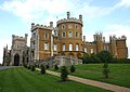 Belvoir Castle - geograph.org.uk - 1707164.jpg 2,000 × 1,420; 308 KB
-
 Bench by the footpath (geograph 3234779).jpg 2,000 × 1,500; 515 KB
-
 Bicycle rack on Collingwood Street (geograph 3635233).jpg 2,000 × 1,500; 764 KB
-
 Binton Station (geograph 3320088).jpg 2,000 × 1,500; 539 KB
-
 Bishop's Old Palace, Lincoln - geograph.org.uk - 1651506.jpg 640 × 435; 80 KB
-
 Black Hill, A429 - geograph.org.uk - 1750387.jpg 2,000 × 1,491; 166 KB
-
 Blackdown Hall, Sandy Lane, Leamington Spa - geograph.org.uk - 1757944.jpg 2,000 × 1,503; 218 KB
-
 Blaenavon World Heritage Centre.jpg 2,000 × 1,265; 648 KB
-
 Blue Lane Farm - geograph.org.uk - 1716716.jpg 2,000 × 1,496; 305 KB
-
 Blue Lane Farm - geograph.org.uk - 1716841.jpg 2,000 × 1,497; 273 KB
-
 Bluebells in Oakley Woods - geograph.org.uk - 1636213.jpg 640 × 427; 142 KB
-
 Borehole and pumping station, Heath End - geograph.org.uk - 1715719.jpg 2,000 × 1,507; 314 KB
-
 BP Connect at Family Farm services, A34 - geograph.org.uk - 1803176.jpg 2,000 × 1,498; 165 KB
-
 Brand new bridge on the footpath - geograph.org.uk - 1730711.jpg 1,500 × 1,994; 282 KB
-
 Brewer Street, Oxford (geograph 2718434).jpg 1,500 × 1,992; 372 KB
-

-
 Bridge over Goldicote cutting - geograph.org.uk - 1716774.jpg 2,000 × 1,497; 334 KB
-
 Bridge over the River Soar, Abbey Park (geograph 4718856).jpg 2,000 × 1,333; 1.53 MB
-
 Bridge over the Stour at Wimpstone - geograph.org.uk - 1727415.jpg 2,000 × 1,501; 237 KB
-
 Bridge repairs, Lochgoilhead (geograph 4599609).jpg 2,000 × 1,656; 1.42 MB
-
 Bridge to nowhere - geograph.org.uk - 1769347.jpg 1,500 × 2,003; 134 KB
-
 Bridge under the old SandMJR embankment - geograph.org.uk - 1718907.jpg 2,000 × 1,503; 340 KB
-
 Bridges and weir, River Leam, Edmondscote - geograph.org.uk - 1722009.jpg 2,000 × 1,333; 284 KB
-
 Bridleway off Snitterfield Lane - geograph.org.uk - 1715672.jpg 2,000 × 1,508; 333 KB
-
 Bridleway through Devil's Spittleful-geograph-3978795-by-David-P-Howard.jpg 2,000 × 1,451; 897 KB
-
 Bridleway to Ettington Park - geograph.org.uk - 1726777.jpg 2,000 × 1,502; 258 KB
-
 Bridleway to Goldicote Cutting - geograph.org.uk - 1726793.jpg 2,000 × 1,504; 256 KB
-
 Bridleway to Halford - geograph.org.uk - 1716730.jpg 1,500 × 2,013; 272 KB
-
 Bridleway to Halford - geograph.org.uk - 1775140.jpg 2,000 × 1,503; 206 KB
-
 Bridleway to Lower Clopton - geograph.org.uk - 1730777.jpg 2,000 × 1,499; 261 KB
-
 Bridleway to Welcombe Hills Country Park - geograph.org.uk - 1730786.jpg 2,000 × 1,494; 239 KB
-
 Broughton Heath Park and Ride - geograph.org.uk - 3056598.jpg 2,000 × 1,500; 528 KB
-
 Bruton Farm, Admington - geograph.org.uk - 1773669.jpg 2,000 × 1,503; 199 KB
-
 BSS National Tube Distribution Centre, Coventry - geograph.org.uk - 1748184.jpg 2,000 × 1,411; 196 KB
-
 Budgens of Trinity Mead - geograph.org.uk - 1740341.jpg 2,000 × 1,498; 185 KB
-
 Bullimore Wood and A46 sliproad - geograph.org.uk - 1723915.jpg 2,000 × 1,492; 193 KB
-
 Bus on the Cambridgeshire Guided Busway, near Trumpington, Cambridgeshire, England 2.jpg 2,000 × 1,495; 409 KB
-
 Bus stop and control tower, Luton Airport - geograph.org.uk - 1965880.jpg 1,500 × 2,000; 192 KB
-
 Bus waiting at Solihull Railway Station - geograph.org.uk - 2962191.jpg 2,000 × 1,333; 608 KB
-
 Butlers Marston - geograph.org.uk - 1779510.jpg 2,000 × 1,499; 170 KB
-
 Caldwell Spring Wood from A439 Black Hill - geograph.org.uk - 1742887.jpg 2,000 × 1,506; 191 KB
-
 Calshot Spit light vessel on the dockside (geograph 4052506).jpg 2,000 × 2,000; 634 KB
-
 Campanile Hotel and Restaurant, Wigston Road, Coventry - geograph.org.uk - 1748290.jpg 2,000 × 1,466; 220 KB
-
 Campion Hills cycle route - geograph.org.uk - 1723848.jpg 2,000 × 1,491; 212 KB
-
 Car park, Beamish Museum, 28 August 2013 (1).jpg 2,000 × 1,500; 755 KB
-
 Car park, Beamish Museum, 28 August 2013 (2).jpg 2,000 × 1,500; 532 KB
-
 Carpark, All Saints Church, Leek Wootton - geograph.org.uk - 1756591.jpg 2,000 × 1,439; 206 KB
-
 Castle Drogo - geograph.org.uk - 1652352.jpg 640 × 427; 65 KB
-
 Cattle grid at entrance to Burton Dassett Hills - geograph.org.uk - 1732255.jpg 2,000 × 1,502; 234 KB
-
 Centre of the gridsquare - geograph.org.uk - 1701659.jpg 2,000 × 1,489; 368 KB
-
 Chaldrons, Colliery, Beamish Museum, 28 August 2013 (1).jpg 573 × 295; 84 KB
-
 Chaldrons, Colliery, Beamish Museum, 28 August 2013 (2).jpg 690 × 310; 91 KB
-
 Chesil Beach, Abbotsbury - geograph.org.uk - 1637520.jpg 640 × 427; 75 KB
-
 Chimney, Clarks Shoes factory, Street - geograph.org.uk - 1700323.jpg 2,000 × 1,406; 297 KB
-
 China Town (geograph 3636188).jpg 2,000 × 1,370; 671 KB
-
 Choicehill Road, Over Norton (geograph 3897470).jpg 2,000 × 1,330; 751 KB
-
 Church of St George the Martyr, Newbold Pacey - geograph.org.uk - 1707707.jpg 2,000 × 1,440; 310 KB
-
 Church of St George the Martyr, Newbold Pacey - geograph.org.uk - 1707712.jpg 2,000 × 1,501; 295 KB
-
 Church of St George the Martyr, Newbold Pacey - geograph.org.uk - 1707716.jpg 2,000 × 1,499; 320 KB
-
 Church of St James the Great, Snitterfield - geograph.org.uk - 1706413.jpg 2,000 × 1,406; 304 KB
-
 Church of St James the Great, Snitterfield - geograph.org.uk - 1706416.jpg 2,000 × 1,389; 308 KB
-
 Church of St James the Great, Snitterfield - geograph.org.uk - 1721936.jpg 1,500 × 2,003; 226 KB
-
 Church of St John the Baptist, Wasperton - geograph.org.uk - 1723930.jpg 2,000 × 1,473; 203 KB
-
 Church of St John the Baptist, Wasperton - geograph.org.uk - 1723947.jpg 2,000 × 1,493; 204 KB
-
 Church of St Mary, Preston on Stour - geograph.org.uk - 1735826.jpg 2,000 × 1,308; 245 KB
-
 Church of St Mary, Preston on Stour - geograph.org.uk - 1735852.jpg 2,000 × 1,509; 210 KB
-

-
 Church of the Holy Trinity, Orton Longueville (geograph 3458158).jpg 2,000 × 1,500; 617 KB
-
 Church of the Holy Trinity, Orton Longueville (geograph 3458205).jpg 2,000 × 1,500; 548 KB
-
 Circular copse with a fence round, Admington - geograph.org.uk - 1773021.jpg 2,000 × 1,502; 192 KB
-
 Claydons Farm - geograph.org.uk - 1716879.jpg 2,000 × 1,503; 265 KB
-
 Clemens St. moorings, Grand Union Canal - geograph.org.uk - 1658914.jpg 640 × 522; 127 KB
-
 Clopton Road, Stratford Upon Avon - geograph.org.uk - 1732349.jpg 2,000 × 1,506; 209 KB
-
 Cnoc Reamhar - geograph.org.uk - 1635949.jpg 640 × 427; 53 KB
-
 Co-op shelves, Town, Beamish Museum, 28 August 2013.jpg 2,000 × 2,000; 1,017 KB
-
 Coal winch, Colliery, Beamish Museum, 28 August 2013.jpg 700 × 510; 160 KB
-
 Colliery lamp cabin, Beamish Museum, 28 August 2013.jpg 538 × 283; 75 KB
-
 Colliery sidings, Beamish Museum, 28 August 2013.jpg 2,000 × 1,500; 568 KB
-
 Colliery spoil railway, Beamish Museum, 28 August 2013.jpg 1,500 × 2,000; 875 KB
-
 Colliery spoil wagon, Beamish Museum, 28 August 2013.jpg 210 × 233; 42 KB
-
 Colliery winding engine, Beamish Museum, 2 August 2013.jpg 2,000 × 1,372; 733 KB
-
 Colliery, Beamish Museum, 28 August 2013 (2).jpg 2,000 × 1,371; 764 KB
-
 Colliery, Beamish Museum, 28 August 2013.jpg 2,000 × 1,333; 684 KB
-
 Compton Hill, Compton Verney - geograph.org.uk - 1654950.jpg 640 × 427; 76 KB
-
 Compton Pools, Compton Verney House - geograph.org.uk - 1654916.jpg 640 × 404; 47 KB
-
 Compton Verney House - geograph.org.uk - 1654894.jpg 640 × 422; 57 KB
-
 Compton Verney House - geograph.org.uk - 1654931.jpg 640 × 380; 70 KB
-
 Copdock Hill from near Daisy Hill Farm - geograph.org.uk - 1744926.jpg 2,000 × 1,509; 222 KB
-
 Copse near Bruton Farm, Admington - geograph.org.uk - 1773652.jpg 2,000 × 1,405; 207 KB
-
 Corn Exchange Chambers, Queen Street (geograph 4869332).jpg 2,000 × 1,369; 1.53 MB
-
 Cornhill Corn Exchange, Market Place, Banbury (geograph 2541399).jpg 2,000 × 1,496; 225 KB
-
 Cottages on the Welsh Road - geograph.org.uk - 1652925.jpg 640 × 427; 67 KB
-
 Country lane in the snow - geograph.org.uk - 1650848.jpg 421 × 640; 99 KB
-
 Creux Harbour, Sark - geograph.ci - 31.jpg 640 × 477; 74 KB
-
 Crimscote Downs Farm - geograph.org.uk - 1773566.jpg 2,000 × 1,497; 198 KB
-
 Crimscote village - geograph.org.uk - 1727207.jpg 2,000 × 1,429; 209 KB
-
 Cross O' Th' Hill Farm and B and B - geograph.org.uk - 1746903.jpg 2,000 × 1,501; 241 KB
-

-
 Darwin's greenhouse, Down House - geograph.org.uk - 1659814.jpg 640 × 502; 112 KB
-
 Derelict caravan off Hunscote Lane - geograph.org.uk - 1640161.jpg 640 × 427; 116 KB
-
 Devil's Spittleful Nature Reserve-geograph-3984633-by-David-P-Howard.jpg 2,000 × 1,333; 723 KB
-
 Devil's Spittleful Nature Reserve-geograph-4646946-by-David-P-Howard.jpg 2,000 × 1,589; 1.58 MB
-
 Devil's Spittleful Nature Reserve-geograph-4647664-by-David-P-Howard.jpg 2,000 × 1,333; 1.34 MB
-
 Dipwood Halt at Beamish (geograph 3751734).jpg 2,000 × 1,371; 666 KB
-
 Discovery Museum (geograph 3636176).jpg 2,000 × 1,334; 916 KB
-
 Disused barn, Sandy Lane, Leamington Spa - geograph.org.uk - 1755979.jpg 2,000 × 1,503; 187 KB
-
 Disused range near Ailstone Farm - geograph.org.uk - 1740989.jpg 2,000 × 1,499; 237 KB
-
 Dosey Barn and dozy sheep - geograph.org.uk - 1747140.jpg 2,000 × 1,455; 240 KB
-
 Dovehouse Drive, Dovehouse Estate - geograph.org.uk - 1639975.jpg 640 × 427; 83 KB
-
 Dovehouse Drive, Dovehouse Estate - geograph.org.uk - 1640000.jpg 640 × 427; 54 KB
-
 Dover seafront from Dover Castle - geograph.org.uk - 1660291.jpg 640 × 574; 99 KB
-
 Down House, Downe - geograph.org.uk - 1659819.jpg 640 × 496; 104 KB
-
 Drainage ditch outside Admington - geograph.org.uk - 1774234.jpg 1,500 × 2,008; 210 KB
-
 Driveway to Hillfields - geograph.org.uk - 1650859.jpg 640 × 423; 72 KB
-
 Driveway to Redhouse Farm - geograph.org.uk - 1723865.jpg 2,000 × 1,495; 229 KB
-
 Driveway to Westfields Court - geograph.org.uk - 1650813.jpg 640 × 425; 112 KB
-
 Dubh Loch, Glen Shira (geograph 4596815).jpg 2,000 × 1,333; 1.36 MB
-
 Eas Chia-Aig from B8005 - geograph.org.uk - 1710039.jpg 1,500 × 2,124; 359 KB
-
 Eastern end of Hunscote Lane - geograph.org.uk - 1640171.jpg 640 × 427; 89 KB
-
 Eastern Gateway, Maiden Castle - geograph.org.uk - 1652332.jpg 640 × 427; 71 KB
-
 Eight Men's Math - geograph.org.uk - 1701627.jpg 2,000 × 1,494; 309 KB
-
 Electrical Contractors Association, East Midlands Office - geograph.org.uk - 1672291.jpg 2,000 × 1,653; 396 KB
-
 Electricity sub-station, Sandy Lane, Leamington Spa - geograph.org.uk - 1757990.jpg 2,000 × 1,496; 217 KB
-
 Elevated tram tracks over railway (geograph 3514865).jpg 2,000 × 1,275; 1.04 MB
-
 Engine Works, Colliery, Beamish Museum, 28 August 2013.jpg 2,000 × 1,359; 680 KB
-
 English Baptist Chapel, Blaenavon (geograph 2897485).jpg 2,000 × 1,339; 380 KB
-
 Entering Over Norton (geograph 3897540).jpg 2,000 × 1,339; 808 KB
-
 Entrance B to Stratford Armouries - geograph.org.uk - 1730759.jpg 2,000 × 1,499; 290 KB
-
 Entrance drive to Admington Hall - geograph.org.uk - 1773719.jpg 2,000 × 1,500; 193 KB
-
 Entrance drive to Ettington Park Hotel - geograph.org.uk - 1726812.jpg 2,000 × 1,510; 278 KB
-
 Entrance drive to Ettington Park Hotel - geograph.org.uk - 1726828.jpg 1,500 × 2,144; 240 KB
-
 Entrance drive to Field Barn from Fosse Way - geograph.org.uk - 1711776.jpg 2,000 × 1,491; 273 KB
-
 Entrance drive to Square Close - geograph.org.uk - 1803240.jpg 2,000 × 1,509; 203 KB
-
 Entrance drive to Stratford Armouries - geograph.org.uk - 1730735.jpg 2,000 × 1,414; 209 KB
-
 Entrance drive to Sweet Knowle Farm - geograph.org.uk - 1773269.jpg 2,000 × 1,504; 184 KB
-
 Entrance drive to Woodlands, Fosse Way - geograph.org.uk - 1654649.jpg 640 × 427; 122 KB
-
 Entrance to Alderminster Farm from A3400 - geograph.org.uk - 1773204.jpg 2,000 × 1,506; 200 KB
-
 Entrance to Bishop's Gorse Farm - geograph.org.uk - 1650819.jpg 640 × 421; 107 KB
-
 Entrance to Blackdown Farm - geograph.org.uk - 1756771.jpg 2,000 × 1,501; 209 KB
-
 Entrance to Bromson Hill Nursing Home - geograph.org.uk - 1657110.jpg 640 × 478; 113 KB
-

-
 Entrance to Coombe Farm - geograph.org.uk - 1716852.jpg 2,000 × 1,495; 255 KB
-
 Entrance to Coppington and Middle Hill Farms - geograph.org.uk - 1719210.jpg 2,000 × 1,495; 257 KB
-
 Entrance to Ettington Park Hotel - geograph.org.uk - 1726819.jpg 2,000 × 1,511; 238 KB
-
 Entrance to Ford Farm - geograph.org.uk - 1652914.jpg 640 × 427; 107 KB
-

-
 Entrance to Goldicote Business Park - geograph.org.uk - 1716781.jpg 2,000 × 1,500; 284 KB
-
 Entrance to Grove Hill and Pastures Farms - geograph.org.uk - 1691144.jpg 2,000 × 1,508; 353 KB
-
 Entrance to Heath Farm - geograph.org.uk - 1716895.jpg 2,000 × 1,501; 305 KB
-
 Entrance to Heathcote Farm - geograph.org.uk - 1707897.jpg 2,000 × 1,501; 336 KB
-

-
 Entrance to Leamington Hall Farm from Fosse Way - geograph.org.uk - 1711784.jpg 2,000 × 1,482; 337 KB
-
 Entrance to Little Hill Farm - geograph.org.uk - 1719160.jpg 2,000 × 1,508; 317 KB
-
 Entrance to Lodge Farm - geograph.org.uk - 1654756.jpg 640 × 399; 46 KB
-
 Entrance to Luscombe Farm - geograph.org.uk - 1715682.jpg 2,000 × 1,497; 298 KB
-
 Entrance to Moreton Morrell Centre - geograph.org.uk - 1656947.jpg 640 × 476; 102 KB
-
 Entrance to Riverside Caravan Park, Tiddington - geograph.org.uk - 1727853.jpg 2,000 × 1,507; 219 KB
-
 Entrance to sewage works, Snitterfield - geograph.org.uk - 1715663.jpg 2,000 × 1,501; 299 KB
-
 Entrance to the Croft Preparatory School - geograph.org.uk - 1691084.jpg 2,000 × 1,376; 339 KB
-
 Entrance to Tile Barn Farm - geograph.org.uk - 1723979.jpg 2,000 × 1,479; 221 KB
-
 Entrance to Woodside Farm - geograph.org.uk - 1672376.jpg 2,000 × 1,509; 336 KB
-
 Entrance, Castle Drogo - geograph.org.uk - 1652376.jpg 640 × 347; 86 KB


.jpg)


_2007_MAN_14.240_MCV_Evolution,_Luton_Airport,_17_July_2010.jpg)


_-_geograph.org.uk_-_1708366.jpg)


.jpg)


.jpg)
.jpg)
.jpg)


.jpg)


.jpg)

.jpg)


.jpg)


.jpg)
.jpg)


.jpg)
.jpg)


.jpg)
.jpg)


.jpg)
.jpg)


.jpg)


.jpg)
.jpg)


.jpg)
.jpg)


.jpg)


.jpg)

.jpg)
.jpg)


