Category:Images by Colin Edgar
Jump to navigation
Jump to search

Media in category "Images by Colin Edgar"
The following 43 files are in this category, out of 43 total.
-
 Asda - geograph.org.uk - 106413.jpg 640 × 480; 39 KB
-
 Blackhill Cemetery South - geograph.org.uk - 74474.jpg 480 × 640; 80 KB
-
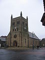
 St John the Evangelist Church - geograph.org.uk - 105902.jpg 640 × 480; 114 KB
-
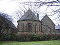 Christ Church Rear Buildings - geograph.org.uk - 102800.jpg 640 × 480; 136 KB
-
 Christ Church, Consett - geograph.org.uk - 102796.jpg 480 × 640; 61 KB
-
 Consett Christ Church tower nave GeoUK 102796.jpg 1,136 × 1,124; 135 KB
-
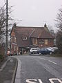 Derwent Walk Inn - geograph.org.uk - 102947.jpg 480 × 640; 92 KB
-
 Ebchester Church - geograph.org.uk - 102941.jpg 640 × 480; 133 KB
-
 Fire Station, Consett - geograph.org.uk - 102880.jpg 640 × 480; 53 KB
-
 Methodist Church - geograph.org.uk - 102923.jpg 480 × 640; 87 KB
-
 Old Co-Op Building - geograph.org.uk - 102809.jpg 480 × 640; 65 KB
-
 Pavilion Cantonese Restaurant - geograph.org.uk - 102821.jpg 640 × 480; 77 KB
-
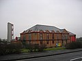
 Sewage Works - geograph.org.uk - 102874.jpg 640 × 480; 62 KB
-
 Shotley Bridge Hospital - geograph.org.uk - 74467.jpg 640 × 480; 82 KB
-
 Shotley Hall Gatehouse - geograph.org.uk - 74988.jpg 480 × 640; 71 KB
-
 St Patrick Catholic Church - geograph.org.uk - 102807.jpg 480 × 640; 63 KB
-
 Summerhill House - geograph.org.uk - 102901.jpg 640 × 480; 56 KB
-
 The Dene - geograph.org.uk - 102950.jpg 640 × 480; 51 KB
-
 The Old Transformers - geograph.org.uk - 106372.jpg 640 × 480; 61 KB
-
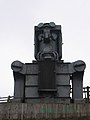 The Old Transformers, The IronMaster - geograph.org.uk - 106379.jpg 480 × 640; 44 KB
-
 The Old Transformers, The Miner - geograph.org.uk - 106380.jpg 640 × 480; 62 KB
-
 Allensford Picnic Area - geograph.org.uk - 74984.jpg 640 × 480; 76 KB
-
 Blackhill Cemetery - geograph.org.uk - 74475.jpg 480 × 640; 174 KB
-
 Blackhill Main Street - geograph.org.uk - 74469.jpg 480 × 640; 66 KB
-
 Bunker Hill Farmhouse - geograph.org.uk - 102884.jpg 480 × 640; 41 KB
-
 Concealed Crossing - geograph.org.uk - 74994.jpg 480 × 640; 152 KB
-
 Derwent River at Allensford - geograph.org.uk - 74983.jpg 480 × 640; 131 KB
-
 Disused Workings Path - geograph.org.uk - 74977.jpg 480 × 640; 88 KB
-
 East Castle Railway Bridge - geograph.org.uk - 106385.jpg 640 × 480; 60 KB
-
 Gorecock Lane - geograph.org.uk - 106393.jpg 640 × 480; 69 KB
-
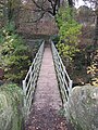
 Greencroft Footbridge - geograph.org.uk - 106399.jpg 640 × 480; 76 KB
-
 Hassockfield STC - geograph.org.uk - 102893.jpg 640 × 480; 57 KB
-
 Loud Hill Water Works - geograph.org.uk - 106396.jpg 640 × 480; 76 KB
-
 Low Brooms Farm - geograph.org.uk - 102831.jpg 640 × 480; 92 KB
-
 Old Fire Station at Delves - geograph.org.uk - 102816.jpg 640 × 480; 59 KB
-
 Panshield Hags - geograph.org.uk - 102931.jpg 640 × 480; 45 KB
-
 Salt Storage Container - geograph.org.uk - 106404.jpg 640 × 480; 52 KB
-
 Shotley Bridge - geograph.org.uk - 74996.jpg 640 × 480; 61 KB
-
 Shotley Bridge Hospital - geograph.org.uk - 74465.jpg 640 × 480; 80 KB
-
 Shotley Grove Lane - geograph.org.uk - 74990.jpg 480 × 640; 164 KB
-
 Shotley Park Home - geograph.org.uk - 102916.jpg 640 × 480; 110 KB
-
 Spen Banks - geograph.org.uk - 105897.jpg 480 × 640; 51 KB
-
 The Grove - geograph.org.uk - 74980.jpg 640 × 480; 79 KB


