Category:Images by Chris Morgan
Jump to navigation
Jump to search
Subcategories
This category has only the following subcategory.
N
Media in category "Images by Chris Morgan"
The following 200 files are in this category, out of 351 total.
(previous page) (next page)-
-2021-07-29 Castle Hotel, Downham Market, Norfolk.jpg 3,612 × 2,252; 1.99 MB
-
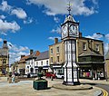
-2021-07-29 Clock tower, Downham Market, Norfolk.jpg 2,854 × 2,526; 1.33 MB
-
-2021-07-29 Railway station, Downham Market, Norfolk.jpg 4,000 × 2,252; 2.84 MB
-
-2021-07-29 Railway station, King’s Lynn, Norfolk.jpg 3,774 × 2,125; 1.79 MB
-
-2021-07-30 British Railways Class 101 DMU, Holt railway station, Norfolk.jpg 3,481 × 2,159; 2.29 MB
-
-2021-07-30 Signal box, Cromer railway station, Norfolk.jpg 3,606 × 2,005; 2.5 MB
-
-2021-07-30 Station sign, West Runton railway station, Norfolk.jpg 3,912 × 2,202; 3.04 MB
-
-2023-02-02 Transport for Wales Class 197 at Liverpool South Parkway.jpg 4,000 × 2,252; 2.5 MB
-
-2023-02-02 Bus interchange at Liverpool South Parkway.jpg 4,000 × 2,252; 2.1 MB
-
80 bus from Thurso just arrived outside Seaview Hotel, John OGroats (geograph 5245739).jpg 3,684 × 2,604; 1.87 MB
-
A glimpse of Fulford Hall - geograph.org.uk - 5069592.jpg 3,072 × 1,728; 4.03 MB
-
A very green lane (geograph 5600809).jpg 5,376 × 3,024; 3.97 MB
-
A wet frog attracts interest at Melton West Business Park (geograph 5318668).jpg 5,376 × 3,024; 1.87 MB
-
A1079 entering Hull from the North (geograph 5307705).jpg 5,376 × 3,024; 2.42 MB
-
A164 Beverley Southern by-pass, Minster Way (geograph 4446646).jpg 1,280 × 960; 845 KB
-
A64 near Bishopthorpe - geograph.org.uk - 4804224.jpg 2,992 × 1,570; 2.64 MB
-
Above us the lanes - geograph.org.uk - 5069596.jpg 3,072 × 1,728; 2.96 MB
-
Across the River Hull towards new housing development at Kingswood (geograph 5307723).jpg 5,376 × 3,024; 2.13 MB
-
Adlingfleet Common (geograph 6557264).jpg 3,122 × 1,729; 1.76 MB
-
AESSEAL New York Stadium - geograph.org.uk - 6390621.jpg 3,236 × 1,904; 1.21 MB
-
All Saints Parish Church, Matlock Bank (geograph 4214070).jpg 4,000 × 2,248; 4.73 MB
-
All Saints' Church, Cawthorne 2845603.jpg 2,111 × 2,111; 648 KB
-
Along the boundary at Kelvedon & Feering Cricket Club (geograph 5887819).jpg 5,376 × 3,024; 5.07 MB
-
Approaching Beverley Parks Crossing (geograph 4448818).jpg 1,280 × 954; 852 KB
-
Approaching Cherry Tree Cottage (geograph 4459662).jpg 1,280 × 960; 1.32 MB
-
Approaching Mill Lane, Huggate (geograph 6108195).jpg 3,648 × 2,736; 3.81 MB
-
Approaching Poplar Farm (geograph 4448549).jpg 1,280 × 954; 1.09 MB
-
Approaching Sicey Farm (geograph 5307726).jpg 5,304 × 2,888; 2.18 MB
-
Art beside the track at Spring Lane Farm (geograph 5600804).jpg 5,376 × 3,024; 3.62 MB
-
Asselby Marsh (geograph 3435976).jpg 3,950 × 2,156; 2.16 MB
-
Asselby Roll of Honour (geograph 5600651).jpg 2,775 × 4,520; 2.04 MB
-
Baled in Grassthorpe (geograph 4590902).jpg 3,072 × 1,728; 3.82 MB
-
Bamburgh (geograph 6055302).jpg 2,560 × 1,297; 1.18 MB
-
Barge across the River Hull at Wawne (geograph 5307727).jpg 5,376 × 3,024; 2.76 MB
-
Barmby Marsh Water Treatment Works (geograph 3435946).jpg 4,000 × 2,248; 1.9 MB
-
Beneath Moor Lane bridge - geograph.org.uk - 5072557.jpg 3,072 × 1,728; 3.96 MB
-
Bentham station (geograph 6319243).jpg 3,648 × 1,744; 2.63 MB
-
Beside Marsh Lane (geograph 3435980).jpg 4,000 × 2,248; 2.71 MB
-
Between the lines (geograph 4448517).jpg 1,280 × 939; 1.07 MB
-
Beverley 20 path heads south into open country (geograph 4448510).jpg 1,280 × 960; 1.4 MB
-
Beverley Westwood golf course (geograph 4446672).jpg 1,280 × 960; 1.39 MB
-
Bibury Court Hotel (geograph 2856845).jpg 1,562 × 1,148; 322 KB
-
Bishopthorpe Methodist church - geograph.org.uk - 4801678.jpg 2,970 × 1,516; 3.18 MB
-
Bishopthorpe Palace - geograph.org.uk - 5617838.jpg 5,376 × 3,024; 2.87 MB
-
Blacksmiths Arms, Naburn - geograph.org.uk - 5071602.jpg 3,072 × 1,728; 2.91 MB
-
Blue House corner, Newcastle upon Tyne - geograph.org.uk - 2848616.jpg 987 × 577; 210 KB
-
Boat of Garten station, Strathspey Railway (geograph 7529736).jpg 3,101 × 1,749; 1.42 MB
-
Boats on River Ouse - geograph.org.uk - 5069588.jpg 3,072 × 1,728; 3.8 MB
-
Boats on the river - geograph.org.uk - 5069585.jpg 3,072 × 1,728; 1.65 MB
-
Boothferry Bridge, west side - geograph.org.uk - 4807669.jpg 3,072 × 1,728; 1.44 MB
-
Brickyard Lane (geograph 4343106).jpg 4,000 × 2,248; 6.51 MB
-
Brickyard Lane blocked (geograph 5317823).jpg 3,072 × 1,728; 2.49 MB
-
Bridge across dry ditch (geograph 5600828).jpg 5,376 × 3,024; 4.12 MB
-
Bridge across gully in the woods (geograph 5600831).jpg 5,376 × 3,024; 3.76 MB
-
Bridge over York ^ Selby Path, National Cycle Route 65 - geograph.org.uk - 5072804.jpg 3,034 × 1,658; 3.98 MB
-
Bridleways are for horses, not cars or 4x4s (geograph 4342441).jpg 4,000 × 2,248; 5.47 MB
-
Brind Lane (geograph 5600646).jpg 5,304 × 2,888; 2.5 MB
-
Brind Lane (geograph 5600703).jpg 5,376 × 3,024; 2.51 MB
-
Broadgate Farm, Beverley (geograph 4446550).jpg 1,600 × 878; 350 KB
-
Burrows Court tower block stands sentinel (geograph 5042597) (cropped).jpg 847 × 1,036; 410 KB
-
Burrows Court tower block stands sentinel (geograph 5042597).jpg 3,072 × 1,728; 1.45 MB
-
Burton Joyce station (geograph 5042790).jpg 3,072 × 1,728; 3.78 MB
-
By Braffords Clump with Fox Covert to left horizon (geograph 4342491).jpg 4,000 × 2,248; 5.74 MB
-
Caledonian Canal Lock gate, Gairlochy (geograph 6886809).jpg 4,000 × 2,252; 3.17 MB
-
Caledonian MacBraynes ferry MV Hallaig (geograph 4532739).jpg 3,072 × 1,728; 1.32 MB
-
Calving stalls at Morthen (geograph 5630306).jpg 4,557 × 2,833; 2.29 MB
-
Canoes at Gairlochy (geograph 6886787).jpg 3,824 × 2,094; 2.87 MB
-
Caravan farm at Wanlass (geograph 4448560).jpg 1,280 × 960; 1.14 MB
-
Cattle at Gortenachullish (geograph 6883142).jpg 4,000 × 2,252; 2.03 MB
-
Chapel Hill, Welton (geograph 4380173).jpg 4,000 × 2,248; 6.32 MB
-
Chapel-en-le-Frith railway station (geograph 3522524).jpg 3,954 × 2,164; 5.25 MB
-
Cheddleton Flint Mill (geograph 3376020).jpg 3,862 × 2,806; 2.12 MB
-
City walls and Micklegate bar, York - geograph.org.uk - 2851007.jpg 4,000 × 2,672; 2.75 MB
-
Cluanie Inn on the A87 Road to the Isles (geograph 4533732).jpg 3,072 × 1,728; 1.31 MB
-
Confined by barracks - geograph.org.uk - 5069552.jpg 3,072 × 1,728; 1.37 MB
-
Copmanthorpe Youth Club - geograph.org.uk - 4804340.jpg 3,072 × 1,728; 3.32 MB
-
Corner of Ferry Lane and Thearne Lane, Thearne (geograph 5307734).jpg 5,376 × 3,024; 2.52 MB
-
Course of old Roman road towards York - geograph.org.uk - 4804728.jpg 2,624 × 1,650; 4.09 MB
-
Cows beside Model Farm (geograph 4448824).jpg 1,280 × 829; 1 MB
-
Crossing Farm (geograph 3435982).jpg 3,986 × 2,222; 1.52 MB
-
Crossing Howden Parks (geograph 5600797).jpg 5,350 × 2,976; 2.09 MB
-
Crossing the tracks (geograph 6516390).jpg 3,648 × 1,744; 3.07 MB
-
Culvert below new road (geograph 4446642).jpg 1,280 × 960; 1.18 MB
-
Dam on Crowle Waste or Moors (geograph 7304297).jpg 3,711 × 2,092; 2.65 MB
-
Davy's Fried Fish, Pit Village, Beamish Museum, 16 September 2013.jpg 1,527 × 502; 228 KB
-
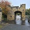
Defensive gateway to Warkworth Bridge - geograph-7007520-by-Chris-Morgan.jpg 2,992 × 2,992; 3.26 MB
-
Derelict house at Stonely (geograph 5556299).jpg 5,376 × 3,024; 2.31 MB
-
Descending to Autherd Drain (geograph 4446665).jpg 1,280 × 960; 1.18 MB
-
Descending Turtle Hill (geograph 4380789).jpg 4,000 × 2,248; 2.5 MB
-
Distant Askham Bryan College - geograph.org.uk - 4804776.jpg 2,962 × 1,494; 2.95 MB
-
Ditching work in progress near Adlingfleet (geograph 6556365).jpg 3,894 × 2,369; 2.03 MB
-
Dochfour House (geograph 6889267).jpg 4,000 × 2,252; 3.63 MB
-
Drainage ditch beside Barmby Marsh Water Treatment Works (geograph 3435968).jpg 3,976 × 2,204; 1.93 MB
-
Earthworks from Nun Cotham Priory (geograph 6003505).jpg 5,249 × 2,953; 3.38 MB
-
East Carlton Hall (geograph 4416957).jpg 4,000 × 2,248; 1.65 MB
-
Eastoft Station House (geograph 6557289).jpg 3,648 × 1,744; 2.27 MB
-
End of the line at South Hylton (geograph 5735291).jpg 5,327 × 2,997; 2.8 MB
-
End of the walk - geograph.org.uk - 4798401.jpg 2,210 × 1,557; 594 KB
-
England Springs Crossing (geograph 4459658).jpg 1,280 × 959; 1.02 MB
-
Enjoy your journey from Drigg - geograph.org.uk - 4367776.jpg 3,267 × 2,188; 3.96 MB
-
Ennerdale Link Bridges across the River Hull (geograph 5307721).jpg 5,376 × 3,024; 2.67 MB
-
Entering Asselby (geograph 5600714).jpg 5,376 × 3,024; 2.58 MB
-
Entrance to Bishopthorpe Palace - geograph.org.uk - 5070339.jpg 2,875 × 1,517; 3.09 MB
-
Entrance to Wood Farm (geograph 5600698).jpg 5,360 × 2,996; 2.91 MB
-
Entry to Burley Park station (geograph 3925092).jpg 3,970 × 2,194; 6.14 MB
-
Entry to Designer Outlet Park ^ Ride site - geograph.org.uk - 5067875.jpg 3,072 × 1,728; 1.73 MB
-
Entry to Manor House Gardens - geograph.org.uk - 4804350.jpg 3,072 × 1,728; 4.03 MB
-
Epworth Methodist Church (geograph 4664897).jpg 3,072 × 1,728; 1.64 MB
-
Exhibition Park lake, Newcastle upon Tyne (geograph 2854352).jpg 3,303 × 2,142; 936 KB
-
Fargate, Sheffield, reconstruction in progress (geograph 7263216).jpg 4,000 × 2,252; 2.89 MB
-
Field and path by Old Hall (geograph 4448524).jpg 1,280 × 960; 1.36 MB
-
Figham Bridge over Beverley and Barmston Drain (geograph 4460122).jpg 1,280 × 960; 1.2 MB
-
Fighham Common Pasture beside Tokenspire Park Industrial Estate (geograph 5307420).jpg 5,310 × 2,900; 1.76 MB
-
Fighters on display - geograph.org.uk - 3479311.jpg 4,000 × 2,672; 2.42 MB
-
Finningley Station (geograph 5251742).jpg 5,368 × 3,010; 1.79 MB
-
Flooded former peat workings (geograph 7304283).jpg 3,881 × 2,185; 2.24 MB
-
Following the leader... (geograph 6516386).jpg 3,648 × 1,744; 3.33 MB
-
Footbridge across Scurf Dyke (geograph 6516399).jpg 3,648 × 1,744; 3.45 MB
-
Footbridge across Scurf Dyke (geograph 6517085).jpg 3,648 × 1,744; 3.24 MB
-
Footpath off Thearne Lane (geograph 5307736).jpg 5,376 × 3,024; 4.09 MB
-
Footpath on High Hunsley Circuit (geograph 4380757).jpg 4,000 × 2,248; 7.74 MB
-
Ford across Bradbourne brook (geograph 2852629).jpg 4,000 × 2,672; 2.74 MB
-
Former Commandants House, Shoeburyness Barracks (geograph 4522980).jpg 3,072 × 1,728; 1.37 MB
-
Former LMS Stanier Class 5 at Arisaig (geograph 6883141).jpg 4,000 × 2,252; 3.09 MB
-
Former Martins Bank on Railway Street, Altrincham (geograph 3856921).jpg 4,000 × 2,248; 4.44 MB
-
Former St James Chapel (geograph 5630307).jpg 5,342 × 2,960; 3.38 MB
-
Forres station (geograph 7531551).jpg 3,918 × 2,938; 2.71 MB
-
Forres station with Scotrail Inter7City train (geograph 7531581).jpg 4,000 × 3,000; 2.49 MB
-
From Humber Bank at Oyster Ness looking east (geograph 4343063).jpg 4,000 × 2,248; 3.84 MB
-
From Red Cliff looking across Redcliff Sand (geograph 4343115).jpg 4,000 × 2,248; 5.49 MB
-
Gently does it (geograph 4684478).jpg 3,072 × 1,728; 3.82 MB
-
Getting ready for Christmas (geograph 5600717).jpg 5,376 × 3,024; 3.26 MB
-
Green Lane (Track) (geograph 5600815).jpg 5,376 × 3,024; 2.88 MB
-
Green Lane (Track) (geograph 5600821).jpg 5,376 × 3,024; 2.67 MB
-
Grimsby Dock Tower (geograph 5369506).jpg 2,369 × 4,512; 1.05 MB
-
Grosmont, North York Moors Railway - geograph.org.uk - 2852585.jpg 4,000 × 2,672; 2.67 MB
-
Hangingbridge across the River Dove (geograph 5312354).jpg 5,376 × 3,024; 2.24 MB
-
Packhorse bridge in Derbyshire.jpg 4,000 × 2,248; 1.94 MB
-
Harvest gathered in and now the cycle starts again (geograph 5600692).jpg 5,376 × 3,024; 2.39 MB
-
High School tram stop (geograph 3885252).jpg 4,000 × 2,248; 1.6 MB
-
Hollywood Way Bridge, Stockport (geograph 6600725).jpg 2,660 × 2,047; 1.72 MB
-
Horses behind young rowan trees (geograph 6557272).jpg 3,091 × 1,634; 1.71 MB
-
House on Whins Gate (geograph 6557283).jpg 3,454 × 1,651; 1.19 MB
-
Housing at Woodmansey (geograph 4459685).jpg 1,280 × 960; 986 KB
-
Howden Lane bridge, Naburn - geograph.org.uk - 5070511.jpg 3,072 × 1,728; 4.44 MB
-
Hulley's of Baslow Breezer bus (geograph 7501281).jpg 2,186 × 1,834; 1.23 MB
-
Humber Bank at Oyster Ness looking west (geograph 4343056).jpg 4,000 × 2,248; 5.59 MB
-
Humber foreshore beside Melton Ings (geograph 4343093).jpg 3,980 × 2,212; 5.72 MB
-
Imerys Minerals calcium carbonate plant, Beverley (geograph 4445377).jpg 4,896 × 3,672; 6.72 MB
-
Keldmarsh Primary School, Beverley (geograph 4448513).jpg 1,280 × 719; 810 KB
-
Kelham Bridge (geograph 4738024).jpg 3,072 × 1,728; 1.45 MB
-
Kenley Reach on River Hull (geograph 5307733).jpg 5,342 × 2,960; 2.44 MB
-
Knedlington Old Hall (geograph 5600712).jpg 5,376 × 3,024; 2.55 MB
-
Lake at Bleach House Farm (geograph 4459679).jpg 1,280 × 960; 1.04 MB
-
Last cottage on York Road, Tadcaster - geograph.org.uk - 4804368.jpg 3,072 × 1,728; 3.7 MB
-
Laying a smokescreen on Macclesfield Canal (geograph 7061906).jpg 2,992 × 2,992; 2.52 MB
-
Leaving Wressle (geograph 5600678).jpg 5,376 × 3,024; 6.52 MB
-
Lighthouse on South Shields pier (geograph 5802173).jpg 5,313 × 2,989; 2.34 MB
-
LNER Azuma at Grantham - geograph.org.uk - 6187562.jpg 3,648 × 2,736; 2 MB
-
Loftsome Bridge (geograph 3435955).jpg 3,970 × 2,194; 1.78 MB
-
Longbenton Metro station - geograph.org.uk - 5645753.jpg 5,235 × 2,945; 3.31 MB
-
Longbenton Metro station - geograph.org.uk - 5645780.jpg 5,067 × 2,851; 3.17 MB
-
Longbenton Metro station looking east (geograph 5645758).jpg 5,376 × 3,024; 4.83 MB
-
Longbenton St Bartholomew south face GeoUK 5668442.jpg 5,376 × 3,024; 2.87 MB
-
Longhirst Hall Hotel (geograph 3170003).jpg 4,000 × 2,121; 1.49 MB
-
Looking across Figham Common Pasture (geograph 5307740).jpg 5,304 × 2,888; 2.2 MB
-
Looking across the Humber at West Clough (geograph 4343084).jpg 3,978 × 2,206; 6.51 MB
-
Looking down from Elloughton Wold to Elloughton Dale (geograph 4380190).jpg 4,000 × 2,248; 5.34 MB
-
Looking towards Barmby Marsh Water Treatment Station (geograph 3435962).jpg 3,970 × 2,194; 1.53 MB
-
Looking towards site of old Cistercian Abbey, from Abbey Green (geograph 3249836).jpg 4,000 × 2,248; 2.37 MB
-
Looking up Dale Road, Welton (geograph 4343018).jpg 4,000 × 2,248; 6.88 MB
-
Magnolias at Box Tree Farm, Main Street, Asselby (geograph 3435925).jpg 3,960 × 2,172; 1.66 MB
-
Manor Heath, Copmanthorpe - geograph.org.uk - 4804356.jpg 3,072 × 1,728; 3.38 MB
-
Market Place, York - geograph.org.uk - 2851000.jpg 4,000 × 3,000; 2.89 MB
-
Melton Lane Level Crossing (geograph 5318316).jpg 5,376 × 3,024; 2.15 MB
-
Milepost on Tadcaster and Doncaster Road at Bentley with Arksey (geograph 5093620).jpg 1,870 × 3,492; 1.56 MB
-
Milestone on old turnpike, Houndkirk Road (geograph 4331662).jpg 3,726 × 1,820; 2.88 MB
-
Mill Farm, Wressle (geograph 5600672).jpg 5,376 × 3,024; 2.59 MB
-
Millennium Bridge over River Ouse - geograph.org.uk - 5067872.jpg 3,072 × 1,728; 1.49 MB
-
Mount St Mary's College by Chris Morgan geograph 7103958.jpg 4,000 × 2,252; 2.71 MB
-
Naburn station, as was. Now a cafe - geograph.org.uk - 5070499.jpg 3,072 × 1,728; 3.98 MB
-
Naburn Village Hall - geograph.org.uk - 5072535.jpg 3,020 × 1,628; 2.99 MB
-
National Cycle Network Route 65 - geograph.org.uk - 4801687.jpg 1,728 × 3,072; 4.59 MB
-
NCN Millennium Milepost MP814 Admirals Park Chelmsford.jpeg 3,072 × 1,728; 2.07 MB
-
New Everton Stadium (geograph 7396627).jpg 2,498 × 1,701; 685 KB
-
New housing development at The Ings, Kingswood Estate (geograph 5307725).jpg 5,376 × 3,024; 1.67 MB
-
Newcastle Central Station (geograph 2855149).jpg 1,428 × 890; 256 KB
-
Newcastle City Hall (geograph 2855131).jpg 1,600 × 1,200; 267 KB
-
Nimrod MR2 XV250 at Yorkshire Air Museum - geograph.org.uk - 3479315.jpg 3,964 × 1,928; 965 KB
-
No sign of Hunting Bridge (geograph 6516426).jpg 3,648 × 1,744; 2.46 MB
-
North Ferriby foreshore (geograph 4342042).jpg 4,000 × 2,248; 1.43 MB
-
Northern Class 150-2 at Brind Crossing, heading west (geograph 5600655).jpg 3,989 × 2,156; 1.38 MB
-
Northern Railway Class 195 003 at Meadowhall (geograph 6358807).jpg 3,310 × 1,582; 1.63 MB


