Category:Illustrations of SWOT
Jump to navigation
Jump to search
Media in category "Illustrations of SWOT"
The following 9 files are in this category, out of 9 total.
-
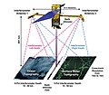
Diagram of SWOT Data Collection.jpg 3,428 × 2,989; 3.72 MB
-
Illustration of the Surface Water and Ocean Topography satellite.jpg 2,000 × 1,280; 1.46 MB
-
PhotoGalHiResImage-2.jpg 1,000 × 844; 193 KB
-
PhotoGalHiResImage-26.jpg 2,000 × 2,000; 1.86 MB
-
Surface Water and Ocean Topography (SWOT).jpg 4,500 × 3,374; 7.93 MB
-
Swot bus.png 880 × 1,063; 744 KB
-
SWOT KaRIn Antenna Deployment (Animation) (PIA25596).jpg 960 × 540; 24 KB
-
Swot payload.jpg 1,150 × 1,533; 728 KB
-
SWOT spacecraft model.png 1,450 × 994; 1.12 MB


