Category:Illertal
Jump to navigation
Jump to search
Illertal
[edit]Das Illertal ist das Iller-Urstromtal das bei Oberstdorf am Zusammenfluß von Stillach, Breitach und Trettach beginnt und in Ulm an der Illerspitze bei der Einmündung der Iller in die Donau endet.
Media in category "Illertal"
The following 52 files are in this category, out of 52 total.
-
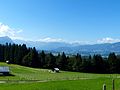
 Allg-alp.jpg 2,296 × 1,528; 1.06 MB
-
 Ausblick Iseler.jpg 4,000 × 3,000; 4.75 MB
-
 Bad Grönenbach - Manneberg Ri N, Illerwinkel, Flussnebel 160820 - 01.jpg 4,608 × 2,592; 722 KB
-
 Betzigau - Hochgreut westl - Illertal, Allgäuer Voralpen, Nebel 191221.jpg 4,608 × 2,592; 806 KB
-
 Birnbaum in voller Blüte.jpg 3,648 × 2,736; 3.57 MB
-
 Blaichach - Seifriedsberg, Blaichach, Rottachberg v SW, Herbstmorgen.jpg 3,264 × 1,840; 1.37 MB
-
 Blaichach-Gunzesried - Sicht auf Illertal und Rettenberg.JPG 4,864 × 3,648; 3.34 MB
-
 Blick nach Kempten 2.jpg 4,000 × 3,000; 1.8 MB
-
 Blick über Betzigau Illertal.jpg 4,000 × 3,000; 1.6 MB
-
 Das dicht besiedelte Illertal - panoramio.jpg 2,592 × 1,944; 1.1 MB
-
 Das Illertal bei Wasserei - panoramio.jpg 2,592 × 1,944; 1.04 MB
-
 Fahrt ins Illertal - panoramio.jpg 1,280 × 960; 501 KB
-
 Freidorf Rettenberg GO.jpg 2,592 × 1,944; 1.43 MB
-
 Gleitschirmflieger im Illertal - panoramio.jpg 800 × 602; 213 KB
-
 Helmknabenkraut Orchis militaris.JPG 2,736 × 3,648; 3.34 MB
-
 Hochwasser im Illerauwald 06.08.2010.JPG 3,648 × 2,736; 3.44 MB
-
 Hurter Iller-Gebiet 1619 Karte BSB Mapp XI-374 I Web.jpg 3,402 × 1,423; 3.1 MB
-
 Hurter-illergebiet-1619.jpg 4,878 × 2,077; 6.53 MB
-
 Iller Flußkilometer 15 am 12.11.2015.jpg 4,578 × 2,562; 618 KB
-
 Iller-Rad- und Wanderweg bei Wiblingen.jpg 3,237 × 2,162; 1.52 MB
-
 Iller-Radweg bei Wiblingen.jpg 3,264 × 2,448; 2.04 MB
-
 Illerauwald bei Au.JPG 3,648 × 2,736; 3.56 MB
-
 Illerdurchbruch Molasse Sandstein Mergel.jpg 4,000 × 3,000; 3.85 MB
-
 Illertal - Richtung Kloster Bonlanden geknipst.JPG 4,000 × 2,672; 2.7 MB
-
 Illertal 2.jpg 1,536 × 1,152; 830 KB
-
 Illertal 2019 (6).JPG 4,000 × 3,000; 4.6 MB
-
 Illertal bei Thanners-2, 18.10.2014.jpg 2,592 × 1,944; 1.13 MB
-
 Illertal Herbst Auto mit Baum.JPG 2,672 × 4,000; 2.62 MB
-
 Illertal Herbst Autro mit Baum.JPG 2,672 × 4,000; 3.16 MB
-
 Illertal Herbst Autro mit—Baum (Halbgeviertstrich).JPG 4,000 × 2,344; 2.66 MB
-
 Illertal Richtung Erolzheim 2019.JPG 4,000 × 2,444; 2.31 MB
-
 Illertal Richtung Kellmünz an der Iller.JPG 4,000 × 2,672; 2.56 MB
-
 Illertal von Oben.jpg 3,267 × 2,178; 4.21 MB
-
 Illertal-2008-12-29b.jpg 800 × 600; 117 KB
-
 Illertal.jpg 1,536 × 1,152; 813 KB
-
 Kempten - Rappenscheuchen v W 02.jpg 4,608 × 2,592; 701 KB
-
 NP-By-Allgäuer Nagelfluhkette-Wannenkopf-02.10.2013-NL1.jpg 4,941 × 2,465; 12.03 MB
-
 Obereres Illertal-0811a.jpg 5,431 × 3,587; 4.74 MB
-
 Obereres Illertal-0811ab.jpg 5,431 × 3,587; 4.79 MB
-
 Oberstdorf, Germany - panoramio.jpg 2,304 × 1,728; 1.49 MB
-
 Oberstdorfer Berge IMG 4008a.jpg 5,472 × 3,648; 7.49 MB
-
 Orchis ustulata Brand-Knabenkraut.JPG 3,648 × 2,736; 3.35 MB
-
 Oyhof-e.jpg 960 × 720; 147 KB
-
 Sonntag 17. November 2019 (3).jpg 320 × 180; 41 KB
-
 Sonntag 17. November 2019 (9).JPG 4,000 × 2,672; 3.38 MB
-
 Sulzberg, OA - Eulen - Seebach Nr 1, Eigen, Öschlesee, Hegge.jpg 4,000 × 2,248; 1.39 MB
-
 Sulzberg, OA - OA 6 südl - Waltenhofen v SO 280620.jpg 4,423 × 2,355; 992 KB
-
 WikiProjekt Landstreicher Südhang Grünten 01.jpg 4,000 × 3,000; 2.78 MB
-
 WikiProjekt Landstreicher Südhang Grünten 02.jpg 4,000 × 3,000; 2.52 MB
-
 WikiProjekt Landstreicher Südhang Grünten 07.jpg 4,000 × 3,000; 3.08 MB
-
 WikiProjekt Landstreicher Südhang Grünten 17.jpg 4,000 × 3,000; 3.08 MB
-
 WikiProjekt Landstreicher Südhang Grünten 18.jpg 4,000 × 3,000; 3.1 MB


.JPG)


.JPG)


.jpg)
.JPG)


