Category:Iken
Jump to navigation
Jump to search
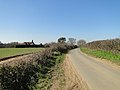
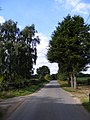
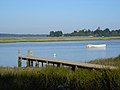
English: Iken is a small village and civil parish in the marshlands of the English county of Suffolk.

village in the United Kingdom  | |||||
| Upload media | |||||
| Instance of | |||||
|---|---|---|---|---|---|
| Location |
| ||||
| Population |
| ||||
 | |||||
Subcategories
This category has the following 2 subcategories, out of 2 total.
B
I
- Iken WWI Memorial Plaque (4 F)
Media in category "Iken"
The following 200 files are in this category, out of 279 total.
(previous page) (next page)-
 A long straight track into Tunstall Forest - geograph.org.uk - 4056319.jpg 1,200 × 1,600; 313 KB
-
 Access No.30 into Tunstall Forest - geograph.org.uk - 2667507.jpg 3,072 × 2,304; 1.67 MB
-
 Alde Cottage hiding behind a hedge - geograph.org.uk - 4375296.jpg 1,024 × 768; 403 KB
-
 Alde estuary - geograph.org.uk - 7209071.jpg 1,024 × 768; 210 KB
-
 Alde Mudflats - geograph.org.uk - 4310780.jpg 1,024 × 768; 235 KB
-
 Alde Mudflats Sign - geograph.org.uk - 4310785.jpg 1,024 × 768; 222 KB
-
 And away - geograph.org.uk - 4375387.jpg 1,024 × 768; 150 KB
-
 Baling off Turnstall Road - geograph.org.uk - 3386397.jpg 640 × 480; 118 KB
-
 Barge and horse, River Alde - geograph.org.uk - 1994568.jpg 2,848 × 2,136; 1.69 MB
-
 Barge moored on Cliff Reach, Iken - geograph.org.uk - 2300759.jpg 760 × 570; 215 KB
-
 Barn conversion near Hill Farm, Iken - geograph.org.uk - 2300910.jpg 760 × 570; 220 KB
-
 Beached boats on the Alde estuary - geograph.org.uk - 7209074.jpg 1,024 × 768; 150 KB
-
 Blackheath Mansion across the Alde - geograph.org.uk - 6971590.jpg 1,024 × 768; 315 KB
-
 Blacksmith's Cottage - geograph.org.uk - 4375346.jpg 1,024 × 768; 561 KB
-
 Boardwalk in the reeds - geograph.org.uk - 7082850.jpg 4,032 × 3,024; 3 MB
-
 Boat ^ Tower, Iken - geograph.org.uk - 3997912.jpg 3,648 × 2,052; 2.1 MB
-
 Bull with a view - geograph.org.uk - 3089745.jpg 1,421 × 1,059; 381 KB
-
 Bungalow at Iken Boot - geograph.org.uk - 4375336.jpg 1,024 × 768; 477 KB
-
 Byway at the entrance to Iken Cliff Picnic Site - geograph.org.uk - 4450000.jpg 3,072 × 2,304; 1.7 MB
-
 Byway off Tunstall Road - geograph.org.uk - 4449946.jpg 3,072 × 2,304; 1.82 MB
-
 Byway sign off Tunstall Road - geograph.org.uk - 4449991.jpg 2,304 × 3,072; 2.55 MB
-
 Cabbage crop - geograph.org.uk - 7031529.jpg 1,600 × 901; 800 KB
-
 Canoes at Cliff Reach - East - geograph.org.uk - 4568692.jpg 3,772 × 2,356; 1.42 MB
-
 Canoes at Cliff Reach - North - geograph.org.uk - 4568706.jpg 3,860 × 2,552; 1.79 MB
-
 Canoes at Cliff Reach - West - geograph.org.uk - 4568698.jpg 4,000 × 2,664; 1.94 MB
-
 Canoes for Hire on River Alde - geograph.org.uk - 4132630.jpg 1,600 × 1,200; 482 KB
-
 Causeway through the marsh - geograph.org.uk - 4574140.jpg 3,880 × 2,448; 2.63 MB
-
 Church Farm, Iken - geograph.org.uk - 7209077.jpg 1,024 × 768; 216 KB
-
 Church Lane south of The Anchorage - geograph.org.uk - 3559525.jpg 3,519 × 2,581; 1.4 MB
-
 Cliff Reach - Iken - geograph.org.uk - 463006.jpg 640 × 480; 47 KB
-
 Cliff Reach Iken - geograph.org.uk - 2180908.jpg 2,048 × 1,536; 630 KB
-
 Cliff Reach, Iken - geograph.org.uk - 666279.jpg 640 × 427; 67 KB
-
 Cliff Reach, Iken, Suffolk - geograph.org.uk - 2300756.jpg 760 × 570; 179 KB
-
 Cliff Reach, River Alde - geograph.org.uk - 666253.jpg 640 × 427; 112 KB
-
 Conundrum, Iken Cliff - geograph.org.uk - 5603987.jpg 1,064 × 1,600; 370 KB
-
 Corner house on Ferry Road, High Street - geograph.org.uk - 5897129.jpg 4,995 × 3,627; 4.28 MB
-
 Cottage at High Street - geograph.org.uk - 3389099.jpg 640 × 480; 110 KB
-
 Countryside south west of Iken Hall - geograph.org.uk - 5897004.jpg 5,068 × 3,655; 3.73 MB
-
 Crop irrigation near Red House Farm, Sudbourne - geograph.org.uk - 4139269.jpg 3,072 × 1,728; 1.21 MB
-
 Crossroads on the Snape Road - geograph.org.uk - 2663929.jpg 3,072 × 2,304; 1.26 MB
-
 Cultivated and planted with potatoes - geograph.org.uk - 4375262.jpg 1,024 × 768; 451 KB
-
 Curlew, Numenius arquata - geograph.org.uk - 4375343.jpg 1,024 × 768; 332 KB
-
 Cyclists on Ferry Road, Iken - geograph.org.uk - 6180396.jpg 2,183 × 1,455; 569 KB
-
 Decoy Cottage, Iken - geograph.org.uk - 185024.jpg 640 × 480; 87 KB
-
 Entrance of Iken Cliff Picnic site - geograph.org.uk - 4450192.jpg 3,072 × 2,304; 2.2 MB
-
 Entrance to Alde House Farm - geograph.org.uk - 4574184.jpg 1,024 × 681; 191 KB
-
 Entrance to footpath west of Iken Hall - geograph.org.uk - 3559532.jpg 3,648 × 2,736; 1.82 MB
-
 Entrance to Iken Bay Livery at Iken Hall - geograph.org.uk - 4450242.jpg 3,072 × 2,304; 2.92 MB
-
 Entrance to Iken Cliff Picnic site - geograph.org.uk - 4450020.jpg 3,072 × 2,304; 1.83 MB
-
 Falcons Bottom Farm sign - geograph.org.uk - 2667415.jpg 3,072 × 2,304; 1.45 MB
-
 Farm access road to Forest Farm - geograph.org.uk - 4056302.jpg 1,536 × 1,152; 1,006 KB
-
 Farm sign - geograph.org.uk - 4375353.jpg 1,024 × 768; 173 KB
-
 Farm Track - geograph.org.uk - 4494303.jpg 1,024 × 768; 211 KB
-
 Farmland near Cowton House - geograph.org.uk - 7052707.jpg 4,032 × 3,024; 3.64 MB
-
 Farmland off Tunstall Road - geograph.org.uk - 4450639.jpg 3,072 × 2,304; 1.86 MB
-
 Fazeboons Main entrance - geograph.org.uk - 2667420.jpg 3,072 × 2,304; 1.5 MB
-
 Fazeboons Main entrance - geograph.org.uk - 2667421.jpg 2,304 × 3,072; 1.63 MB
-
 Fazeboons near Sudbourne - geograph.org.uk - 2300766.jpg 760 × 570; 336 KB
-
 Fazeboons sign - geograph.org.uk - 2667422.jpg 3,072 × 2,304; 1.54 MB
-
 Ferry road junction - geograph.org.uk - 2608824.jpg 3,072 × 2,304; 1.3 MB
-
 Ferry Road junction with Church Lane ^ Tunstall Road - geograph.org.uk - 3559520.jpg 3,393 × 2,592; 1.45 MB
-
 Ferry Road junction with Sandy Lane - geograph.org.uk - 3559314.jpg 3,548 × 2,671; 1.85 MB
-
 Field of pigs - geograph.org.uk - 3125490.jpg 1,600 × 1,064; 459 KB
-

-
 Fields south of Iken Hall - geograph.org.uk - 5581043.jpg 1,600 × 1,064; 217 KB
-
 Fir Tree Cottages, Iken - listed building (geograph 7498225).jpg 5,035 × 3,112; 5.97 MB
-
 Fire hydrant and covered crop - geograph.org.uk - 4375375.jpg 1,024 × 768; 480 KB
-
 Footpath off Tunstall Road - geograph.org.uk - 4450245.jpg 3,072 × 2,304; 1.84 MB
-
 Footpath off Tunstall Road - geograph.org.uk - 4450248.jpg 3,072 × 2,304; 2.31 MB
-
 Footpath sign on Suffolk Coast Path - geograph.org.uk - 4450160.jpg 2,240 × 2,978; 4.13 MB
-
 Footpath Signs - geograph.org.uk - 4310776.jpg 768 × 1,024; 316 KB
-
 Footpath to Alde House Farm - geograph.org.uk - 4375267.jpg 1,024 × 768; 267 KB
-

-

-

-
 Footpath to Iken Cliff - geograph.org.uk - 2608829.jpg 2,304 × 3,072; 1.48 MB
-

-

-
 Forest Farm sign - geograph.org.uk - 2667315.jpg 2,304 × 3,072; 1.35 MB
-
 Forestry Commission Road into Tunstall Forest - geograph.org.uk - 2666850.jpg 3,072 × 2,304; 1.67 MB
-
 Forestry Commission sign - geograph.org.uk - 2666862.jpg 2,304 × 3,072; 1.67 MB
-
 From Iken Cliff - geograph.org.uk - 5863395.jpg 1,024 × 768; 172 KB
-
 Gate opposite Iken Hall - geograph.org.uk - 3386818.jpg 640 × 480; 105 KB
-
 Grass field, Iken - geograph.org.uk - 3997921.jpg 3,648 × 2,736; 2.73 MB
-
 Harvested bales and oil tank - geograph.org.uk - 5863392.jpg 768 × 1,024; 191 KB
-
 High Street road junction - geograph.org.uk - 2608801.jpg 3,072 × 2,304; 1.37 MB
-
 Hill Farm, Iken - geograph.org.uk - 2300938.jpg 760 × 570; 182 KB
-

-
 Horses in field at Iken - geograph.org.uk - 7209079.jpg 1,024 × 768; 135 KB
-
 Iken Bay Livery - geograph.org.uk - 4450239.jpg 3,072 × 2,304; 2.31 MB
-
 Iken Bay Livery - geograph.org.uk - 4877151.jpg 3,678 × 2,456; 5.07 MB
-
 Iken Bay Livery sign at Iken Hall - geograph.org.uk - 4450243.jpg 2,304 × 3,072; 4.49 MB
-
 Iken Bay Livery, Two horses - geograph.org.uk - 4877153.jpg 3,678 × 2,456; 5.23 MB
-
 Iken Bay Livery, Two horses - geograph.org.uk - 4877154.jpg 3,678 × 2,456; 4.86 MB
-
 Iken Boot - geograph.org.uk - 4375330.jpg 1,024 × 768; 477 KB
-
 Iken bridleway - geograph.org.uk - 5863393.jpg 768 × 1,024; 127 KB
-
 Iken Canoe moorings - geograph.org.uk - 7209072.jpg 1,024 × 768; 181 KB
-
 Iken church across Troublesome Reach - geograph.org.uk - 2072104.jpg 1,488 × 888; 1.1 MB
-

-
 Iken church from Troublesome Reach in the River Alde - geograph.org.uk - 7269387.jpg 1,600 × 1,064; 250 KB
-
 Iken Cliff Picnic site - geograph.org.uk - 4450025.jpg 3,072 × 2,304; 1.8 MB
-
 Iken Cliff Picnic site - geograph.org.uk - 4450034.jpg 3,072 × 2,304; 1.69 MB
-
 Iken Cliff Picnic site - geograph.org.uk - 4450108.jpg 3,072 × 2,304; 1.96 MB
-
 Iken Cliff Picnic Site sign - geograph.org.uk - 4450011.jpg 2,291 × 3,046; 4.38 MB
-
 Iken Hall Postbox - geograph.org.uk - 2608836.jpg 3,072 × 2,304; 1.35 MB
-
 Iken Hall Postbox - geograph.org.uk - 2608837.jpg 3,072 × 2,304; 1.3 MB
-
 Iken Hall Postbox - geograph.org.uk - 2608838.jpg 2,304 × 3,072; 1.48 MB
-
 Iken Hall Postbox - geograph.org.uk - 2608840.jpg 2,304 × 3,072; 1.47 MB
-
 Iken picnic area - geograph.org.uk - 7209069.jpg 1,024 × 768; 165 KB
-
 Iken Road - geograph.org.uk - 2608819.jpg 2,304 × 3,072; 1.46 MB
-
 Iken Road ^ Iken Hall Postbox - geograph.org.uk - 2608835.jpg 3,072 × 2,304; 1.31 MB
-
 Iken Road, Tunstall to the B1069 Snape Road - geograph.org.uk - 2663959.jpg 3,072 × 2,304; 1.34 MB
-
 Iken's 24 hour store, Anchor Farm Preserves - geograph.org.uk - 4166091.jpg 3,648 × 2,736; 4.11 MB
-

-
 Iken, Post box - geograph.org.uk - 4882622.jpg 3,678 × 2,456; 4.04 MB
-
 Iken, Sheep by the church car park - geograph.org.uk - 4882614.jpg 2,928 × 3,629; 5.54 MB
-
 Iken, Sheep by the church car park - geograph.org.uk - 4882617.jpg 4,373 × 2,869; 6.27 MB
-
 Iken, St. Botolph's Church, Church reach from the churchyard - geograph.org.uk - 4882583.jpg 3,678 × 2,456; 6.69 MB
-
 Information Board on Suffolk Coast Path - geograph.org.uk - 4450068.jpg 2,228 × 2,962; 4.91 MB
-
 Information Board on Suffolk Coast Path - geograph.org.uk - 4450075.jpg 3,072 × 2,304; 1.91 MB
-
 Interior of St Botolph's Church, Iken - geograph.org.uk - 7209080.jpg 768 × 1,024; 132 KB
-
 Jetty on the Alde - geograph.org.uk - 3684658.jpg 2,048 × 1,536; 545 KB
-
 Junction on Tunstall Road west of Iken - geograph.org.uk - 5896997.jpg 5,184 × 3,888; 3.58 MB
-

-
 Landing stage on the Alde estuary - geograph.org.uk - 7209070.jpg 1,024 × 768; 227 KB
-
 Lane at Iken - geograph.org.uk - 5581039.jpg 1,600 × 1,064; 645 KB
-

-
 Lay-by on Tunstall Road - geograph.org.uk - 4056330.jpg 1,536 × 1,152; 1,010 KB
-
 Leaning Stile - geograph.org.uk - 4310770.jpg 1,024 × 768; 378 KB
-
 Looking across the Alde from near Westrow Point - geograph.org.uk - 7160181.jpg 4,032 × 3,024; 3.18 MB
-
 Looking across Troublesome Reach to Iken Church - geograph.org.uk - 5896985.jpg 5,184 × 3,888; 4.2 MB
-
 Looking off the footpath near Oak Covert, Iken - geograph.org.uk - 6313371.jpg 1,600 × 1,064; 308 KB
-

-
 Looking to the Alde from Iken Churchyard - geograph.org.uk - 4166073.jpg 3,648 × 2,736; 3.04 MB
-

-
 Looking towards Snape - geograph.org.uk - 6103577.jpg 3,648 × 2,432; 2.01 MB
-
 Looking towards the Alde, Iken - geograph.org.uk - 3997906.jpg 3,648 × 2,736; 2.74 MB
-
 Low Sun - geograph.org.uk - 4758776.jpg 1,024 × 768; 88 KB
-
 Lower Troublesome Reach, Iken, Suffolk - geograph.org.uk - 43719.jpg 640 × 480; 60 KB
-
 Minor track into Tunstall Forest - geograph.org.uk - 4056324.jpg 1,536 × 1,152; 1.5 MB
-
 Nave of St Botolph's Church - geograph.org.uk - 7138112.jpg 1,600 × 1,066; 906 KB
-
 Newly planted hedgerow - geograph.org.uk - 4375268.jpg 1,024 × 768; 397 KB
-
 Old barge at Iken, with Snape Maltings in background - geograph.org.uk - 1994575.jpg 2,848 × 2,136; 1.67 MB
-
 Old Post Office Corner Postbox - geograph.org.uk - 2608810.jpg 3,072 × 2,304; 1.48 MB
-
 Old Post Office Corner Postbox - geograph.org.uk - 2608811.jpg 3,072 × 2,304; 1.51 MB
-
 Old Post Office Corner Postbox - geograph.org.uk - 2608814.jpg 3,072 × 2,304; 1.69 MB
-
 Old Post Office Corner Postbox - geograph.org.uk - 2608815.jpg 2,304 × 3,072; 1.67 MB
-
 Old Post Office Corner Postbox - geograph.org.uk - 2608820.jpg 2,304 × 3,072; 1.48 MB
-
 Old School House, Iken - geograph.org.uk - 5581040.jpg 1,600 × 1,064; 350 KB
-
 Old tree by the path, Iken Cliffs - geograph.org.uk - 7083266.jpg 3,024 × 4,032; 6.13 MB
-
 Old Tree in the Marsh - geograph.org.uk - 4574153.jpg 3,764 × 2,468; 1.52 MB
-
 On the Suffolk Coast Path - geograph.org.uk - 5863396.jpg 1,024 × 768; 207 KB
-
 On the Suffolk Coast Path - geograph.org.uk - 5863397.jpg 1,024 × 768; 203 KB
-
 Path beside the Alde estuary - geograph.org.uk - 7209075.jpg 1,024 × 768; 169 KB
-
 Path near Peach Cottage - geograph.org.uk - 7081944.jpg 3,024 × 4,032; 4.76 MB
-
 Pig farming - geograph.org.uk - 1016201 (cropped).jpg 478 × 306; 37 KB
-
 Pig farming - geograph.org.uk - 1016201.jpg 640 × 480; 72 KB
-
 Pigs to the left - geograph.org.uk - 5871345.jpg 1,024 × 768; 142 KB
-
 Pines at edge of Tunstall Forest, Suffolk - geograph.org.uk - 2946127.jpg 1,600 × 957; 516 KB
-
 Plaque on the seat at Iken Cliff Picnic site - geograph.org.uk - 4450124.jpg 3,033 × 2,272; 3.82 MB
-
 Plaque on the seat at Iken Cliff Picnic site - geograph.org.uk - 4450177.jpg 3,072 × 2,304; 1.81 MB
-

-
 Ploughed field off the Suffolk Coast Path - geograph.org.uk - 6316133.jpg 1,600 × 1,064; 299 KB
-
 River Alde - geograph.org.uk - 1016187.jpg 640 × 480; 68 KB
-
 River Alde and Iken church from Iken Cliff - geograph.org.uk - 6316026.jpg 1,600 × 1,064; 172 KB
-
 River Alde from Iken Cliff - geograph.org.uk - 6934201.jpg 5,815 × 3,594; 3.69 MB
-
 Road crossing - geograph.org.uk - 1016212.jpg 640 × 480; 152 KB
-
 Road into Iken - geograph.org.uk - 4375264.jpg 1,024 × 768; 393 KB
-
 Road Junction - geograph.org.uk - 4494318.jpg 1,024 × 768; 189 KB
-

-
 Road to Stanny House Farm at High Street - geograph.org.uk - 2608803.jpg 2,304 × 3,072; 1.38 MB
-
 Roadsign at High Street road junction - geograph.org.uk - 2608802.jpg 2,304 × 3,072; 1.48 MB
-
 Roadsign at the Sandy Lane junction - geograph.org.uk - 2608806.jpg 2,304 × 3,072; 1.49 MB
-
 Roadsign at the Snape Road Crossroads - geograph.org.uk - 2663935.jpg 2,304 × 3,072; 1.63 MB
-
 Roadsign near to Iken Hall ^ Sandy Lane - geograph.org.uk - 2608847.jpg 2,304 × 3,072; 1.35 MB
-
 Roadsign on Ferry Road - geograph.org.uk - 2608825.jpg 2,304 × 3,072; 1.44 MB
-
 Roadsign on Tunstall Road - geograph.org.uk - 4449985.jpg 2,227 × 2,956; 3.41 MB
-
 Rooftops of Red House - geograph.org.uk - 6180432.jpg 2,286 × 1,524; 857 KB
-
 Rough ground by the Alde estuary - geograph.org.uk - 7031526.jpg 1,600 × 907; 802 KB
-
 Sandy Lane road junction - geograph.org.uk - 2608830.jpg 3,072 × 2,304; 1.27 MB
-
 Sandy Lane, Iken - geograph.org.uk - 2608807.jpg 3,072 × 2,304; 1.3 MB
-
 Sandy Lane, Iken - geograph.org.uk - 2608849.jpg 2,304 × 3,072; 1.35 MB
-
 Sandy Lane, Iken Common - geograph.org.uk - 4375309.jpg 1,024 × 768; 354 KB
-
 Sandy Lane, Iken road junction - geograph.org.uk - 2608805.jpg 3,072 × 2,304; 1.44 MB
-
 Sandy Lane, Iken road junction - geograph.org.uk - 2608809.jpg 3,072 × 2,304; 1.38 MB
-
 School House Cottage, Iken - geograph.org.uk - 7209076.jpg 1,024 × 768; 156 KB
-
 Sculpture at Iken Cliff Picnic site - geograph.org.uk - 4450179.jpg 2,304 × 3,072; 3.04 MB
-
 Sculpture at Iken Cliff Picnic site - geograph.org.uk - 4450181.jpg 2,304 × 3,072; 2.93 MB
-
 Sculpture at Iken Cliff Picnic site - geograph.org.uk - 4450200.jpg 2,265 × 3,011; 3.6 MB
-
 Sea defences at the foot of Iken Cliff - geograph.org.uk - 7209073.jpg 1,024 × 768; 230 KB
-
 Seat at Iken Cliff Picnic site - geograph.org.uk - 4450114.jpg 3,072 × 2,304; 1.93 MB
-
 Seat at Iken Cliff Picnic site - geograph.org.uk - 4450125.jpg 3,072 × 2,304; 1.91 MB
-
 Seat at Iken Cliff Picnic site - geograph.org.uk - 4450173.jpg 3,072 × 2,304; 1.95 MB
-
 Sign by the entrance to Yarn Hill Farm - geograph.org.uk - 4375349.jpg 1,024 × 768; 426 KB
-
 Signpost for Suffolk Coast Path in Tunstall Forest - geograph.org.uk - 4056308.jpg 1,200 × 1,600; 631 KB
-
 Snape Road - geograph.org.uk - 2666840.jpg 3,072 × 2,304; 1.34 MB
-
 Snape Road - geograph.org.uk - 2666846.jpg 3,072 × 2,304; 1.3 MB
-
 Snape Road - geograph.org.uk - 2666855.jpg 3,072 × 2,304; 1.3 MB
-
 Snape Road - geograph.org.uk - 2667428.jpg 3,072 × 2,304; 1.61 MB
-
 Snape Road - geograph.org.uk - 2667430.jpg 3,072 × 2,304; 1.32 MB


.jpg)


.jpg)


