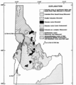
Category:Idaho Batholith - maps
Jump to navigation
Jump to search
Subcategories
This category has only the following subcategory.
*
Media in category "Idaho Batholith - maps"
The following 6 files are in this category, out of 6 total.
-
Balloon logging in the Idaho Batholith - feasibility study (1978) (20165140170).jpg 2,340 × 3,041; 2.08 MB
-
Boulder batholith location.jpg 712 × 779; 81 KB
-
Idaho Batholith and Salmon River Arch.png 438 × 783; 143 KB
-
Idaho Batholith.png 698 × 781; 164 KB
-
Level IV ecoregions, Blue Mountains.png 1,179 × 838; 719 KB
-
Snake river plain.png 1,161 × 928; 179 KB


