category:iD (software)
Jump to navigation
Jump to search
web-based OpenStreetMap editor | |||||
| Upload media | |||||
| Instance of |
| ||||
|---|---|---|---|---|---|
| Facet of | |||||
| Named after |
| ||||
| Language of work or name |
| ||||
| Copyright license |
| ||||
| Has use |
| ||||
| Based on | |||||
| Collection |
| ||||
| Developer |
| ||||
| Platform | |||||
| Software version identifier |
| ||||
| Inception |
| ||||
| Different from | |||||
| official website | |||||
| |||||
English: notice: when taking screenshots of iD, ensure that the imagery used is licensed for redistribution (rather than simply tracing) or turn off aerials altogether.
Media in category "iD (software)"
The following 45 files are in this category, out of 45 total.
-
2 custom made lanyards, and 3 multicoloured id card holders - LesarUK.png 2,271 × 1,907; 4.31 MB
-
2023-10-09 12 18 17-OpenStreetMap — Mozilla Firefox.jpg 874 × 715; 67 KB
-
Afghanistan earthquake Esri buildings.gif 922 × 694; 1.47 MB
-
Antiguo estándar de mapeo en calles de Costa Rica.jpg 390 × 263; 13 KB
-
Editeur iD pour OSM, interface en français, juillet 2021.png 1,561 × 925; 2.03 MB
-
EWP Instrucitons OSM Point added on map.png 1,912 × 942; 2.89 MB
-
EWP Instructions OSM add image tag.png 810 × 437; 217 KB
-
EWP Instructions OSM after edit select fountain.png 1,592 × 771; 1.76 MB
-
EWP Instructions OSM Click Save.png 675 × 551; 754 KB
-
EWP Instructions OSM Edit Point cursor becomes cross.png 1,911 × 1,030; 2.66 MB
-
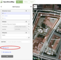
EWP Instructions OSM Finding the tag fields.png 918 × 905; 840 KB
-
EWP Instructions OSM go to Edit mode.png 1,910 × 943; 2.9 MB
-
EWP Instructions OSM Select Feature Type.png 976 × 707; 742 KB
-
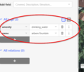
EWP Instructions OSM tag1 fountain drinking water.png 507 × 436; 65 KB
-
EWP Instructions OSM tag2 fountain drinking water.png 757 × 430; 315 KB
-
EWP Instructions OSM upload change.png 979 × 613; 369 KB
-
Harley draft OSM.png 399 × 262; 15 KB
-
Hastedter Heerstr tags.jpg 927 × 409; 344 KB
-
ID Editor 3.png 1,364 × 636; 1.33 MB
-
Id sample.png 1,280 × 873; 1.4 MB
-
Missing Maps Mapathon Berlin 2.png 1,849 × 839; 2.16 MB
-
Nincoper Deich tags (Land).jpg 949 × 479; 315 KB
-
Nincoper Deich tags (Ort).jpg 974 × 479; 322 KB
-
Nuevo estándar de mapeo en calles de Costa Rica.jpg 483 × 341; 27 KB
-
OpenStreetMap-Editor iD Logo.svg 100 × 100; 17 KB
-
OSM draft replace name.png 396 × 542; 25 KB
-
Osm-editing-relation-wikidata.png 778 × 570; 287 KB
-
RapiD screenshot.png 1,920 × 1,080; 1,002 KB
-
River geodata models.png 960 × 713; 75 KB
-
Special rendering for demolished=yes in iD editor of OSM data.png 831 × 421; 20 KB
-
State of the Map US 2019 (48719640351).jpg 1,365 × 2,048; 638 KB
-
Tutorial10 PEA.png 800 × 528; 498 KB
-
Tutorial13 PEA.png 788 × 541; 749 KB
-
Tutorial14 PEA.png 966 × 569; 961 KB
-
Tutorial15 PEA.png 973 × 190; 157 KB
-
Tutorial16 PEA.png 1,090 × 622; 826 KB
-
Tutorial17 PEA.png 1,088 × 693; 930 KB
-
Tutorial18 PEA.png 965 × 487; 922 KB
-
Tutorial19 PEA.png 669 × 525; 251 KB
-
Tutorial20 PEA.png 498 × 294; 56 KB
-
Tutorial21 PEA.png 1,366 × 561; 1.01 MB
-
Tutorial24 PEA.png 1,362 × 541; 945 KB
-
Tutorial25 PEA.png 445 × 403; 13 KB
-
Tutorial9 PEA.png 800 × 366; 422 KB
-
Website OSM.png 386 × 510; 26 KB


