Category:Hydrology of Georgia (U.S. state)
Jump to navigation
Jump to search
Subcategories
This category has the following 8 subcategories, out of 8 total.
D
F
L
R
W
Media in category "Hydrology of Georgia (U.S. state)"
The following 13 files are in this category, out of 13 total.
-
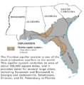
Floridan Aquifer USGS.gif 402 × 408; 19 KB
-
Floridan hydrogeologic units.png 689 × 949; 165 KB
-
Ga coast.jpg 816 × 1,056; 105 KB
-
HUC 031300010103 - Dukes Creek.PNG 517 × 421; 507 KB
-
HUC 031300010104 - Chickamauga Creek.PNG 473 × 528; 581 KB
-
HUC 031300010105 - Amys Creek-Chattahoochee River.PNG 385 × 364; 320 KB
-
HUC 031300010106 - Blue Creek-Chattahoochee River.PNG 464 × 491; 512 KB
-
HUC 031300010201 - Headwaters Soque River.PNG 505 × 447; 529 KB
-
HUC 031300010201 topographical map.PNG 474 × 716; 686 KB
-
HUC 031300010202 - Shoal Creek-Upper Soque River.PNG 432 × 452; 450 KB
-
HUC 031300010305 - Limestone Creek-Chattahoochee River.tiff 1,176 × 1,032; 2.62 MB
-
Underground waters of the coastal plain of Georgia (IA undergroundwater00step).pdf 810 × 1,329, 596 pages; 41.67 MB
-
Wakulla Springs Flow Rate G056.jpg 664 × 858; 120 KB


