Category:Hutton, Cumbria
Jump to navigation
Jump to search
settlement and civil parish in Cumbria, UK  | |||||
| Upload media | |||||
| Instance of | |||||
|---|---|---|---|---|---|
| Location |
| ||||
| Population |
| ||||
 | |||||
Subcategories
This category has the following 4 subcategories, out of 4 total.
Media in category "Hutton, Cumbria"
The following 200 files are in this category, out of 251 total.
(previous page) (next page)-
 A very private forest - geograph.org.uk - 5164831.jpg 640 × 480; 223 KB
-
 A66 - geograph.org.uk - 2694926.jpg 3,888 × 2,592; 1.5 MB
-
 A66 and Lay-by - geograph.org.uk - 3093704.jpg 640 × 464; 71 KB
-

-
 A66 junction - geograph.org.uk - 6569919.jpg 1,024 × 683; 383 KB
-
 A66 near Whitbarrow - geograph.org.uk - 3376359.jpg 640 × 480; 432 KB
-
 A66, Troutbeck - geograph.org.uk - 3376362.jpg 640 × 480; 462 KB
-
 Access road for Spring Bank - geograph.org.uk - 5019911.jpg 1,500 × 1,125; 1.94 MB
-
 Along the A66 - geograph.org.uk - 6569920.jpg 1,024 × 683; 398 KB
-
 Approaching the Summit - geograph.org.uk - 2782412.jpg 2,560 × 1,920; 1.95 MB
-
 Ash wood, Great Mell Fell - geograph.org.uk - 4282551.jpg 800 × 533; 119 KB
-
 B5288 junction - geograph.org.uk - 6569934.jpg 1,024 × 683; 513 KB
-
 Barn near Hutton - geograph.org.uk - 2623489.jpg 640 × 427; 253 KB
-
 Beech Tree Great Mell Fell - geograph.org.uk - 5312143.jpg 1,920 × 1,280; 558 KB
-
 Beech Tree, Great Mell Fell - geograph.org.uk - 5312142.jpg 1,920 × 1,280; 577 KB
-

-
 Bend on the road - geograph.org.uk - 6569547.jpg 683 × 1,024; 525 KB
-
 Binks Moss - geograph.org.uk - 3347521.jpg 2,592 × 1,944; 1.82 MB
-
 Bird's Foot Trefoil - geograph.org.uk - 2520322.jpg 2,560 × 1,920; 507 KB
-
 Blencathra, from Great Mell Fell - geograph.org.uk - 3769543.jpg 1,024 × 577; 229 KB
-
 Bonfire Hill - geograph.org.uk - 2695556.jpg 3,888 × 2,592; 1.77 MB
-
 Boundary walls at Beckces - geograph.org.uk - 5594415.jpg 1,024 × 667; 200 KB
-
 Bridge over Thackthwaite Beck - geograph.org.uk - 5314425.jpg 1,024 × 768; 185 KB
-
 Brownhow Hill - geograph.org.uk - 2623082.jpg 640 × 427; 249 KB
-
 Brownhow Hill - geograph.org.uk - 4196454.jpg 640 × 480; 64 KB
-
 Cottages at Whitbarrow Village - geograph.org.uk - 4320132.jpg 1,500 × 1,036; 1.84 MB
-
 Curving dry stone wall - geograph.org.uk - 5355159.jpg 1,500 × 924; 1.46 MB
-
 Cycle path along the A66 - geograph.org.uk - 6569922.jpg 1,024 × 683; 495 KB
-
 Cycle path beside the A66 - geograph.org.uk - 6569955.jpg 1,024 × 683; 471 KB
-
 Cycle path towards Penruddock - geograph.org.uk - 6569925.jpg 1,024 × 683; 483 KB
-
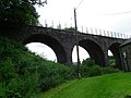 Disused Railway Viaduct Penruddock - geograph.org.uk - 3066688.jpg 4,000 × 3,000; 1.81 MB
-
 Driveway to Kirkbarrow - geograph.org.uk - 6569913.jpg 1,024 × 683; 404 KB
-
 Eggs for Sale at Wham Sike Bridge - geograph.org.uk - 2623457.jpg 640 × 427; 297 KB
-
 Entrance to Whitbarrow Hall - geograph.org.uk - 6569538.jpg 1,024 × 683; 701 KB
-
 Farm gate beside the road - geograph.org.uk - 6569936.jpg 1,024 × 683; 571 KB
-
 Farmhouse at Brownrigg - geograph.org.uk - 5022450.jpg 1,500 × 961; 1.38 MB
-
 Farmland at Swinescales - geograph.org.uk - 5314486.jpg 1,024 × 768; 130 KB
-

-
 Farmland west of Penruddock - geograph.org.uk - 6334736.jpg 2,557 × 1,512; 784 KB
-
 Farmland west of Penruddock - geograph.org.uk - 6569932.jpg 1,024 × 683; 409 KB
-
 Fence Post - geograph.org.uk - 2623389.jpg 427 × 640; 219 KB
-
 Field with farm track - geograph.org.uk - 5019756.jpg 1,499 × 924; 1.1 MB
-
 Fields at Hutton Farm - geograph.org.uk - 3381383.jpg 2,592 × 1,944; 1.24 MB
-
 Fields at Troutbeck - geograph.org.uk - 3159354.jpg 1,500 × 927; 1.14 MB
-
 Fields near Highgate Farm - geograph.org.uk - 3381377.jpg 2,592 × 1,944; 1.24 MB
-
 Fields near to Swinescales - geograph.org.uk - 5018941.jpg 1,500 × 740; 932 KB
-
 Fields near Troutbeck - geograph.org.uk - 3209247.jpg 2,906 × 1,584; 968 KB
-
 Fields ^ woods at Kirkbarrow - geograph.org.uk - 4489864.jpg 4,000 × 3,000; 2.76 MB
-
 Fields, wall and tree south of A66 - geograph.org.uk - 5268007.jpg 1,500 × 840; 896 KB
-
 Footpath ascending Great Mell Fell - geograph.org.uk - 3769575.jpg 768 × 1,024; 523 KB
-
 Footpath Motherby - geograph.org.uk - 2650858.jpg 3,648 × 2,736; 2.17 MB
-

-
 Footpath through trees on Great Mell Fell - geograph.org.uk - 3769568.jpg 768 × 1,024; 518 KB
-
 Footpath to Greystoke - geograph.org.uk - 2650893.jpg 3,648 × 2,736; 4.79 MB
-
 From the Sportsman's Inn - geograph.org.uk - 6206582.jpg 2,048 × 1,536; 854 KB
-
 From The Sportsmans Inn - geograph.org.uk - 835719.jpg 640 × 480; 64 KB
-
 Gate and sheep field - geograph.org.uk - 6569943.jpg 1,024 × 683; 422 KB
-
 Gate beside the road - geograph.org.uk - 6569535.jpg 1,024 × 683; 479 KB
-
 Gate on Greystoke Moor - geograph.org.uk - 6569544.jpg 1,024 × 683; 425 KB
-
 Get your kicks on route A66 heading into the North Lakes - geograph.org.uk - 4035745.jpg 4,288 × 3,216; 259 KB
-
 Grassland at Troutbeck - geograph.org.uk - 4970363.jpg 1,600 × 1,200; 186 KB
-
 Great Mell Fell - geograph.org.uk - 1247856.jpg 640 × 426; 88 KB
-
 Great Mell Fell - geograph.org.uk - 1258740.jpg 640 × 392; 128 KB
-
 Great Mell Fell - geograph.org.uk - 1259452.jpg 640 × 403; 99 KB
-
 Great Mell Fell - geograph.org.uk - 2618634.jpg 640 × 427; 241 KB
-
 Great Mell Fell - geograph.org.uk - 5169397.jpg 640 × 480; 84 KB
-
 Great Mell Fell - geograph.org.uk - 6683649.jpg 640 × 480; 153 KB
-
 Great Mell Fell path - geograph.org.uk - 5852425.jpg 2,048 × 1,536; 1.42 MB
-
 Great Mell Fell Summit - geograph.org.uk - 2218506.jpg 640 × 480; 73 KB
-
 Great Mell Fell summit - geograph.org.uk - 5605752.jpg 4,320 × 2,432; 4.39 MB
-
 Great Mell Fell summit - geograph.org.uk - 5852422.jpg 2,048 × 1,536; 958 KB
-
 Greenah Moss - geograph.org.uk - 2695557.jpg 3,284 × 2,427; 1.25 MB
-
 Greystoke Moor Cottage - geograph.org.uk - 5164838.jpg 640 × 480; 271 KB
-
 Greystoke Moor Cottage - geograph.org.uk - 6569553.jpg 1,024 × 683; 538 KB
-
 Greystoke to A66 lane - geograph.org.uk - 6569905.jpg 683 × 1,024; 557 KB
-
 Greystoke to Berrier road - geograph.org.uk - 6569546.jpg 1,024 × 683; 496 KB
-
 Harebells - geograph.org.uk - 2520316.jpg 1,920 × 2,560; 699 KB
-
 Heading up Great Mell Fell - geograph.org.uk - 2218490.jpg 640 × 480; 121 KB
-
 Herdwick Inn - geograph.org.uk - 6569930.jpg 1,024 × 683; 454 KB
-
 Highgate Farm - geograph.org.uk - 3373770.jpg 640 × 427; 452 KB
-
 Hill slope beyond Naddles Beck - geograph.org.uk - 4321266.jpg 1,500 × 994; 1.64 MB
-
 Horizontal Larch - geograph.org.uk - 804918.jpg 640 × 480; 54 KB
-
 Hutch Head - geograph.org.uk - 2623494.jpg 640 × 427; 293 KB
-
 In Motherby village - geograph.org.uk - 5320531.jpg 2,592 × 1,944; 1.21 MB
-
 In Penruddock village - geograph.org.uk - 2595504.jpg 2,592 × 1,944; 1.03 MB
-
 Junction B5288 Penruddock - geograph.org.uk - 2650837.jpg 3,648 × 2,736; 4.7 MB
-
 Junction of cycleways - geograph.org.uk - 5164824.jpg 640 × 480; 285 KB
-
 Kirkbarrow - geograph.org.uk - 2695702.jpg 3,888 × 2,592; 2.46 MB
-
 Kirkbarrow - geograph.org.uk - 2695711.jpg 3,417 × 2,021; 1.19 MB
-
 Lane near Kirkbarrow - geograph.org.uk - 4489839.jpg 3,000 × 4,000; 2.73 MB
-
 Lane to Green Close - geograph.org.uk - 2623479.jpg 427 × 640; 306 KB
-
 Layby on the A66 - geograph.org.uk - 3376354.jpg 640 × 480; 439 KB
-
 Leaving Motherby on the B5288 for Greystoke - geograph.org.uk - 5320527.jpg 2,592 × 1,944; 1.8 MB
-
 Lofshaw Hill - geograph.org.uk - 2695281.jpg 3,888 × 2,447; 1.49 MB
-
 Lofshaw Hill - geograph.org.uk - 2695283.jpg 3,833 × 2,277; 1.24 MB
-
 Lofshaw Hill - geograph.org.uk - 3592352.jpg 2,592 × 1,944; 1.68 MB
-
 Looking down on the A66 - geograph.org.uk - 6569938.jpg 1,024 × 683; 563 KB
-
 Looking east along the A66 at Troutbeck - geograph.org.uk - 3769518.jpg 1,024 × 768; 363 KB
-
 Looking south from Great Mell Fell - geograph.org.uk - 6666290.jpg 640 × 480; 115 KB
-
 Looking towards Cross Fell - geograph.org.uk - 6666298.jpg 640 × 480; 98 KB
-
 Looking towards Great Mell Fell - geograph.org.uk - 1155300.jpg 640 × 480; 99 KB
-
 Looking towards Riverside Farm - geograph.org.uk - 3769538.jpg 1,024 × 768; 424 KB
-
 Looking towards Saddleback - geograph.org.uk - 6683660.jpg 640 × 480; 118 KB
-
 Looking towards the Dodds - geograph.org.uk - 1155340.jpg 640 × 480; 62 KB
-
 Looking west along the A66 at Troutbeck - geograph.org.uk - 3769515.jpg 1,024 × 768; 378 KB
-
 Lower slopes of Great Mell Fell - geograph.org.uk - 4196471.jpg 640 × 480; 107 KB
-
 Marshy ground on Greystoke Moor - geograph.org.uk - 5164837.jpg 640 × 480; 240 KB
-
 Mell Fell View - geograph.org.uk - 1258734.jpg 640 × 415; 71 KB
-
 Mell Fell Wood - geograph.org.uk - 4196475.jpg 640 × 480; 145 KB
-
 Mellfell Beck near Brownrigg Farm - geograph.org.uk - 3772956.jpg 1,024 × 768; 502 KB
-

-

-
 Minor road parallel to the A66 - geograph.org.uk - 6569948.jpg 1,024 × 683; 466 KB
-
 Minor road west of Penruddock - geograph.org.uk - 6409969.jpg 2,000 × 1,371; 2.48 MB
-
 Minor stream crossing field with rough grazing - geograph.org.uk - 5227028.jpg 1,499 × 749; 1.01 MB
-
 Moorland north of Great Mell Fell - geograph.org.uk - 4321247.jpg 1,500 × 1,125; 1.81 MB
-
 Moorland with rushes south of Troutbeck - geograph.org.uk - 4867859.jpg 1,500 × 1,125; 1.4 MB
-
 Mossy Beech - geograph.org.uk - 5312147.jpg 1,920 × 1,280; 565 KB
-
 Motherby - geograph.org.uk - 2695277.jpg 3,888 × 2,592; 1.56 MB
-
 Old A66(East) - geograph.org.uk - 6405053.jpg 640 × 480; 67 KB
-
 Old Access Lane - geograph.org.uk - 2618638.jpg 640 × 427; 286 KB
-

-
 Old Rifle Range - geograph.org.uk - 1155297.jpg 640 × 480; 82 KB
-
 Old rifle range - geograph.org.uk - 5022193.jpg 1,500 × 1,125; 2.01 MB
-
 Old Road, Troutbeck - geograph.org.uk - 1512147.jpg 640 × 480; 53 KB
-
 On Great Mell Fell - geograph.org.uk - 1512155.jpg 640 × 480; 67 KB
-
 On Great Mell Fell - geograph.org.uk - 1512166.jpg 640 × 480; 65 KB
-
 On Great Mell Fell - geograph.org.uk - 1512173.jpg 640 × 480; 76 KB
-
 On Great Mell Fell - geograph.org.uk - 2520326.jpg 2,560 × 1,920; 1.57 MB
-
 On Great Mell Fell - geograph.org.uk - 2782411.jpg 2,560 × 1,920; 1.16 MB
-
 On Great Mell Fell - geograph.org.uk - 2782414.jpg 2,560 × 1,920; 1.04 MB
-
 On Great Mell Fell - geograph.org.uk - 3254206.jpg 2,560 × 1,920; 574 KB
-
 On Great Mell Fell - geograph.org.uk - 4282573.jpg 800 × 533; 97 KB
-
 On Great Mell Fell - geograph.org.uk - 5312145.jpg 1,920 × 1,280; 497 KB
-
 On Great Mell Fell - geograph.org.uk - 804901.jpg 640 × 480; 64 KB
-
 On Greystoke Moor - geograph.org.uk - 5320446.jpg 2,592 × 1,944; 2.08 MB
-
 Passing Penruddock Primary School - geograph.org.uk - 6569929.jpg 1,024 × 683; 465 KB
-
 Pastoral view, Hutton - geograph.org.uk - 1039893.jpg 640 × 480; 151 KB
-
 Pastoral view, Hutton - geograph.org.uk - 1039898.jpg 640 × 480; 148 KB
-
 Pasture Adjacent Swinscales Beck - geograph.org.uk - 2623461.jpg 640 × 427; 261 KB
-
 Pasture, Hutton - geograph.org.uk - 1075055.jpg 640 × 480; 92 KB
-
 Pastures, Hutton - geograph.org.uk - 1075051.jpg 640 × 480; 109 KB
-
 Pastures, Hutton - geograph.org.uk - 1075061.jpg 640 × 480; 114 KB
-
 Pastures, Matterdale - geograph.org.uk - 1075098.jpg 640 × 480; 142 KB
-
 Path ascending Great Mell Fell - geograph.org.uk - 3769541.jpg 1,024 × 768; 373 KB
-
 Path descending Great Mell Fell - geograph.org.uk - 5605755.jpg 4,320 × 2,432; 4.57 MB
-
 Path on Great Mell Fell - geograph.org.uk - 5605743.jpg 4,320 × 2,432; 4.24 MB
-
 Penrith to Cockermouth Railway - geograph.org.uk - 2695694.jpg 2,824 × 2,592; 1.31 MB
-
 Penruddock - geograph.org.uk - 2695264.jpg 3,888 × 2,592; 2.12 MB
-
 Penruddock - geograph.org.uk - 2695268.jpg 3,888 × 2,592; 1.47 MB
-
 Penruddock - geograph.org.uk - 2695273.jpg 3,888 × 2,592; 1.91 MB
-
 Penruddock Primary School - geograph.org.uk - 2650817.jpg 3,648 × 2,736; 2.3 MB
-
 Penruddock turning on the A66 - geograph.org.uk - 3093708.jpg 640 × 478; 56 KB
-
 Penruddock, Highgate Farm Guesthouse, 1991 - geograph.org.uk - 4325839.jpg 2,352 × 1,499; 3.74 MB
-
 Pine trees by Swinescales Beck - geograph.org.uk - 2692783.jpg 640 × 480; 52 KB
-

-
 Road and high fence - geograph.org.uk - 6569550.jpg 1,024 × 683; 485 KB
-
 Road heading north at Swinescales - geograph.org.uk - 5314482.jpg 1,024 × 768; 165 KB
-
 Road heading south at Swinescales - geograph.org.uk - 5314490.jpg 1,024 × 768; 202 KB
-
 Road heading to Greystoke - geograph.org.uk - 6569916.jpg 1,024 × 683; 506 KB
-
 Road junction on the old A66 - geograph.org.uk - 2595501.jpg 2,592 × 1,944; 1.31 MB
-
 Road leading to Greystoke - geograph.org.uk - 6569548.jpg 683 × 1,024; 572 KB
-
 Road leading to Penruddock - geograph.org.uk - 6569951.jpg 1,024 × 683; 559 KB
-
 Road leading to the A66 - geograph.org.uk - 6569915.jpg 1,024 × 683; 555 KB
-
 Road near Holmbeck Lodge - geograph.org.uk - 6569959.jpg 1,024 × 683; 477 KB
-
 Road near Stoddah Bank, looking north - geograph.org.uk - 5314442.jpg 1,024 × 768; 127 KB
-
 Road near Stoddah Bank, looking south - geograph.org.uk - 5314467.jpg 1,024 × 768; 227 KB
-
 Road north of the A66 - geograph.org.uk - 6569960.jpg 1,024 × 683; 409 KB
-
 Road on Greystoke Moor - geograph.org.uk - 6569549.jpg 1,024 × 683; 455 KB
-
 Road south of Greystoke - geograph.org.uk - 6569912.jpg 1,024 × 683; 484 KB
-
 Road through Penruddock - geograph.org.uk - 6569927.jpg 1,024 × 683; 424 KB
-
 Road to Berrier - geograph.org.uk - 6569540.jpg 1,024 × 683; 693 KB
-
 Road to Greystoke - geograph.org.uk - 6569542.jpg 1,024 × 683; 490 KB
-
 Road to Greystoke from the A66 - geograph.org.uk - 6569906.jpg 683 × 1,024; 501 KB
-
 Road to Nabend - geograph.org.uk - 2520328.jpg 2,560 × 1,920; 1.94 MB
-
 Road to Stoddah Bank - geograph.org.uk - 2520330.jpg 2,560 × 1,920; 2.08 MB
-
 Rookin House Farm seen from Great Mell Farm - geograph.org.uk - 3769558.jpg 1,024 × 768; 383 KB
-
 Rough grassland near Troutbeck - geograph.org.uk - 3769525.jpg 1,024 × 768; 411 KB
-
 Routing Gill Beck - geograph.org.uk - 1512174.jpg 640 × 480; 73 KB
-
 Routing Gill Beck - geograph.org.uk - 1512177.jpg 480 × 640; 124 KB
-
 Ruined farm building, Lofshaw Hill - geograph.org.uk - 4196419.jpg 640 × 480; 72 KB
-
 Scots pines, Great Mell Fell - geograph.org.uk - 4282562.jpg 800 × 533; 179 KB
-
 Shed on site of former rifle range - geograph.org.uk - 3769534.jpg 1,024 × 768; 369 KB
-

-

-
 Sheep pasture, west of Stoddah Bank - geograph.org.uk - 5314451.jpg 1,024 × 768; 231 KB
-
 Silver Birch - geograph.org.uk - 2782415.jpg 1,920 × 2,560; 2 MB
-
 Sportsman's Inn - geograph.org.uk - 6569939.jpg 1,024 × 683; 435 KB
-
 Stoddahgate - geograph.org.uk - 2623459.jpg 640 × 427; 244 KB
-
 Summit Cairn on Great Mell Fell - geograph.org.uk - 1444582.jpg 640 × 480; 119 KB
-
 Summit cairn, Great Mell Fell - geograph.org.uk - 3635596.jpg 1,600 × 1,064; 558 KB
-
 Summit Cairn, Great Mell Fell - geograph.org.uk - 804923.jpg 640 × 480; 56 KB
-
 Summit, Great Mell Fell - geograph.org.uk - 4282568.jpg 800 × 533; 99 KB
-
 Sunset From the Pub - geograph.org.uk - 3292715.jpg 2,560 × 1,920; 387 KB
-
 The end of the track from Motherby - geograph.org.uk - 5320451.jpg 2,592 × 1,944; 2.48 MB
-
 The Greystoke road - geograph.org.uk - 2595485.jpg 2,592 × 1,944; 1.57 MB
-
 The lane from Hutton - geograph.org.uk - 3381384.jpg 2,592 × 1,944; 2.23 MB
-
 The lane to Hutton - geograph.org.uk - 5988051.jpg 4,032 × 3,024; 2.85 MB
-
 The lane to Watermillock - geograph.org.uk - 3590833.jpg 2,592 × 1,944; 1.61 MB
-
 The lower east slopes of Great Mell Fell - geograph.org.uk - 3590844.jpg 2,592 × 1,944; 1.63 MB


.jpg)


_-_geograph.org.uk_-_6405053.jpg)


_Great_Mell_Fell_-_geograph.org.uk_-_5314464.jpg)


