Category:Hury
Jump to navigation
Jump to search
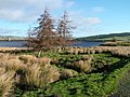
English: Hury is a village in Baldersdale, in the civil parish of Hunderthwaite, in the Pennines of England. It was historically located in the North Riding of Yorkshire but along with the rest of the former Startforth Rural District it was transferred to County Durham for administrative and ceremonial purposes on 1 April 1974, under the provisions of the Local Government Act 1972.
village in United Kingdom | |||||
| Upload media | |||||
| Instance of | |||||
|---|---|---|---|---|---|
| Location | Hunderthwaite, County Durham, North East England, England | ||||
 | |||||
Media in category "Hury"
The following 106 files are in this category, out of 106 total.
-
 Barn above Hury Reservoir - geograph.org.uk - 3010110.jpg 800 × 600; 116 KB
-
 Fenceline on Race Yate Rigg - geograph.org.uk - 1567860.jpg 640 × 512; 119 KB
-
 Forest edge on Blake Hill - geograph.org.uk - 1768373.jpg 1,280 × 1,000; 314 KB
-
 Green Post Box - geograph.org.uk - 686515.jpg 319 × 640; 66 KB
-
 How Gill Waterfall - geograph.org.uk - 1410009.jpg 480 × 640; 107 KB
-
 Hunder Beck - geograph.org.uk - 621246.jpg 640 × 480; 169 KB
-
 Hunder Beck - geograph.org.uk - 684809.jpg 480 × 640; 125 KB
-
 Hunder Beck - geograph.org.uk - 713718.jpg 640 × 480; 109 KB
-
 Hunder Beck - geograph.org.uk - 713721.jpg 640 × 480; 141 KB
-
 Hury - geograph.org.uk - 1226148.jpg 640 × 427; 101 KB
-
 Hury Reservoir - geograph.org.uk - 521224.jpg 640 × 480; 71 KB
-
 Kearton Rigg - geograph.org.uk - 385139.jpg 640 × 384; 68 KB
-
 Light at the end..... - geograph.org.uk - 1270827.jpg 640 × 480; 43 KB
-
 Old shelter - geograph.org.uk - 397092.jpg 640 × 480; 91 KB
-
 Race Yate Stile - geograph.org.uk - 1567864.jpg 480 × 640; 110 KB
-
 Ram -bo^ - geograph.org.uk - 685632.jpg 640 × 480; 156 KB
-
 Romaldkirk Moor - geograph.org.uk - 1257640.jpg 640 × 480; 120 KB
-
 Sheep on the hill. - geograph.org.uk - 685303.jpg 640 × 373; 69 KB
-
 Snowed Under - geograph.org.uk - 1270724.jpg 480 × 640; 61 KB
-
 Stone Bridge over Hill Gill - geograph.org.uk - 684699.jpg 640 × 480; 122 KB
-
 Sweet tasting hay. - geograph.org.uk - 685300.jpg 640 × 511; 130 KB
-
 The start of the Balder descent - geograph.org.uk - 1577858.jpg 2,240 × 2,240; 2.96 MB
-
 Trees at Briscoe - geograph.org.uk - 1577829.jpg 640 × 511; 133 KB
-
 Upper reaches of Mawmon Sike - geograph.org.uk - 713600.jpg 640 × 480; 101 KB
-
 West Briscoe field - geograph.org.uk - 1584666.jpg 640 × 460; 147 KB
-
 Access Gate - geograph.org.uk - 267110.jpg 640 × 480; 227 KB
-
 Barns at Hury - geograph.org.uk - 684472.jpg 640 × 480; 119 KB
-
 Beck Head - geograph.org.uk - 6766.jpg 640 × 419; 41 KB
-
 Bield below Ravock - geograph.org.uk - 483684.jpg 640 × 480; 64 KB
-
 Bield on Ravock - geograph.org.uk - 483700.jpg 640 × 480; 117 KB
-
 Black Hill - geograph.org.uk - 672679.jpg 640 × 480; 138 KB
-
 Blackpool Sike - geograph.org.uk - 383244.jpg 640 × 426; 82 KB
-
 Blackton Bridge - geograph.org.uk - 713707.jpg 640 × 480; 95 KB
-
 Botany - geograph.org.uk - 227999.jpg 640 × 479; 113 KB
-
 Boundary fence on Black Hill - geograph.org.uk - 672670.jpg 640 × 480; 91 KB
-
 Boundary Fence on Great Dodd - geograph.org.uk - 397015.jpg 640 × 480; 91 KB
-
 Bridge , Hill Gill - geograph.org.uk - 227679.jpg 640 × 282; 48 KB
-
 Bridge across swollen Deepdale Beck - geograph.org.uk - 483629.jpg 640 × 480; 106 KB
-
 Bridge over Deepdale Beck - geograph.org.uk - 483564.jpg 640 × 480; 77 KB
-
 Clova Lodge, Baldersdale - geograph.org.uk - 685692.jpg 640 × 480; 79 KB
-
 Clove House , Baldersdale - geograph.org.uk - 227771.jpg 640 × 479; 123 KB
-
 East Loup's - geograph.org.uk - 383260.jpg 640 × 384; 96 KB
-
 Erratic Boulder - geograph.org.uk - 684825.jpg 640 × 480; 142 KB
-
 Fence across Caucabush Rigg - geograph.org.uk - 483617.jpg 640 × 609; 121 KB
-
 Fence at Knott Hills - geograph.org.uk - 483620.jpg 640 × 480; 78 KB
-
 Fence on Galloway Rigg - geograph.org.uk - 713621.jpg 640 × 480; 96 KB
-
 Fiddler House - geograph.org.uk - 656057.jpg 640 × 480; 83 KB
-
 Flat Moss - geograph.org.uk - 621308.jpg 640 × 480; 138 KB
-
 Footbridge over river Balder - geograph.org.uk - 397049.jpg 640 × 480; 105 KB
-

-
 Ford and track across Mawmon Sike - geograph.org.uk - 713674.jpg 640 × 480; 102 KB
-
-
 Gate, Ladyfold Rigg - geograph.org.uk - 385150.jpg 640 × 384; 59 KB
-
 Great Allotment - geograph.org.uk - 483585.jpg 640 × 480; 75 KB
-
 Grouse butts near Nine Holes - geograph.org.uk - 621345.jpg 640 × 427; 134 KB
-
-
 Haggworm Hall - geograph.org.uk - 684859.jpg 640 × 480; 113 KB
-
 Hanna's Meadow Nature Reserve - geograph.org.uk - 139544.jpg 640 × 428; 79 KB
-
 Hannah's Meadow and High Birk Hatt - geograph.org.uk - 46669.jpg 480 × 640; 153 KB
-
 Head of Balderdale - geograph.org.uk - 397103.jpg 640 × 480; 82 KB
-
 House renovation with thatched roof - geograph.org.uk - 483572.jpg 640 × 480; 83 KB
-
 In need of Improvement - geograph.org.uk - 684486.jpg 640 × 480; 139 KB
-
 Kelton Hill - geograph.org.uk - 6767.jpg 640 × 391; 77 KB
-
 Larches at Selset - geograph.org.uk - 673526.jpg 640 × 480; 114 KB
-
 Looking South from near Blake Hill - geograph.org.uk - 672604.jpg 640 × 480; 114 KB
-
 Low New Houses - geograph.org.uk - 685621.jpg 640 × 480; 99 KB
-

-
 Middle Mere - geograph.org.uk - 622053.jpg 640 × 480; 137 KB
-
 Moorland above Baldersdale - geograph.org.uk - 621296.jpg 640 × 480; 151 KB
-
 Moorland above Baldersdale - geograph.org.uk - 622052.jpg 640 × 480; 94 KB
-
 Moorland near Deepdale Head - geograph.org.uk - 621327.jpg 640 × 480; 108 KB
-
 Moorland track - geograph.org.uk - 656063.jpg 640 × 480; 64 KB
-
 Moorland, Cotherstone - geograph.org.uk - 621337.jpg 640 × 480; 120 KB
-
 Moorland, Cotherstone - geograph.org.uk - 622039.jpg 640 × 480; 96 KB
-
 New grouse Butts on Rough Sike - geograph.org.uk - 672738.jpg 640 × 480; 151 KB
-
 Newly Constructed Drystone Wall - geograph.org.uk - 385148.jpg 640 × 384; 88 KB
-
 Old Farmhouse at Hury - geograph.org.uk - 684498.jpg 640 × 480; 147 KB
-
 On the Pennine Way - geograph.org.uk - 6768.jpg 640 × 385; 37 KB
-

-
 Pile of stones Pennine Way, Ravock - geograph.org.uk - 483669.jpg 640 × 480; 93 KB
-
 Pillar on Blake Hill - geograph.org.uk - 672606.jpg 640 × 480; 106 KB
-
 Pindhill Sike - geograph.org.uk - 672753.jpg 640 × 480; 98 KB
-
 Road from Hury Reservoir - geograph.org.uk - 227988.jpg 479 × 640; 98 KB
-
 Road from Hury to Mickleton - geograph.org.uk - 227994.jpg 640 × 479; 108 KB
-
 Road to Romaldkirk , Botany Road - geograph.org.uk - 228004.jpg 479 × 640; 108 KB
-
 Romaldkirk Moor trig - geograph.org.uk - 304583.jpg 640 × 480; 93 KB
-
 Rowantree Beck - geograph.org.uk - 673536.jpg 640 × 480; 103 KB
-
 Ruin, East Loups's - geograph.org.uk - 385166.jpg 640 × 426; 92 KB
-
 Sheepfold - geograph.org.uk - 397100.jpg 640 × 480; 110 KB
-
 Sheepfold and shelter - geograph.org.uk - 662455.jpg 640 × 480; 117 KB
-
 Sheepfolds - geograph.org.uk - 397095.jpg 640 × 480; 118 KB
-
 Shooting Butt, Lamb Hill - geograph.org.uk - 383270.jpg 640 × 384; 77 KB
-
 Shooting Butt, Near Scur Beck - geograph.org.uk - 386555.jpg 640 × 426; 81 KB
-

-
 Soulgill Sike - geograph.org.uk - 673546.jpg 640 × 480; 85 KB
-
 Strand Foot Farm, Deep Dale - geograph.org.uk - 113540.jpg 640 × 480; 56 KB
-
 The Old Chapel, Baldersdale - geograph.org.uk - 27171.jpg 640 × 427; 68 KB
-
 Three Chimneys Farm - geograph.org.uk - 673525.jpg 640 × 480; 84 KB
-
 Track - geograph.org.uk - 277801.jpg 640 × 480; 237 KB
-
 Tuft of Grass - geograph.org.uk - 385160.jpg 640 × 384; 78 KB
-
 Wall, Ladyfold Rigg - geograph.org.uk - 385144.jpg 640 × 384; 39 KB
-
 Wall, Long Rigg - geograph.org.uk - 385124.jpg 640 × 384; 71 KB
-
 Wall, Loups's Hill - geograph.org.uk - 385122.jpg 640 × 384; 75 KB
-
 Wall, Whitstone Rigg - geograph.org.uk - 385114.jpg 640 × 384; 72 KB
-
 Water Knott - geograph.org.uk - 282935.jpg 640 × 394; 65 KB
-
 West Loup's - geograph.org.uk - 383249.jpg 640 × 384; 71 KB


