Category:Hurricane Cliffs
Jump to navigation
Jump to search
cliffs in Mohave County, Arizona and Iron and Washington counties in Utah in the United States  | |||||
| Upload media | |||||
| Instance of | |||||
|---|---|---|---|---|---|
| Location |
| ||||
| Elevation above sea level |
| ||||
 | |||||
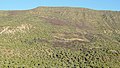
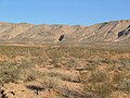
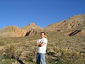
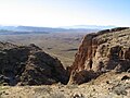
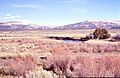
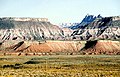
English: Media related to the Hurricane Cliffs, a mountain ridge (about 135 miles [217 km] long) in Mohave County, Arizona and Washington and Iron counties in Utah, United States, that are comprised of en:Kaibab Limestone.
The cliffs run from the west perimeter of the en:Uinkaret Plateau at the North Rim of the Grand Canyon, in the en:Arizona Strip, northeast through en:Hurricane, Utah, en:Cedar City, Utah, to north of en:Parowan, Utah, and the northeast of the Parowan Valley, at the southwest of the en:Tushar Mountains (Utah DeLorme Atlas, & Arizona Atlas, Benchmark Maps).
The cliffs run from the west perimeter of the en:Uinkaret Plateau at the North Rim of the Grand Canyon, in the en:Arizona Strip, northeast through en:Hurricane, Utah, en:Cedar City, Utah, to north of en:Parowan, Utah, and the northeast of the Parowan Valley, at the southwest of the en:Tushar Mountains (Utah DeLorme Atlas, & Arizona Atlas, Benchmark Maps).
Subcategories
This category has the following 11 subcategories, out of 11 total.
A
- Anderson Mountain (Utah) (1 F)
C
G
H
- Hurricane Canal (25 F)
L
P
- P Hill (Utah) (1 F)
T
V
W
- Warner Valley (Arizona) (16 F)
Media in category "Hurricane Cliffs"
The following 44 files are in this category, out of 44 total.
-
 2010-1101-CedarCity-Utah.jpg 3,345 × 1,902; 6.79 MB
-
 2013-09-21 12 28 39 View east along Utah State Route 20 near Interstate 15.JPG 3,264 × 2,448; 2.82 MB
-
 Basalt flows on Hurricane Cliffs.jpeg 800 × 453; 82 KB
-
 Cacti Hurricane Cliffs, Utah-Arizona Border (92977438).jpg 1,280 × 960; 425 KB
-
 Cemetery La Verkin, Utah, Oct 16.jpg 2,592 × 1,944; 2.33 MB
-
 Desert Mountain in Northern Arizona - panoramio.jpg 2,512 × 1,888; 1.05 MB
-
 Dtn st george.jpg 800 × 533; 149 KB
-
 East at I-15 & S-17 interchange, Oct 16.jpg 2,592 × 1,944; 2.43 MB
-
 East at SR-9 & SR-17, La Verkin, Utah, Oct 16.jpg 2,592 × 1,944; 2.38 MB
-
 East at SR-9 & SR-59, Hurricane, Utah, Oct 16.jpg 2,592 × 1,944; 2.4 MB
-
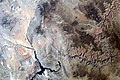 Grand Canyon area of Arizona by Sally Ride EarthKAM.jpg 4,312 × 2,868; 6.62 MB
-
 Grand Staircase-big.jpg 1,700 × 483; 204 KB
-
 Hurricane banner.jpg 2,816 × 402; 262 KB
-
 Hurricane Cliffs and Mount Trumbull School House, Arizona (14017067800).jpg 4,000 × 3,000; 2.55 MB
-
 Hurricane Cliffs Near St. George, Utah (101363393).jpg 1,600 × 1,200; 696 KB
-
 Hurricane Cliffs Near St. George, Utah (101363487).jpg 1,200 × 1,600; 701 KB
-
 Hurricane Cliffs Near St. George, Utah (101363551).jpg 1,600 × 1,200; 720 KB
-
 Hurricane Cliffs Near St. George, Utah (101363642).jpg 1,600 × 1,200; 700 KB
-
 Hurricane Cliffs Near St. George, Utah (9179235143).jpg 4,000 × 3,000; 1.93 MB
-
 Hurricane Cliffs Near St. George, Utah (9181449356).jpg 4,000 × 3,000; 1.98 MB
-
 Hurricane Cliffs, Arizona (14017030738).jpg 4,000 × 3,000; 2.7 MB
-
 Hurricane Cliffs, Utah-Arizona Border (71862728).jpg 1,280 × 960; 340 KB
-
 Hurricane Cliffs, Utah-Arizona Border (71862804).jpg 1,280 × 960; 335 KB
-
 Hurricane Cliffs, Utah-Arizona Border (71862901).jpg 1,280 × 960; 277 KB
-
 Hurricane Cliffs, Utah-Arizona Border (71862932).jpg 1,280 × 960; 264 KB
-
 Hurricane Cliffs, Utah-Arizona Border (71862970).jpg 1,280 × 960; 314 KB
-
 Hurricane Cliffs, Utah-Arizona Border (71862995).jpg 1,280 × 960; 165 KB
-
 Hurricane Cliffs, Utah-Arizona Border (71863011).jpg 1,280 × 960; 137 KB
-
 Hurricane Cliffs1.jpeg 1,000 × 392; 100 KB
-
 Hurricane Cliffs2a.jpeg 1,000 × 543; 126 KB
-
 Hurricaneutah.jpg 2,816 × 2,120; 1.44 MB
-
 Ken and Alicia, Hurricane Cliffs, Utah-Arizona Border (71862638).jpg 1,280 × 960; 340 KB
-
 Ken, Hurricane Cliffs, Utah-Arizona Border (71862662).jpg 1,280 × 960; 257 KB
-
 Lund Highway, Utah. East to Cedar City.jpg 1,000 × 667; 314 KB
-
 Northwest at Anderson Junction Road, Oct 16.jpg 2,592 × 1,944; 2.43 MB
-
 Rocky Descent Down Hurricane Cliffs, Utah-Arizona Border (68915856).jpg 1,280 × 960; 236 KB
-
 South along SR-17 in La Verkin, Utah, Oct 16.jpg 2,592 × 1,944; 2.37 MB
-
 South at SR-9 & SR-17, La Verkin, Utah, Oct 16.jpg 2,592 × 1,944; 2.45 MB
-
 South at SR-9 & SR-59, Hurricane, Utah, Oct 16.jpg 2,592 × 1,944; 2.41 MB
-
 South Guardian Angell Zion West Rim Trail.jpg 1,292 × 586; 244 KB
-
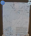 Toroweap Area map - Flickr - brewbooks.jpg 2,073 × 2,393; 1.62 MB
-
 UT Ash creek.jpg 2,226 × 1,449; 504 KB
-
 Utah 1989 02.jpg 1,005 × 646; 809 KB
-
 West at SR-9 & SR-17, La Verkin, Utah, Oct 16.jpg 2,592 × 1,944; 2.36 MB


.jpg)


.jpg)
.jpg)
.jpg)
.jpg)
.jpg)
.jpg)
.jpg)
.jpg)
.jpg)
.jpg)
.jpg)
.jpg)
.jpg)
.jpg)
.jpg)

.jpg)
.jpg)


.jpg)


Categories:
- Uinkaret Plateau
- Kaibab Limestone
- Arizona Strip
- Cedar Valley (Iron County, Utah)
- High Plateaus section of Utah
- High Plateaus section of Arizona
- Rock formations in Zion National Park
- Landforms of Mohave County, Arizona
- Landforms of Iron County, Utah
- Landforms of Washington County, Utah
- Geology of Arizona
- Geology of Iron County, Utah
- Rock formations in Arizona
- Limestone formations in Arizona
- Limestone formations in Utah
- Mountains of Utah
- Inland cliffs of Arizona
- Transform faults
- Fracture zones (geology)
- Hurricane, Utah
- La Verkin, Utah
- Locations along Interstate 15 in Iron County, Utah
- Locations along Interstate 15 in Washington County, Utah
- Locations along U.S. Route 91 in Utah (1926-1974) in Iron County, Utah
- Locations along U.S. Route 91 in Utah (1926-1974) in Washington County, Utah
- Locations along Utah State Route 9 in Washington County, Utah
- Locations along Utah State Route 15 (1912-1977) in Washington County, Utah
- Locations along Utah State Route 14 in Iron County, Utah
- Locations along Utah State Route 17
- Locations along Utah State Route 20 in Iron County, Utah
- Locations along Utah State Route 59
- Locations along Utah State Route 143 in Iron County, Utah
- Locations along Kolob Canyon Road