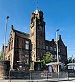
Category:Hurlford
Jump to navigation
Jump to search
village in East Ayrshire, Scotland, UK | |||||
| Upload media | |||||
| Instance of | |||||
|---|---|---|---|---|---|
| Location |
| ||||
| Population |
| ||||
 | |||||
Hurlford ( Scottish Gaelic: Átha Cliath) is a village in East Ayrshire, Scotland. Including Crookedholm, it has a population of 4,968. Hurlford's former names include Whirlford and Hurdleford. The village was named Whirlford as a result of a ford crossing the River Irvine east of Hurlford Cross, near Shawhill.. It shares its name in Gaelic, Átha Cliath ("The Ford of the Hurdles") with the Irish capital Dublin.
Subcategories
This category has the following 6 subcategories, out of 6 total.
C
- Carnell Estate (13 F)
H
- HM Prison Kilmarnock (3 F)
- Hoodston Bridge (2 F)
O
- Old Mans Cabin, Hurlford (2 F)
U
Media in category "Hurlford"
The following 36 files are in this category, out of 36 total.
-
Approaching Hurlford from the west - geograph.org.uk - 170800.jpg 640 × 474; 90 KB
-
Barleith Station site of 1835341 5f2533c4.jpg 640 × 351; 98 KB
-
Burn Near Bridgehouse Bridge - geograph.org.uk - 292513.jpg 640 × 480; 197 KB
-
Chris Hoy Cycle Way - geograph.org.uk - 3689081.jpg 1,600 × 1,067; 698 KB
-
Chris Hoy Cycle Way - geograph.org.uk - 3689091.jpg 1,600 × 1,067; 622 KB
-
Darvel branch bridge.jpg 1,536 × 1,152; 693 KB
-
Derelict Out-Building at Liffnock - geograph.org.uk - 3689067.jpg 1,600 × 1,067; 567 KB
-
Derelict Out-Building at Liffnock - geograph.org.uk - 3689072.jpg 5,184 × 3,456; 7.14 MB
-
Edge of Hurlford - geograph.org.uk - 350619.jpg 640 × 480; 101 KB
-
Electricity Substation - geograph.org.uk - 291128.jpg 480 × 640; 171 KB
-
Farm Building at Liffnock - geograph.org.uk - 3689053.jpg 1,600 × 1,067; 444 KB
-
Flood prevention levees near Hurleford - geograph.org.uk - 70954.jpg 640 × 407; 68 KB
-
Hedge and Trees Near Treeswoodhead Road - geograph.org.uk - 292515.jpg 640 × 480; 174 KB
-
Houses at Grougar Mains - geograph.org.uk - 170755.jpg 640 × 480; 71 KB
-
Hurlford Cross, Scotland.jpg 5,184 × 3,456; 7.29 MB
-
Hurlford Primary School.jpg 1,943 × 2,113; 1.24 MB
-
Hurlford railway station in 1983.jpg 640 × 427; 89 KB
-
Hurlfordfromkerrmuir.jpg 2,848 × 2,134; 1.17 MB
-
Loading up - geograph.org.uk - 205133.jpg 640 × 480; 141 KB
-
Milton Farm - geograph.org.uk - 350607.jpg 640 × 480; 67 KB
-
Minor Road Near Trees Farm - geograph.org.uk - 291163.jpg 640 × 480; 193 KB
-
Muggersland Burn at Balgray Bridge - geograph.org.uk - 292537.jpg 480 × 640; 207 KB
-
New flood defences at Hurleford - geograph.org.uk - 70940.jpg 640 × 480; 80 KB
-
Purrock Farm - geograph.org.uk - 205136.jpg 640 × 480; 139 KB
-
Railway bridge over Cessnock Water - geograph.org.uk - 481826.jpg 640 × 480; 64 KB
-
Red Road to Midtown of Balgray - geograph.org.uk - 292535.jpg 640 × 480; 197 KB
-
Roost for Crows - geograph.org.uk - 292529.jpg 480 × 640; 189 KB
-
Shawhill House, Crookedholm.JPG 2,288 × 1,712; 1.34 MB
-
Shed at Liffnock - geograph.org.uk - 3689061.jpg 5,184 × 3,456; 6.99 MB
-
The River Irvine Weir - geograph.org.uk - 350610.jpg 640 × 480; 101 KB
-
Track approaching Liffnock - geograph.org.uk - 3689057.jpg 1,600 × 1,067; 562 KB
-
Trees Farm - geograph.org.uk - 292530.jpg 640 × 480; 193 KB
-
Treeswoodhead Road - geograph.org.uk - 291122.jpg 640 × 480; 173 KB
-
Walking the dogs - geograph.org.uk - 350603.jpg 640 × 480; 113 KB
-
West Ashyard Farm - geograph.org.uk - 404920.jpg 640 × 480; 75 KB
-
Windswept Tree Near Gatehead - geograph.org.uk - 291168.jpg 640 × 480; 198 KB


