Category:Huntly (civil parish)
Jump to navigation
Jump to search
Scottish parish in Aberdeenshire, Scotland, UK | |||||
| Upload media | |||||
| Instance of | |||||
|---|---|---|---|---|---|
| Named after | |||||
| Location |
| ||||
| Population |
| ||||
| Area |
| ||||
 | |||||
Subcategories
This category has the following 3 subcategories, out of 3 total.
Media in category "Huntly (civil parish)"
The following 200 files are in this category, out of 516 total.
(previous page) (next page)-
 'HUNTLY FISHING RIVER DEVERON' notice - geograph.org.uk - 2621973.jpg 2,592 × 1,944; 693 KB
-
 'The Mermaid' reach of the River Deveron - geograph.org.uk - 2621953.jpg 1,151 × 813; 354 KB
-
 19 Castle Street, Huntly - geograph.org.uk - 5638461.jpg 2,530 × 1,911; 2.26 MB
-
 23-25 Gordon Street, Huntly - geograph.org.uk - 5636195.jpg 2,720 × 1,993; 2.42 MB
-
 24 to 30 The Square - geograph.org.uk - 4379990.jpg 640 × 392; 327 KB
-
 41 Duke Street - geograph.org.uk - 4380247.jpg 500 × 640; 412 KB
-
 8 Church Street, Huntly - geograph.org.uk - 5637583.jpg 2,619 × 1,948; 2.13 MB
-

-

-
 A Commonwealth War Grave, Huntly Cemetery - geograph.org.uk - 2621789.jpg 777 × 1,029; 426 KB
-
 A cottage at the east end of Bogie Street - geograph.org.uk - 3083438.jpg 1,264 × 1,090; 321 KB
-

-
 A Gordon for me^ - geograph.org.uk - 1821652.jpg 480 × 640; 77 KB
-
 A house on Deveron Road (A96) - geograph.org.uk - 3629276.jpg 3,648 × 2,736; 1.58 MB
-
 A large house on Deveron Road - geograph.org.uk - 1822525.jpg 640 × 480; 81 KB
-
 A local Butcher's Shop, Huntly - geograph.org.uk - 3399724.jpg 1,368 × 1,824; 712 KB
-
 A medley of crops and timescales - geograph.org.uk - 931982.jpg 640 × 485; 119 KB
-
 A moss covered boulder - geograph.org.uk - 2618663.jpg 1,296 × 972; 727 KB
-
 A new housing development, Huntly - geograph.org.uk - 2621896.jpg 1,263 × 929; 395 KB
-
 A pair of white-washed cottages in King Street, Huntly - geograph.org.uk - 3629200.jpg 1,824 × 1,368; 907 KB
-
 A paved track west to Deveron Park - geograph.org.uk - 3629016.jpg 1,368 × 1,824; 848 KB
-
 A Rickle o' Stanes - geograph.org.uk - 955793.jpg 640 × 427; 289 KB
-
 A rocky outcrop in Bin Forest - geograph.org.uk - 2618648.jpg 1,296 × 972; 644 KB
-
 A sheepfold and farm track - geograph.org.uk - 1523059.jpg 640 × 455; 77 KB
-
 A Slippery Slope - geograph.org.uk - 4342980.jpg 427 × 640; 484 KB
-
 A small building by A97 - geograph.org.uk - 974023.jpg 640 × 561; 103 KB
-

-
 A town house in Huntly - geograph.org.uk - 3083416.jpg 1,671 × 1,301; 520 KB
-
 A track east from Deveron Park - geograph.org.uk - 3629007.jpg 1,368 × 1,824; 814 KB
-
 A track south from the Deveron Road (A920) - geograph.org.uk - 3629000.jpg 1,824 × 1,368; 750 KB
-
 A villa on Deveron Road (A920) - geograph.org.uk - 3629381.jpg 3,648 × 2,736; 2.32 MB
-

-
 A96 by-passing Huntly - geograph.org.uk - 4089497.jpg 640 × 480; 64 KB
-
 A96 by-passing Huntly - geograph.org.uk - 4089503.jpg 640 × 480; 67 KB
-
 A96 heading south east - geograph.org.uk - 4089485.jpg 640 × 480; 60 KB
-
 A96 heading south east, Westerton - geograph.org.uk - 4089474.jpg 640 × 480; 79 KB
-
 A96 towards Huntly - geograph.org.uk - 4089479.jpg 640 × 480; 54 KB
-
 A96 towards Keith - geograph.org.uk - 4089467.jpg 640 × 480; 67 KB
-
 A96 underpass to Milltown - geograph.org.uk - 2621921.jpg 1,296 × 972; 469 KB
-
 Abandoned Cottage - geograph.org.uk - 4033917.jpg 640 × 427; 395 KB
-
 Above Gordonsburn - geograph.org.uk - 1232111.jpg 640 × 427; 241 KB
-
 Above Upper Gordonsburn - geograph.org.uk - 1232069.jpg 640 × 427; 242 KB
-
 Access to Grampian Conservatory Offices - geograph.org.uk - 2622030.jpg 2,592 × 1,944; 1,014 KB
-
 Access to Robieston - geograph.org.uk - 2622045.jpg 1,296 × 972; 466 KB
-
 Agritech depot, Huntly - geograph.org.uk - 2953938.jpg 3,648 × 2,736; 1.21 MB
-
 An Ancient Site^ - geograph.org.uk - 956095.jpg 640 × 427; 272 KB
-
 An elegant town residence - geograph.org.uk - 1822486.jpg 640 × 480; 81 KB
-
 An old cobbled road to Huntly Castle - geograph.org.uk - 2954270.jpg 2,736 × 3,648; 1.47 MB
-
 An old stone gatepost - geograph.org.uk - 2954138.jpg 1,824 × 1,368; 1.15 MB
-
 Ancient Cairns - geograph.org.uk - 956080.jpg 640 × 427; 262 KB
-
 Another Hut Circle^ - geograph.org.uk - 956087.jpg 640 × 427; 261 KB
-
 Approach to Costlyburn Plantation - geograph.org.uk - 974003.jpg 640 × 409; 55 KB
-
 Approach to Milton - geograph.org.uk - 2621933.jpg 1,296 × 972; 292 KB
-
 Approach to Mossat - geograph.org.uk - 978857.jpg 640 × 489; 69 KB
-
 Approaching Dunbennan Cemetery - geograph.org.uk - 1232295.jpg 640 × 427; 302 KB
-
 Archway exit from Gordon Schools playing fields - geograph.org.uk - 2954112.jpg 1,749 × 1,220; 475 KB
-
 Archway exit from Huntly Castle Hotel grounds - geograph.org.uk - 2954123.jpg 2,736 × 3,648; 1.8 MB
-
 Ascending Clashmach Hill - geograph.org.uk - 955707.jpg 640 × 427; 248 KB
-
 Auchinbo Farm - geograph.org.uk - 4345520.jpg 640 × 427; 358 KB
-
 Auchmull Wood - geograph.org.uk - 4033882.jpg 640 × 427; 417 KB
-
 Avenue to Huntly Castle Hotel - geograph.org.uk - 4343311.jpg 640 × 427; 423 KB
-
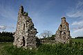 Avochie Castle (geograph 4033834).jpg 640 × 427; 381 KB
-
 Avochie Castle - geograph.org.uk - 2579311.jpg 3,456 × 2,304; 1.44 MB
-
 Avochie Castle - geograph.org.uk - 4033803.jpg 640 × 427; 342 KB
-
 Avochie Castle - geograph.org.uk - 4033808.jpg 640 × 427; 374 KB
-
 Avochie Castle - geograph.org.uk - 4033835.jpg 640 × 427; 343 KB
-
 Avochie Castle ruin - geograph.org.uk - 2486082.jpg 3,648 × 2,736; 2.34 MB
-
 Avochie Cottage - geograph.org.uk - 4033784.jpg 640 × 427; 466 KB
-
 B9022 near Huntly - geograph.org.uk - 3737960.jpg 1,600 × 1,200; 438 KB
-
 Bailiesward - geograph.org.uk - 1231923.jpg 640 × 427; 246 KB
-
 Bailiesward - geograph.org.uk - 1232133.jpg 640 × 427; 248 KB
-
 Bailiesward Pond - geograph.org.uk - 1232142.jpg 640 × 427; 223 KB
-
 Bank of Scotland, Huntly - geograph.org.uk - 5637885.jpg 2,242 × 1,855; 1.84 MB
-
 Beech Among the Conifers - geograph.org.uk - 1231942.jpg 427 × 640; 307 KB
-
 Bench by path through Meadow Plantation - geograph.org.uk - 1822564.jpg 640 × 480; 125 KB
-
 Bin Forest Car Park - geograph.org.uk - 4343225.jpg 640 × 427; 479 KB
-
 Bin Forest information board - geograph.org.uk - 2618639.jpg 972 × 1,296; 434 KB
-
 Bin Hill Forest car park - geograph.org.uk - 6661481.jpg 1,024 × 683; 990 KB
-
 Bin Hill Forest Walks - geograph.org.uk - 6661487.jpg 1,024 × 683; 1.23 MB
-
 Boddum Path - geograph.org.uk - 5167312.jpg 2,848 × 4,272; 3.36 MB
-
 Brander Library, the Square, Huntly - geograph.org.uk - 5637771.jpg 2,166 × 1,899; 1.85 MB
-
 Bridge of Gibston - geograph.org.uk - 4343271.jpg 640 × 427; 464 KB
-
 Bridge of Gibston - geograph.org.uk - 4343280.jpg 640 × 427; 428 KB
-
 Bridge over the Deveron, by Huntly Castle - geograph.org.uk - 2617432.jpg 3,648 × 2,736; 6.23 MB
-
 Brown Hill - geograph.org.uk - 1231804.jpg 640 × 427; 253 KB
-
 Brown Hill - geograph.org.uk - 1232201.jpg 640 × 427; 257 KB
-
 Brown Hill - geograph.org.uk - 1232207.jpg 640 × 427; 236 KB
-
 Brown Hill - geograph.org.uk - 1232308.jpg 640 × 427; 275 KB
-
 Buildings at Huntly Cottage Hospital - geograph.org.uk - 5525284.jpg 1,600 × 1,200; 485 KB
-
 Burn beneath Meadow Bridge - geograph.org.uk - 2621911.jpg 1,296 × 972; 493 KB
-
 Burn course through forestry - geograph.org.uk - 931977.jpg 640 × 485; 79 KB
-
 Burnfield and Pylons - geograph.org.uk - 4033782.jpg 640 × 427; 361 KB
-
 Bydand Place, Huntly - geograph.org.uk - 1822475.jpg 640 × 480; 79 KB
-
 Cascade and Pond in Bin Forest - geograph.org.uk - 2953913.jpg 3,648 × 2,736; 1.23 MB
-
 Castle Bridge - geograph.org.uk - 4625055.jpg 800 × 534; 442 KB
-
 Castle Hotel - geograph.org.uk - 4432196.jpg 800 × 534; 432 KB
-
 Castle Hotel, Huntly - geograph.org.uk - 2617446.jpg 3,648 × 2,736; 5.1 MB
-
 Castle Hotel, Huntly - geograph.org.uk - 3201001.jpg 1,795 × 1,213; 501 KB
-
 Cattle Grid - geograph.org.uk - 956051.jpg 640 × 427; 269 KB
-
 Christ Church episcopal church, Huntly - geograph.org.uk - 5637158.jpg 2,426 × 1,990; 1.99 MB
-
 Christie Park in Huntlyvision - geograph.org.uk - 2739862.jpg 640 × 360; 206 KB
-
 Clachan Ruin - geograph.org.uk - 5167644.jpg 4,263 × 2,841; 3.21 MB
-
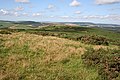 Clashmach Hill - geograph.org.uk - 955809.jpg 640 × 427; 259 KB
-
 Clasmach Hill Trig Point Flush Bracket S6198 - geograph.org.uk - 6773753.jpg 2,448 × 3,264; 5.62 MB
-
 Clean Hill Path - geograph.org.uk - 5167503.jpg 2,835 × 4,253; 3.89 MB
-
 Cleanbrae Fence - geograph.org.uk - 5167594.jpg 3,967 × 2,645; 1.95 MB
-
 Cottage at Greens of Glenbeg - geograph.org.uk - 1233631.jpg 640 × 427; 272 KB
-
 Cottage at Nether Brunstane - geograph.org.uk - 4344371.jpg 640 × 427; 392 KB
-
 Cottage on Deveron Road (A920) - geograph.org.uk - 3629431.jpg 1,501 × 1,095; 578 KB
-
 Council houses, King Street, Huntly - geograph.org.uk - 5000039.jpg 2,664 × 2,000; 2.14 MB
-
 Country road - geograph.org.uk - 934366.jpg 640 × 485; 100 KB
-
 Craighead Water Treatment Works - geograph.org.uk - 1192560.jpg 640 × 427; 235 KB
-
 Craigwillie - geograph.org.uk - 4089492.jpg 640 × 480; 54 KB
-
 Craigwillie - geograph.org.uk - 975111.jpg 640 × 427; 101 KB
-
 Craigwillie - geograph.org.uk - 975131.jpg 640 × 427; 77 KB
-
 Croft of Bridges - geograph.org.uk - 4345504.jpg 640 × 427; 489 KB
-
 Crop field and woodland - geograph.org.uk - 4089477.jpg 640 × 480; 54 KB
-
 Crop field near the River Deveron - geograph.org.uk - 4089484.jpg 640 × 480; 56 KB
-
 Crop field near Westerton - geograph.org.uk - 4089471.jpg 640 × 480; 70 KB
-
 Cycle path north through Bin Forest - geograph.org.uk - 2618683.jpg 972 × 1,296; 512 KB
-
 Cycle path south through Bin Forest - geograph.org.uk - 2618677.jpg 972 × 1,296; 678 KB
-
 Dean's of Huntly - geograph.org.uk - 3754887.jpg 640 × 480; 41 KB
-
 Dean's of Huntly Visitor Centre - geograph.org.uk - 4371011.jpg 640 × 480; 381 KB
-
 Dean's shortbread factory and visitor centre - geograph.org.uk - 5638672.jpg 2,484 × 1,862; 1.9 MB
-
 Dean's, History in the baking - geograph.org.uk - 3629149.jpg 1,824 × 1,368; 846 KB
-
 Deans Biscuit Factory - geograph.org.uk - 3629134.jpg 1,824 × 1,368; 606 KB
-
 Derelict building - geograph.org.uk - 930952.jpg 640 × 485; 123 KB
-
 Descent by road from Tullochbeg - geograph.org.uk - 2953975.jpg 1,229 × 791; 239 KB
-
 Deveron Downstream - geograph.org.uk - 2563018.jpg 2,304 × 3,456; 1.03 MB
-
 Deveron House Group building - geograph.org.uk - 1822465.jpg 640 × 480; 63 KB
-
 Deveron riverbank in autumn - geograph.org.uk - 2621993.jpg 972 × 1,296; 669 KB
-
 Deveron Street, Huntly - geograph.org.uk - 5637896.jpg 2,784 × 2,000; 2.57 MB
-
 Disappearing Road - geograph.org.uk - 797136.jpg 427 × 640; 291 KB
-
 Dowmin by the Deveron - geograph.org.uk - 1226168.jpg 640 × 427; 246 KB
-
 Downstream River Deveron - geograph.org.uk - 2621965.jpg 1,296 × 972; 479 KB
-
 Drain crossing beneath path in Bin Forest - geograph.org.uk - 2618641.jpg 972 × 1,296; 632 KB
-
 Duke of Richmond statue, the Square, Huntly - geograph.org.uk - 5637730.jpg 1,881 × 1,882; 1.56 MB
-
 Duke Street, Huntly - geograph.org.uk - 1822144.jpg 640 × 450; 72 KB
-
 Dunbennan - geograph.org.uk - 1232291.jpg 640 × 427; 292 KB
-
 Dunbennan Cemetery - geograph.org.uk - 1232253.jpg 640 × 427; 255 KB
-
 Dunbennan Cemetery - geograph.org.uk - 1232267.jpg 640 × 427; 275 KB
-
 Dunbennan Cemetery - geograph.org.uk - 1232279.jpg 640 × 427; 280 KB
-
 Dunbennan Cemetery - geograph.org.uk - 1232286.jpg 640 × 427; 302 KB
-
 Dunbennan Cemetery - geograph.org.uk - 6534452.jpg 5,053 × 3,369; 3.28 MB
-
 Dunbennan Kirk - geograph.org.uk - 6534462.jpg 4,949 × 3,299; 3.34 MB
-
 Dunbennan Pasture - geograph.org.uk - 6534475.jpg 5,053 × 3,369; 2.46 MB
-
 Dunbennan Steading - geograph.org.uk - 6534446.jpg 5,184 × 3,456; 2.69 MB
-
 Dunbennan Wood - geograph.org.uk - 6534491.jpg 5,184 × 3,456; 2.74 MB
-
 Dunbennan Yews - geograph.org.uk - 6534477.jpg 5,184 × 3,456; 4.16 MB
-
 Earthballs (Lycoperdon echinatum) - geograph.org.uk - 955833.jpg 640 × 441; 303 KB
-
 Eastern parapet of Meadow Bridge, Huntly - geograph.org.uk - 2621907.jpg 972 × 1,296; 447 KB
-
 Edelweiss, King Street - geograph.org.uk - 2354115.jpg 1,824 × 1,368; 900 KB
-
 Entering Huntly - geograph.org.uk - 4089487.jpg 640 × 480; 54 KB
-
 Entrance arch to Castle Hotel, Huntly - geograph.org.uk - 2954201.jpg 3,648 × 2,736; 2 MB
-
 Entrance porch, Castle Hotel - geograph.org.uk - 3201013.jpg 1,679 × 1,215; 484 KB
-
 Entrance to Kinnoir Sawmill - geograph.org.uk - 4033927.jpg 640 × 403; 363 KB
-
 Exit from Bin Forest car park - geograph.org.uk - 2618623.jpg 972 × 1,296; 312 KB
-
 Family Centre -Deveron Road - geograph.org.uk - 5524447.jpg 1,600 × 1,200; 375 KB
-
 Farm track near Huntly - geograph.org.uk - 1108110.jpg 640 × 480; 110 KB
-
 Farmland near Huntly - geograph.org.uk - 4089494.jpg 640 × 480; 60 KB
-
 Farmland south of Huntly - geograph.org.uk - 4089499.jpg 640 × 480; 53 KB
-

-
 Field of Hay - geograph.org.uk - 4033852.jpg 640 × 427; 387 KB
-
 Field on Hill of Bogairdy - geograph.org.uk - 1938121.jpg 640 × 480; 157 KB
-
 Field with Cereal Crop - geograph.org.uk - 4033840.jpg 640 × 427; 432 KB
-
 Fields at Gibston - geograph.org.uk - 4343260.jpg 640 × 419; 382 KB
-
 Fields at Gibston - geograph.org.uk - 4343264.jpg 640 × 427; 370 KB
-
 Fields by Westertom - geograph.org.uk - 5167298.jpg 4,239 × 2,827; 1.15 MB
-
 Fields near Gibston - geograph.org.uk - 4343287.jpg 640 × 427; 371 KB
-
 Fields near South Redhill - geograph.org.uk - 4345549.jpg 640 × 427; 388 KB
-
 Fields near Tullochbeg - geograph.org.uk - 2954002.jpg 1,824 × 1,368; 904 KB
-
 Fire Station, Depot Road - geograph.org.uk - 2354125.jpg 1,824 × 1,368; 1.1 MB
-
 Fire Station, Huntly - geograph.org.uk - 3629161.jpg 3,648 × 2,736; 1.3 MB
-
 Forest Clearing - geograph.org.uk - 1231905.jpg 640 × 427; 291 KB
-
 Forest edge on Bowman Hillock - geograph.org.uk - 930939.jpg 640 × 485; 91 KB
-
 Forest flotsam in the River Deveron - geograph.org.uk - 2621989.jpg 1,296 × 972; 497 KB
-
 Forest on Muckle Long Hill - geograph.org.uk - 1231937.jpg 640 × 427; 308 KB
-
 Forest path mark on a beech tree - geograph.org.uk - 2618658.jpg 1,296 × 972; 650 KB
-
 Forest Pond - geograph.org.uk - 5167434.jpg 3,967 × 2,645; 2.63 MB
-
 Forest Track - geograph.org.uk - 1231918.jpg 640 × 427; 285 KB
-
 Forest Track - geograph.org.uk - 1232124.jpg 640 × 427; 286 KB
-
 Forest track heading towards Torry Hillock and Brown Hill - geograph.org.uk - 5957851.jpg 4,000 × 3,000; 4.16 MB
-
 Forest track on Bowman Hillock - geograph.org.uk - 930933.jpg 640 × 485; 104 KB
-
 Forest Walks signpost - geograph.org.uk - 2618631.jpg 1,296 × 972; 712 KB
-
 Forestry Track up Boddum Hill - geograph.org.uk - 5167344.jpg 2,657 × 3,985; 2.97 MB
-
 Former bank - geograph.org.uk - 5637085.jpg 1,600 × 1,200; 410 KB
-
 Former Forest - geograph.org.uk - 956058.jpg 640 × 427; 264 KB
-
 Former tollhouse - geograph.org.uk - 6689009.jpg 1,600 × 1,200; 485 KB
-
 Former tollhouse - geograph.org.uk - 6689207.jpg 1,600 × 1,200; 384 KB
-

-
 Fragment of a mediaeval road to Huntly Castle - geograph.org.uk - 2954268.jpg 3,648 × 2,736; 1.06 MB
-
 Fungus, species unknown - geograph.org.uk - 955879.jpg 640 × 566; 348 KB
-
 Game at Huntly Cricket Club - geograph.org.uk - 5638528.jpg 3,008 × 2,000; 2.16 MB
-
 Gardener's shed, Huntly Cemetery - geograph.org.uk - 2621817.jpg 1,296 × 972; 622 KB
-
 Gate and Stile - geograph.org.uk - 5139626.jpg 4,111 × 2,741; 3.28 MB
-
 Gated access to 'Linnorie' - geograph.org.uk - 2618607.jpg 1,199 × 848; 512 KB
-
 Gated access to Tullochbeg - geograph.org.uk - 2954039.jpg 1,658 × 1,120; 441 KB
-
 Gatehouse lodge, Castle Hotel - geograph.org.uk - 2954131.jpg 3,648 × 2,736; 1.56 MB
-
 Gates and Pens - geograph.org.uk - 956054.jpg 640 × 403; 259 KB
-
 Gauld's grocers - geograph.org.uk - 5636928.jpg 2,671 × 1,889; 2.19 MB


_-_geograph.org.uk_-_3629276.jpg)


_-_geograph.org.uk_-_3629000.jpg)
_-_geograph.org.uk_-_3629381.jpg)


.jpg)


_-_geograph.org.uk_-_3629431.jpg)


_-_geograph.org.uk_-_955833.jpg)


&filefrom=Gladstone+Road+playground%2C+Huntly+-+geograph.org.uk+-+3083403.jpg#mw-category-media)