Category:Hungarian-language maps showing history
Jump to navigation
Jump to search
Subcategories
This category has the following 2 subcategories, out of 2 total.
Media in category "Hungarian-language maps showing history"
The following 28 files are in this category, out of 28 total.
-
1700 CE world map.hu.png 4,500 × 2,234; 701 KB
-
1860 CE world map hu.png 4,500 × 2,234; 489 KB
-
A Mexikói-völgy 1519-ben.png 1,330 × 1,794; 1.25 MB
-
Colonisation 1800.hu.png 1,425 × 625; 42 KB
-
Colonisation 1885.hu.png 1,425 × 625; 51 KB
-
Elcsatolt finn területek1940.png 619 × 800; 34 KB
-
Etnographic Iberia 200 BCE-hu.png 2,551 × 2,561; 359 KB
-
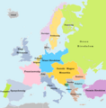
Europa 1914 (Hungarian).png 1,011 × 1,024; 192 KB
-
Europa 1929-1938 (Hungarian).png 1,011 × 1,024; 202 KB
-
Europe after 1815.hu.png 767 × 594; 770 KB
-
Európa Mátyás király uralkodásának végén.png 13,373 × 8,688; 16.58 MB
-
Germán népvándorlás és Vizigót királyság.jpg 1,024 × 668; 300 KB
-
Hispánia a Római birodalomban, I.század.jpg 1,024 × 668; 257 KB
-
Hispánia meghódítása.jpg 1,024 × 668; 339 KB
-
Ibéria, őskori lelőhelyek.jpg 1,024 × 668; 93 KB
-
Italy 1000 AD-hu.svg 565 × 811; 361 KB
-
Kelta népvándorlás, Ibériai-félsziget.jpg 1,024 × 674; 341 KB
-
Kingdom of Israel (Hungarian).png 620 × 939; 303 KB
-
Kolóniák az VIII-VII században.jpg 1,024 × 559; 377 KB
-
Norman conquest 1066HU.jpg 761 × 754; 178 KB
-
Nyugati skizma.jpg 1,271 × 981; 207 KB
-
Rzeczpospolita Rozbiory 3 hu.svg 2,541 × 2,091; 258 KB
-
Révai nagy lexikona; az ismeretek enciklopédiája (1911) (14782298054).jpg 1,790 × 2,962; 747 KB
-
Seljuq Empire1100.svg 642 × 396; 253 KB
-
Sw BalticProv hu.svg 1,229 × 1,105; 775 KB
-
The-Decapolis-map hu.svg 519 × 749; 103 KB
-
Vassal states of the Ottoman Empire in 1683 hu.svg 877 × 688; 397 KB
-
Verduni szerződés - 843.png 800 × 772; 146 KB


