Category:Hungarian-language SVG maps
Jump to navigation
Jump to search
Subcategories
This category has only the following subcategory.
H
Media in category "Hungarian-language SVG maps"
The following 103 files are in this category, out of 103 total.
-
 A magyar nyelv elterjedese.svg 688 × 438; 144 KB
-
 Abházia térképe.svg 1,008 × 786; 1.6 MB
-
 African continent-hu.svg 1,525 × 1,440; 752 KB
-
 African language families hu.svg 600 × 650; 60 KB
-
 Albania map-hu.svg 1,880 × 3,850; 5.74 MB
-
 Alemannic-Dialects-Map-Hungarian.svg 1,400 × 1,000; 483 KB
-
 Andorra topographic map-hu.svg 1,625 × 1,300; 1.22 MB
-
 Baarle-Nassau - Baarle-Hertog-hu.svg 1,700 × 1,700; 259 KB
-
 Baffin Bay map-hu.svg 840 × 623; 43 KB
-
 Balkan hu.svg 1,400 × 1,278; 507 KB
-
 Barents Sea map hu.svg 1,583 × 1,445; 801 KB
-
 Bay-of-Piran maritime-boundary-dispute-hu.svg 789 × 735; 36 KB
-
 Bayern Regierungsbezirke-HU.svg 1,227 × 1,236; 159 KB
-
 Borneo admin map-hu.svg 1,063 × 1,183; 334 KB
-
 Breuschstellung-map-hu.svg 1,047 × 1,167; 497 KB
-
 Budapest Metro 2010 hu.svg 826 × 568; 41 KB
-
 Bulgaria Chiprovtsi Municipality geographic map hu.svg 1,200 × 1,000; 2.08 MB
-
 Canadian Rocky Mountain parks map hu.svg 408 × 424; 176 KB
-
 Carte Neandertaliens classiques hu.svg 824 × 535; 373 KB
-
 Caucasus-ethnic hu.svg 984 × 1,144; 362 KB
-
 Central Asia Geographical Map HUN.svg 1,052 × 815; 7.15 MB
-
 Corfu topographic map-hu.svg 2,100 × 2,345; 2.47 MB
-
 Course Channeltunnel hu.svg 472 × 387; 28 KB
-
 Crete integrated map-hu.svg 900 × 425; 265 KB
-
 Croatia Serbia border Backa Baranja-hun.svg 520 × 520; 755 KB
-
 Dakar Rally 2010 map-hu.svg 1,513 × 1,584; 3.53 MB
-
 Del-Amerika.svg 454 × 608; 247 KB
-
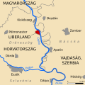
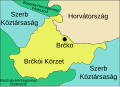 District de Brcko hu.svg 643 × 463; 13 KB
-
 East Siberian Sea map hu.svg 1,589 × 884; 194 KB
-
 Easter Island map-hu.svg 1,750 × 1,245; 877 KB
-
 Ellesmere-sziget.svg 668 × 536; 534 KB
-
 Eszaki-sarkvidek.svg 1,010 × 1,267; 1.4 MB
-
 Ethnic groups in Skopje hu.svg 580 × 600; 577 KB
-
 Fergana Valley map-hu.svg 840 × 629; 1.17 MB
-
 Franz Josef Land location-hu.svg 507 × 470; 68 KB
-
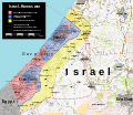
 Gaza Strip map-hu.svg 719 × 882; 248 KB
-
 Georgia, Ossetia, Russia and Abkhazia (hu).svg 676 × 400; 96 KB
-
 Great Rift Valley map-hu.svg 1,403 × 1,808; 1.05 MB
-
 Greece 2011 subdivisions-hu.svg 8,637 × 7,563; 2.24 MB
-
 Greece linguistic minorities-hu.svg 566 × 617; 444 KB
-
 Guatemala map hu.svg 656 × 706; 24 KB
-
 Guyanas-hu.svg 480 × 330; 396 KB
-
 GySEV2-hu.svg 1,112 × 1,785; 2.81 MB
-
 Hecataeus world map-hu.svg 825 × 803; 67 KB
-
 Indus river-hu.svg 2,309 × 2,495; 84 KB
-
 Isle of Man topographic map-hu.svg 1,200 × 1,100; 645 KB
-
 Karte Föderationskreis Nordkaukasus-hu.svg 1,201 × 1,132; 50 KB
-
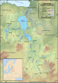
 Kenya topographic map-hu.svg 1,181 × 1,231; 3.28 MB
-
 Korea DMZ hu.svg 681 × 537; 1,005 KB
-
 Korea DMZ.svg 800 × 600; 60 KB
-
 Kosovo map-hu.svg 1,777 × 1,830; 3.75 MB
-
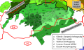
 Kraje Slovenska-hu.svg 953 × 464; 375 KB
-
 Laptev Sea map hu.svg 2,000 × 1,121; 615 KB
-
 Laurasia-Gondwana-hu.svg 519 × 435; 25 KB
-
 Liechtenstein topographic map-hu.svg 1,301 × 1,697; 2.01 MB
-
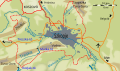
 Liptovská Mara hu.svg 992 × 609; 72 KB
-
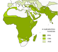 MaláriaElterjedés.svg 476 × 424; 109 KB
-
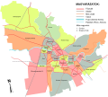
 Map City of Skopje hu.svg 1,550 × 910; 142 KB
-
 Map of Inner City of Cluj-Napoca-hu.svg 1,800 × 1,500; 1.34 MB
-
 Map of the Canary Islands hu.svg 3,152 × 1,400; 835 KB
-
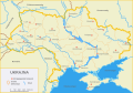 Map of Ukraine hu.svg 377 × 264; 742 KB
-
 Map of USA with state names hu.svg 959 × 593; 203 KB
-
 Mestské časti Bratislavy HUN.svg 998 × 1,250; 170 KB
-
 Mezen hu.svg 566 × 774; 128 KB
-
 Mount Everest location in Himalaya map-hu.svg 1,190 × 685; 1.31 MB
-
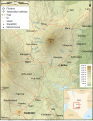 Mount Kenya Region map-hu.svg 1,782 × 2,300; 1.47 MB
-
 Mount Kilimanjaro and Mount Meru map-hu.svg 2,242 × 1,888; 1.45 MB
-
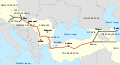
 Nabucco Gas Pipeline-hu.svg 1,100 × 600; 219 KB
-
 Nabucco Gas Pipeline-hu2.svg 1,100 × 600; 211 KB
-
 Nagyvárad Negyedek HU.svg 5,000 × 4,500; 514 KB
-
 Narva basin map hu.svg 743 × 1,053; 2.45 MB
-
 October 2023 Gaza−Israel conflict.svg 3,763 × 3,258; 8.42 MB
-
 Ortogonalis polikonikus kepzetes kupvetulet.svg 1,381 × 927; 2.91 MB
-
 Plan Centre Spatial Guyanais-hu.svg 1,060 × 980; 524 KB
-
 Plan Troy-Hisarlik-hu.svg 1,280 × 1,155; 158 KB
-
 PolskySpis-hu.svg 629 × 599; 246 KB
-
 Puncak Jaya topographic map-hu.svg 1,280 × 915; 868 KB
-
 Red Sea topographic map-hu.svg 1,655 × 2,705; 1.5 MB
-
 Red Sea topographic map-hu2.svg 1,655 × 2,705; 1.67 MB
-
 Red Zone Map-hu.svg 1,421 × 953; 122 KB
-
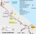
 Romania Motorway A1 HU.svg 2,003 × 1,431; 1.11 MB
-
 Romania Motorway A2 HU.svg 2,003 × 1,431; 897 KB
-
 Romania Motorway A3 HU.svg 2,003 × 1,431; 931 KB
-
 Romania Motorway A4 HU.svg 2,003 × 1,431; 921 KB
-
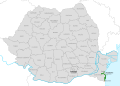
 Romania Motorways HU.svg 2,003 × 1,431; 965 KB
-
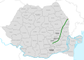 Romania Ploiesti-Albita Motorway HU.svg 2,003 × 1,431; 900 KB
-
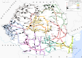 Romania-cfr-hu.svg 3,826 × 2,734; 1.51 MB
-
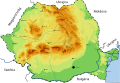 Romanian mountains-hu.svg 2,714 × 1,863; 293 KB
-
 SarlósejtesElterjedés.svg 476 × 424; 108 KB
-
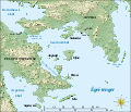 Saronic Gulf map-hu.svg 1,490 × 1,280; 808 KB
-
 Subcarpathia Ukraine districts-hu.svg 695 × 525; 73 KB
-
 Tanzania map-hu.svg 2,064 × 2,075; 2.13 MB
-
 Topographic map of Socotra-hu.svg 1,309 × 375; 229 KB
-
 Topographic map of Zanzibar-hu.svg 400 × 601; 61 KB
-
 Treaty of Verdun-hu.svg 995 × 744; 31 KB
-
 Turkish Strait disambig hu.svg 469 × 388; 89 KB
-
 Ukrajna - Hozzácsatolt területek.svg 1,090 × 756; 365 KB
-
 United states-hu.svg 505 × 670; 1.16 MB
-
 Uralic languages hu.svg 1,966 × 1,345; 2.18 MB
-
 Vnitřní Západní Karpaty-hu.svg 1,000 × 600; 107 KB
-
 Vnější Východní Karpaty-hu.svg 1,100 × 1,180; 122 KB
-
 Vnější Západní Karpaty-hu.svg 999 × 666; 101 KB
-
 Volga Federal District (numbered)-hu.svg 1,000 × 989; 329 KB


.svg)


-hu.svg)